Nomz
-
Posts
743 -
Joined
-
Last visited
Content Type
Profiles
Blogs
Forums
American Weather
Media Demo
Store
Gallery
Everything posted by Nomz
-
January 24-26: Miracle or Mirage JV/Banter Thread!
Nomz replied to SnowenOutThere's topic in Mid Atlantic
Oh, I know I'll be better up there. Just very spiteful about it. Anyways, either GFS should be permanently ignored or it's about to go on the greatest model Linsanity run I've ever seen. -
January 24-26: Miracle or Mirage JV/Banter Thread!
Nomz replied to SnowenOutThere's topic in Mid Atlantic
GFS is a money run -
January 24-26: Miracle or Mirage JV/Banter Thread!
Nomz replied to SnowenOutThere's topic in Mid Atlantic
Some weenie cope for us if the GFS somehow holds -
But when we get to this point, all that stuff is baked into the models already. If they're presenting the same on models, they have the same chance of going north or south regardless of the temperature of the Pacific Ocean.
-
But the thing is, it isn't. Any storm like this has the same odds to uptrend or downtrend regardless of ENSO state. It just doesn't matter in this small of a timeframe.
-
January 24-26: Miracle or Mirage JV/Banter Thread!
Nomz replied to SnowenOutThere's topic in Mid Atlantic
Look at my location. First winter away from Boston for college. Debating between wanting this to stay as it is so we can get some good thump, and hoping for it shoot way north so I don't have to see pictures of home covered in 24" -
January 24-26: Miracle or Mirage JV/Banter Thread!
Nomz replied to SnowenOutThere's topic in Mid Atlantic
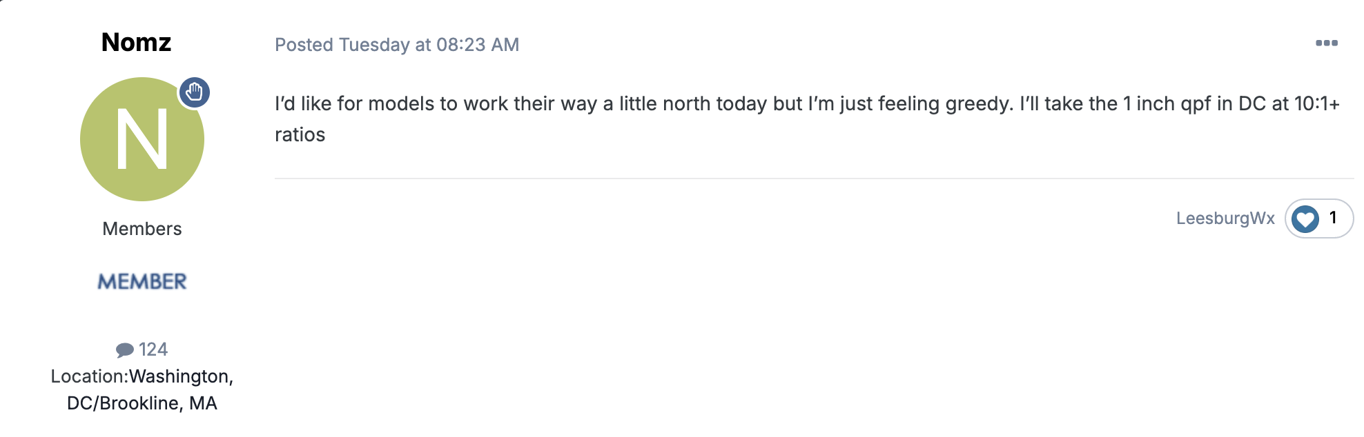
Not sure how to do the embedded post thing but mine is somehow worse: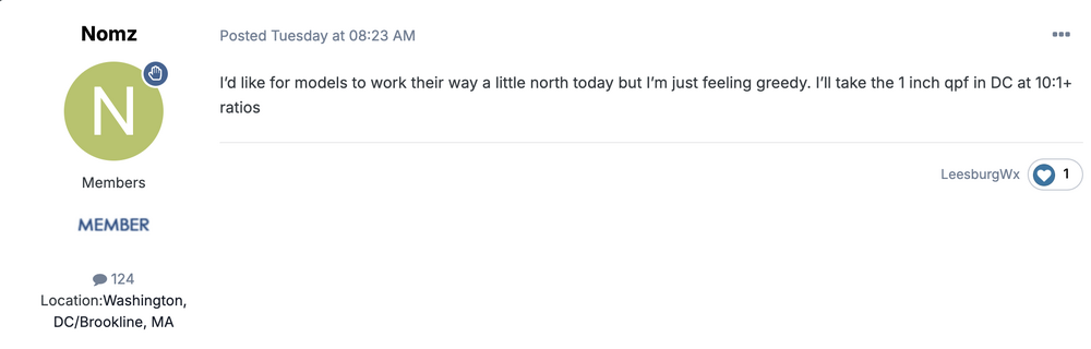
-
I don't understand the comments about the ENSO state for a system within 72 hours. The ENSO is helpful for long-range guesstimating, not short-term anything. Is it less likely to have a MECS in a Niña? Yes. If the correct ingredients are there for a MECS, and it happens to be in a Niña, will it still happen? Yes. ENSO only affects the odds of the players coming to the table. Once the players are on the table, the atmosphere cares not if it's Niña or Niño; a storm won't downtrend or uptrend solely because of the ENSO state.
-
January 24-26: Miracle or Mirage JV/Banter Thread!
Nomz replied to SnowenOutThere's topic in Mid Atlantic
My PM forecast and discussion for the DC area. Tried to highlight the uncertainty in this forecast..thumb.jpg.76063945c36a88a1383e352a64924ee1.jpg)
.thumb.jpg.363b66ff698e856888c6f1a0aff79046.jpg)
-
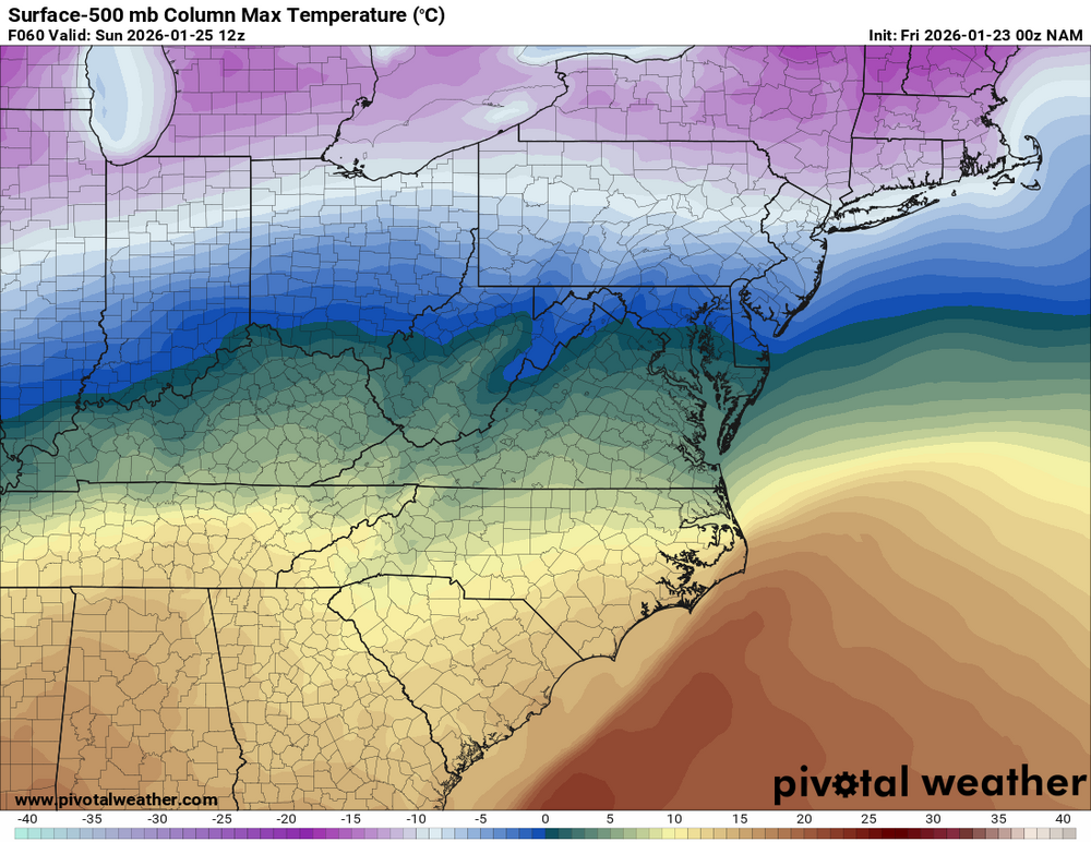
Here's why its changing over to snow:
-
January 24-26: Miracle or Mirage JV/Banter Thread!
Nomz replied to SnowenOutThere's topic in Mid Atlantic
NAM is gonna push a lotttt of people to the cliff -
January 24-26: Miracle or Mirage JV/Banter Thread!
Nomz replied to SnowenOutThere's topic in Mid Atlantic
Hey, I wishcasted this thing to shift north... it just went a little too far north -
Because half an inch of ice is crippling, and even the GFS shows that it's more than likely to happen. Richmond should be buckling down.
-
January 24-26: Miracle or Mirage JV/Banter Thread!
Nomz replied to SnowenOutThere's topic in Mid Atlantic
I've never lived out in food desert-y areas, I guess. I stopped at a grocery store in DC to pick up hot chocolate supplies (college, so other food is hopefully taken care of) and it was completely stocked -
Means a lot to me, actually. If I see some semblance of support for this at 00z, I'll put a solid amount of faith in it.
-
January 24-26: Miracle or Mirage JV/Banter Thread!
Nomz replied to SnowenOutThere's topic in Mid Atlantic
Oh yeah, non-salted/sanded roads will be rough/impassable. Definitely want to get all your essentials by Saturday midday. -
January 24-26: Miracle or Mirage JV/Banter Thread!
Nomz replied to SnowenOutThere's topic in Mid Atlantic
NWS point forecast changed from the snow icon to the wintry mix icon for me
-
January 24-26: Miracle or Mirage JV/Banter Thread!
Nomz replied to SnowenOutThere's topic in Mid Atlantic
Gray slushy roads for the foreseeable future, yay! -
January 24-26: Miracle or Mirage JV/Banter Thread!
Nomz replied to SnowenOutThere's topic in Mid Atlantic
Open up your Apple weather app, lol -
Even though models have started to converge a little, I still can't shake the uncertainty of this forecast. If 700mb temps are off by even 1c, we have massively different outcomes, especially in the DC/South MD area. Literally two degrees C at 700mb stands between 5 and 12 inches. Tough forecast!
-
January 24-26: Miracle or Mirage JV/Banter Thread!
Nomz replied to SnowenOutThere's topic in Mid Atlantic
FWIW, I'm "dropping" my forecast for DC from 6-10+ to 6-10. Subtle but I hope that helps get the message across. -
January 24-26: Miracle or Mirage JV/Banter Thread!
Nomz replied to SnowenOutThere's topic in Mid Atlantic
Beyond the Soto trade a lot of y’all’s old pieces left for nothing or immediately turned into pumpkins (Strasburg, Corbin, Rendon). The Scherzer trade was good in principle but the prospects that came back busted big time. And the draft/IFA classes have been whiff after whiff. The new gm was actually our old director of scouting I believe, he should be able to improve drafting and IFAs a lot. -
January 24-26: Miracle or Mirage JV/Banter Thread!
Nomz replied to SnowenOutThere's topic in Mid Atlantic
What do you mean, we're getting 0% snow 100% sleet. I've seen this too many times. Trust me guys. -
January 24-26: Miracle or Mirage JV/Banter Thread!
Nomz replied to SnowenOutThere's topic in Mid Atlantic
I'm a Sox fan (see location). I think it's a pretty good haul for a guy that's probably not gonna be around for any possible winning window. Fein has a good chance of getting into the t100 very soon, and the others guys are really good high upside plays. Rosario and Fitz-Gerald (yes with a hyphen) had a ton of helium before they got injured this year, with Rosario likely out for all of 2027 because of TJ. Don't know about the last two guys. -
GFS sticks to its guns basically. Still not believing it.


.jpg.589ad7ff72cfdc32a355396c1c2a8a34.jpg)
.jpg.6f6f31b337ea39c7301dcb320e013335.jpg)