wthrmn654
-
Posts
3,953 -
Joined
-
Last visited
Content Type
Profiles
Blogs
Forums
American Weather
Media Demo
Store
Gallery
Everything posted by wthrmn654
-
 Man the waters high barely a shore left before road starts going. 1 foot to spare lol
- 731 replies
-
- 1
-

-
- heavy rain
- damaging wind
- (and 2 more)
-
There's over 2,000 people without power in Brookhaven along, worth what looks to be all of port Jefferson out. Jeez
- 731 replies
-
- 1
-
-
- heavy rain
- damaging wind
- (and 2 more)
-
Douglas marine, took out there boat a little while ago. Brace souls must be going to rescue a boat somewhere....
- 731 replies
-
- 1
-
-
- heavy rain
- damaging wind
- (and 2 more)
-
Something to keep in mind, it's rather rare to get such a long lasting storm, for it to actually last long versus pulling out quickly too.. do i can understand people saying this was a nothing storm last night all over social media etc. Unfortunately, it was well advertised to be the worst at night but seems everyone ignored that or just forgot. Who knows.
- 731 replies
-
- 4
-

-
-
- heavy rain
- damaging wind
- (and 2 more)
-
I wonder how many rain gauges are over reporting show to wind, cross sound ferry is showing over 4 inches now, highly suspicious
-
Fire island is showing outages, I wonder if water related
- 731 replies
-
- 1
-
-
- heavy rain
- damaging wind
- (and 2 more)
-
Over 230 active individual outages for pseg li with over 3k outages. The large amount of individual outages is what makes it so much longer to restore.
-
The winds are insane now in the 40s gusting to 50s should of kept the wind advisory imo. Tides are very high and low tide just happened few at 10 am.
- 731 replies
-
- 2
-
-
- heavy rain
- damaging wind
- (and 2 more)
-
Fire at nursing home resulting in everyone being evacuated to riverhead pbmc. Didn't call orient though.
- 731 replies
-
- 1
-
-
- heavy rain
- damaging wind
- (and 2 more)
-
We had a lot of severe erosion worth massive waves right now on gardiners bay
- 731 replies
-
- 1
-
-
- heavy rain
- damaging wind
- (and 2 more)
-
Over 4k workout power now
-
Blowing over 50 knots (60 mph) at the buoy south of fire island
-
Now it's blowing over 40. Dam windy
-
Yep and those winds are moving north.
-
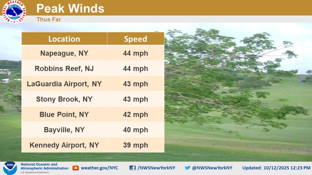
Airports has gusts in the 40s earlier though
-
Wind starting to make my house making noises. Oh my
-
Buoy just off the south shore, roughly south of fire island, wind and wave height
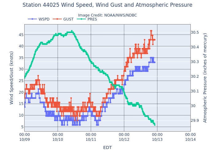
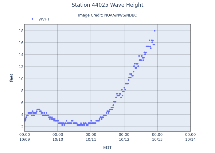
- 731 replies
-
- 1
-
-
- heavy rain
- damaging wind
- (and 2 more)
-
Talking about the flooding not wind lol
-
3k without power now on long Island and tides are now rising. Fire island go bye bye i bet
- 731 replies
-
- 1
-

-
- heavy rain
- damaging wind
- (and 2 more)