wthrmn654
-
Posts
3,953 -
Joined
-
Last visited
Content Type
Profiles
Blogs
Forums
American Weather
Media Demo
Store
Gallery
Everything posted by wthrmn654
-
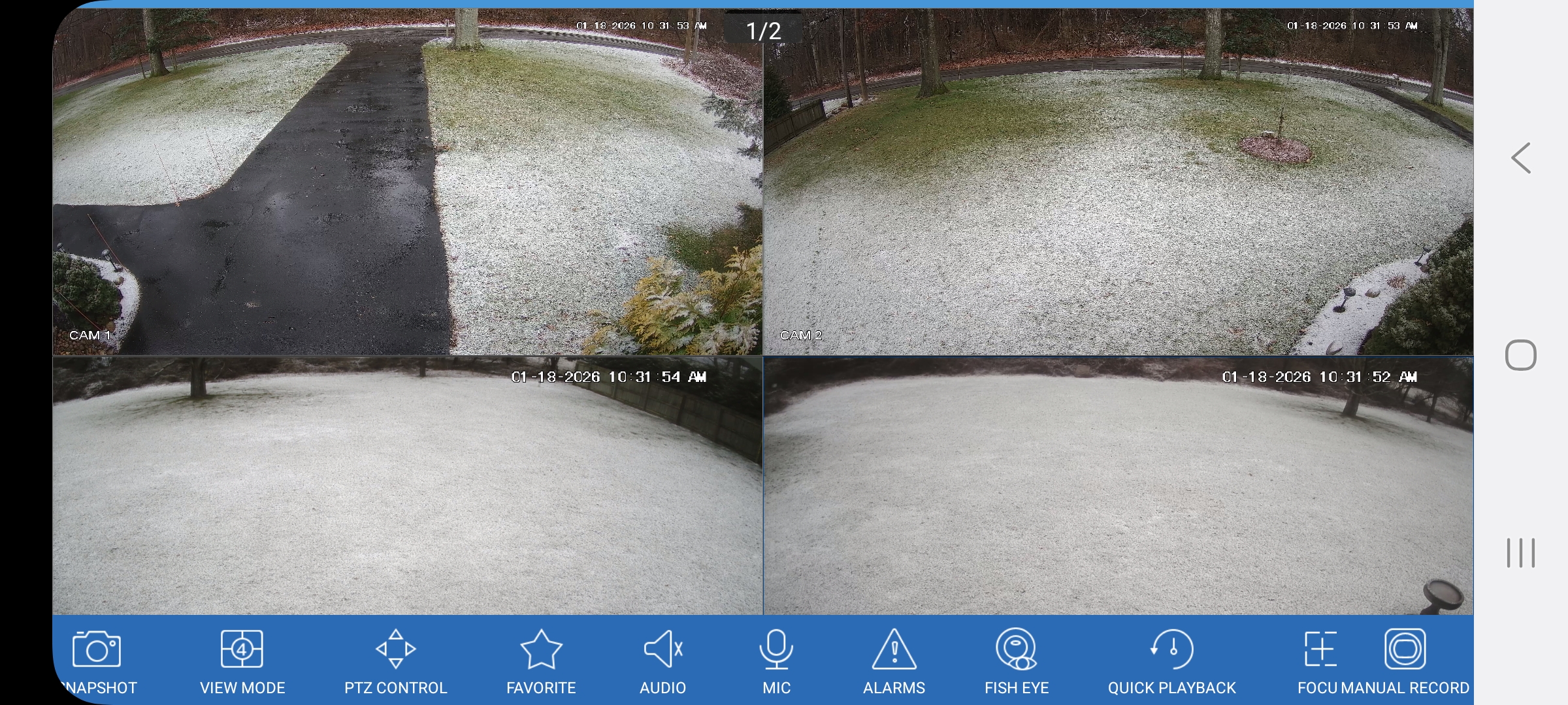
Yey it's snowing
-
Suppose to be really really good northern lights tonight. Problem is these dam clouds came out of nowhere must be sound effect related with the wind
-
I read that way to fast just now I thought that said your son is 71 Lmfao need more coffee
-

Storm potential January 17th-18th
wthrmn654 replied to WeatherGeek2025's topic in New York City Metro
Something to keep in mind and we do this every single time.... when snow events have borderline temps for nearly the entire event, on top of storms is a glancing blue, totals should be half of what models depict... on top of wet ground versus dry ground don't accumulate nearly as easy. But if heavy enough or banding, it can overcome those issues eventually. -
Storm potential January 17th-18th
wthrmn654 replied to WeatherGeek2025's topic in New York City Metro
1-1.5 inches new tonight on top of .25 this morning. -
Storm potential January 17th-18th
wthrmn654 replied to WeatherGeek2025's topic in New York City Metro
It's bad out, 3 car accidents in the past 5 mintues out here 3 cars with airbags and 1 into a tree -
Storm potential January 17th-18th
wthrmn654 replied to WeatherGeek2025's topic in New York City Metro
You using desktop mode or mobile mode? -
Storm potential January 17th-18th
wthrmn654 replied to WeatherGeek2025's topic in New York City Metro
Doesn't for me lol -
Storm potential January 17th-18th
wthrmn654 replied to WeatherGeek2025's topic in New York City Metro
Thank you is puking snow out and it's sticking to all grassy surfaces at the moment -
Storm potential January 17th-18th
wthrmn654 replied to WeatherGeek2025's topic in New York City Metro
Yum if I didn't have to take down all my indoor Christmas stuff and take apart my real tree tonight id have make chicken parm. -
Storm potential January 17th-18th
wthrmn654 replied to WeatherGeek2025's topic in New York City Metro
Liquid wise so far about 0.32. To bad it wasn't colder that would of been nice amounts on ground -
Storm potential January 17th-18th
wthrmn654 replied to WeatherGeek2025's topic in New York City Metro
By golly I see someone either sailing in a tiny sailboat or low surfing right now. But there going slow so I'm fairly certain there idiotic and sailing into the abyss..... -
Storm potential January 17th-18th
wthrmn654 replied to WeatherGeek2025's topic in New York City Metro
Montauk is 33 right now -
Storm potential January 17th-18th
wthrmn654 replied to WeatherGeek2025's topic in New York City Metro
Dude idk where your located but long island deft isn't wet aka meaning rain.... -
Storm potential January 17th-18th
wthrmn654 replied to WeatherGeek2025's topic in New York City Metro
Looking at loop, this area has had the biggest lul of anyone. -
Storm potential January 17th-18th
wthrmn654 replied to WeatherGeek2025's topic in New York City Metro
Back to decent snow i think it was a slight mix for a bit, but temps are dropping. -
Storm potential January 17th-18th
wthrmn654 replied to WeatherGeek2025's topic in New York City Metro
Updated to limit rain and rain/snow mix along the coast as warmer air is no longer expected to moves into the coastal areas. Otherwise, snowfall totals remain about the same with widespread 3 to 5 inch amounts across the forecast area. The Winter Weather Advisories remain in effect as issued. -
Storm potential January 17th-18th
wthrmn654 replied to WeatherGeek2025's topic in New York City Metro
Not bad for first round ish.
-
Storm potential January 17th-18th
wthrmn654 replied to WeatherGeek2025's topic in New York City Metro
For areas to the west like jersey, where i saw lots of rain reports, that maybe true but a lot of Long Island started out colder then forecast and as all snow, for the most part.... -
Storm potential January 17th-18th
wthrmn654 replied to WeatherGeek2025's topic in New York City Metro
33.2 id say we got about 0.25 inches of snow so far today. -
Storm potential January 17th-18th
wthrmn654 replied to WeatherGeek2025's topic in New York City Metro
When the roads really start accumulating, that means the temps are finally getting cold enough. Until then, Snow accumulation will be slow. -
Storm potential January 17th-18th
wthrmn654 replied to WeatherGeek2025's topic in New York City Metro
Roads are starting to get stylishly slushy finally, I think the cold was better and the storms producing better then models were saying. Was supposed to be middle to upper 30s on some of the future casts i had seen and so far is freezing and been there. -
Storm potential January 17th-18th
wthrmn654 replied to WeatherGeek2025's topic in New York City Metro
To bad ground/ air wasn't cooler this would stick so much better and stack up -
Storm potential January 17th-18th
wthrmn654 replied to WeatherGeek2025's topic in New York City Metro
Holy snow flakes, monster size snow flakes been falling for a while now wow temps dropped too -
Storm potential January 17th-18th
wthrmn654 replied to WeatherGeek2025's topic in New York City Metro
Pure snow no mix everything is getting coated already minutes roads