wake4est
-
Posts
950 -
Joined
-
Last visited
Content Type
Profiles
Blogs
Forums
American Weather
Media Demo
Store
Gallery
Everything posted by wake4est
-
Potential 1/28-1/30 2022 winter storm
wake4est replied to Prismshine Productions's topic in Southeastern States
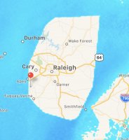
The eye -
Potential 1/28-1/30 2022 winter storm
wake4est replied to Prismshine Productions's topic in Southeastern States
This event doesn't deserve multiple threads. -
Potential 1/28-1/30 2022 winter storm
wake4est replied to Prismshine Productions's topic in Southeastern States
Man this system is dry. Are any of the models showing any decent qpf in NC? -
Potential 1/28-1/30 2022 winter storm
wake4est replied to Prismshine Productions's topic in Southeastern States
The gfs has been freaky consistent the last few runs -
Potential 1/28-1/30 2022 winter storm
wake4est replied to Prismshine Productions's topic in Southeastern States
This run of the 12k NAM may attempt to wipe New England off the face of the earth. -
Potential 1/28-1/30 2022 winter storm
wake4est replied to Prismshine Productions's topic in Southeastern States
Wow the NAM is gonna crush enc -
Potential 1/28-1/30 2022 winter storm
wake4est replied to Prismshine Productions's topic in Southeastern States
Terrible. -
Potential 1/28-1/30 2022 winter storm
wake4est replied to Prismshine Productions's topic in Southeastern States
-
Potential 1/28-1/30 2022 winter storm
wake4est replied to Prismshine Productions's topic in Southeastern States
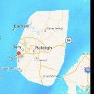
We’ll that’s an interesting map. -
heck of a gradient
-
Potential 1/28-1/30 2022 winter storm
wake4est replied to Prismshine Productions's topic in Southeastern States
Models are spitting out such a tiny amount of qpf I wouldn't be surprised to see most of central NC end up with nothing on the ground unless you get under a nice band. -
Potential 1/28-1/30 2022 winter storm
wake4est replied to Prismshine Productions's topic in Southeastern States
Goofy -
Potential 1/28-1/30 2022 winter storm
wake4est replied to Prismshine Productions's topic in Southeastern States
Time to see if the 12k and 3k NAM are still bipolar. -
Potential 1/28-1/30 2022 winter storm
wake4est replied to Prismshine Productions's topic in Southeastern States
but it's fast and light and drops about 1 inch -
Potential 1/28-1/30 2022 winter storm
wake4est replied to Prismshine Productions's topic in Southeastern States
Still flurries in the triangle on the last frame of the run -
Potential 1/28-1/30 2022 winter storm
wake4est replied to Prismshine Productions's topic in Southeastern States
Oof. Through 44 the HRRRRRR is doing well for the Piedmont, complete whiff for the Triangle. -
Potential 1/28-1/30 2022 winter storm
wake4est replied to Prismshine Productions's topic in Southeastern States
RGEM -
Potential 1/28-1/30 2022 winter storm
wake4est replied to Prismshine Productions's topic in Southeastern States
Excited to see the GFS probably rip the rug out from under us.. -
Potential 1/28-1/30 2022 winter storm
wake4est replied to Prismshine Productions's topic in Southeastern States
BOOM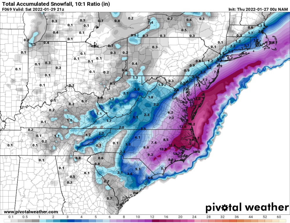
-
Potential 1/28-1/30 2022 winter storm
wake4est replied to Prismshine Productions's topic in Southeastern States
7”+ from RDU east, over a foot in NE NC still snowing in ENC at 66 -
Potential 1/28-1/30 2022 winter storm
wake4est replied to Prismshine Productions's topic in Southeastern States
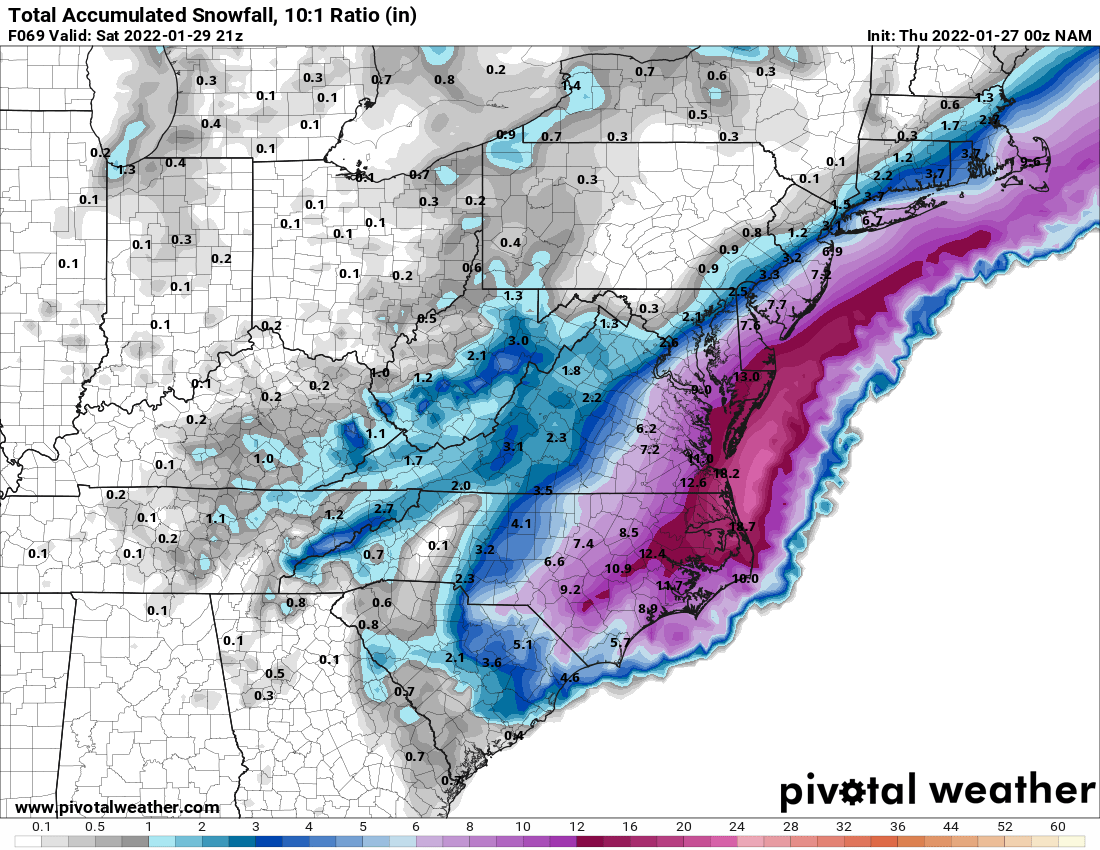
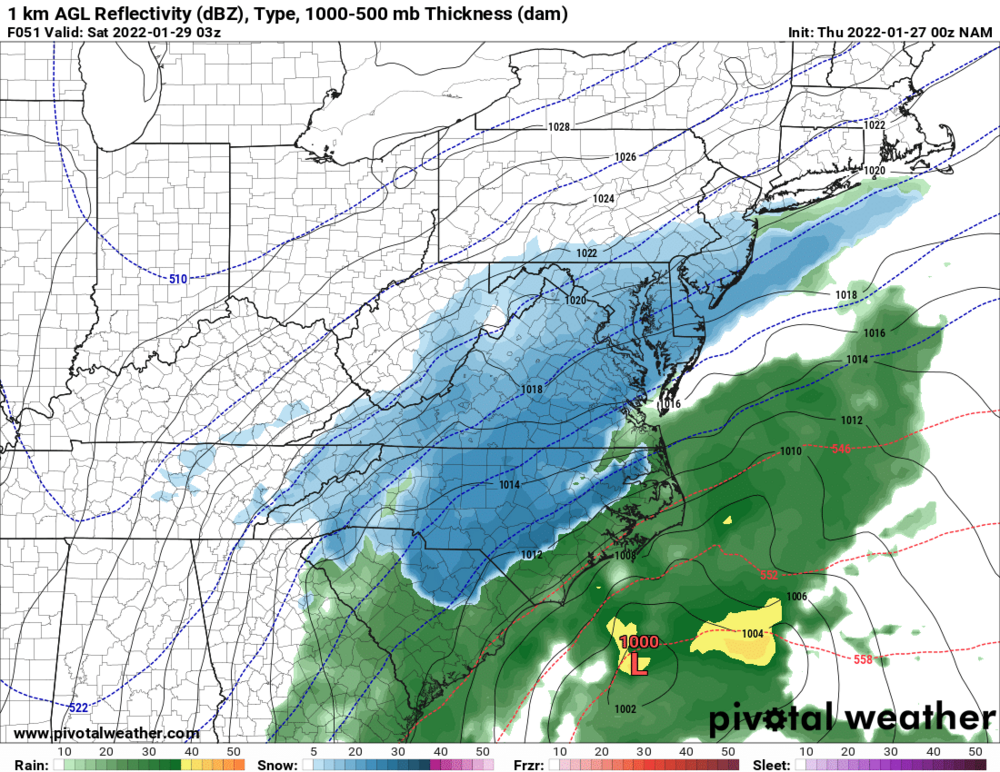
The NAM just pastes NC -
Potential 1/28-1/30 2022 winter storm
wake4est replied to Prismshine Productions's topic in Southeastern States
-
Potential 1/28-1/30 2022 winter storm
wake4est replied to Prismshine Productions's topic in Southeastern States
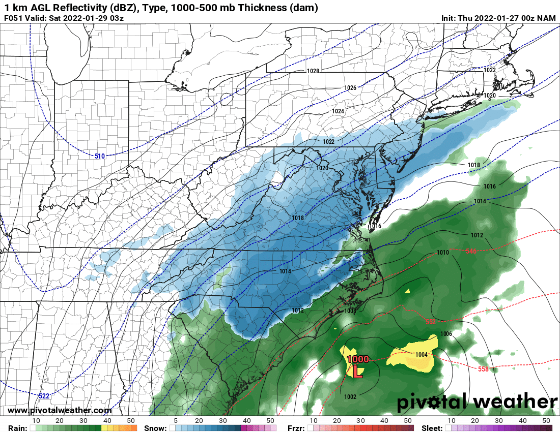
NAM!!!!!!!! -
Potential 1/28-1/30 2022 winter storm
wake4est replied to Prismshine Productions's topic in Southeastern States
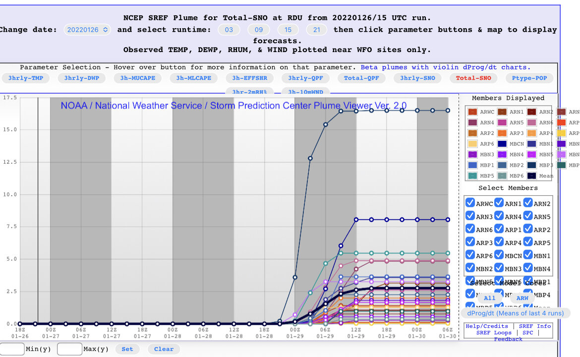
Ugh. Pain. The GFS hates Wake County.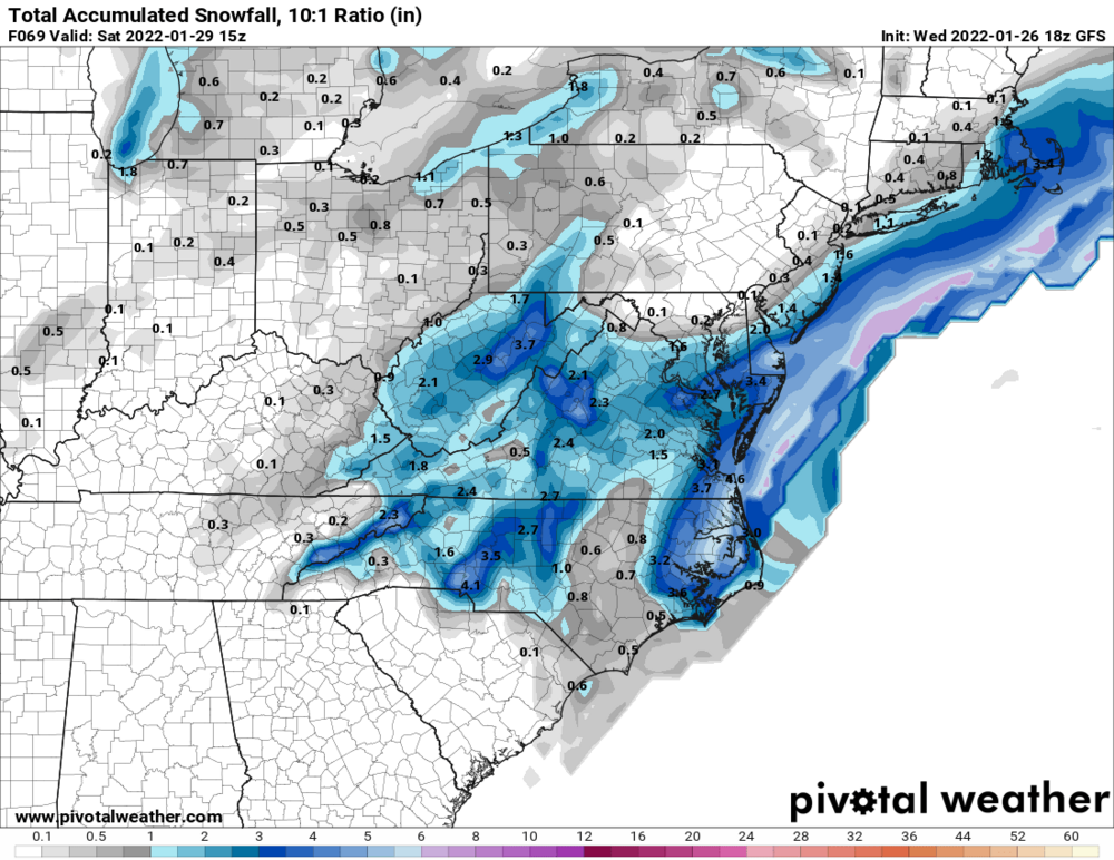
-
Potential 1/28-1/30 2022 winter storm
wake4est replied to Prismshine Productions's topic in Southeastern States
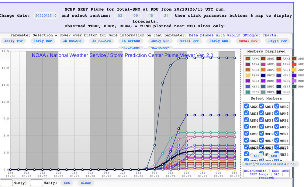
Shoutout to the SREF and it’s wacky member.