wake4est
-
Posts
950 -
Joined
-
Last visited
Content Type
Profiles
Blogs
Forums
American Weather
Media Demo
Store
Gallery
Everything posted by wake4est
-
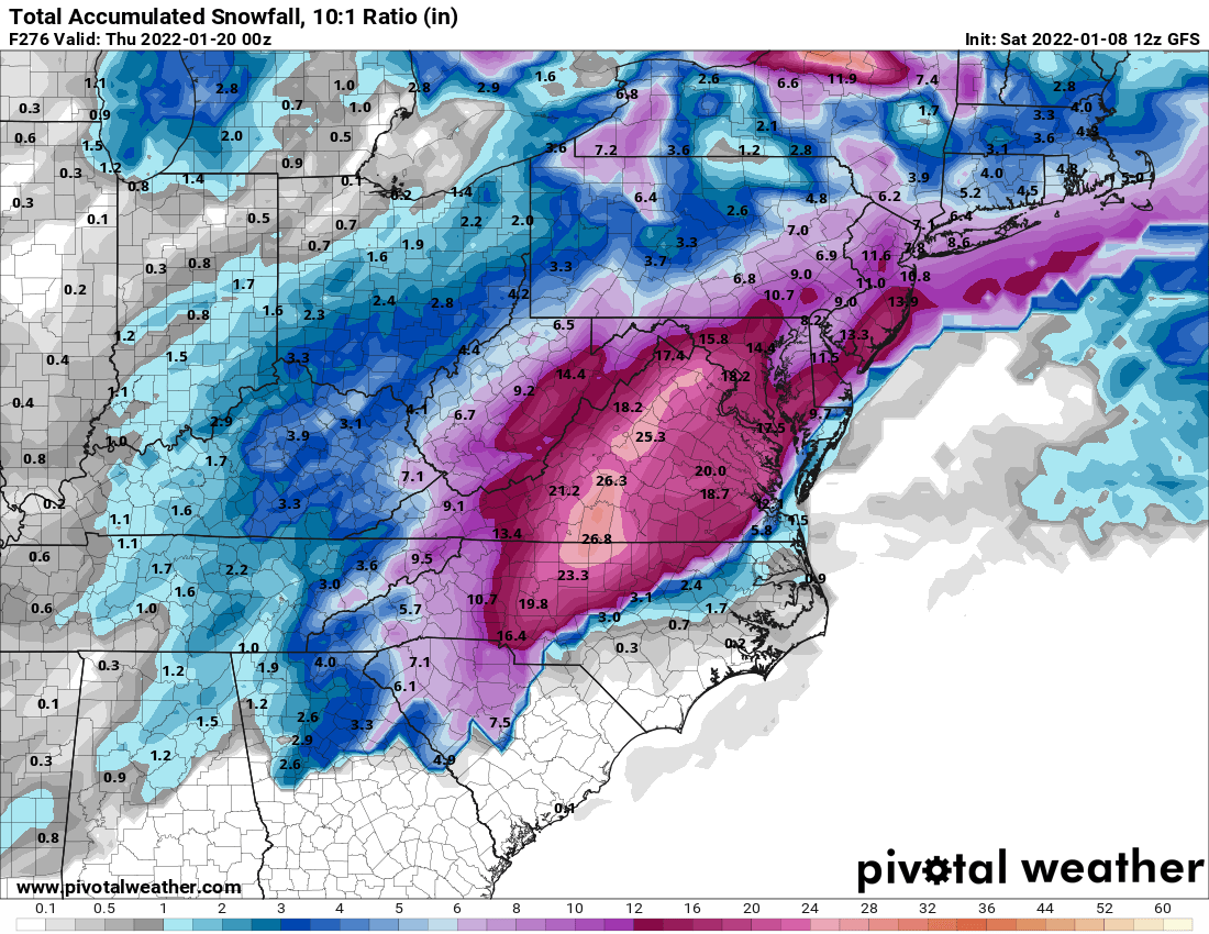
For RDU the Weather Channel has 5-11” from sat nite thru Sunday. BANK IT!
-
Impressive for WNC
-
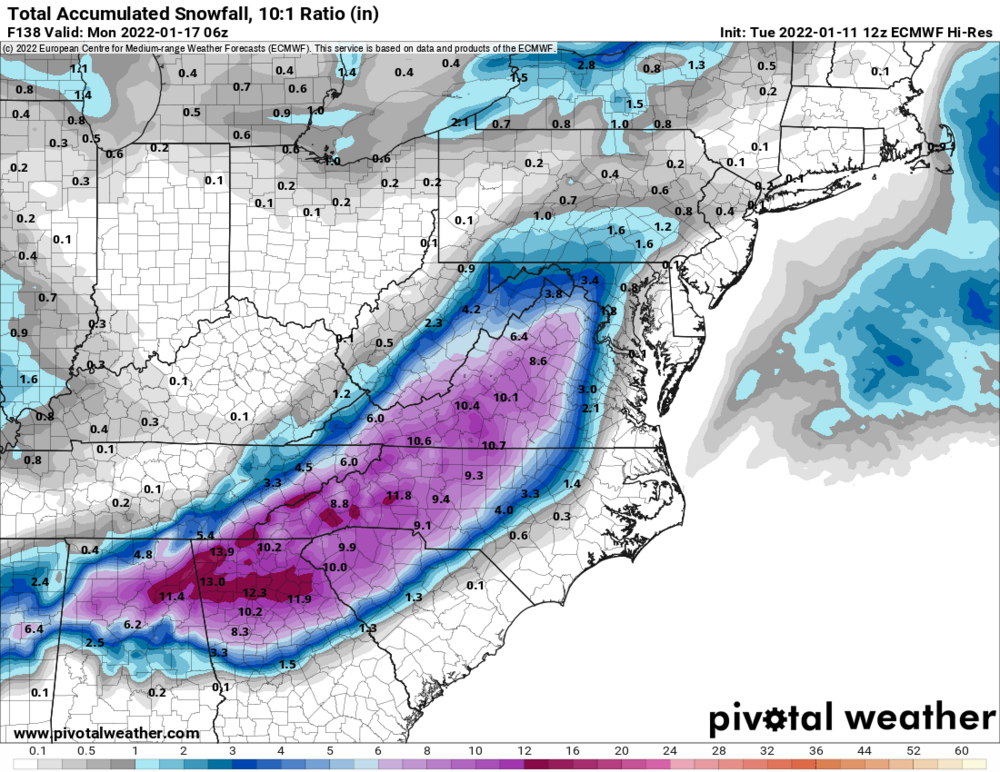
Lol at the Wake County gradient
-
I don't think I have ever seen more water on the roads in Western Wake than I did this morning.
-
February 18-19 MAJOR Ice Storm Threat
wake4est replied to NorthHillsWx's topic in Southeastern States
Yet they are still pushing this graphic
-
February 18-19 MAJOR Ice Storm Threat
wake4est replied to NorthHillsWx's topic in Southeastern States
RAH AFD has no real changes at all with the forecast -
February 18-19 MAJOR Ice Storm Threat
wake4est replied to NorthHillsWx's topic in Southeastern States
Isn’t ISW criteria .5”+? -
February 18-19 MAJOR Ice Storm Threat
wake4est replied to NorthHillsWx's topic in Southeastern States
Wow.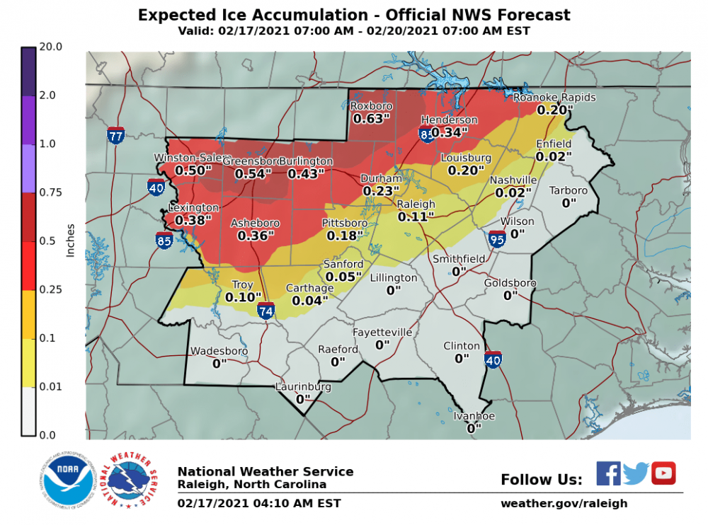
-
February 18-19 MAJOR Ice Storm Threat
wake4est replied to NorthHillsWx's topic in Southeastern States
RAH has gone all in. WWA looks like it’s for .1” and the WSW is for .25-.5”. edit: Blacksburg changed the watches to warnings as well with .5-.75” of ice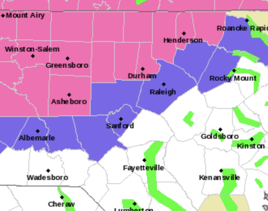
-
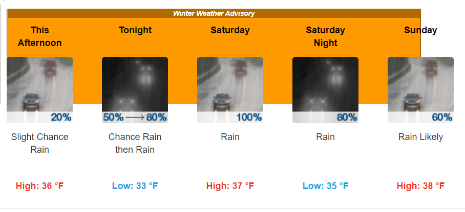
A Winter Weather Advisory for Rain.
-
HRRR has .22 of ice in Wake County, .5" for the Triad
-
What the NAM
-
Yikes. Where did the low go?
-
And Le Canadien...
-
Eww. Para vs. OG.
-
GFS Para hates the Triad and wants to see it suffer. 1.65" of zr in Winston-Salem. Also, the Para decided to work finally.
-
Interesting local forecast on Wunderground for Wake County snow . Really shows the reloading going on next weekend: Thursday Night - 1" Friday 1-3" Friday Night - 1" Saturday - 0" Saturday Night - 0" Sunday - 1-3" Sunday Night - 1" Monday - 0" Monday Night - 1-3" Tuesday - 1-3" Tuesday Night - Flurries Whatever they use to generate their forecast is definitely seeing possibility after possibility in the 10 day.
-
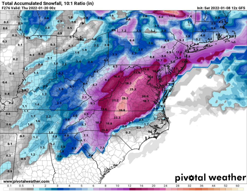
Lol from hour 60 to 66 on the gfs it dumps over 6" on Wake county.
-
Lol I’ve seen this before. The GFS, from 4 years ago today for roughly the same time frame as the monster run from this afternoon.
-
That is interesting for sure. Regular GFS is close to a similar solution.
-
Still snowing...
-
SuperBowl Sunday!
-
Just ripping up on Beech Mtn
-
Snow off and on consistently since about midnight. About 2” ish so far up in Seven Devils. 27 degrees
-
I’m up in Banner Elk for the weekend. Radar is showing snow overhead but it’s not reaching the ground. 34/26dp Edit: Aaaannnnndddd it starting pouring snow