wake4est
-
Posts
950 -
Joined
-
Last visited
Content Type
Profiles
Blogs
Forums
American Weather
Media Demo
Store
Gallery
Everything posted by wake4est
-
Honestly with this setup, I would not.
-
The whiff on this event for us is just the build up for the big show next weekend….
-
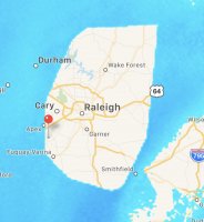
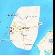
1” in Holly Springs
-
Flurries here in Southwest wake
-
February 19-20 Major Winter Storm Threat
wake4est replied to NorthHillsWx's topic in Southeastern States
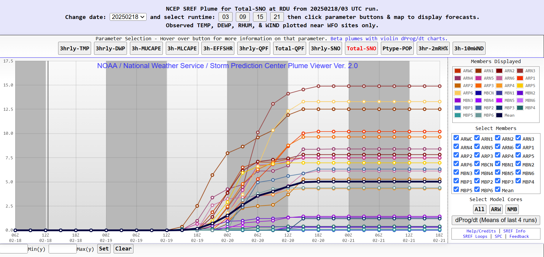
SREF plumes are a less reliable DGEX -
February 19-20 Major Winter Storm Threat
wake4est replied to NorthHillsWx's topic in Southeastern States
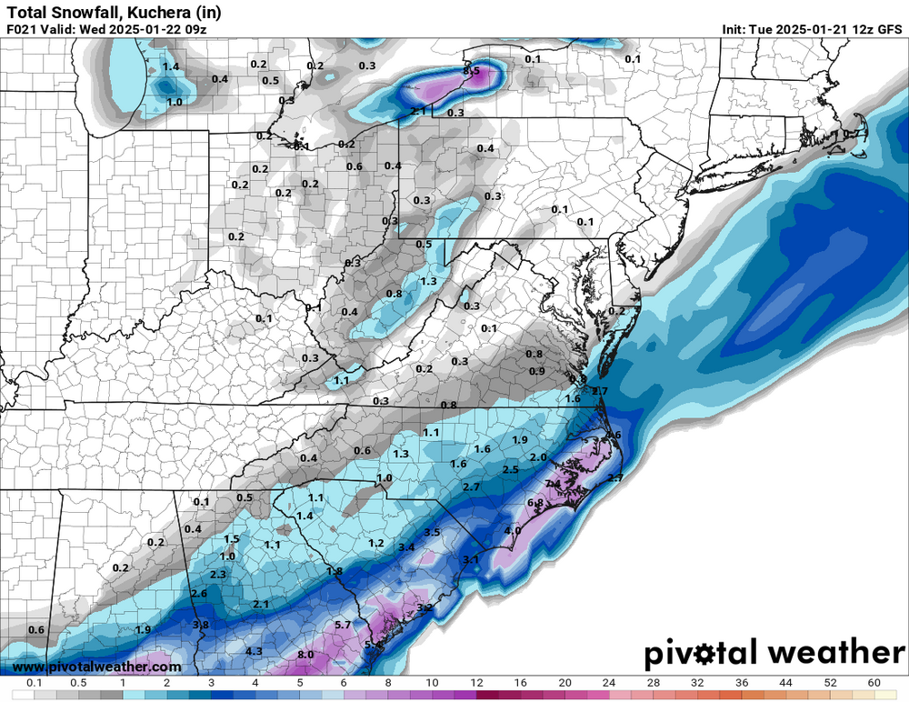
Lol just go here, click Total Sno and zoom in on the map below to find a blue dot near you, and then question all of your life choices https://www.spc.noaa.gov/exper/sref/srefplumes/ -
February 19-20 Major Winter Storm Threat
wake4est replied to NorthHillsWx's topic in Southeastern States
Y'all do what you want, but I'm rolling with the SREF Plumes TO THE MOON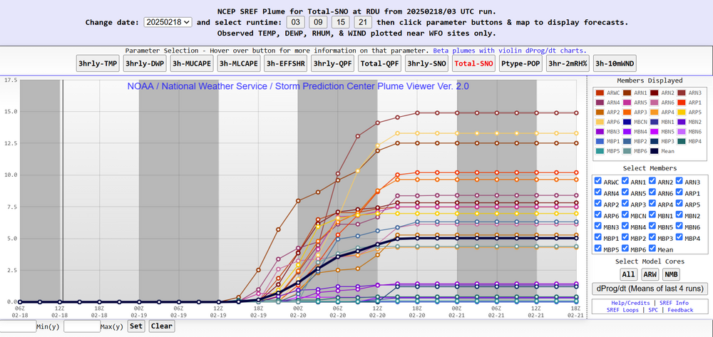
-
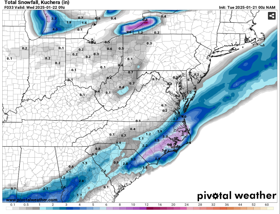
Oh my lord the NAM just did that.
-
brick check the rap...
-
Well, pretty sure you won't see school tomorrow.
-
My guess is that RAH will extend WSWs west to US-1 in the early afternoon.
-
RAP is lookin Mighty Fine
-
the afd this morning said that us-1 east should monitor for likely forecast changes and upgraded watches/warnings.
-
RAH just put Cumberland and Sampson County under a WS Warning.
-
GFS will raise some eyebrows triangle west
-
I am ready and waiting for the NAM to do some nasty things for us. Bring it.
-

-
-
Oh my the NaM is doing nam things
-
is the gfs a nice thing tho
-
Canadian paints 2.5 feet in onslow County.
-
yeah it is. go canada!
-
AND next Friday. But I preferred yesterday when it was giving us 17-21"
-
1/10-11 super awesome winter SE OBS thread
wake4est replied to strongwxnc's topic in Southeastern States
90% sleet and 10% snow. Has been this way in Holly Springs since it started.