IrishRob17
-
Posts
11,531 -
Joined
-
Last visited
Content Type
Profiles
Blogs
Forums
American Weather
Media Demo
Store
Gallery
Everything posted by IrishRob17
-
-8.3 at the moment here
-
What's the verdict? I'm sure you saw above that I had only a .01 difference this time.
-
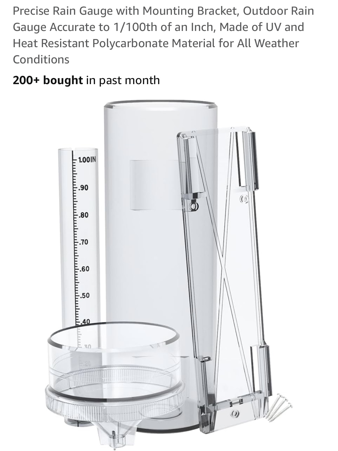
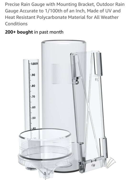
You betcha, see below, it's around $30. Everyone knows I like to bust chops but I also like to encourage and help folks with at least somewhat accurate measuring and record keeping. I can't stand the eye ball measurements not followed up with a real measurement. If anyone has any questions on how to use the Stratus just let us know.
-
Ok, CPcantmeasuresnowormelthisownsnowtotals I figured you'd be all over measuring anything and everything about snow. I took a core sample from the pack to dig a little deeper and got .48" Sometimes snow can miss the Stratus, especially in bigger storms.
-
Does anyone else measure liquid too? 6.9" here melted down to .49" We knew the ratios would increase as the arctic air moved in but that's an impressive average ratio of 14:1 for the storm IMO. 21.5" for the season.
-
Nice. Measured 5.5" about 45 minutes ago, light snow 26/24 here.
-
I measured 3.3" about 15 minutes ago. I picked up the bride at work, the roads are slicker than snot on a door knob, as my Old Man used to say.
-
 7" over what time period? Did it change?
-
I like driving in the snow when the idiots stay home. I remember driving during the State of Emergency in Feb 2010 and it was awesome.
-
I have a whole house humidifier that does ok but still have one in my bedroom too. I'm sensitive to humidity either way, too much or too little. Things do look to be going our way and as you pointed out, with the cold coming in we'll have some snow cover to go with the pond ice. I'll have to look at the winds after but I'm guessing we'll get some drifting afterwards as well.
-
I had such a shit day at work today that I have not had time to look into or think about this storm but this post is spot on. And as for Monday night...GO IRISH!
-
Have had steady light snow most of the afternoon around here., .2 on the board.
-
9 for the low for me as well.
-
Yep, you got it. On my chart 12/20 and 12/22 are equivalent. Someone smarter than I may make a correction on that but I figure its close enough.
-
Love see pond hockey each afternoon in the park.
-
.5 this morning, 14.3 on the season
-
My son flew out of DFW to Miami on Wednesday. It was killing him to be leaving the storm but he had to do what he had to do LOL. Some PSU fans put the ass in class where he was sitting last night, throwing empty beer cans at him but he had the last laugh. No one owned up to throwing the cans when he turned around so at the end of the game he turned around with one of the cans in his hand and simply said "Got any more?!" Crickets of course after that. HERE COME THE IRISH!
-
Good because you don't have a choice.
- 993 replies
-
- 3
-

-

-
- metsfan vs snowman
- bomb
- (and 2 more)
-
I'm somewhat less tolerant of the cold but much less tolerant of a cold wind. Last Thursday I took down my outdoor decorations before the wind picked up in the afternoon, wanted to get it down before the freeze set in. I was in a t-shirt for much of it even though temps were in the 30s. If I'm doing something, the cold doesn't bother me too much it's when I'm just sitting or stand out there that it can start to get to me. A man fell through the ice the other night in Lumberland. Lets be careful out there.
-
Don't know if it's my imagination but it seems like this has been one of the overall windier stretches we've had in a while.
-
Another clean up that the leaf blower took care off.
-
The bride measured .2 on the board at home.
-
You posted in this thread on Saturday unless there is another post you are referring to that was taken down.
-
Snowfall NYC subforum Jan 6 and OBS if needed
IrishRob17 replied to wdrag's topic in New York City Metro
Sorry, bust day at work. It was steady light snow for a few hours but has stopped as of right now. Untreated roads/sidewalks are slick and there are numerous accidents reported throughout Orange County. I did have time to report that on mPING earlier, keep that resource in mind as it can be useful. Stay safe out there. -
Yeah, that's one of them, I was on that one in between NE.Weather and Eastern.