
Violentweatherfan
-
Posts
3,217 -
Joined
-
Last visited
Content Type
Profiles
Blogs
Forums
American Weather
Media Demo
Store
Gallery
Posts posted by Violentweatherfan
-
-
1 hour ago, Newman said:
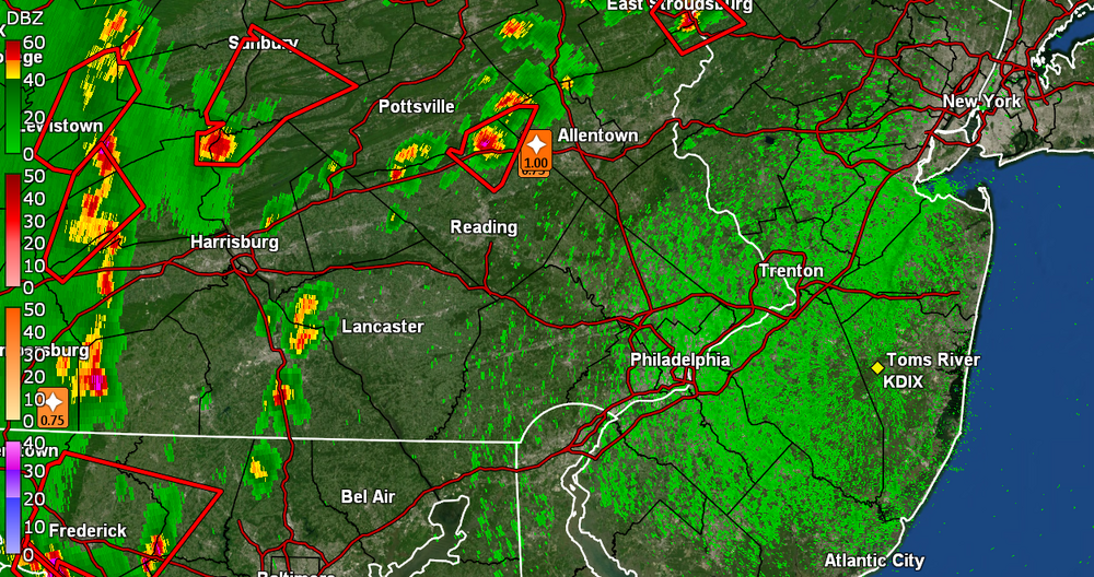
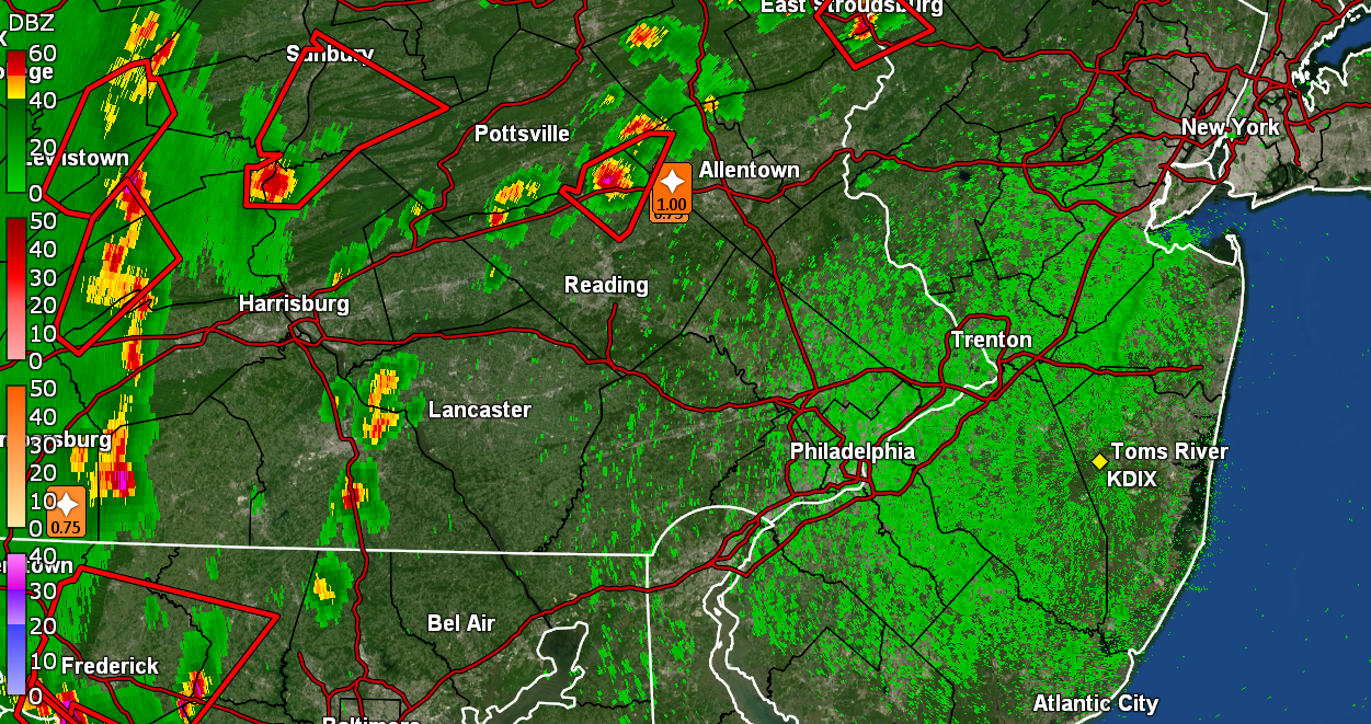
NWS upgraded the NW burbs WWA to 3-5" on the latest forecast package. If the NAM is to be believed, there could be an iso 6"+ in there across Berks or the Lehigh Valley. Depends if we get some good banding to set up across that area, otherwise i don't think rates or snow growth will be spectacular. Snow comes in around 7-9pm, gone by 10-11am on the NAM. That's a solid 14-16 hours of snow. But, we won't be seeing consistent 1" hour rates or something.
Good post in the MA subforum regarding how good(when in its wheelhouse) the 3K name is with temperature profiles.
-
8 minutes ago, snowman19 said:
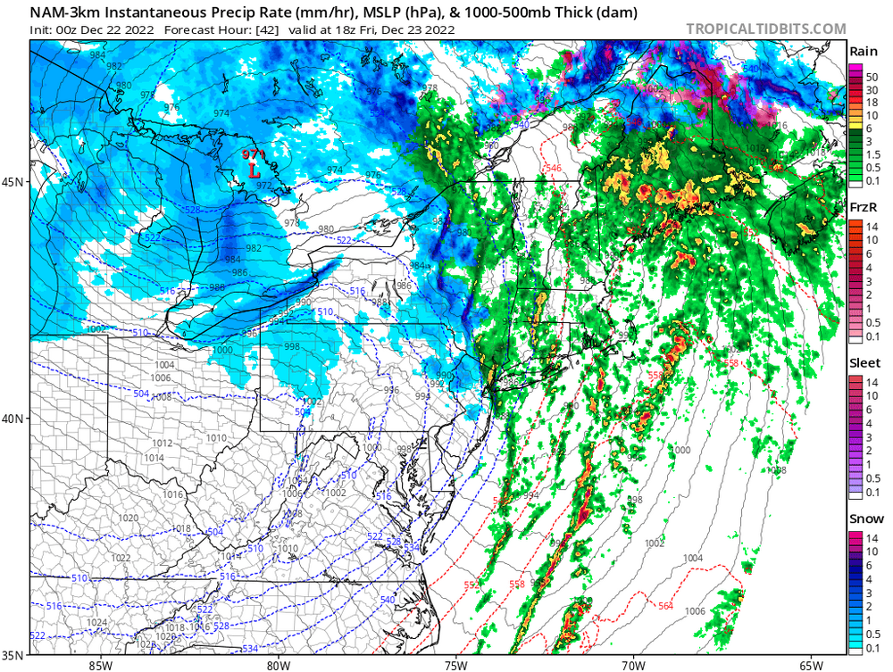
Why are you using the HRRR at this range?
And with Kuchera snow map
-
 2
2
-
-
Pessimistic about the Kuchera snow ratio
-
 1
1
-
-
Looks like the squalls are going to dry up before getting here.
-
 1
1
-
-
28 minutes ago, Hurricane Agnes said:
I remember when Chief Halftown used to be at Crystal Cave.
Wow, blast from the past.
-
6 hours ago, forkyfork said:
this weather is dreadful. thankfully it won't last too long
I hope so too, want some heat and humidity to return.
-
1
-
-
Keep your vehicles away, definitely negativity impact the value.
-
Did you order the code red! You're God damn right I did.
-
1
-
-
7 hours ago, RedSky said:
Can't forget the Neshaminy Inn dude
")
Was that the one with the heart shaped beds?
-
1 hour ago, RedSky said:
Biggest severe event in years all I got was a thundershower. Even the wind gusts were pedestrian compared to others this February and March no power outage or trees down locally.
What was really surprising was geographically within a few miles how dark it was. Like night and day.
Literally
-
1
-
-
52 minutes ago, Hurricane Agnes said:
Enough to get you outta storage and posting after that event yesterday!


Yeah, pretty much an uneventful winter. Kinda looking forward to severe
-
1
-
 1
1
-
-
Probably the darkest storm cloud civer I've ever seen.
-
2
-
-
22 minutes ago, floridapirate said:
Ive seen one flash freeze in my life despite the many calls for one. Im banking on the latter.
The most recent one 2011-15 timeframe if I recall correctly had little or no wind.
-
6 hours ago, forkyfork said:
the meso models show a line of convection with heavy rain along the front. that is the worst possible scenario for flash freezing
The wind that will come with front will help limit any potential flash freeze.
-
1
-
-
I'm hearing cicadas in Bucks County and seeing plenty of cicada killers. It's still early for cicadas, wait til August.
-
Since we are talking birds, Warblers are returning to the area. Black and White and Yellow-rumped Warbers are back.
-
Nothing now in Langhorne
-
Wet snow in langhorne
-
Will there be any wind associated with this cold front? Usually there is, and will blow dry the walkways and roadways limiting any icing probabilities.
-
41 minutes ago, Birds~69 said:
I think the geese already punted winter and headed back. A little pond near me had a flock of geese pecking at the ground this morning.
Good thing about this rain/fog is the car is receiving a decent rinse off. Thinking about watching the radar and in between heavier bands.....go outside w/a bucket of soapy water and do a quick wash then let the rain wash it off.
I have zero concern about icing and hope the township does as well so they don't lay down anymore salt/brine or whatever...
41F/Fog and the snowpack is patchy
The Northern Cardinals are singing too

-
6 minutes ago, JTA66 said:
We had one in 2014 I believe. Friends in Chester County were without power for nearly a week.
I remember there was one that I thought was 10 years ago but this is it.
-
I only remember one ice storm that happened and that was in 1994. the one most of us remember. Back in the seventies there was one that I recall, but only bus ride to high school. I remember the trees that had frozen glaze being highlighted by the sun, quite a remarkable sight.
Ice storms are so rare, really doubted this ever verifying.
-
17 minutes ago, MGorse said:
I feel like I am being interviewed. Lol. That statement sums it up well. Many times this is being said incorrectly because the energy is not being transferred. New coastal low develops due to incoming upper level support (results in surface pressure falls) while the inland low weakens then dissipates as the upper level support leaves it behind.
Thanks, no interview from me. I have brought this up many times when I see someone post "energy transfer" and mention there is no transfer and the term is incorrect.
I just wanted to be sure, thanks.
-
1
-
-
Question for @MGorse. During a Miller B storm is there really no transfer of energy to the coast for redevelopment.
It's actually not a transfer of energy. That terminology is incorrectly used many times. What happens is that the primary low is becoming more vertically stacked, and thus losing upper level support (differential vorticity and temperature advections). The best upper level dynamics are now out ahead of the primary low, and as it reaches the coast where a natural baroclinic zone is present between the warm ocean and cold land, a secondary low develops.
First of all in no way am I referencing yesterday's storm, just Miller B's in general and do you agree with the above.
-
1
-
 1
1
-
E PA/NJ/DE Winter 2023-2024 OBS/Discussion
in Philadelphia Region
Posted
At the surface we will near 30, but upper levels will be plenty cold to produce high ratio snow.