jimmosk
-
Posts
122 -
Joined
-
Last visited
Content Type
Profiles
Blogs
Forums
American Weather
Media Demo
Store
Gallery
Everything posted by jimmosk
-
https://www.mysanibel.com/live-street-cams
-
That cam was about at the level of the bottom of the two houses behind the center one in the shot, so those hosues at sea level now. The center house stands about four feet higher than them; I bet the owner is feeling glad they paid for the extra height... for the moment.
-
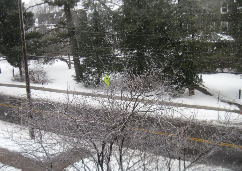
Rain mixed with sleet in Swarthmore at the moment. 39°.
-
Not a plane for Cancun?
-
After a half hour of white rain, changed back to all snow, at almost +SN intensity!
-
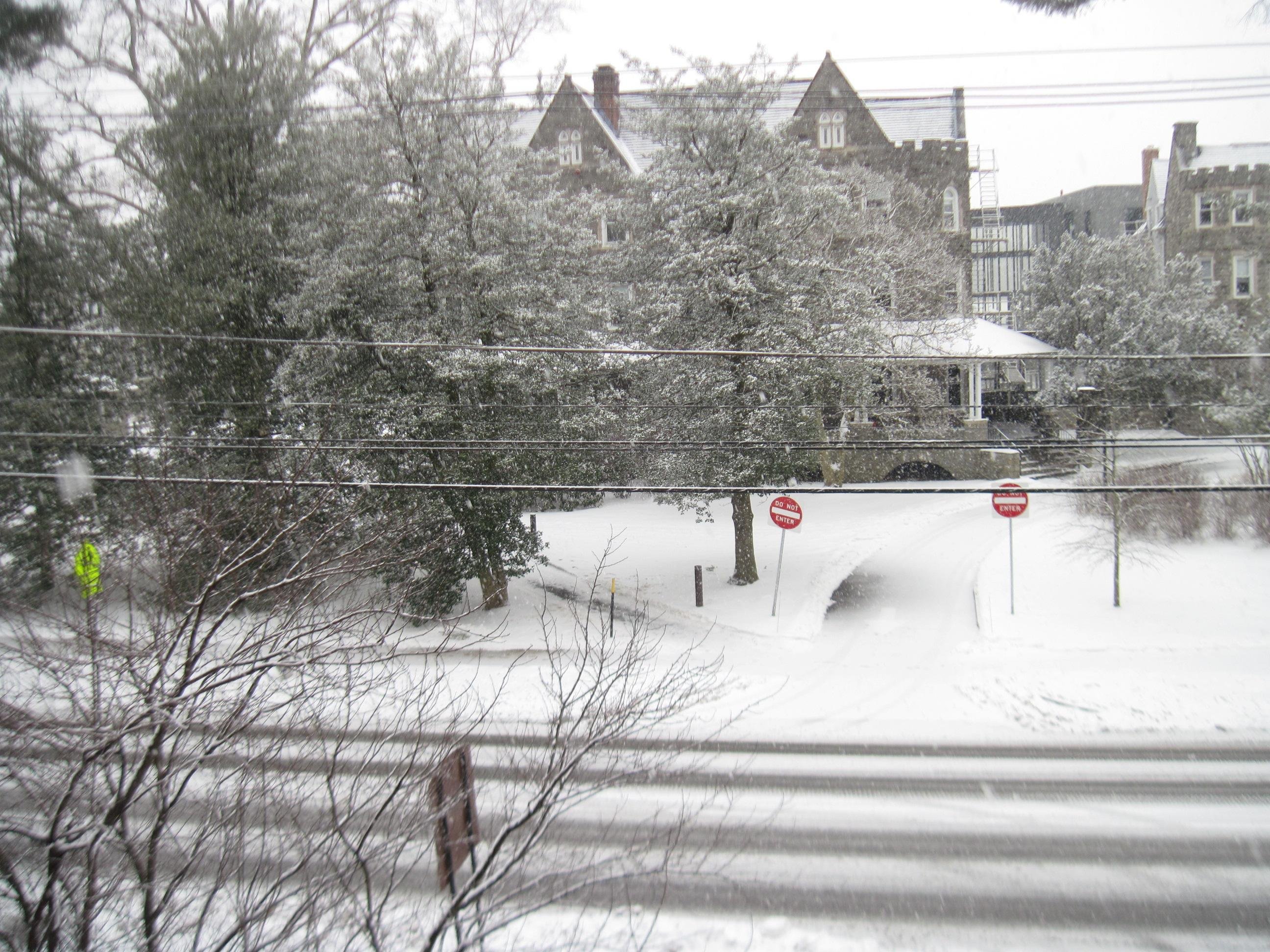
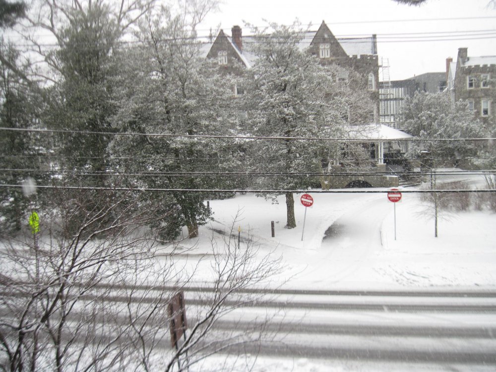
Looks like the rain/snow line is getting close, so the current view out my window is probably as pretty as it's gonna get. Which is to say, very. A little over 1" at this point. ...and yep, as soon as I posted this, rain began mixing in.
-
Pretty steady increase in intensity, getting close to +SN now. Untreated surfaces have a coating.
-
Reality is currently trouncing radar in Swarthmore - just a few flakes, while the returns suggest SN to +SN This snirga can't last, though...
-
Moderate snow started up again here, 15 minutes ago. Added a photo of how quickly the snow is sticking to the still--iced-over trees:
-
15 minutes ago it was tiny flakes with a bit of graupel, but in the last ten minutes the strength picked up to SN, nearly +SN levels, with larger flakes. Depth has almost reached 3" in Swarthmore.
-
Intensity is back up to SN, at times even +SN, with decent-size flakes again. No big pillow flakes, though.
-
Intensity dropped to -SN in Swarthmore, down from SN. Tiny flakes, with a small amount of sleet. We’ve had a little more than 1” so far.
-
The northern and western burbs, to be specific. Some burbs are to the south (and, depending on how you classify areas in a different state, to the east). But if you do mean this neck of Delaware County has a shot at 8", kudos!
-
I'd put the final total for Swarthmore at a coating to 1/2 inch. There was plenty of snow in the air... but gone as soon as it touched down, whether onto pavement, grass, or trees. PHL's 0.7" sounds plausible to me.
-
Still melting on contact here in Swarthmore. There's a trace on the grass, but I'm jealous of those near me (Media) who're measuring it in inches.
-
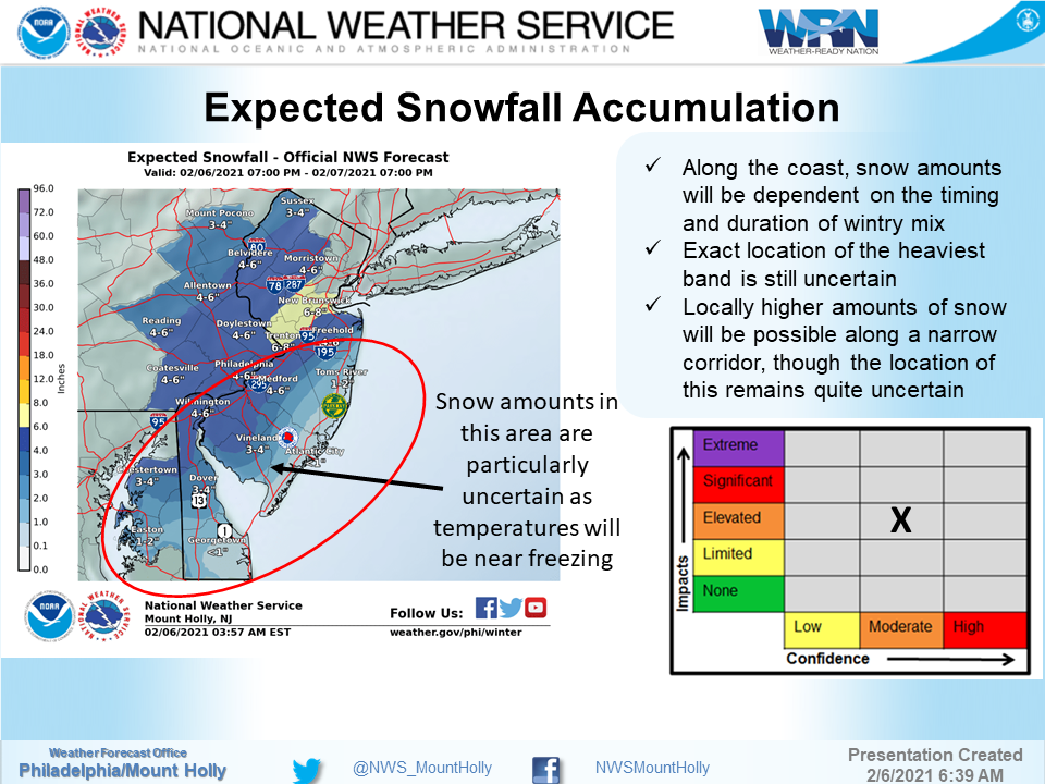
Well, that plus the NWS itself putting their confidence level at only Moderate, in their briefing about the storm: https://www.weather.gov/media/phi/current_briefing.pdf
-

January 31-February 2, 2021 Major Winter Storm Observations
jimmosk replied to Ralph Wiggum's topic in Philadelphia Region
Send some of that stuff south! Light sleet here at the moment, atop a tenth of an inch of freezing rain from overnight, which in turn is on top of 2.5" of snow from yesterday. -
For VWF: The models all show good qpf in Philly and surroundings. The differential in the snow amounts is mostly differences in how much warm nose pushes in and hence how much mixing occurs. My exp is that given the cold air that's been in place, and the high precip rates expected due to the rapid deepening low, you'll get the typical evap cooling effect where the heavy rates keep the column at freezing so long as precip is sufficiently robust. The lull period tnght tmrw am is where the risk is as has been stated. Heaviest rates, 1-2" hr are really only progged for a short time on any of the models, and it's right after precip ramps back up. Some models show that period being sleet for many of us; that cuts the totals. Others keep it all snow. That will be the difference for the corridor though btwn a 6-8-12-15 storm total. Remember that if we got 2" thundersnow type rates for several hours, we'd be talking plural feet in the corridor, not 10ish inches over 3 days. *Most* of this event is clearly NOT heavy snow. So, don't panic if things don't work out exactly as the models project. Expect that they won't be perfect. One thing they all show is that this system is with us for awhile and should produce some snow most of that time. By Tuesday pm, we will probably add up to what this forum expects, but, expect a lot of panic and concern from people here tonight and Monday, beyond the lull, just bc I think people are expecting a major 2"+ hr rate situation and again, outside a few hour window, this is a low and slow burn. I also think based on what I'm seeing live that the models may be underdoing the overrunning totals a bit, and that may also help us get to expected totals. We're going to be fine, folks.
-
Just back from a walk in the white and the holiday lights. We're over 3 inches but I don't think up to 4 yet. Regardless, that's more than I guessed we would get before the changeover, and it's still coming down pretty heavily. Just as I was coming inside I started hearing the pitter-patter of little sleet, so the mix line may not hold off for much longer. Thanks for the inspiration, Jeb!