.jpg.b9a795a9fe89b3aa2ead015665ae36fe.jpg)
nvck
-
Posts
453 -
Joined
-
Last visited
About nvck

- Birthday 06/22/2006
Recent Profile Visitors
7,124 profile views


-
New hrrr has the whole LP engulfed in smoke by tonight, and most of Ohio by tomorrow morning.
-
Mt Pleasant at 100, Oscoda County at 104, models definitely had a good handle on the placement of the hottest temps being northeast central MI
-
90/69 at the cmu wx station now, maybe signs of dews starting to mix lower? Ticked down over the last half hour, need to see that pick up for a run at 100
-
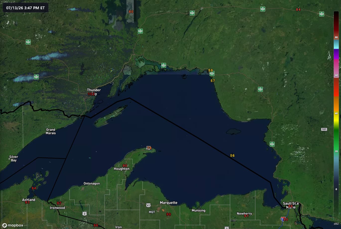
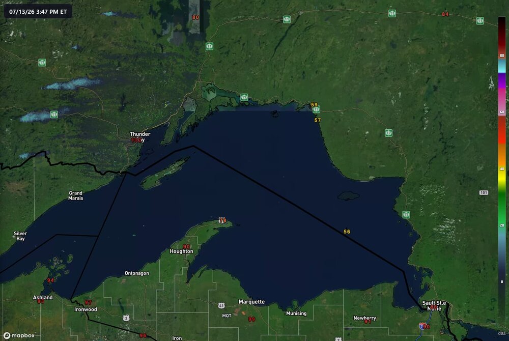
102 in thunder bay, 59 across the lake... nature's AC
-
this video is from vietnam, but there was, incredibly, another strong tornado in china a few days ago https://www.bbc.com/news/videos/cq61d22ved2o
-
81/78/89 at 8:30am... No thanks
-
90/80 imby is tough, air is just so thick. station might be running a bit warm/moist, but another PWS a couple blocks away is showing 93/81.
-
don't really buy the slight risk being pushed into Ohio tomorrow, ample shear but MLCAPE will likely be below 300j/kg. like wednesday's event on a budget.
-
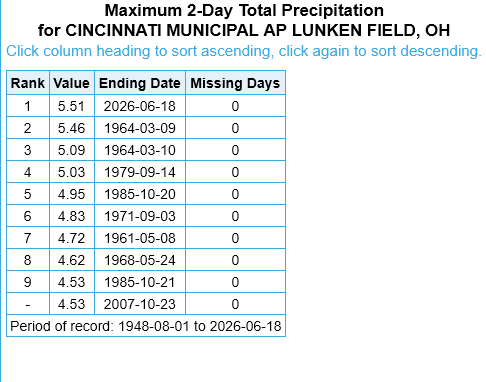
just had the wettest 2-day stretch on record at the municipal airport here, and those 5.51" came in a ~18 hour span.
-
oh for sure, the imagery from TCVG was insane nonetheless with that storm that went through florence
-
risk definitely verified around here
-
i think that southern one will stay south of 275, but the northern one could potentially impact the metro
-
even with the consistent stratiform stuff here, thinking it could be a busy next few hours, given whats unfolded to my west
-
80/70 probs on the new watch
-
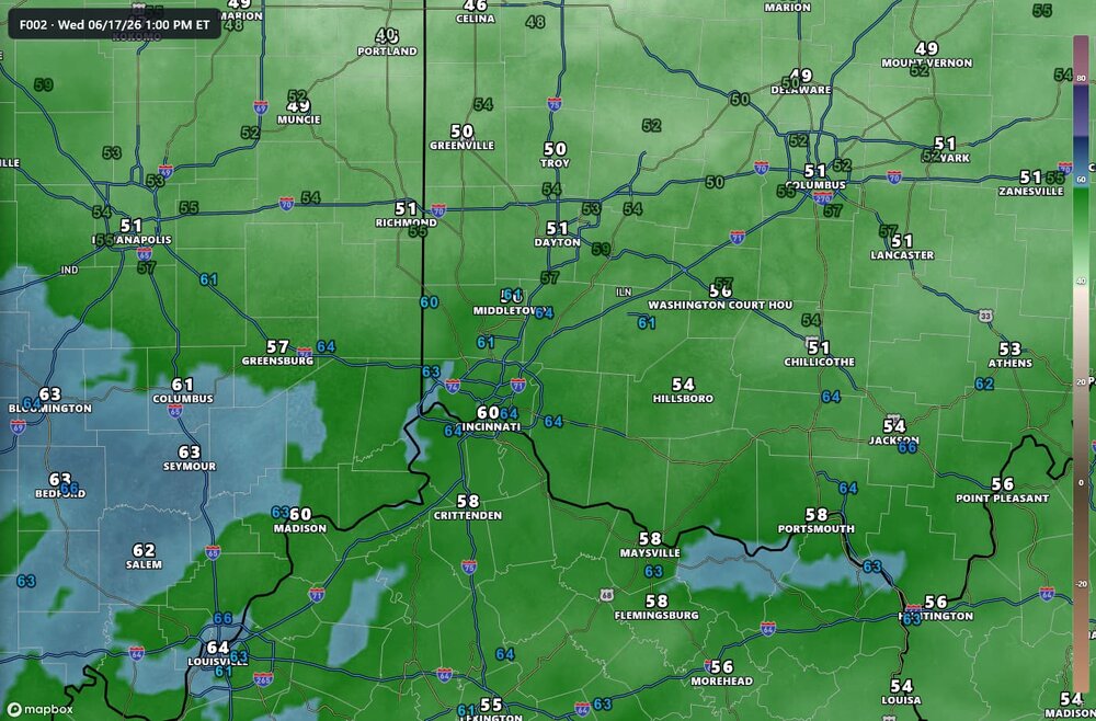
HRRR over-mixing bias on display once again, latest run undershoots dew points by several degrees across my area, with obs in the colored labels. 13z RRFS seems to have a much better handle on moisture, although it's under-doing SBCAPE by 750-1000J/kg, per mesoanalysis
.thumb.jpg.ad3a2e31d30aff035044689b311a0540.jpg)