Bob Chill
-
Posts
36,356 -
Joined
Content Type
Profiles
Blogs
Forums
American Weather
Media Demo
Store
Gallery
Everything posted by Bob Chill
-
The 6z Sunday sounding looks AMAZING. Mlcape in the 350s and pounding snow. Maybe a rumble or 2?
-
Pretty sure I'll mix at some point. 18z Euro fired the first warning shot but 1.75" qpf had already fallen before the mix. Good thing is (so far) all the mix soundings are sleet. Warn nose is @ h7 and there's plenty of cold below to make grape nuts instead of ice.
-
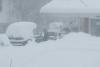
I did all the maintenance due on my generator and loader/tractor today. Got gas for the camping stove and indoor propane heater. Still need tighten up all my solar panels and whatever else I have to worry about breaking lol. Hopefully I get sleet and not zr. This storm is getting serious for my area and south....
-
I'm thinkin sleet is likely for me even though most models show my area in the safe zone. If it's a qpf bomb like it appears to want to be, climo strongly favors sleet. But it's quite a wall of confluence unlike a scared HP running away so maybe not...
-
There is no doubt in my mind the gfs is SPOT ON this time. Someone please ctrl+alt+del it immediately, m'kay? Tx!
-
Gfs is coming around. Closed low unclosing and ns is digging further back in BC. Should be a better run (not saying much lol)
-
-
Gefs is a hive to the op and it becomes more pronounced at shorter leads. EPS can be similar but not on the same level. Gefs always mirrors the op inside of 7 days. If the 18z op goes big, so will the gefs.
-
Never easy. Gfs would make my yard happy but honestly it would be a big letdown to me as well. I'm never sold on a major until 48-72hrs but imho, I highly doubt the gfs. Too many ingredients in place for a MA snowstorm and too much general model support to believe the gfs just figured out the final solution. Euro has been crazy steady. People expecting 12-18" already are setting themselves up but a widespread warning level event for all our yards seems quite likely
-
Everything is trending that way. Primary driving into the TN valley then a handoff off of NC. Interestingly, the euro ai was showing that type of progression several days ago. CMC was as well but was very amplified. From a history and climo standpoint it makes a lot of sense. It's a classic progression for a major SE/MA winter storm.
-
It came from a tired old model that loves to make shit up way out of range
-
Surprised models still keep my yard safe from mixing but I'm expecting some sleet for a time. Hopefully no zr. Power can go out for weeks (not days) down this way lol. If I mix and the DMV doesn't get widespread double digits ill have to put a check mark in the fail column lol. Getting calls for snow removal help already. Might be a very profitable storm. Deep powder, diesel fuel, and heavy equipment sounds like a good f'n time hahahah
-
I got 30" in Rockville 2016. Rode the edge of the dryslot and it was puking for hours. I'll never forget that one.
-
Upper level support is still pretty far back and there's potential stream interaction as it swings through. Not saying some huge dump is still inbound but verbatim, decent lift and dynamics are continuing beyond this hr144
-
18z aigfs is a pretty big jump south. Still gets a decent swath of snow into DC but weenies won't be as happy. Max qpf stripe in NC this run
-
Very generally speaking, thunder snow is reserved for storms that deepen rapidly near your latitude (bomb out) or less commonly a vigorous closed upper level low pass creating instability and pockets of big lift. I don't really see either with this event yet so my guess is no. There's a big thermal gradient but otherwise not a bomb scenario or gnarly closed upper level low.
-
Agree but it's weird that the analog isn't showing on CIPS or CPC. There are a lot of good storms showing on the lists though including Jan 96, second Feb storm 2010, Jan 2011, and mid Feb 2014 to name a few. The 2007 sleet storm is also in the mix and that one could have been a major snow event. The analog lists are loaded but not with PD2. There must be some key differences at 500mb keeping that one at bay. IIRC, PD2 didn't have a big -NAO so it could be that feature. Not really sure.
-
Climo is climo. I can't buy the 12z euro for 1 simple reason. It would be one of the top 5 biggest storms in history down this way. Idk if this is the kind of setup for something that historic. Blizzard of 96 was 24" in Roanoke. Feb 2014 was close to 20". A 15-20" storm is quite rare. Imo, the DC area is more likely to get 15-20" than central and swva. That said, my yard is in a pretty good spot and I'm pretty fired up over the potential.
-
It's 3 storms. Jan/Feb 2010 redux
-
Lol. Euro AI has 3 hits in a row too. This is #3. Hahaha 3 threads inbound.... hahahaha
-
A lot of that depends on the setup and how developed the storm is in advance. A fast moving NS wave diving down out of Canada and rounding the base is usually moisture starved before the turn and typically has a narrow stripe. Very hard to nail down even at 48-72 hours. This event is nothing like that. Precip will already be breaking out 4 days in advance and the main energy isn't embedded in fast flow. Precip will also cover a pretty large area. Its a classic setup for SE/MA winter wx. For those reasons we'll prob safely know the bulk of who's getting winter wx by 96 hrs with the edges and mix line location causing the most uncertainty. People solidy in the middle of the snow zone by 96hrs can feel pretty good about getting hit. Finer details like max stripes and total qpf in general will always wobble even at 24-48hrs. Subtle differences in track and strength can cause fairly large shifts in amounts. All this said, I expect good agreement with all models for the bulk of the snow zone by 0z Tuesday. Famous last words.... lol Eta: I meant 0z Wednesday runs or tomorrow night. Not tonight's 0z suite
-
Let's just play the ukulele and lock it up. I mix for a bit but if that's what it takes for ALL of us to get buried... I guess I'll make the sacrifice just this once
-
Obviously that's extreme lol but feast/famine or storms in bunches has historically how we roll in the MA. We're conditioned to expect fail (especially the last 10 years or so) but we also haven't had a blocked pattern like this since 2011. I'm personally expecting a second legit threat at least over the next 2 weeks. Blocking cycles like this have historically lasted 30-45 days. Imo, it would be much less likely for things to fall apart quickly than hang around and deliver. I had a hunch this winter would be blocky and so far it has been pretty good in that department. The upcoming period looks ideal. Just need things to remain active to capitalize. That piece is always random and chaotic but give us enough chances and we'll do just fine imo.
-
Gfs AI is a triple header lol #2 #3 Our last heater was 2015. WDI? Lol
-
ICON is more of a tn valley overrunner vs a developed storm. Not much of a circulation or developed surface/850 low. AI models are far different in that respect.