thunderman
-
Posts
757 -
Joined
-
Last visited
Content Type
Profiles
Blogs
Forums
American Weather
Media Demo
Store
Gallery
Everything posted by thunderman
-
From a HAM radio friend of mine just a few moments ago:
-
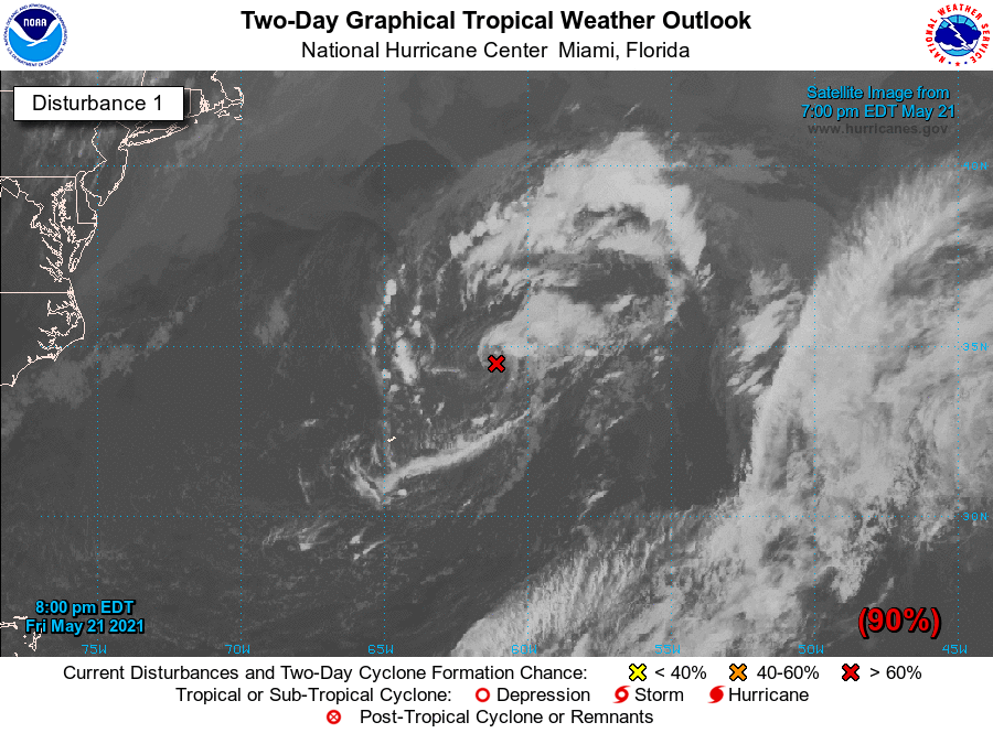
Still 90% with 8PM outlook
.thumb.gif.e195485ada751c707eb109a51caa2134.gif)
-

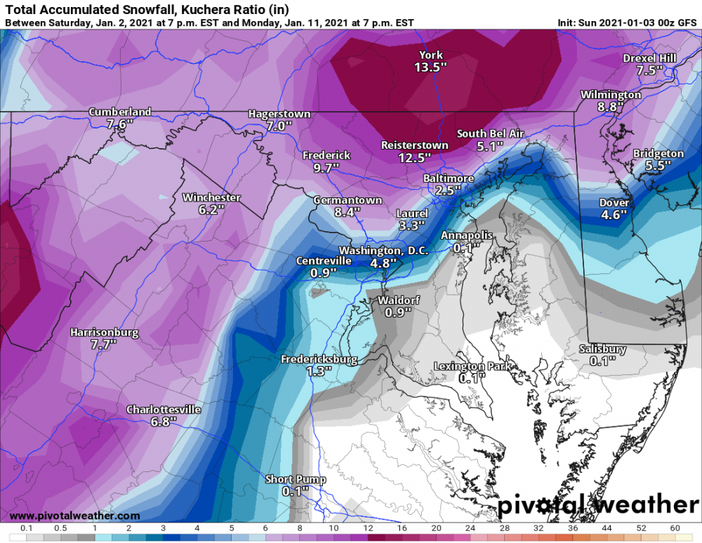
Feb Long Range Discussion (Day 3 and beyond) - MERGED
thunderman replied to WinterWxLuvr's topic in Mid Atlantic
Will have to see how this tracks. Could be very memorable ice event for parts of central Virginia and the southern Shenandoah valley. zr with temps in the 20s is bad news. -
Nice imagery from CIRA this evening!
.thumb.png.b8de3a520f73e9e8ae955407d67438b6.png)
-
It's slightly better than the Jamaican.
-
The Euro soundings is almost a deal breaker for me.
-
Slightly offtopic, but how does Weatherbell compare to Pivotal? I cannot find a list of what plots Weatherbell provides.
-
Gotta post the weenie map
-
Found it. CIPS Historical Analog Guidance (slu.edu)
-
There used to be a site that you could view the top 10 analogs in detail (upper air, surface, measured snowfall, etc.). Does anyone remember what I am referring too? If so , do you have a link?
-
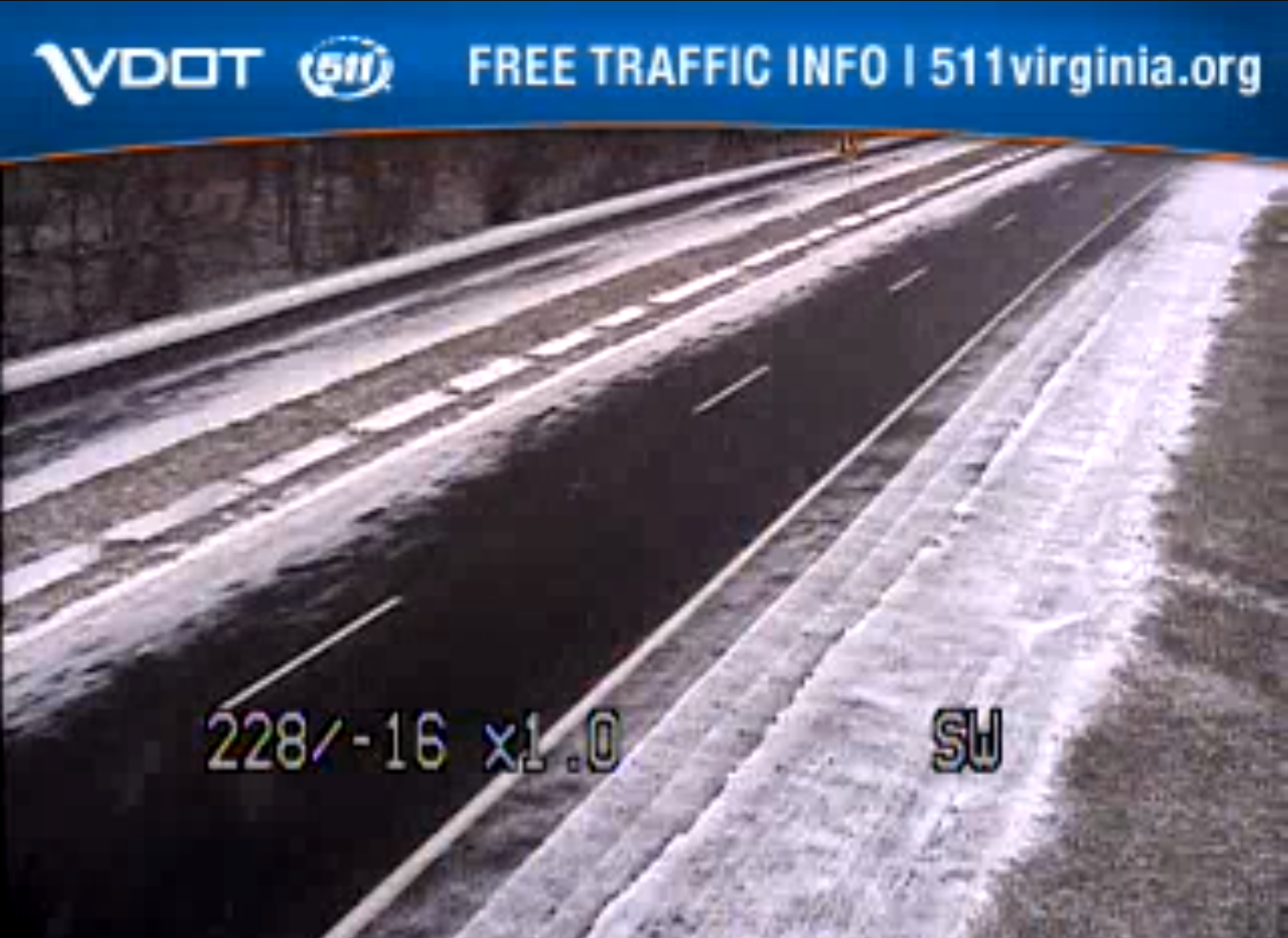
Made it down to 32/29 last night and squeaked out a trace of ice. 33/32 now with light rain falling. Higher elevations of the Blue Ridge hanging onto upper 20s in some spots. Going to be a beautiful sight for anyone brave enough to travel over them this evening. I suspect Skyline Drive will be shut down for quite sometime after this :/
-
One thing I will point out. Lower QPF isn't necessarily bad with borderline surface temps. With borderline temps, light QPF will usually slick things up more than heavier QPF.
-
CHO even gets in on the ice.
-
LWX has watches up for the extreme western zones.
-
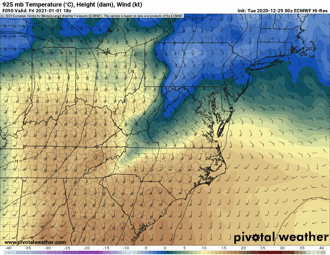
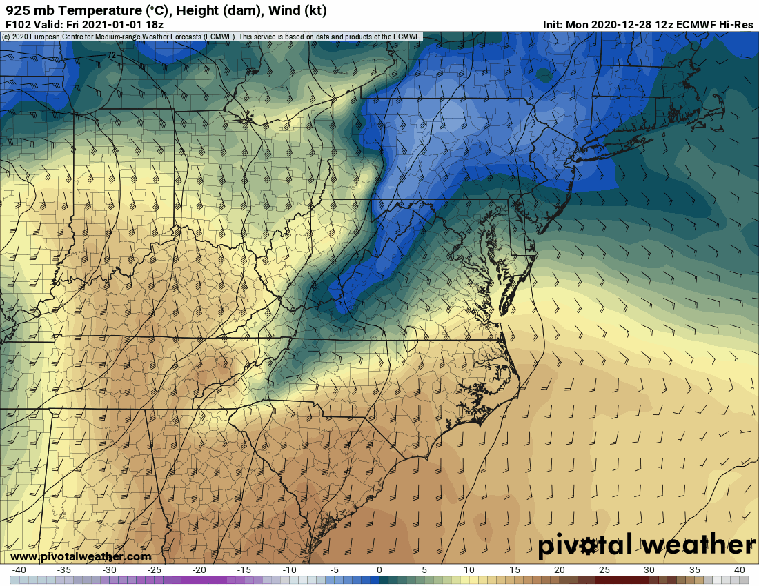
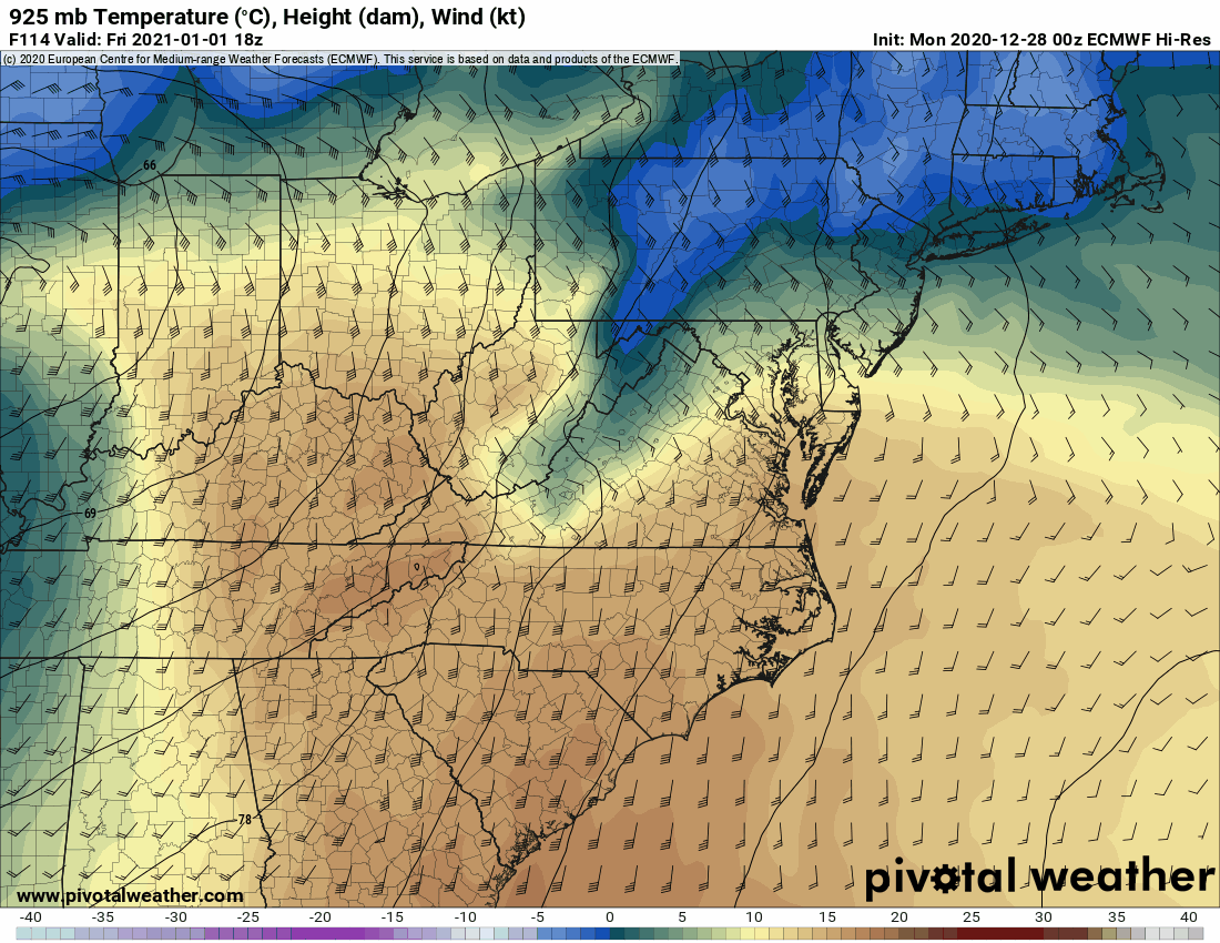
EC 925mb trends

-
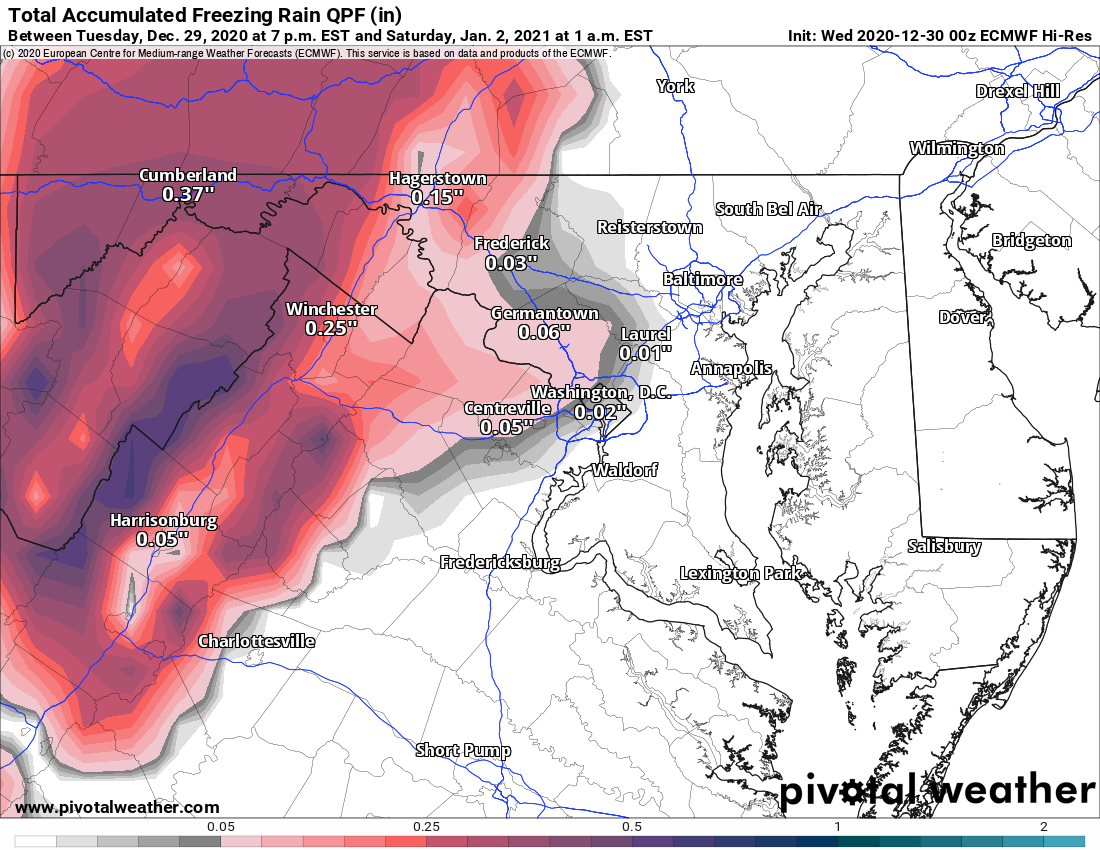
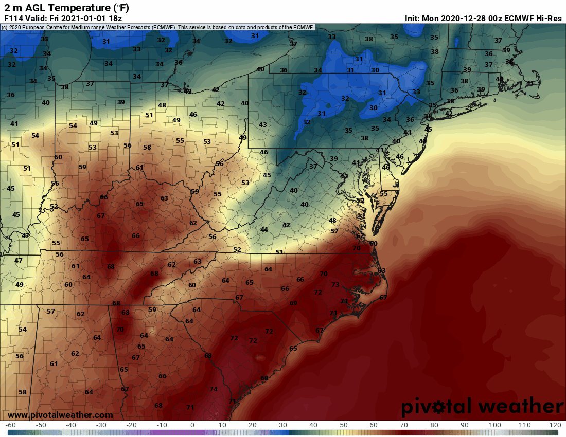
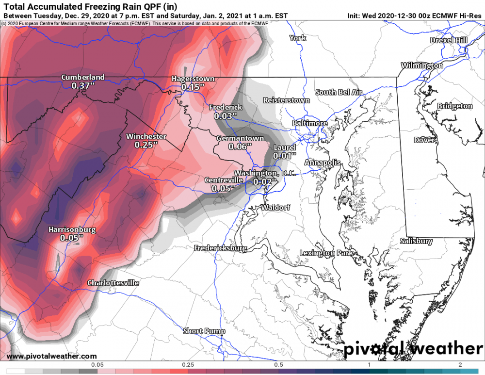
12z GFS trended a touch colder at the surface. A lot of the higher res guidance is dropping dew points ahead of precip into the upper 20s and lower 30s along the 81 corridor. Looks like western areas from west of Hagerstown to Cumberland may be in for a descent ice event. Fairly good agreement on 0.25" - 0.5" falling as zr there for New Years Day. Looks like winter storm watches will be needed there later today. May get an advisory level event across central MD, into northern VA, and then west of the Blue Ridge to around Harrisonburg.
-
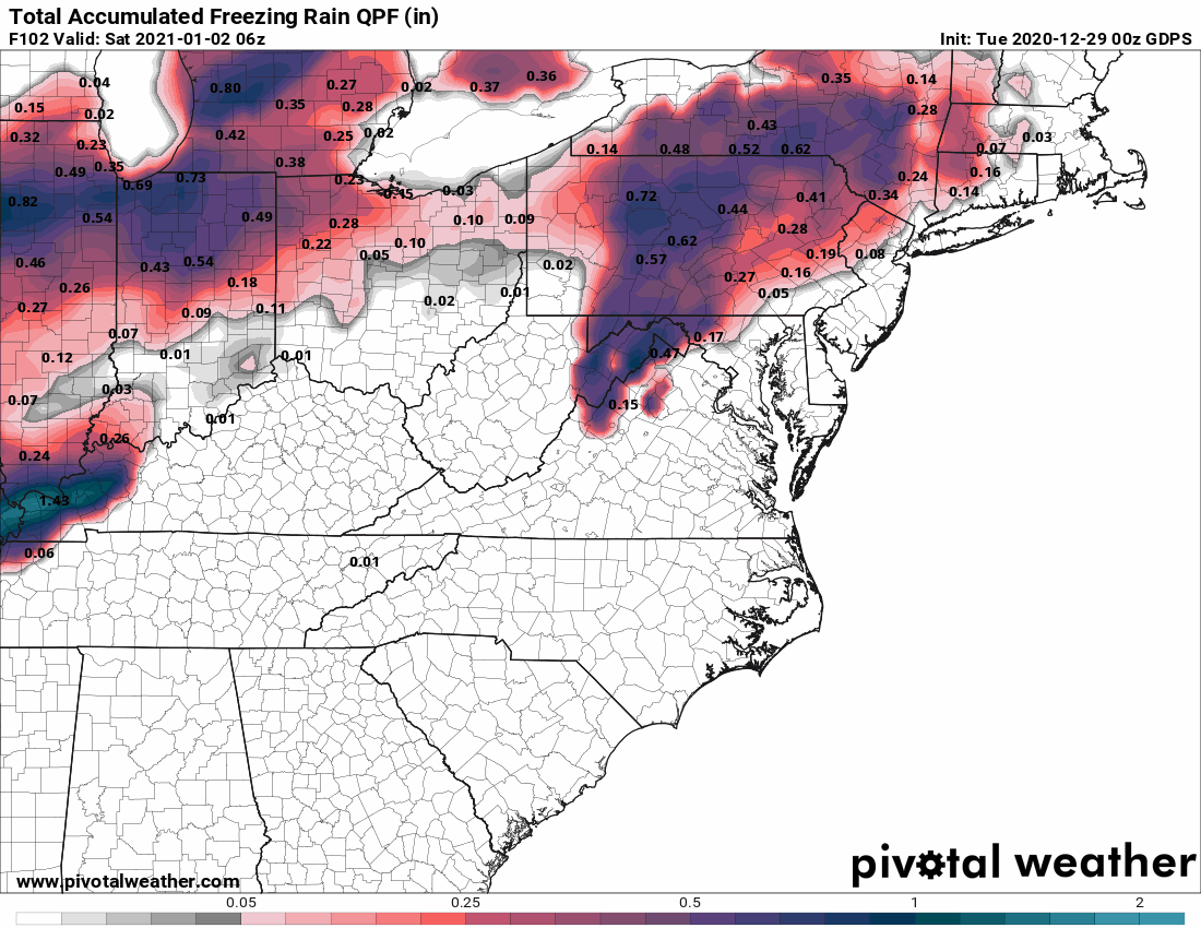
00z EC start New Years Day event off as zr across most of northern VA.
-
12z EC still liking the ice threat for western folks. Model comparison for reference: EC trends:


-
Not much change that I can see at a quick glance of the GFS and Canadian for the New Years event. Canadian zr QPF eye candy for extreme western zones:
-
Canadian is definitely the most bullish right now. Verbatim, would be a significant ice event for western zones.

-
Ice threat for western areas seems to be increasing ... although brief in duration. EC op has freezing rain extending well into VA now along I-81.
-
Going to be a brutal cold for us western folks in the AM.
-
Neither was the GEFS
-
Nice burst of snow here now in Elkton. Good dendrites. Wouldn't be surprised to see someone get an inch out of this.
-
December 16-17, 2020 Winter Storm Obs/Nowcasting
thunderman replied to WxUSAF's topic in Mid Atlantic
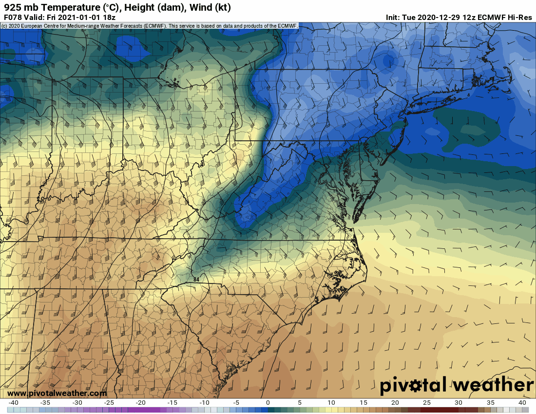
Euro just slightly warmer at h85 through 12z

.gif.791272e48011c7d71e2dd6e12e69f7f8.gif)

.png.ec667e39beae77551648737064e0db8a.png)