AtlanticWx
-
Posts
650 -
Joined
-
Last visited
Content Type
Profiles
Blogs
Forums
American Weather
Media Demo
Store
Gallery
Everything posted by AtlanticWx
-
exactly, js setting urself up for failure tbh
-
| 18z gefs looking a lot more like EPS/GEPS in the long range now. fwiw the baroclinic boundary might still be too far north on that map but we can certaintly still produce in that fs. 18z gefs looking a lot more enthusiastic snow-wise on indies but probably best to refrain from posting that.
-
i understand where ur coming from tbh but for me atl snow is snow so i'll take whatever i can get. living in dc and wanting all snow events prob won't end well so atl imo i just hope for whatever we can get
-
for those hoping for a big one with this pattern, probably gonna be a long stretch to hope for that. however, i think this is more of a CAD pattern where we get snow -> ZR/sleet -> rain events which can rack up pretty fast and bring us to at least not well below normal. i think all of us here would take a nice 1-3"/2-4"/3-6" event out of desperation lmao the pattern does look kinda similar to feb 2021 imo, w/ less amplitude ofc
-
WAR can help us too sometimes tbh, really just don't want it building in the 50/50 area as PSU said which looks to be the case as of now
-
tbh, this has nothing to do with the current patterns and is rlly just my opinion, but id be surprised if we break 10" at any of the airports this year without a decent storm imo we might get 2016-17 similar totals at all airports (and also possibly a snowy march based on a preliminary look at it)
-
not much support from EPS & GEPS tho. GEPS has a transient SE ridge but we turn to cold again w/ no end in sight at the end of the run
-
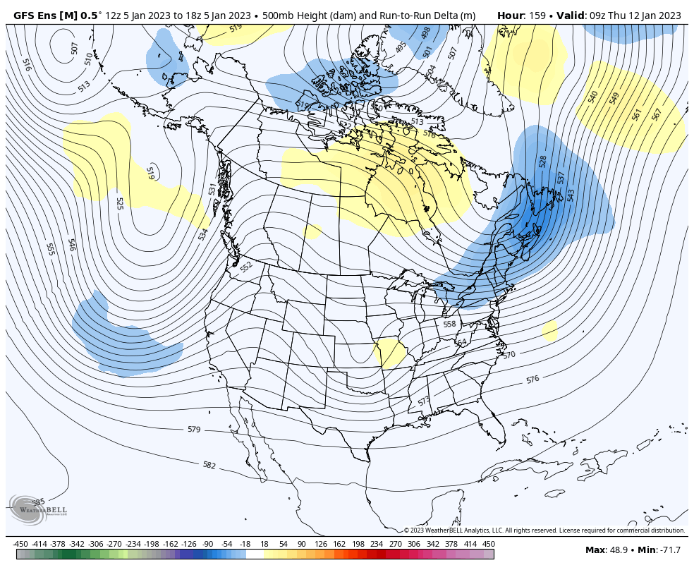
gfs vs euro/cmc/icon, gfs always wins in these battles ofc!
-
honestly we can't get worse than this. let's break some records while we're at it for latest measurable snow at dulles and least snowiest winter at dulles! i'm sure we can do atl the first
-
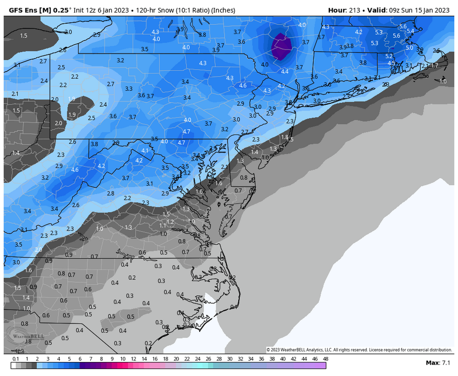
based on the recent models i think we're starting to see a slow wobble back north with more widespread precip. let's hope this continues into tomorrow bc then the metro could really get in on some rush hour heavy snow
-
ah
-
given that we js need more qpf to snow better, idk if it's just me but i always feel like moisture overperforms and models always underdo moisture
-
imo it's better to get one bad suite now before the day of. usually it means we can only improve from here on out
-
-
the snowfall mean is something fs
-
yeah tho the issue this run was just everything being weak tbh
-
gefs still gets the job done for a 50/50 low but just be wary that there’s still time and ways we can lose a 50/50
-
00z gefs has more stream separation. N/S digs more but is faster so there’s less interaction. Might still phase enough for a 50/50 low but
-
hoping euro and eps stay put tonight, the changes on 18z eps weren’t as good for our storm w/ less stream interaction for phasing w the 50/50 low
-
yeah and honestly the probs actually slightly increased
-
pressure map has less cutters which is weird
-
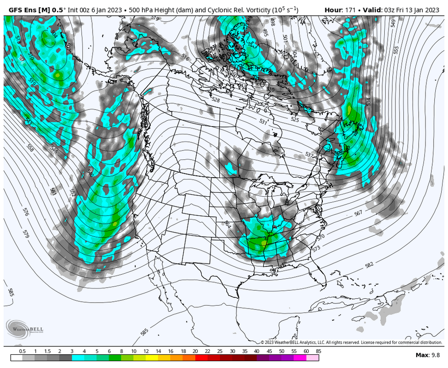
better phasing this run for a proper 50/50 low

-
gefs looks better this run.
-
i'm just posting a map lmao
-
18z gfs