AtlanticWx
-
Posts
650 -
Joined
-
Last visited
Content Type
Profiles
Blogs
Forums
American Weather
Media Demo
Store
Gallery
Everything posted by AtlanticWx
-
so really, we're probably gonna know how this storm pans out with the energy around the 12th given its our table setter
-
replace euro with cmc and spot on for what happened today
-
just for fun, please don’t believe this !!

-
holy shit

-
wow
-
50/50 low is way better this run!
-
things you like to see
-
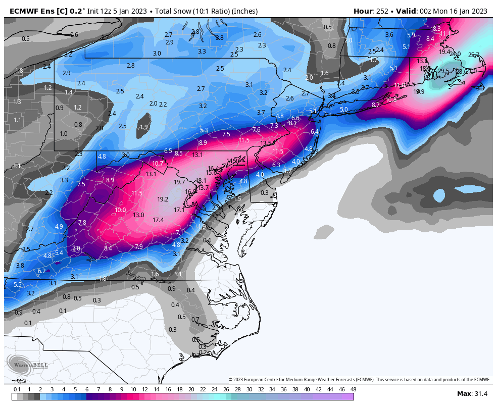
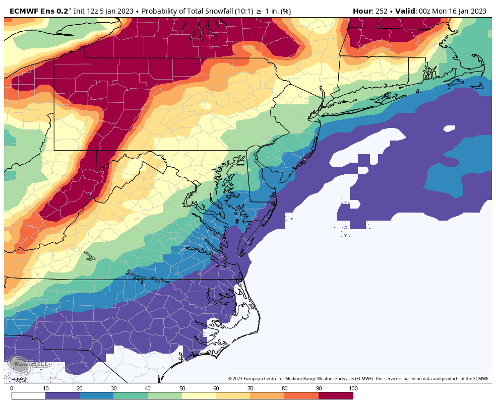
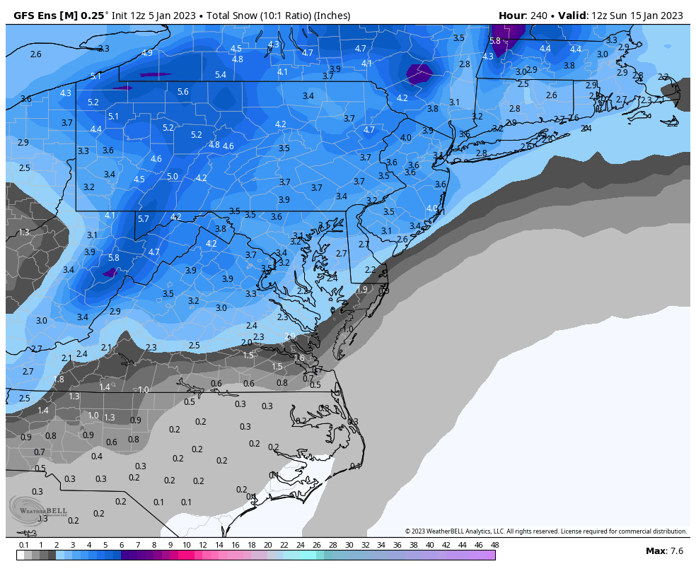
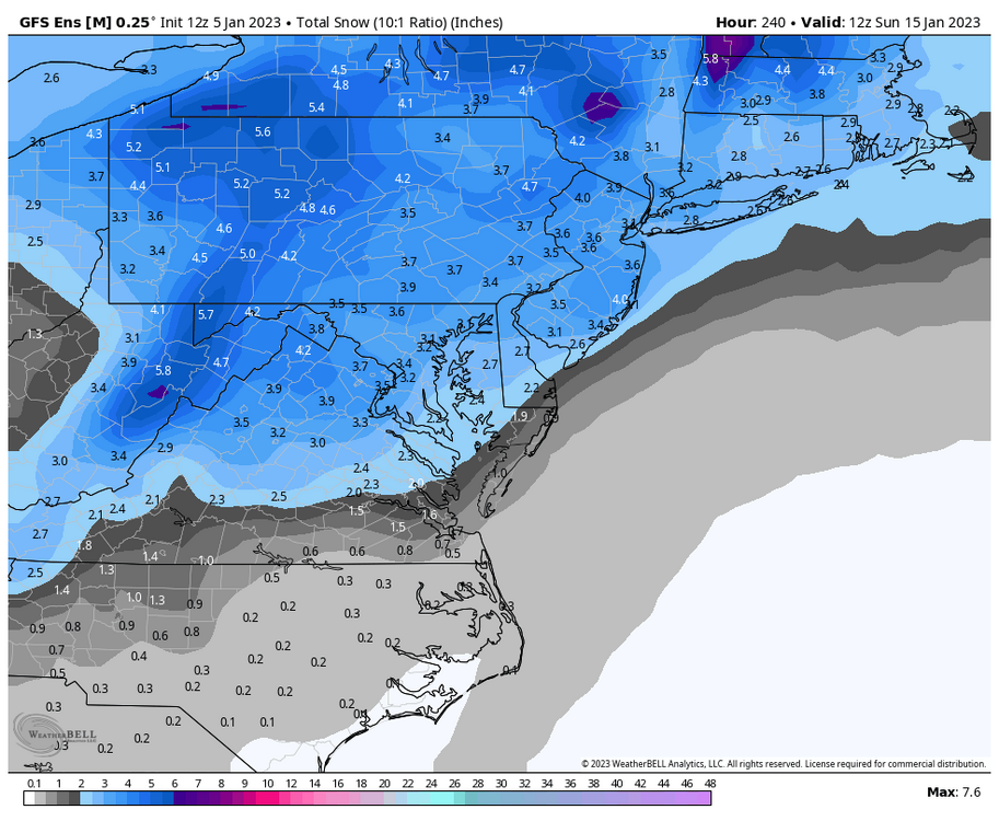
all of it besides like 0.1-0.3” is from that 15th storm
-
yeah no need for a freak out tbh CMCE kinda got worse tho but it has like 20 members it’s quite underdispersive
-
digital blue!!
-
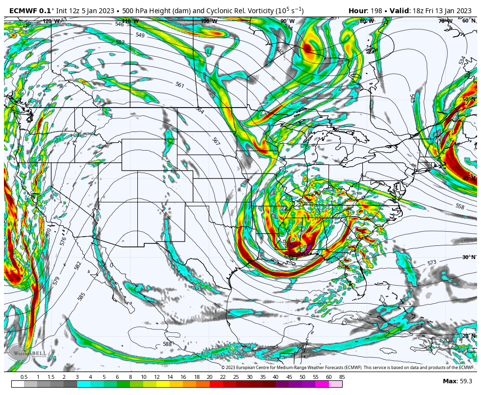
so many indies smoke us between EPS, GEFS & GEPS. two of them have like 30-40” here lmao. obviously won’t verify but tells you the ceiling of the 15th threat
-
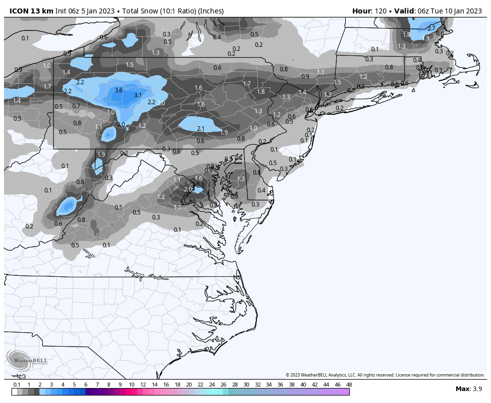
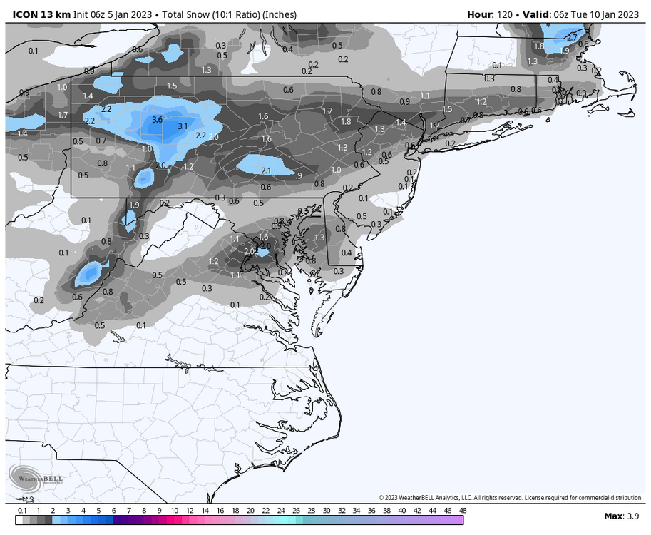
6z icon too
-
gefs continues steps towards eps, nearly identical at day 7/8 now
-
i don’t get why this forum is so negative when tracking storms. yes we’ve had a lot of misses but not every storm works out. imo tracking is really fun and always coming in with low expectations for each storm just kinda ruins the whole vibe of winter storm tracking yk. even if it misses u won’t be happy you were right that nothing happened, just enjoy tracking while you can even if the storm suddenly becomes a buffalo blizzard or a fish storm no hate just an observation with the mojo of this forum compared to say 33andrain
-
honestly we just need everything to trend slower and amped which it’s doing rn imo always on the screwed side when things trend slower and more amped but for once, we’re in the clear ig
-
eps is even crazier. lowkey exciting
-
no need to freak out over an op run 10 days out gefs is trending to eps in all ways lmao
-
an op model 10 days out
-
even a 4-8” event would be awesome, better to focus on the individual events than spending sm time worrying about whether the season will reach average snow or not
-
the fact that this forum was ready to jump off ship yesterday and is excited today probably says a lot about how one day of model runs doesn’t define our winter no hate, just an observation lmao
-
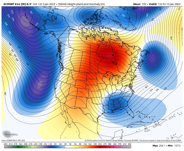
airmass is shit but we still do have cold air aloft and the MSLP anomaly shows a decent canadian high, as long as that trends stronger w due time in which most cases it does, it could be a storm to track
-
yeah, tho i think the entire month of january is prob our window bc the 6th-10th threats are thread the needle but could work out just our best hopes are with the 14th onwards a lot of people are discounting march tho which is surprising since doesnt dc average more snow in march than december now? correct me if i'm wrong tho sun angle is the notably big problem in march but we can still score in march enough for a not completely shit winter
-
tbf the jet retraction that we're rooting for for a good pattern in jan will eventually have the pac jet retract all the way meaning -PNA/SER for atl the beginning of february and probably most of it given niña climo for february
-
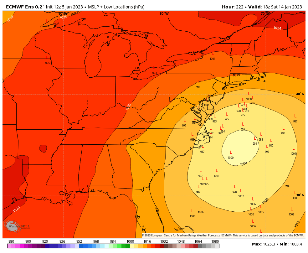
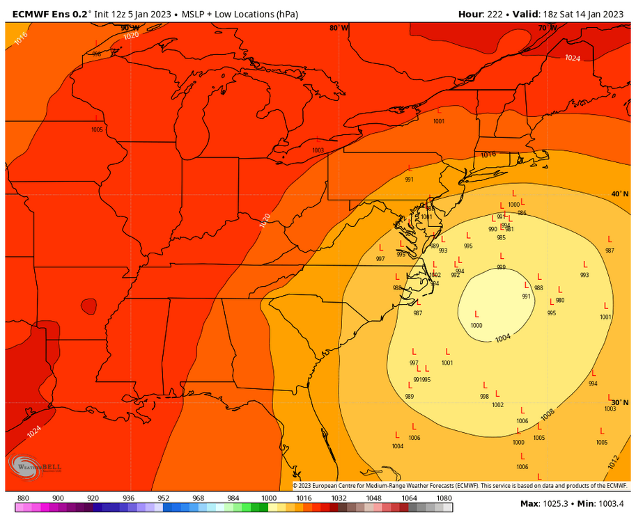
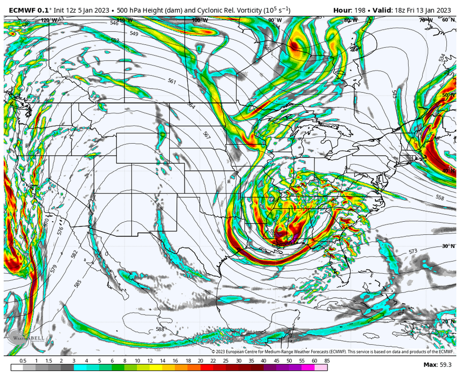
pressure maps have a decent signal for a 50/50 low; a 50/50 low simply won't show up on ensembles 15 days out tbh
-
the more the 7th system continues to amp up the higher rates we'll have and possibly more cold air to drag in for colder 2m temps and colder air aloft? perhaps by 18z we could see some digital blue if trends continue