

Wow
-
Posts
7,988 -
Joined
-
Last visited
Content Type
Profiles
Blogs
Forums
American Weather
Media Demo
Store
Gallery
Posts posted by Wow
-
-
3 minutes ago, Jonathan said:
Also, TT shows a lot of rain where on WxBell it's snow. Looks wonky on TT for whatever reason.
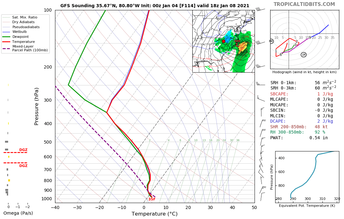
Yes it's all how they are interpreting the profiles.
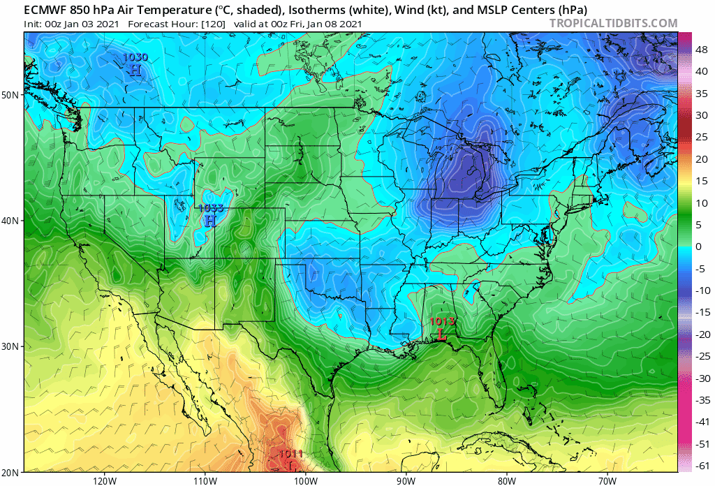
here N of CLT it's only marginal at the surface... a decent precip rate and it's all snow easily.. and based on the strength of that ULL there should be while the low is passing under us.
-
 1
1
-
-
With the cutoff ULL I'd expect to see a lot more precip build back from CLT to RDU but you're likely not going to see that get picked up on the models until we're within 48-60 hrs
-
4
-
-
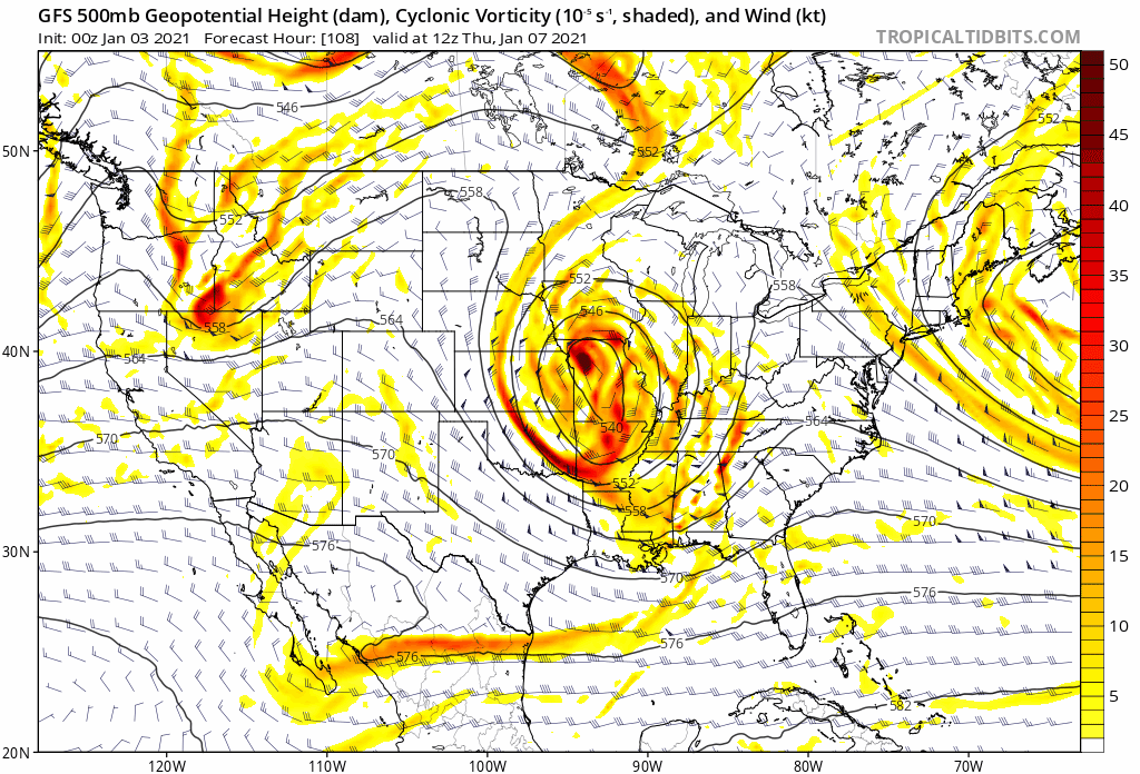
Beautiful. ULL tracking over central GA. Gonna see some good stuff outta this... Verbatim N of I-85 as usual

-
2
-
-
Boom

-
3
-
-
Yeah, 0z GFS further south with the sfc low at 90
-
5 minutes ago, wncsnow said:
I will take a hard pass on that analog. See that downsloping area with no snow cover? That's MBY. Agonizing storm after multiple awful winters here.
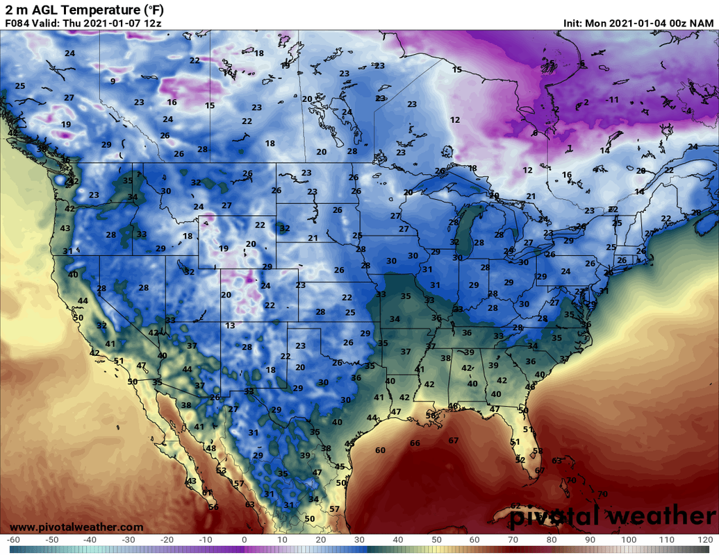
LOL yeah that was a raw deal for the immediate foothills. With the 50/50 in place that shouldn't be a problem here. Sfc temps already in the mid 30's before the precip even arrives per NAM
-
The ICON is a pile of Scheisse
-
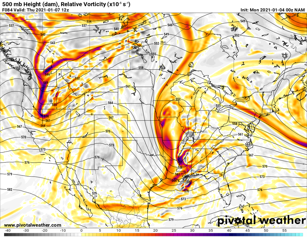
It's a beautiful setup there with the ULL. 0z NAM is slower with wrapping up the ULL show the sfc low track is going to stay well south. Should be a classic miller A track there. I'm trying to find a good analog storm here.. perhaps March '09 with with a 50/50 low in place!
-
2
-
-
Just now, FLweather said:
What is that from? Looks like the nam
top right corner will verify that
")
-
2
-
 2
2
-
-
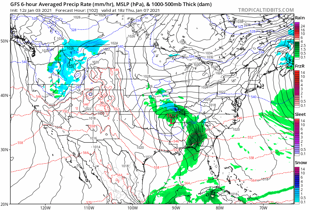
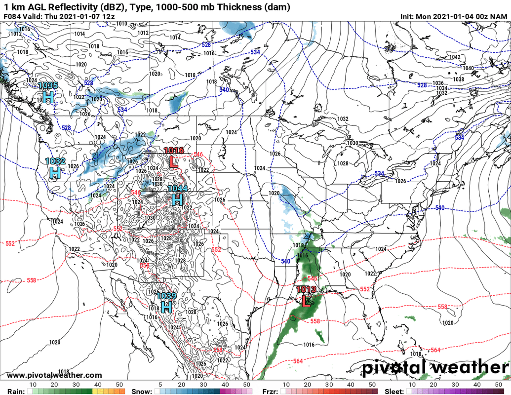
0z NAM @ 84. This looks promising. Sfc low over MSY. Pretty nice phase setting up and with the low heights over the N Atlantic it can't pull it up north.
-
2
-
 1
1
-
-
dude!
-
4
-
-
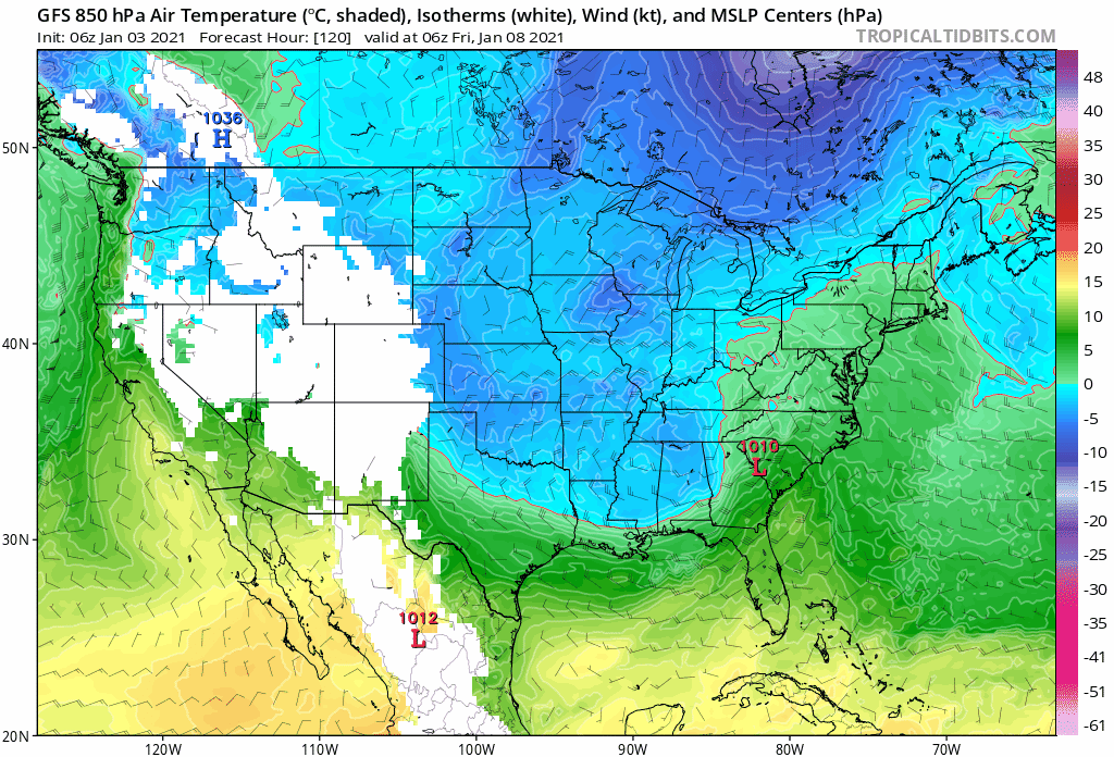
No worries about the moisture.. it'll be there with the strength of this ULL. Actually the temps above the surface trended colder NW of the low
-
3
-
-
It's a better track. Again, cold air supply is going to be the question.
-
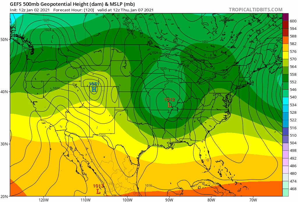
Here's the trend of the GEFS. The ULL trending south and height building overhead into the great lakes which reinforces the HP. Continue just a bit more and would put a lot more of NC in range.
-
3
-
-
2 minutes ago, strongwxnc said:
Getting close to some benchmark areas .
.It's closer.. Still would like it to dig about 80-100 miles further south to pop a low on the gulf coast. It's tracking the low over central MS/AL/GA
-
2
-
-
28 minutes ago, olafminesaw said:
Not bad
Compared to 12z yesterday, definitely in the right direction
-
1
-
-
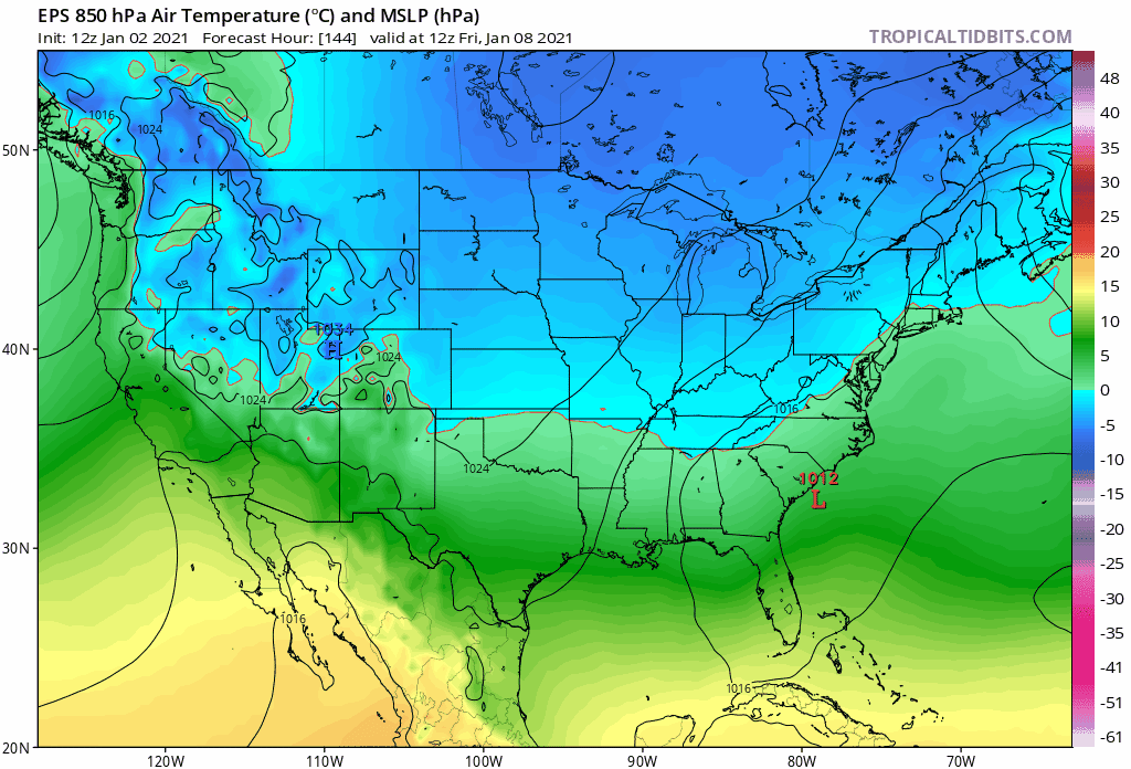
0z Euro had a favorable track and enough cold air is there to work with. Depends how quickly the secondary can pop to allow the lower and mid level cold air to sweep in.
-
5 minutes ago, BornAgain13 said:
12z GFS Para has the snow , but further north... Shows a Snowstorm for most of VA
Yes slower with the low transfer. Pulls the primary low pulls into KY while the secondary moves through GA. OP GFS was further south.
-
I like this trend, digging down the gulf coast will be ideal in this case with the marginal cold air available.
-
2
-
-
Climo wise, this would be confined to NW NC and northward with a Miller B low transfer provided the s/w digs well into the deep south. Any further south and it'll pop a gulf low and it's Miller A ala jan 96. Some of the models 5 days out for that storm were showing this kind of set up initially...
-
2
-
-
So we've got a ULL on the 8th that might make some mischief on the 8th and then a s/w to watch following up on the 12th that could deliver a gulf low
-
4
-
-
We're in a place where only a couple of events define the season .. I think the best is yet to come snow-wise. It's been a looong time coming since we've seen a sustained -NAO sig .. definitely want to roll these dice

-
2
-
-
it's coming. it's been 10 years since i've seen this, but a very sustained -NAO signature looks to be happening.. patience, people. once the PNA pops...
-
11
-
 2
2
-
-
17 minutes ago, wncsnow said:
So far on most of the models, they are playing like the New York Jets
Then one of them will accidently win soon enough
-
2
-
1
-
January 8th-9th threat
in Southeastern States
Posted
Yeah, the parallel GFS shows how the ULL will keep the precip over the area longer