

vortmax
-
Posts
4,641 -
Joined
-
Last visited
Content Type
Profiles
Blogs
Forums
American Weather
Media Demo
Store
Gallery
Posts posted by vortmax
-
-
1 minute ago, tim123 said:
Then later in week shows front coming through winds of 60 to 70 mph with front
The magnitude of cold air, especially with the warm lakes, can cause some really exotic weather. This will be exciting to experience.
-
Just now, tim123 said:
Near pit at 120
Still looking good. Any more wound up and it could get messy.
-
6 minutes ago, Thinksnow18 said:
Mike Cejka from WIVB here in Buf gave his earliest thoughts...he said 12" to 18" metro north and 18" to 24" south over the higher terrain...he stated these were on the "lower side" as some model ( guessing the Euro) is much greater!!! Can we just fast forward to thursday already!!!
I think the TV mets should be quite wary of talking totals this early...I would be, at least.
-
21 minutes ago, wolfie09 said:
At the same time GFS is in SE NY lol
.gif.07834bb2fbe183fff4a16fcdfee2a34c.gif)
That's waaay off from the other models for 12z Sun...yikes. Would like to see the UK reconcile it's differences!
-
1 minute ago, rochesterdave said:
When do you guys think BUF issues WSW? I’d think 4 days out is too soon. Maybe tomorrow?
They'll probably wait until the 1st storm is within the CONUS and models run a time or 2...my guess.
-
Just now, wolfie09 said:

That's great...gonna cause an EC member meltdown.
-
9 minutes ago, tim123 said:
Vortmax your goin to get drifted in up near lakeshore
Bring it. I'm amping the kids up for a big weekend storm so it'd better be good!
-
1 hour ago, tim123 said:
I am almost certain 1999 had a blizzard warning.
Now that you press it, I do remember a 'late' blizzard warning issued for the ROC area about halfway through the storm.
-
 1
1
-
-
13 minutes ago, tim123 said:
We got 24 inches from it then 3 days later 18 from another storm. Was in march.
I remember these storms... Basically 2 strong waves along a frontal boundary. No blizzard warnings but epic nonetheless. First wave started as heavy rain.
-
Wonder how much the global models are picking up on LE for the south shore. ROC usually gets a few extra inches in cold NE flow setups like this - especially with a warmer than normal lake.
-
 1
1
-
-
12 minutes ago, cny rider said:
Yeah that's too close for us in Otsego County.
We want to put the low right over New York Harbor then out across LI.
We're quite fine with that positioning! With that, it will likely change as models resolve.
Anyone have the 12z EC?
-
1 hour ago, CNY-WXFREAK said:
The CMC should cave at 12Z while the King holds serve and I expect the Reg GFS to come back to reality, lol! Funny thing is even with all the rain at the onset we still seem to manage to get to 8", lol, but I'd imagine a little more due to ratios!


Someone in Toronto or Kingston is manipulating the model! lol
-
1
-
 1
1
-
-
German Model?
-
8 minutes ago, TugHillMatt said:
Wow!!!!
We're pretty close to the lake in Ontario (about 2-3 miles) and don't have much on the ground, but snowed all night with a lot of wind. I'd imagine about 10 miles in the white stuff is piling up.
The radar really quieted up in the past hour or so...did we lose moisture? Winds look to be veering as well.
-
7 minutes ago, CNY-WXFREAK said:
I just saw the 18Z GFS, RLMAO as it has 3 KU storms, lol, in one run with Liq Eq of between 3-4" and with most of it being snow which would yield close to 50" for the rest of the month, lol, thats why I'm laughing but if we get even a 1/4 of that we're good!
Lot better look than last month this time. Seems the pattern/teleconnections have shifted enough to start spawning potentials. Game on.
-
6 minutes ago, CNY-WXFREAK said:
I've been mentioning the South shore for days now as it looked good for you guys for days and days now so good for you guys in KROC! Whats up with the Channel 10 weather guy? Saw something on Channel 9 this evening about it?
I don't know the entire story, but the situation sounded way overblown.
-
Looks like good returns over the Monroe cty.

-
4 minutes ago, SouthBuffaloSteve said:
Metro BUF cashing in! Just need another mile south to be in my backyard...

.Looks like a lightning bolt!
-
57 minutes ago, rochesterdave said:
Ontario is really lighting up to the NW of Rochester. Flow looks to be WNW at this time. Exciting! Lol.
The ground is already white here.
-
1 minute ago, tim123 said:
Has to do with microphysics with formation of the process.
CISK - Conditional Instability of the Second Kind...lol
-
2
-
-
Just now, TugHillMatt said:
Just cleaned up. 3 to 4 inches of very heavy, wet snow. Light snow falling right now. Waiting upon the lake effect snow now.
This is when elevation helps. 15 minutes down the road 500 to 700 feet lower in Williamstown they didn't get anything.
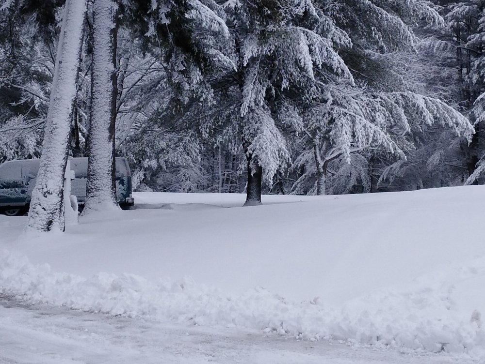
Looks like paste.
-
1
-
-
-
17 minutes ago, DeltaT13 said:
Hi Res NAM really lights up overnight for entire south shore. Will be interesting to see if that lobe of moisture and shortwave ignite the lake this evening. The cold air is still lagging behind so I don't think we have to start panicking just yet.
Also, I realize this is literally as weenie-ish as you can get, but Hour 384 on the 12z GFS is pretty much the most perfect Miller A one could hope for. Almost looks like 93. What a beaut, enjoy it while you can as it will be gone by the 18z run. haha. The East coast is active though over the next few weeks, we just can't get the timing right.
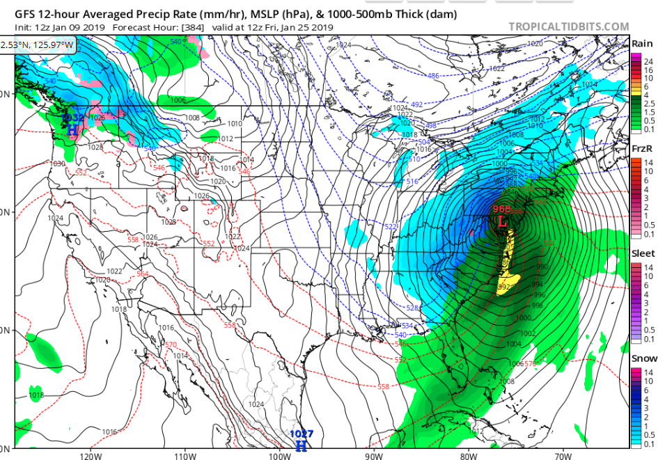
Interestingly enough, the GFS, IIRC, does a pretty good job at predicting these big storms/signals well in advance. Sandy, 93 are two examples that the 'American' model grabbed on to a week in advance. Granted, this is way more than a week, but keep watching!
-
1 hour ago, BuffaloWeather said:
A radar composite of how this event will probably play out in WNY. Deadzone is usually between Metro Buffalo and Hamburg/Eden closer to lake shore.

I think it'll be a bit more NW as well as significantly longer-duration and quasi stationary.
Upstate/Eastern New York
in Upstate New York/Pennsylvania
Posted
15:1 or more...dang...that's a lot of snow. Although the NW ticks are getting a little disconcerting.