

RedSky
-
Posts
17,677 -
Joined
-
Last visited
Content Type
Profiles
Blogs
Forums
American Weather
Media Demo
Store
Gallery
Everything posted by RedSky
-
He is likely referring to intensity as the 87 January storm dumped it all in eight hours and February 83 was long duration.
-
Weather World winter outlook. Textbook strong El Nino winter with a mild December till sometime in January then closer to average but still above average. Couple nor'easters bring most of the snow and above average chance of one big storm. Expect total days with snow cover to be below average with this forecast. Won't have to wait long to see if this forecast is right for December as of now guidance is for above normal first half of December after the late November chill exits.
-
First snow happened on 11/15 a year ago, meant little for the months to come
-
I can't believe it but I was almost stung by a yellowjacket what is going on
-
That would be 7 of 11 months above normal using the newer higher normal years set so nothing cool about it
-
I hear so many people talking about them nesting under their siding it's ridiculous, I think they are getting smarter and taking over.
-
To all the non superstitious believers out there I present this - Bought a rain gauge three weeks ago and here I am at .20" three weeks later...
-
On the lookout for them today this was the worst year ever and anywhere I went there was no escape
-
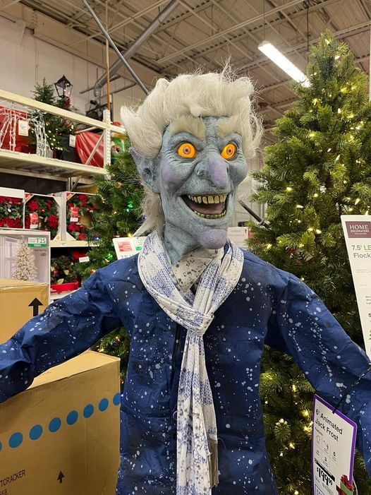
Jack Frost at Home Depot looks like he plans to freeze everyone to death and bury them in snow this winter
-
No worries it will change again, again and again
-
High temp 68F
-
Top 10'er November day, sunny mild light wind blue sky And a yellow jacket on my Tandy cake.. *Make that two jackets
-
Saw one today, a yellow jacket that is. Cruised by me at a shopping center, no doubt looking for trash cans. Hardy lil bastards holding on till the last.
-
Outside eating a sandwich and 30 seconds later a yellow jacket wants a bite, they not gone!
-
24F yellow jackets they gone
-
Too warm at 42F and radar isn't doing anything, the tooth however has some white stuff oozing out so there's that No pain at all funny enough it must be on a long fuse
-
Hey that's a great Halloween
-
My bad wisdom tooth is telling me I have no choice
-
Trick not treat for those snow chances in the long range? Looking more normal first half of November now. * Not counting the chance of an errant flake in the wee hours of tomorrow morning
-
In the it looks good on paper category: Tuesday Night A slight chance of rain after 11pm, mixing with snow after 4am. Partly cloudy, with a low around 34. Northeast wind around 5 mph becoming calm. Chance of precipitation is 20%.
-
Early cold and snow chance a hallmark of El Nino
-
Observations- the lack of a good closer killed them as I been telling people that guy is going to kill them in the playoffs like Mitch Williams. The other problem is being a one dimensional power hitting team swinging for the fences is another killer in the playoffs where good pitching can keep the ball down. The Diamondbacks simply made the adjustments in pitching Houston did in last year's World Series. Why Atlanta failed at is a mystery. They need contact hitting count working talent in the worst way to compliment the power hitters.
-
Fought off a couple yellow jackets it's to late in the season to be doing this damn it. Tree color fading past peek about one third of the leaves are down. Should get the killing frost around Halloween.
-
33F Frosty
-
Bermuda shorts and moonshine in January kinda wait?


