Hurricane Agnes
-
Posts
9,344 -
Joined
Content Type
Profiles
Blogs
Forums
American Weather
Media Demo
Store
Gallery
Everything posted by Hurricane Agnes
-
E PA/NJ/DE Summer 2022 OBS Thread
Hurricane Agnes replied to Maxwell03's topic in Philadelphia Region
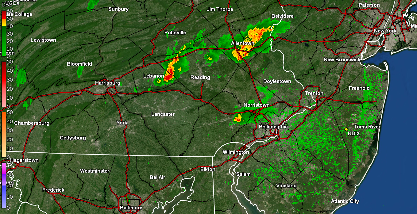
Now getting the steamy windows. Now finally getting some heavier returns - now almost 1.5" per hr. Currently up to 0.29 -
E PA/NJ/DE Summer 2022 OBS Thread
Hurricane Agnes replied to Maxwell03's topic in Philadelphia Region
Finally getting some measurable. Temp down to 77 with dp 75. -
E PA/NJ/DE Summer 2022 OBS Thread
Hurricane Agnes replied to Maxwell03's topic in Philadelphia Region
The line is holding so far. Am actually getting some droplets and lots of convection. Storm being warned as I post.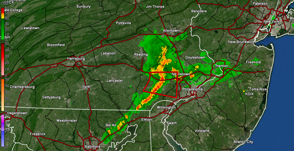
-
E PA/NJ/DE Summer 2022 OBS Thread
Hurricane Agnes replied to Maxwell03's topic in Philadelphia Region
That is getting warned right now. -
E PA/NJ/DE Summer 2022 OBS Thread
Hurricane Agnes replied to Maxwell03's topic in Philadelphia Region
Complete fizzle and nada. Sun back up and temp up to 85 with dp 76. Maybe I can eek something out tomorrow. To recap, I had 0.05" from overnight and that was it. Meanwhile STS issued for Berks, Bucks, Montco - -
E PA/NJ/DE Summer 2022 OBS Thread
Hurricane Agnes replied to Maxwell03's topic in Philadelphia Region
Was hoping on this radar blip but it is fading fast. It did actually make it to 91 today, with sun in and out and it's currently overcast and 87 with dp 74.
-
E PA/NJ/DE Summer 2022 OBS Thread
Hurricane Agnes replied to Maxwell03's topic in Philadelphia Region
I actually got a surprise 0.05" from that between 1 - 3 am. At this point, I'll take whatever dribs and drabs I can get, with the hope that it is at least "measurable". Am now up to 0.77" of rain total for the month. I bottomed out at 72 this morning and it's currently clearing, partly sunny, and 74 with dp 74. -
E PA/NJ/DE Summer 2022 OBS Thread
Hurricane Agnes replied to Maxwell03's topic in Philadelphia Region
I bottomed out at 70 this morning and have so far reached a high of 86 today. The dp has been slowly creeping back up but since today was one of those "unsettled" days, with bouts of clouds and occasional breaks of sun, it has been tolerable. It's currently mostly cloudy and 84 with dp 68. -
E PA/NJ/DE Summer 2022 OBS Thread
Hurricane Agnes replied to Maxwell03's topic in Philadelphia Region
So far I haven't hit 80 today, as much as the sun keeps trying to come out only to self-destruct, which is fine with me at this point. It's currently overcast with occasional breaks of sun and filtered sun and 79 with dp 63. -
E PA/NJ/DE Summer 2022 OBS Thread
Hurricane Agnes replied to Maxwell03's topic in Philadelphia Region
What a difference a day makes! It clouded over (thankfully) and that has suppressed the temps. It's almost 15 degrees cooler right now (@76) than yesterday around this time and almost 20 degrees cooler than the 2 days previous to that! Dewpoint is 60 to boot and it's a big relief before the next bout. -
E PA/NJ/DE Summer 2022 OBS Thread
Hurricane Agnes replied to Maxwell03's topic in Philadelphia Region
I did finally bottom out at 71 this morning and the morning has generally been overcast until the past half hour or so when the sun made its appearance. Temp is currently 75 with dp 61. And I did see that Mt. Holly posted the Philly RER for record high min! I also saw who sucked up all our rain. AC with a record-smashing event! -
E PA/NJ/DE Summer 2022 OBS Thread
Hurricane Agnes replied to Maxwell03's topic in Philadelphia Region
THIS. Grab a bushel of Jersey corn, tomatoes, and peaches as well as some crabs or clams and back across the bridge. Soon as we got in the house, the corn husking began, and the big pot of water was already on the stove to boil. As an obs, the humidity has thankfully dropped and it's currently 72 with dp 64. -
E PA/NJ/DE Summer 2022 OBS Thread
Hurricane Agnes replied to Maxwell03's topic in Philadelphia Region
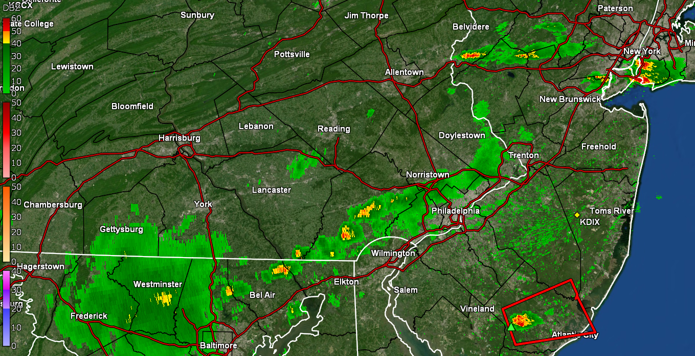
Yeah lots of convection around.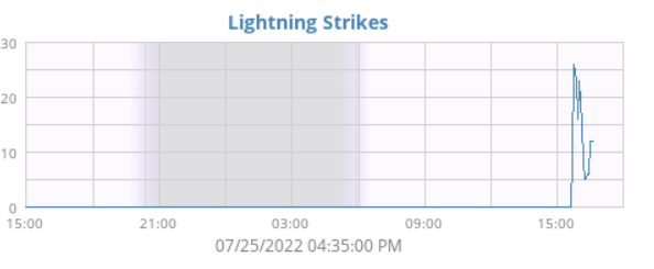
-
E PA/NJ/DE Summer 2022 OBS Thread
Hurricane Agnes replied to Maxwell03's topic in Philadelphia Region
With the sun out, the temp has recovered to 82 and now the air is really juiced with the dp now 78! -
E PA/NJ/DE Summer 2022 OBS Thread
Hurricane Agnes replied to Maxwell03's topic in Philadelphia Region
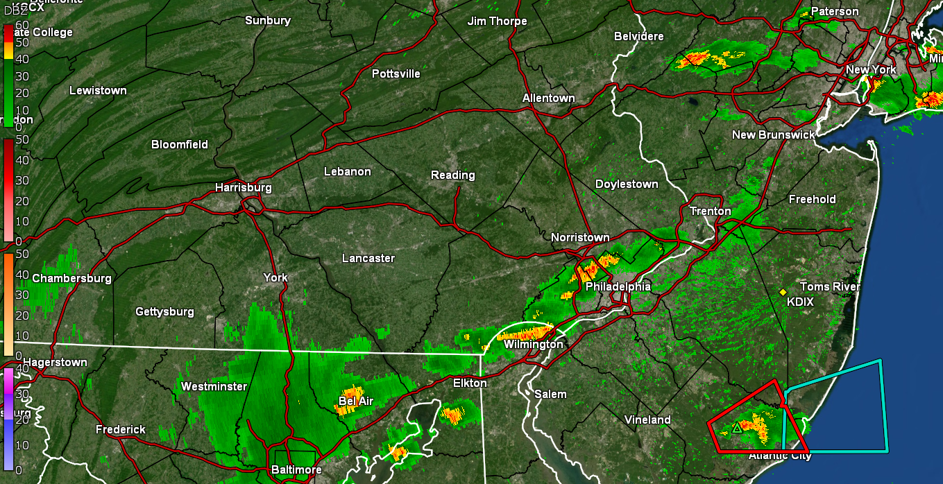
Warning up after the storm passed here (don't see anything back west of that) -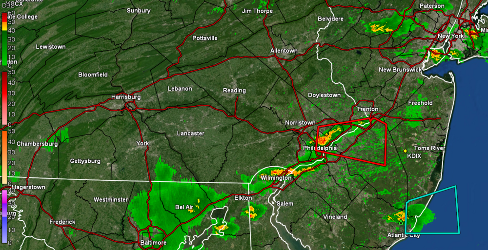
-
E PA/NJ/DE Summer 2022 OBS Thread
Hurricane Agnes replied to Maxwell03's topic in Philadelphia Region
Sun has popped out. Picked up 0.22" from that. Lots of convection still around and a few thunders. Temp down to 77 with dp 75. -
E PA/NJ/DE Summer 2022 OBS Thread
Hurricane Agnes replied to Maxwell03's topic in Philadelphia Region
FINALLY.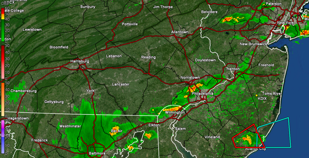
-
E PA/NJ/DE Summer 2022 OBS Thread
Hurricane Agnes replied to Maxwell03's topic in Philadelphia Region
Finally got drops wetting the sidewalk but nothing measurable. It did help "drop" the temp to 84 and raise the dp to 77! -
E PA/NJ/DE Summer 2022 OBS Thread
Hurricane Agnes replied to Maxwell03's topic in Philadelphia Region
Have a slightly darker green return over me and am still waiting for my 10 drops. Currently overcast, 86, and dropless, with dp 76.
-
E PA/NJ/DE Summer 2022 OBS Thread
Hurricane Agnes replied to Maxwell03's topic in Philadelphia Region
I know there are supposedly the mix of the 13 & 17 year broods but like you note, I'm missing the annual giganto, non-red-eyed ones. The kind that you don't want to be in the way when they are flying somewhere fast. I remember getting smacked in the head by one while sitting at the top of the slide to our swing set back when I was a kid! -
E PA/NJ/DE Summer 2022 OBS Thread
Hurricane Agnes replied to Maxwell03's topic in Philadelphia Region
SPC up with the Thunderstorm Watches - Currently overcast with breaks of sun still and 88 with dp 76. -
E PA/NJ/DE Summer 2022 OBS Thread
Hurricane Agnes replied to Maxwell03's topic in Philadelphia Region
I am in NW Philly and have had exactly 0.5" of rain for the entire month of July IMBY, and at this point, I expect whatever line drops down here with the front, will evaporate enough to form dry slots just as they approach my part of the city. I welcome anything I can get but expect I'll be back out with the hose again in a few days (deep watered last on Friday). -
E PA/NJ/DE Summer 2022 OBS Thread
Hurricane Agnes replied to Maxwell03's topic in Philadelphia Region
Now have tapped 90+ #13 for July (#19 since May) just after 10 am this morning. The overrunning precip to the north and west has been throwing clouds down this way and that has been impacting the temps this morning, as the sun has been in and out. Currently overcast with breaks of sun and 88 with dp 76. -
E PA/NJ/DE Summer 2022 OBS Thread
Hurricane Agnes replied to Maxwell03's topic in Philadelphia Region
@5:59 am, 5 minutes after sunrise, it was 80 IMBY! I know this will end up being a RER for PHL for highest min (I think the previous record was 78). Dp is 75. -
E PA/NJ/DE Summer 2022 OBS Thread
Hurricane Agnes replied to Maxwell03's topic in Philadelphia Region
Some RERs up for today (so far). PHL & RDG broke, and ABE & TTN tied their highs - Currently partly sunny and 89 here with dp 73.