Hurricane Agnes
-
Posts
9,263 -
Joined
Content Type
Profiles
Blogs
Forums
American Weather
Media Demo
Store
Gallery
Everything posted by Hurricane Agnes
-
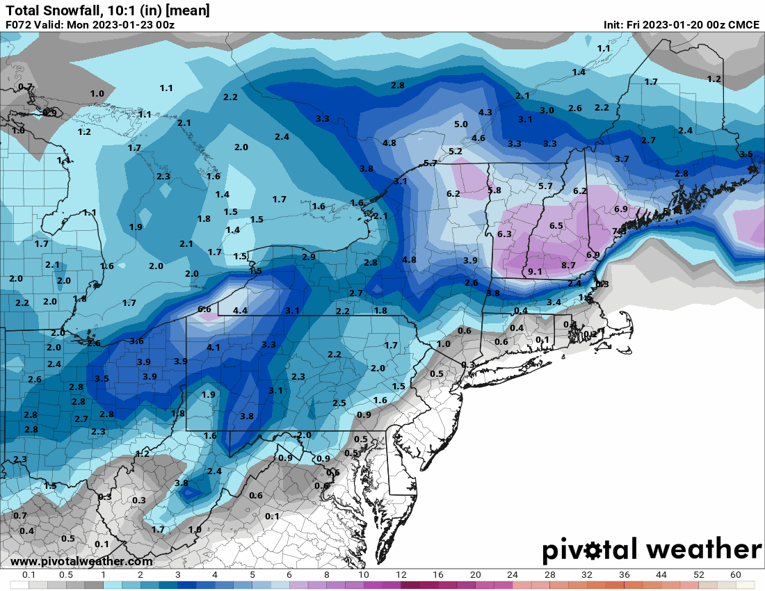
E PA/NJ/DE Winter 2022-2023 OBS Thread
Hurricane Agnes replied to Ralph Wiggum's topic in Philadelphia Region
No accumulation from any of the mix and have just had intermittent rain and am up to 0.39" for the day (1.22" for the 2 days). Currently misting and 37 with dp 37. I did see Paul had reported his snow totals earlier today.
-
E PA/NJ/DE Winter 2022-2023 OBS Thread
Hurricane Agnes replied to Ralph Wiggum's topic in Philadelphia Region
Getting white pancakes here now. Not detecting any rain mixing in (at least when I just checked) and nothing sticking since the ground/surfaces are wet and semi-"warm". Temp is down to 35 with dp 34. So far had 0.34" of rain recorded for today (1.17" 2-day total). -
E PA/NJ/DE Winter 2022-2023 OBS Thread
Hurricane Agnes replied to Ralph Wiggum's topic in Philadelphia Region
Reminded me of finally watching the 1954 movie "White Christmas" (Bing Crosby, Danny Kaye, etc) and how their little performing group decides to head north to VT from FL to a ski lodge owned by an old war commander/buddy and they sing the famous song "Snow" along the way and do a reprise of it when they get off the train in VT to something that I think they described as looking like NC instead of VT, with no snow whatsoever right before Christmas, and whether they got off at the right stop! Scene where the cab takes them to the lodge and there's nothing but bare ground and trees. There's a part in the film when they first go into the lodge and Crosby's character speaks with the receptionist (Mary Wickes) saying - "We came up for the snow. Where're you keeping it?" and she responds "Oh we take it in during the day". A movie done almost 70 years ago that was "for real" when it came to "snow". As an obs - made it up to 42 yesterday and had 0.83" of rain then (the heaviest between about 9 pm and midnight) and so far 0.18" this morning (1.01" at post time as a 2-day total). Low was 36 and it's currently overcast, misty, with occasional light rain and 37 with dp 37. -
E PA/NJ/DE Winter 2022-2023 OBS Thread
Hurricane Agnes replied to Ralph Wiggum's topic in Philadelphia Region
My Upper Darby sis texted just before 2 pm that she was getting sleet there and I just checked outside here in NW Philly and yup - am getting ip. Currently 41 after a low of 31 this morning with light sleet. -
E PA/NJ/DE Winter 2022-2023 OBS Thread
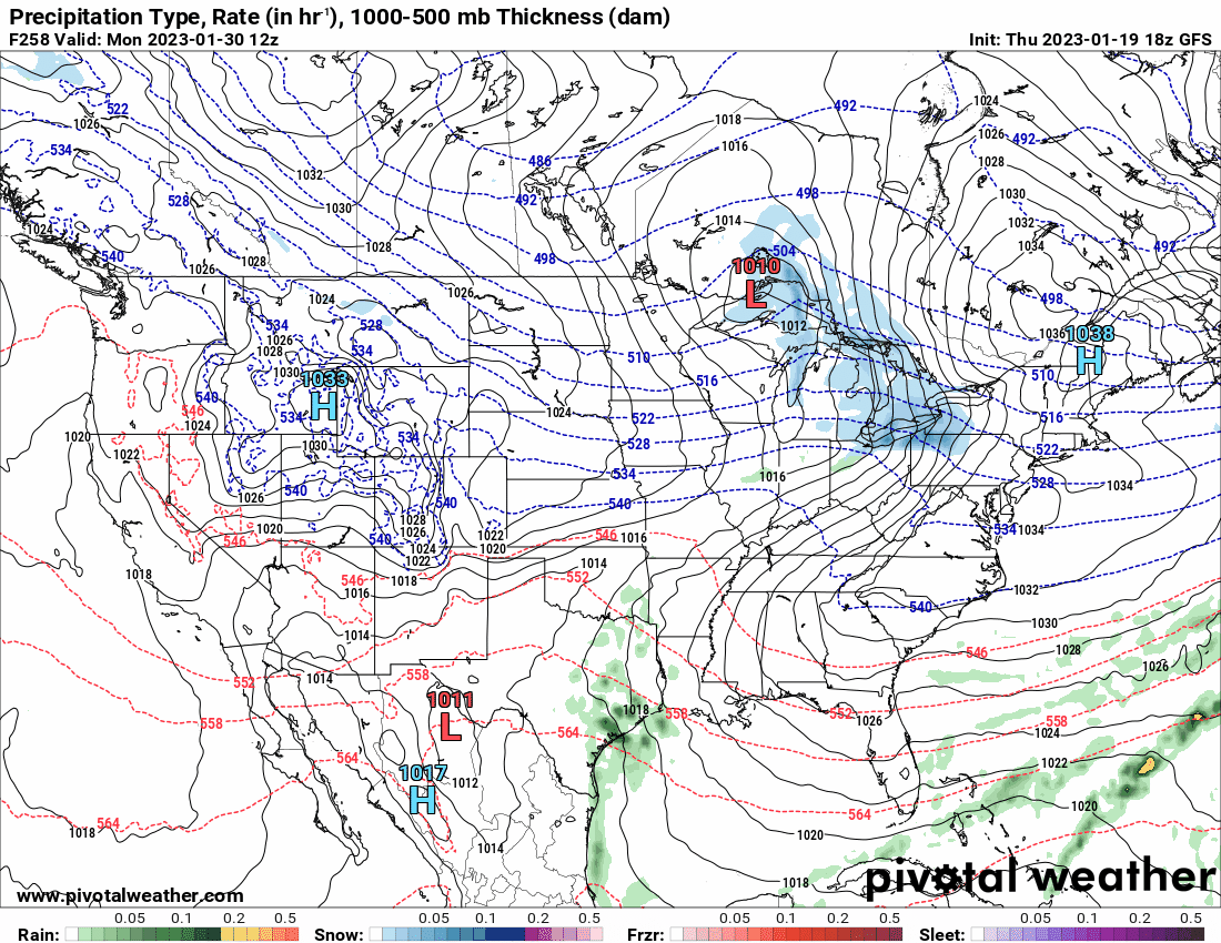
Hurricane Agnes replied to Ralph Wiggum's topic in Philadelphia Region
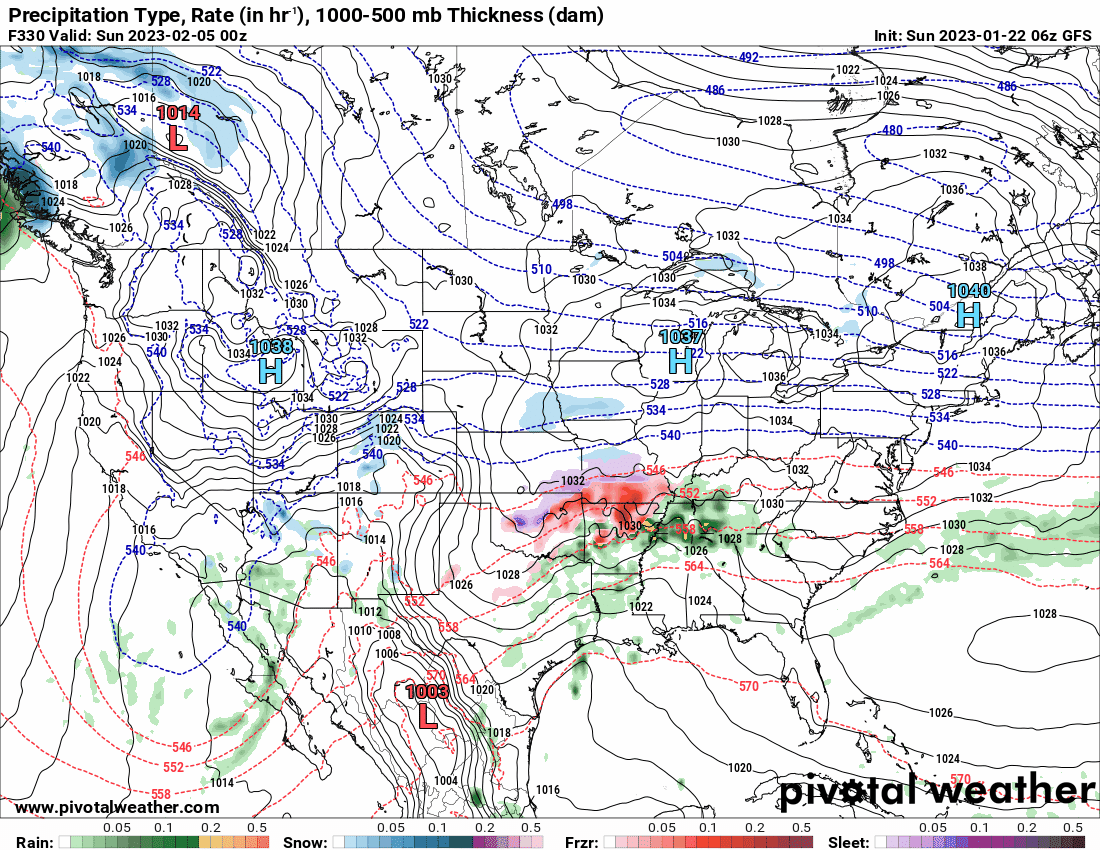
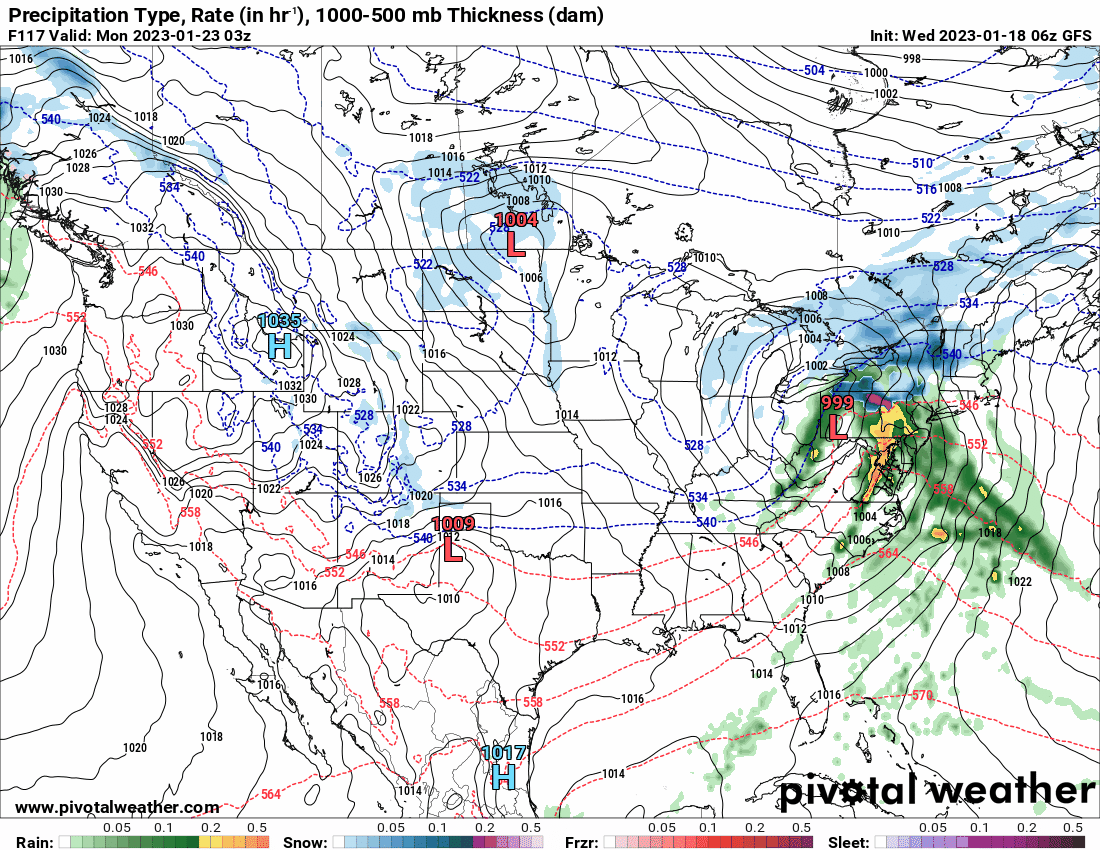
GFS showing a buncha storms blowing through in early Feb. and is honking the 2/5 - 2/6 period.
-
E PA/NJ/DE Winter 2022-2023 OBS Thread
Hurricane Agnes replied to Ralph Wiggum's topic in Philadelphia Region
18z EC not much different from the NAM for Monday but throws a little down into the I-95 corridor.
-
E PA/NJ/DE Winter 2022-2023 OBS Thread
Hurricane Agnes replied to Ralph Wiggum's topic in Philadelphia Region
18z NAM gives some N/W but not down to I-95 corridor. As an obs, after a 35 low, made it up to 40 today for a high with changeable skies this morning and then generally overcast the rest of the day. Currently 38 and overcast with dp 28.
-
E PA/NJ/DE Winter 2022-2023 OBS Thread
Hurricane Agnes replied to Ralph Wiggum's topic in Philadelphia Region
CMC just gave you and north a little luv...
-
E PA/NJ/DE Winter 2022-2023 OBS Thread
Hurricane Agnes replied to Ralph Wiggum's topic in Philadelphia Region
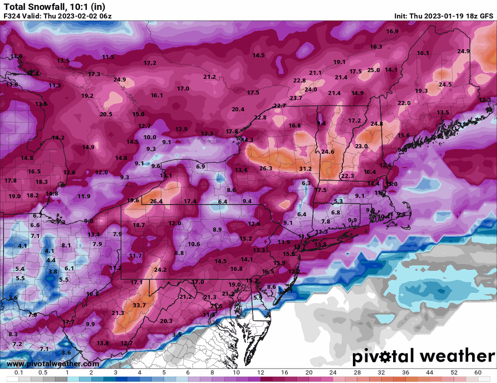
6z GFS showing all kinds of things trying... Ground Hog's day catastrophe whiffed but now a potential for a few days after. I did finish up with 1.17" rain yesterday and my low this morning was 39. Currently partly sunny and 41 with dp 39.
-
E PA/NJ/DE Winter 2022-2023 OBS Thread
Hurricane Agnes replied to Ralph Wiggum's topic in Philadelphia Region
Have been getting the heaviest rain of the day now and just went over the 1" mark to 1.03" for the event so far at post time. Also did register a lightning strike around 8:30 pm. Currently moderate rain and 43 with dp 42.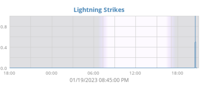
-
E PA/NJ/DE Winter 2022-2023 OBS Thread
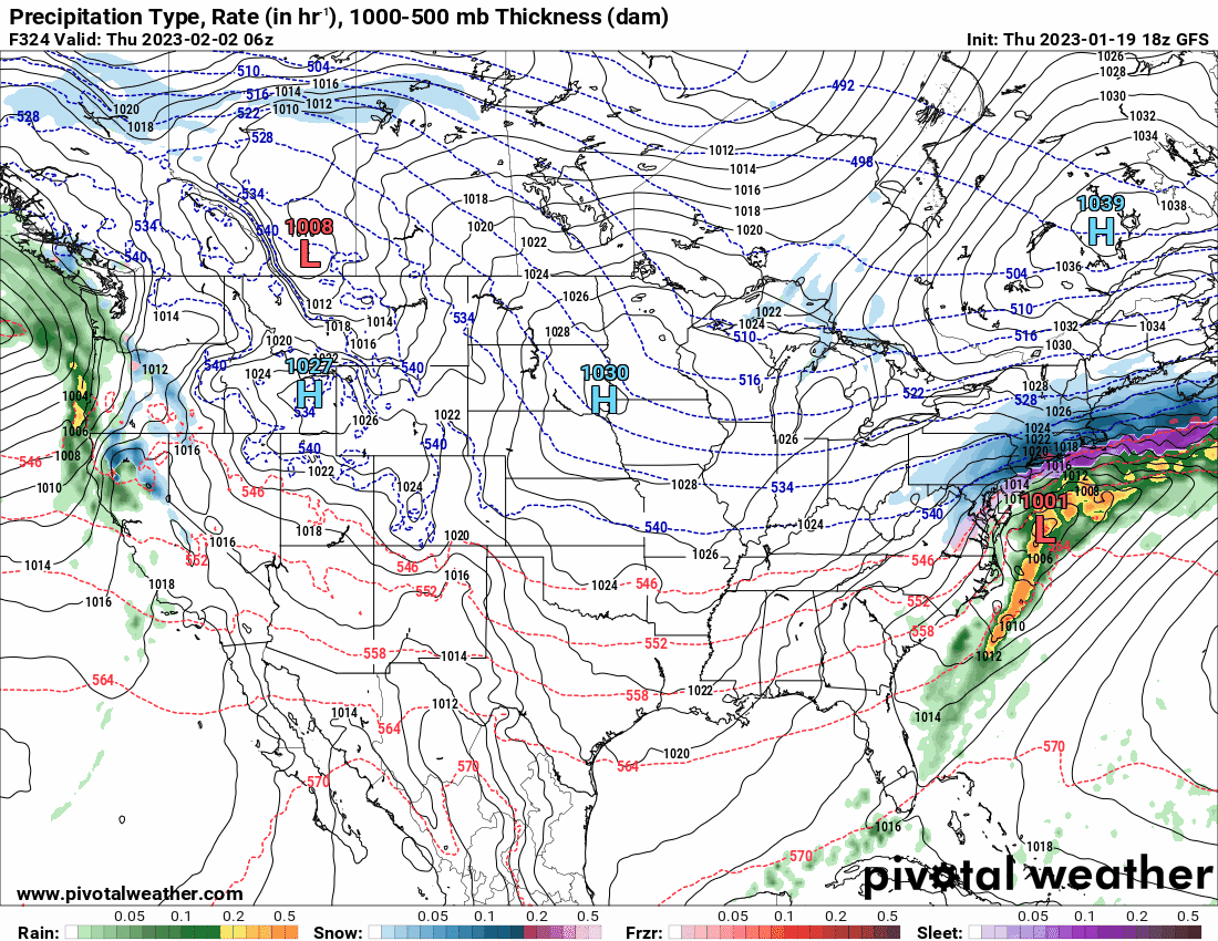
Hurricane Agnes replied to Ralph Wiggum's topic in Philadelphia Region
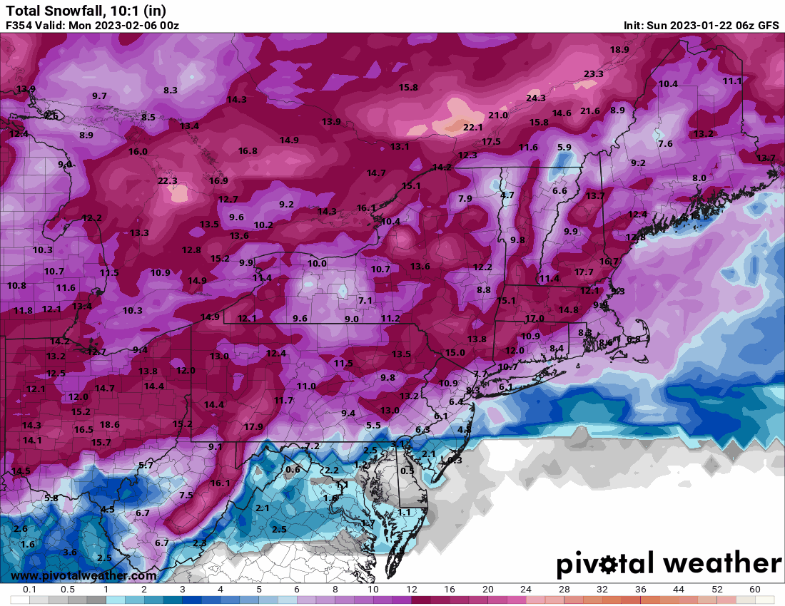
Had to animate the armageddon GFS Ground Hog's Day storm. Looks like there is a cold frontal passage just ahead of it and then overrunning precip -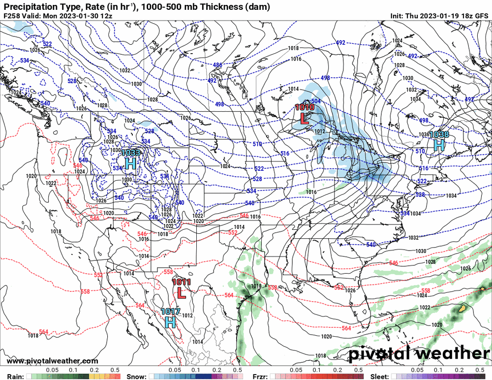
-
E PA/NJ/DE Winter 2022-2023 OBS Thread
Hurricane Agnes replied to Ralph Wiggum's topic in Philadelphia Region
18z GFS Ground Hog's Day special.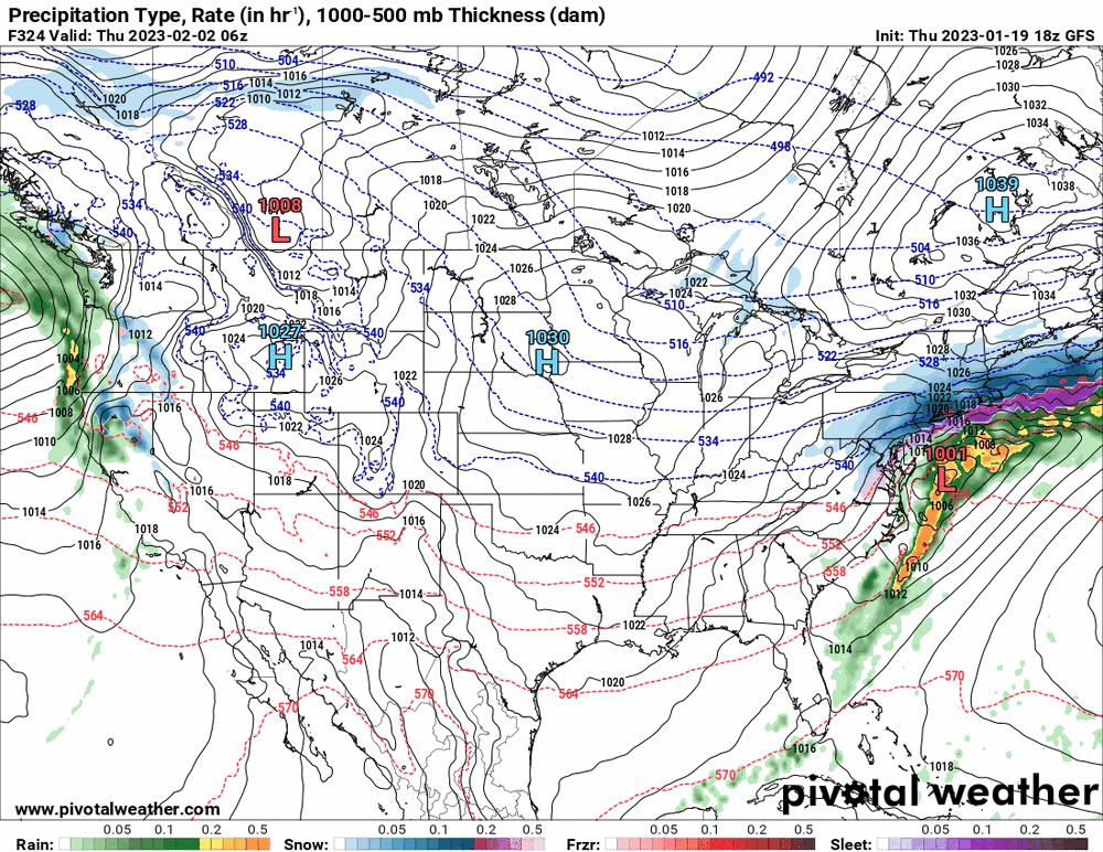
-
E PA/NJ/DE Winter 2022-2023 OBS Thread
Hurricane Agnes replied to Ralph Wiggum's topic in Philadelphia Region
Canadian the little engine that tried but couldn't (at least for storm #1). In other news, high for the day so far has been 41 and it's currently overcast/misty and 41 with dp 41 and 0.58" in the bucket.
-
E PA/NJ/DE Winter 2022-2023 OBS Thread
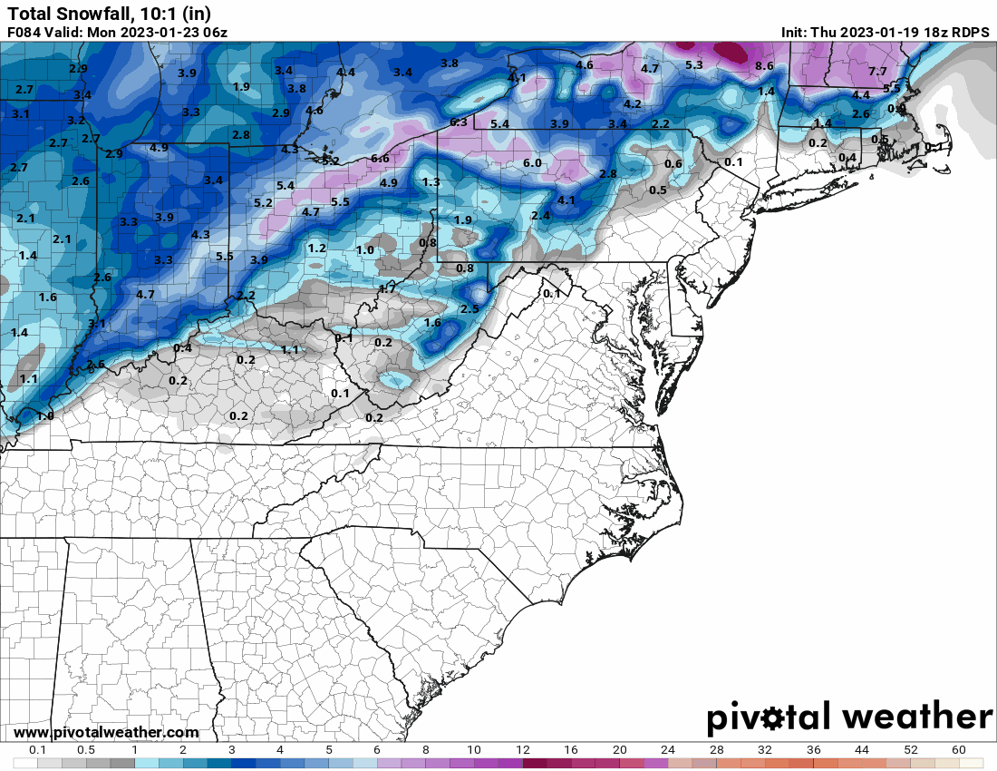
Hurricane Agnes replied to Ralph Wiggum's topic in Philadelphia Region
Was about to throw in the 6z Euro at its last frame... Also as an obs, have so far had a 39 low this morning and it's 40 with light rain, dp 39, and 0.15" in the bucket.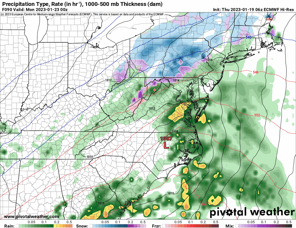
-
E PA/NJ/DE Winter 2022-2023 OBS Thread
Hurricane Agnes replied to Ralph Wiggum's topic in Philadelphia Region
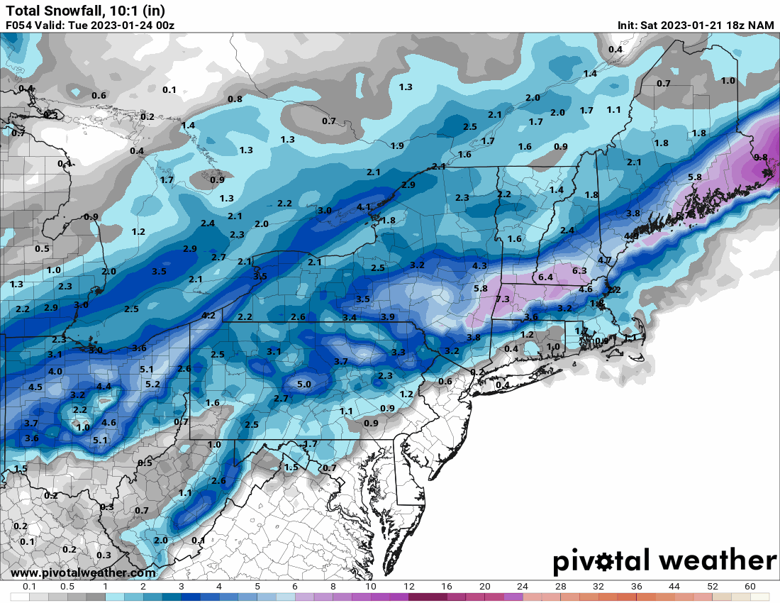
Here's the 6z GEFS showing both storms... (am noticing these guys are coming up from the GOM).
-
E PA/NJ/DE Winter 2022-2023 OBS Thread
Hurricane Agnes replied to Ralph Wiggum's topic in Philadelphia Region
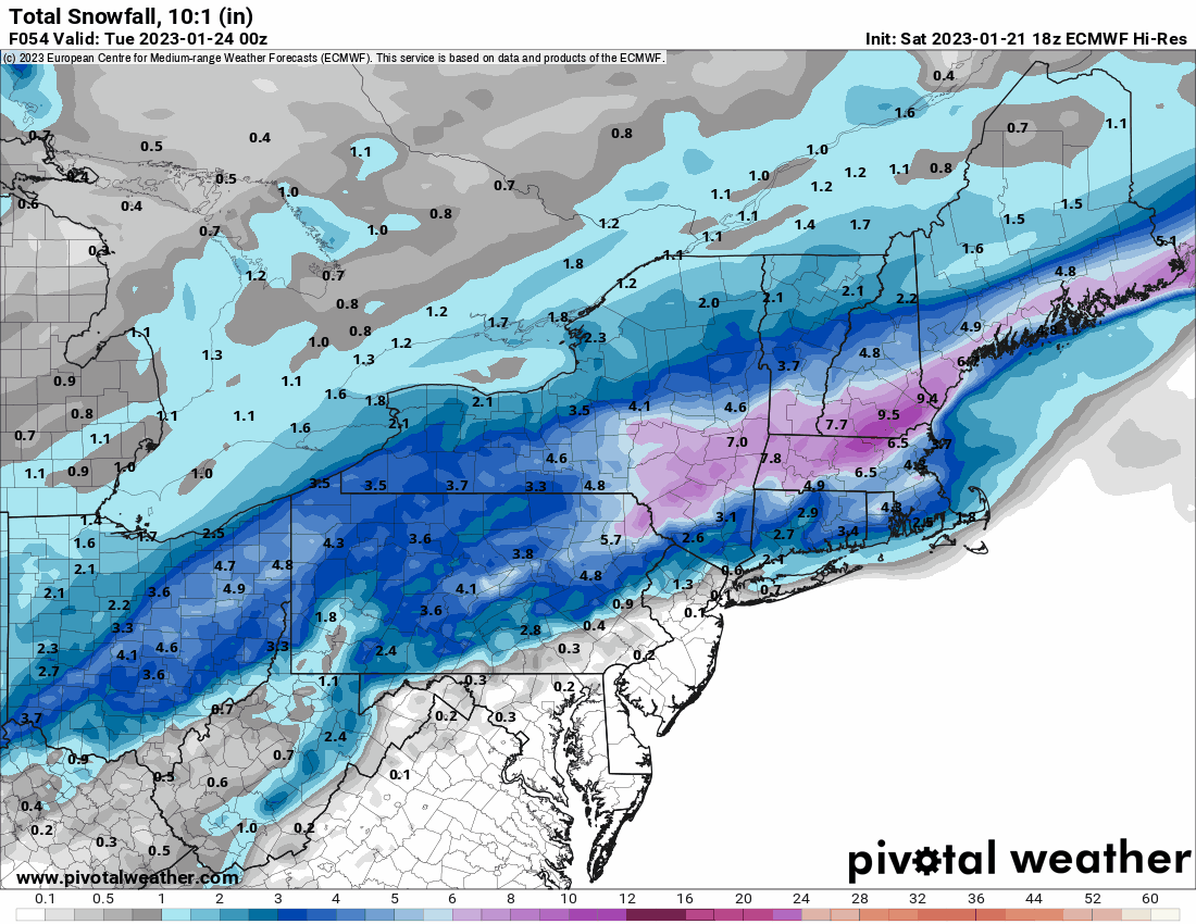
FWIW (for model completeness), the Ukie has been running a bit slower than the others but kept the same general coastal-hugging idea as the others for storm #1. Also keeps frozen to the N/W.

-
E PA/NJ/DE Winter 2022-2023 OBS Thread
Hurricane Agnes replied to Ralph Wiggum's topic in Philadelphia Region
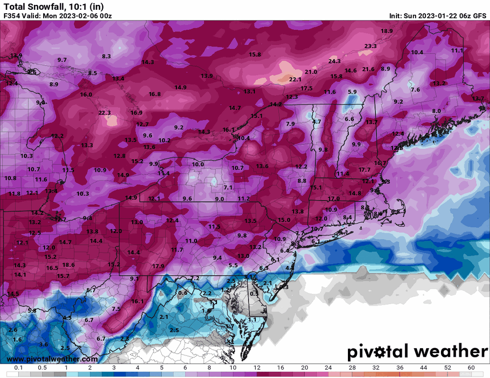
18z GFS looks to have ticked a tiny bit west and comes inland through E. PA and NJ, but gives some wrap-around love to the LV. After a 40 low this morning I made it up to 54 as a high, with changeable skies all day. Currently 46 with dp 36.
-
E PA/NJ/DE Winter 2022-2023 OBS Thread
Hurricane Agnes replied to Ralph Wiggum's topic in Philadelphia Region
EC a bit faster than the GFS but keeping the low coast-hugging.
-
E PA/NJ/DE Winter 2022-2023 OBS Thread
Hurricane Agnes replied to Ralph Wiggum's topic in Philadelphia Region
And 12z GFS moved it east but still inland.
-
E PA/NJ/DE Winter 2022-2023 OBS Thread
Hurricane Agnes replied to Ralph Wiggum's topic in Philadelphia Region
While waiting for the 12z to get to that time frame (almost there), the 6z GFS has that as a RedSky cutter.
-
E PA/NJ/DE Winter 2022-2023 OBS Thread
Hurricane Agnes replied to Ralph Wiggum's topic in Philadelphia Region
My mother had an old cedar tree between her house and her neighbor's house in the front (it was originally planted on their side). It was at least 30ft tall and the whole thing uprooted and fell over thanks to the ice load. The trunk/branches extended out into the street, past the parking lane, and about halfway into a street lane. -
E PA/NJ/DE Winter 2022-2023 OBS Thread
Hurricane Agnes replied to Ralph Wiggum's topic in Philadelphia Region
That was the year of ice storms too! I remember having to get to 30th St. Station to go on a work trip to Baltimore during the aftermath of one of the January ice storms. It ended up that I-76 was closed for 8 hours right after I decided not to go that way to get to the station. The area had run out of road salt and the store shelves were empty of any halite or equivalent. I was actually able to find some down in Baltimore where they just had rain at the time, and brought a couple bags back in my luggage. lol I found Ray's page with data for a snow/ice storm during this period (Jan. 17 - 18) in 1994 - http://www.raymondcmartinjr.com/weather/1994/17-Jan-94.html -
E PA/NJ/DE Winter 2022-2023 OBS Thread
Hurricane Agnes replied to Ralph Wiggum's topic in Philadelphia Region
One stat that is interesting to note is that week in 1994 was considered one of the coldest on record around the state. I even saw this from 5 years ago about this same period of January in 1994 regarding Central PA - https://www.pennlive.com/news/2018/01/think_its_been_cold_in_central.html But as an additional note, January 19, 1994 and KPHL's -5F, was the last time that location registered a below zero temp - http://www.climate.psu.edu/data/city_information/index.php?city=phl&page=mae&type=big7 So if that holds through this year and into next, it will be 30 years since the city proper had a below zero low (and since that time, it has gotten close - basically single digits but not at or below 0F). As an obs, it's been a somewhat unsettled morning (had heard on KYW that there was quite a bit of fog along I-95 very early this morning although I didn't see any here), but it is currently partly sunny and 45 with dp up quite a bit from earlier in the week at 42. -
E PA/NJ/DE Winter 2022-2023 OBS Thread
Hurricane Agnes replied to Ralph Wiggum's topic in Philadelphia Region
EC at that timeframe...

-
E PA/NJ/DE Winter 2022-2023 OBS Thread
Hurricane Agnes replied to Ralph Wiggum's topic in Philadelphia Region
And it wasn't just a full sun day but one with no clouds at all (at least where I am) all day! Had a low of 26 this morning and made it up to 46 as a high. Air has been pretty dry to boot. Currently clear and 43 with dp 16.