Hurricane Agnes
-
Posts
9,263 -
Joined
Content Type
Profiles
Blogs
Forums
American Weather
Media Demo
Store
Gallery
Everything posted by Hurricane Agnes
-
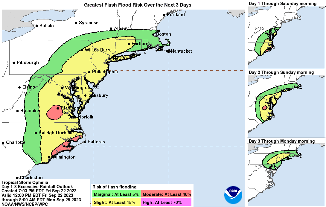
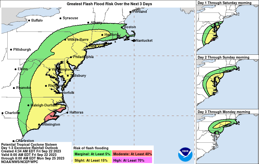
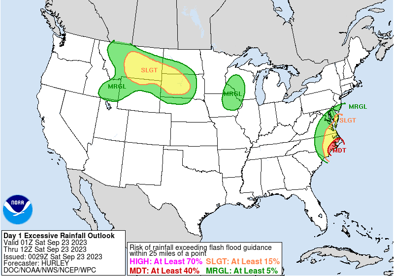
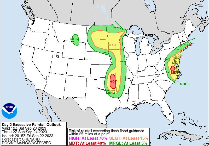
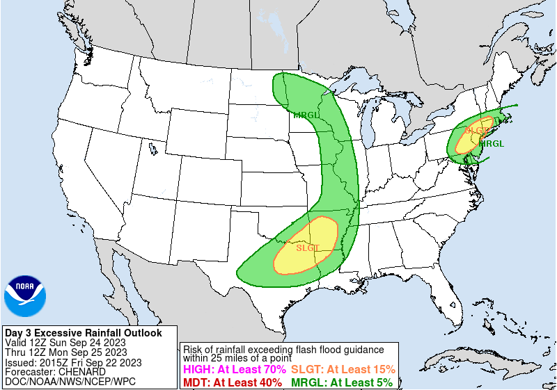
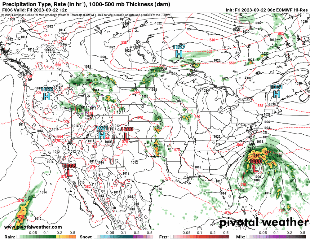
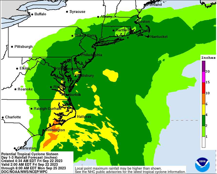
WPC flash flood/excessive rain - targeted as marginal in the southern part of the CWA for day 1, and a mix of marginal and slight for days 2 & 3. Cou;d be for some antecedent dryness.
-
Yup. Just refreshed it.
-
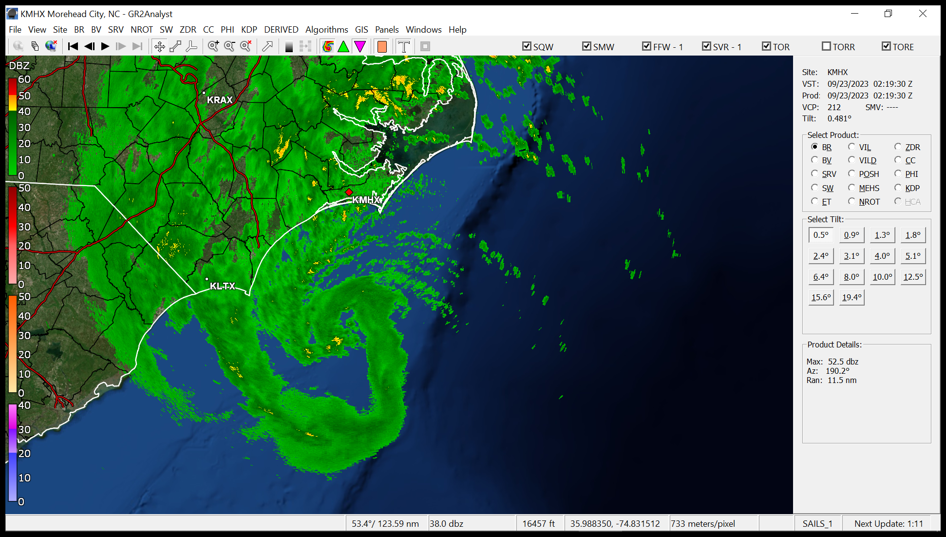
Looking for a couplet. Looks like a big version of this!

- 144 replies
-
- 1
-

-
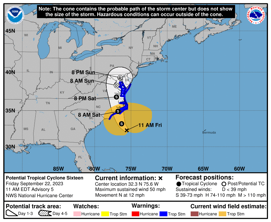
- potential tropical cyclone
- floods
- (and 2 more)
-
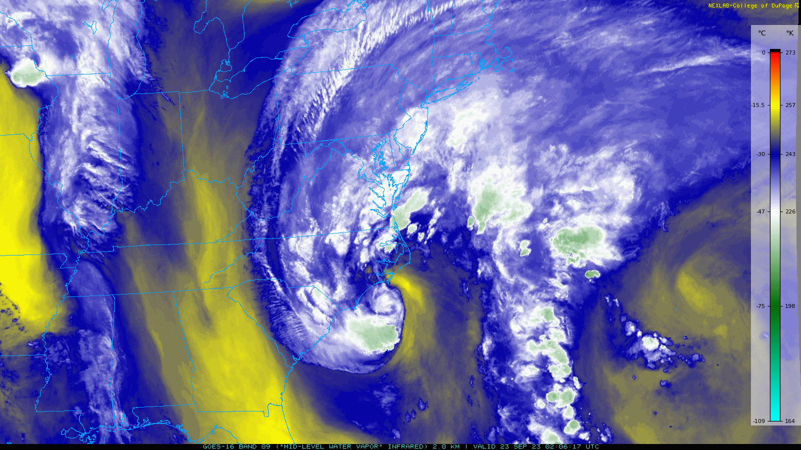
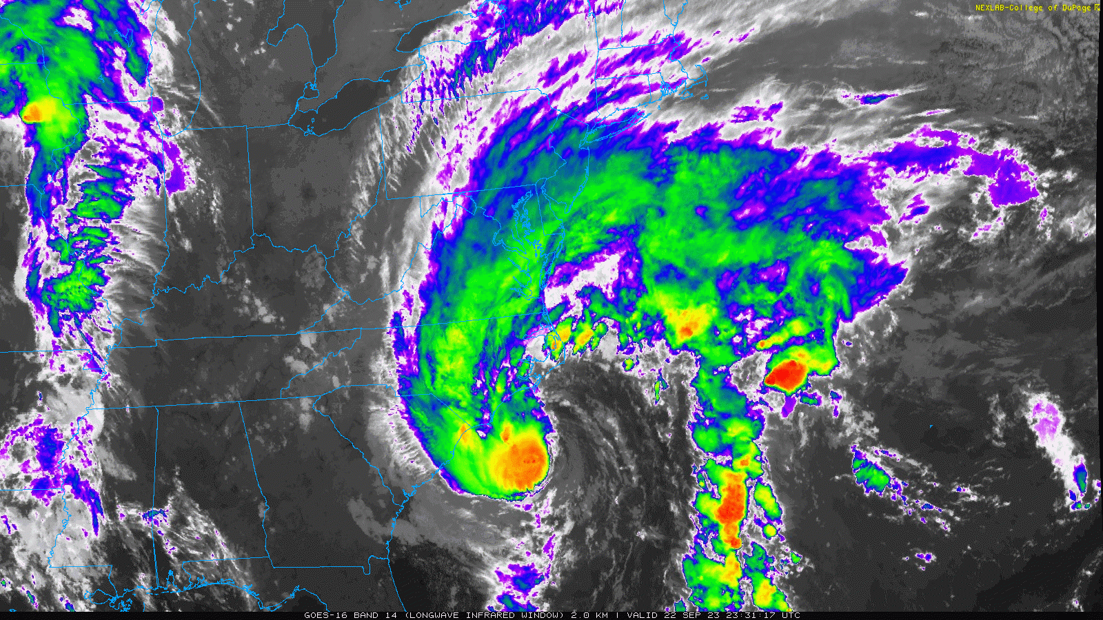
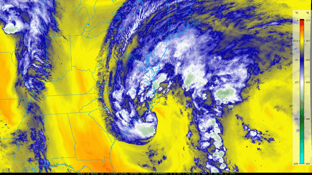
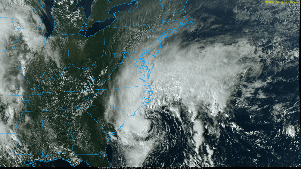
Mid- and lower-level...(Water Vapor). Yup. My dp is currently 55 (temp 62). Wasn't getting the typical "tropical feel" from it - at least yet. I guess as it moves further north, some of that might start mixing in.
-
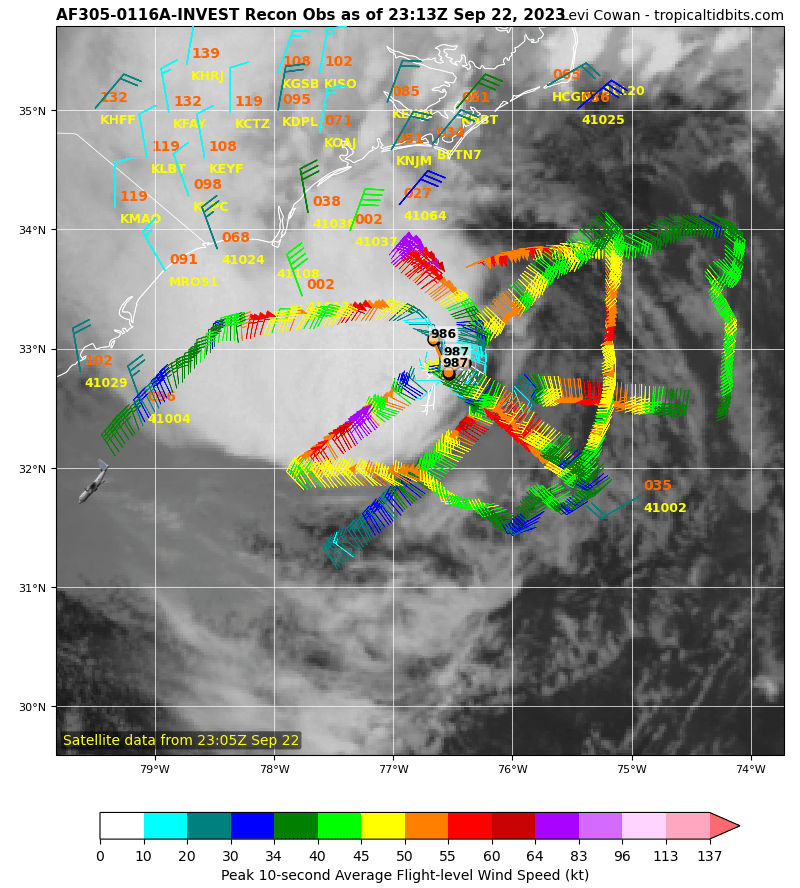
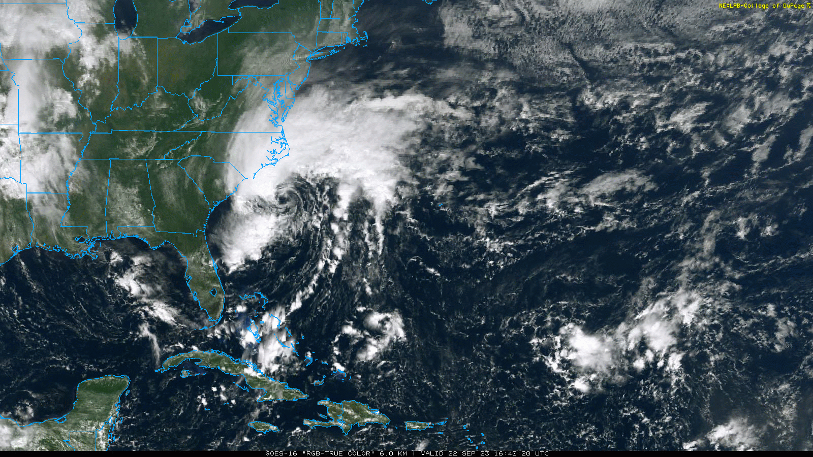
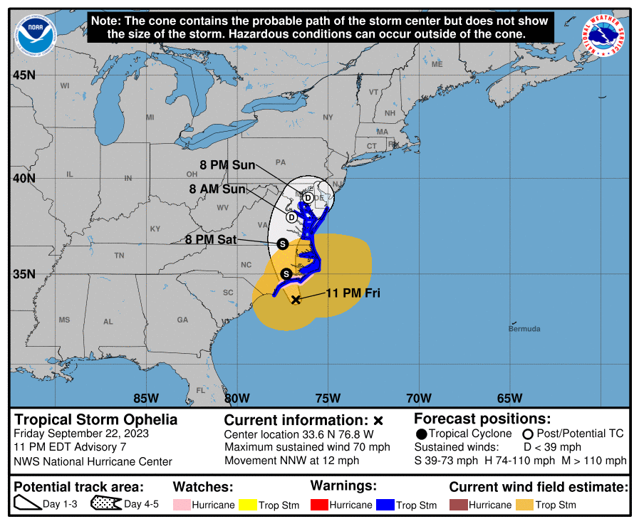
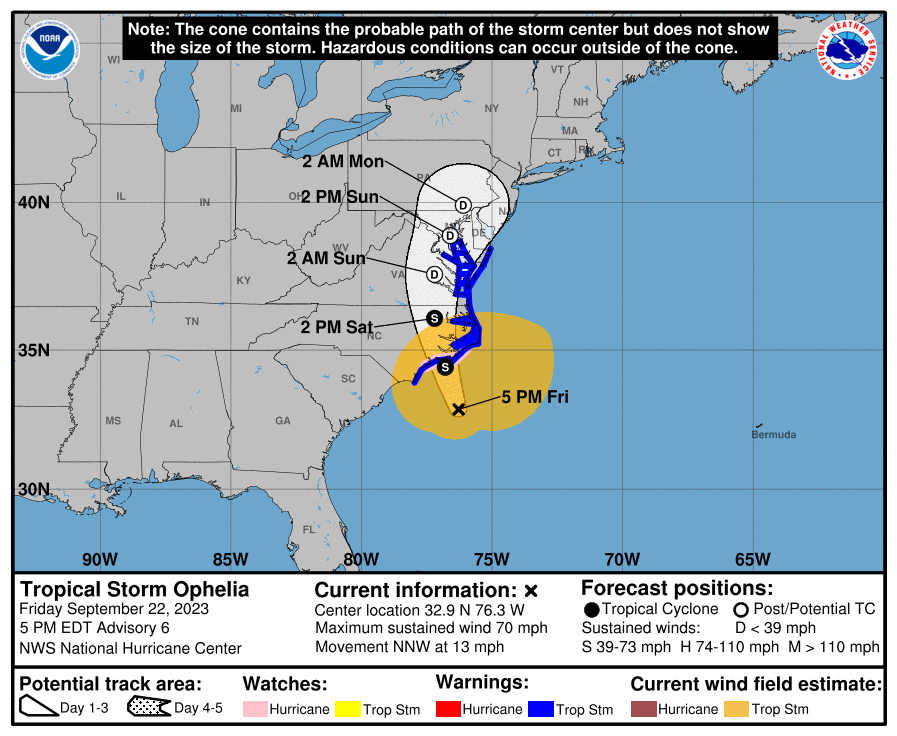
8pm update and still deepening a bit but slowing down and still @70 mph -
-
The above from drop #3 -
-
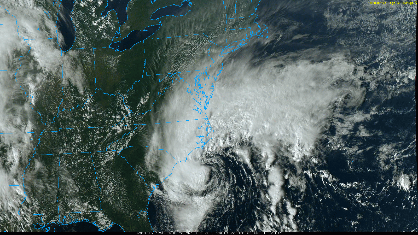
I know it has to be tearing up the Carolina coast and SC already had issues with flooding (especially Charleston) just the past week or so, let alone with Idalia.
-
I was watching the satellite loops and saw the eye start filling in with convection so it seemed to be juicing up. It's one thing having a 50 mph thing landfall and a 70 mph one. Didn't expect that kind of almost-RI. It's just a few mph short of a hurricane but I don't think it has enough room to do that before landfall.
-
Wow. Ophelia hit that bathwater and exploded from 50 mph to 70 mph. Might not have time to become a hurricane before landfall but didn't expect that!
-
E PA/NJ/DE Fall 2023 OBS/Discussion Thread
Hurricane Agnes replied to Rtd208's topic in Philadelphia Region
Maxed out at 72 today with a gusty cool SE breeze. The dews haven't shot up IMBY yet as it is currently overcast and 68 with dp 55. -
OMG. Those cans usually have latches on the front for the lid but that is a huge can too. Am wondering about the Phils tonight because even if the rain doesn't start until later, the winds are going to do a number on where any hit balls end up.
-
When I saw the stuff down there I was wondering if you noticed it! It's definitely breezy out. Was tying up a couple of my potted tropical plants (I have a top heavy plumeria that definitely needed it).
-
Was just out and the winds are whipping and thar she blows!
-
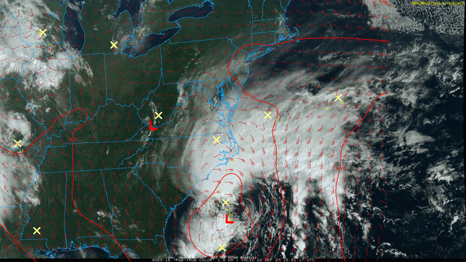
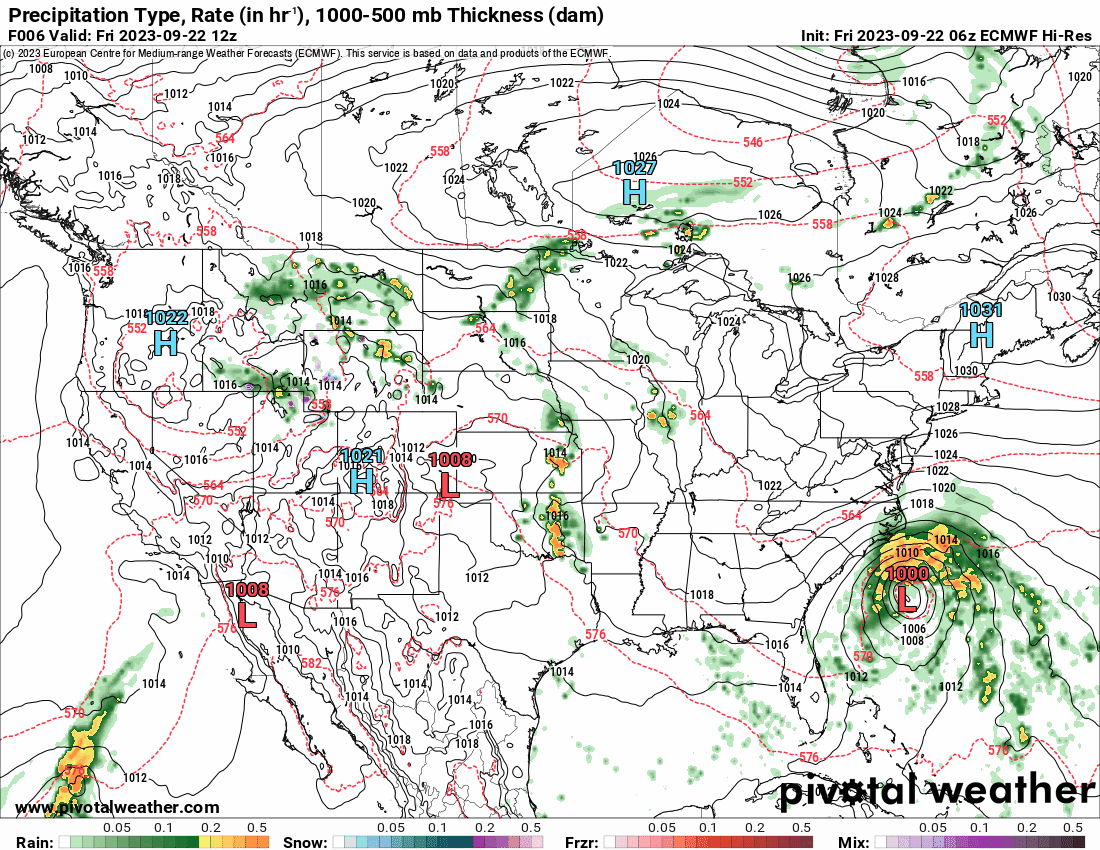
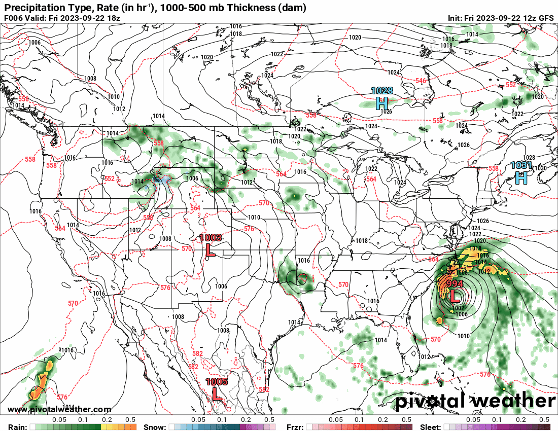
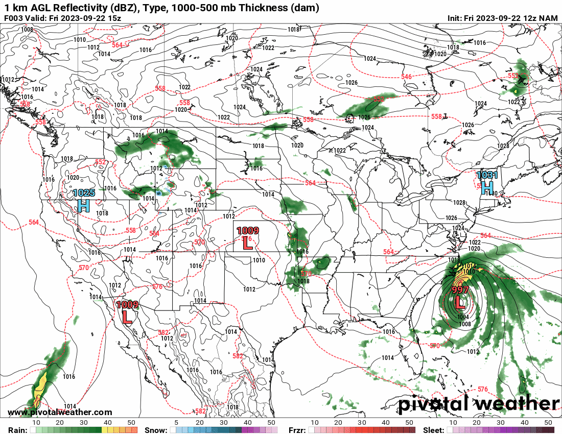
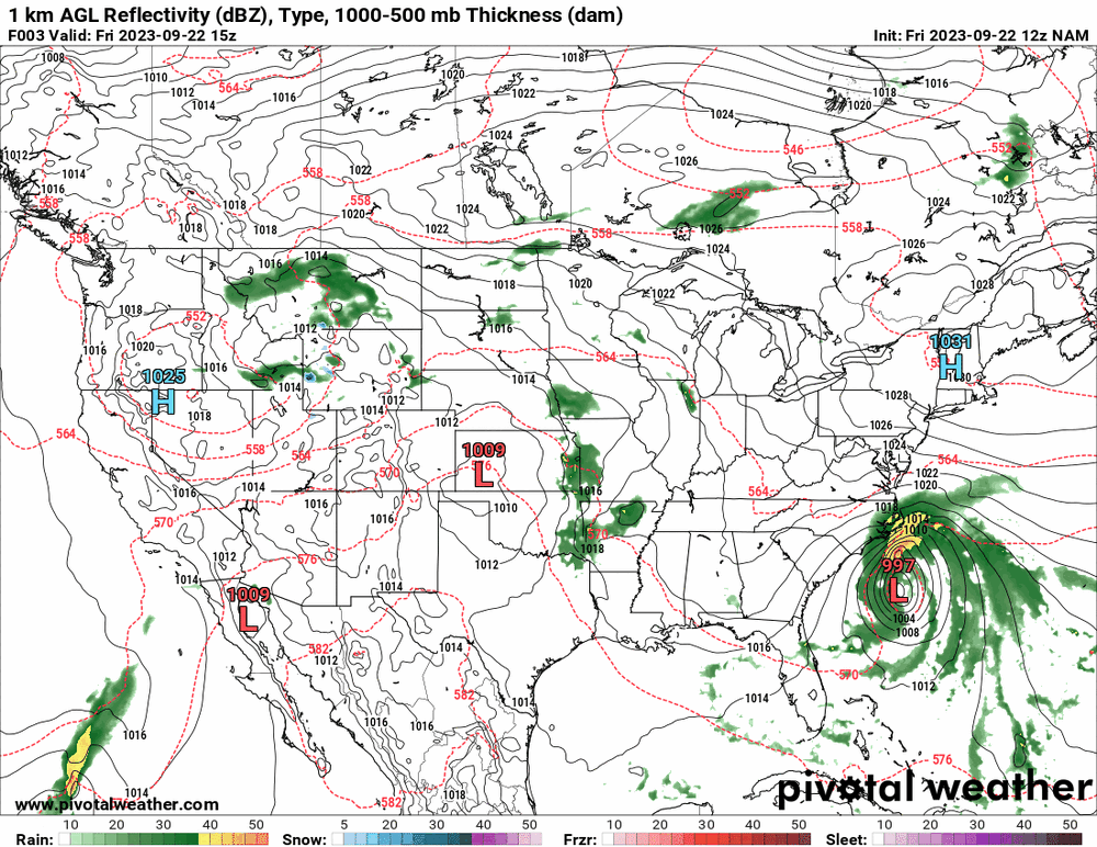
12z GFS is running now and after the 6z kept the scraping, the 12z ticked west with the rest. The Euro had caved to move further to the west too but not as far as the 12z 12k (and 3k) NAM the furthest west.

-
E PA/NJ/DE Fall 2023 OBS/Discussion Thread
Hurricane Agnes replied to Rtd208's topic in Philadelphia Region
Bottomed out at 54 this morning and the clouds have been rolling in since. Currently mostly cloudy and 69with dp 57. -
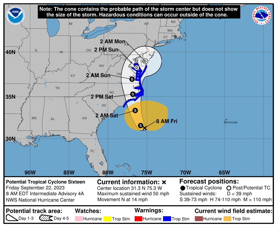
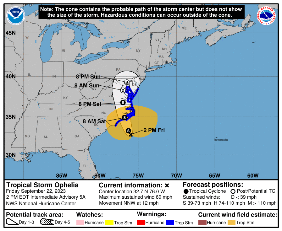
Latest cone @11 am looks like it took a western jog -

-
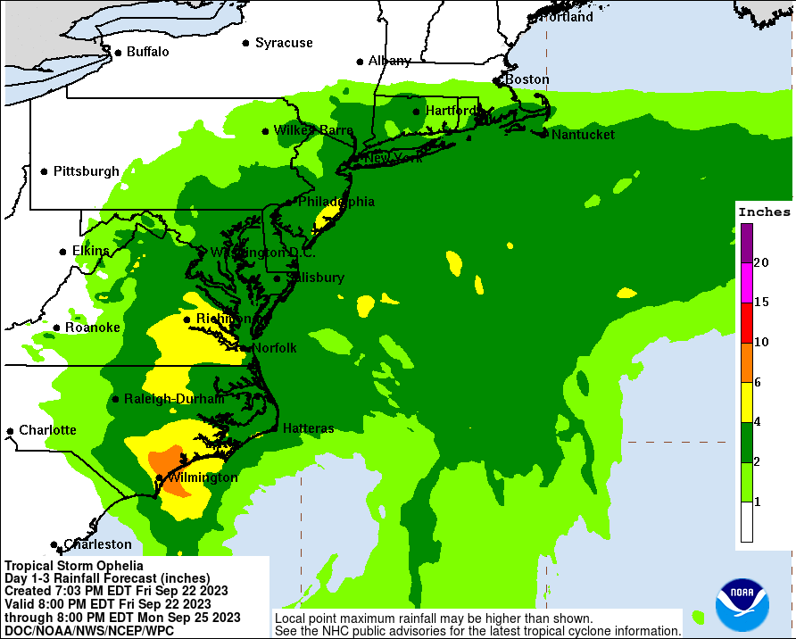
The track is going to make a big difference as well as whether it really does get cut off as being hinted at, and stalls for a bit. If a band sets up over the area, there could be some pretty significant flooding. Fortunately we are almost 1/2 way between a new and full moon so any normally higher tides won't be there to make it worse.
-
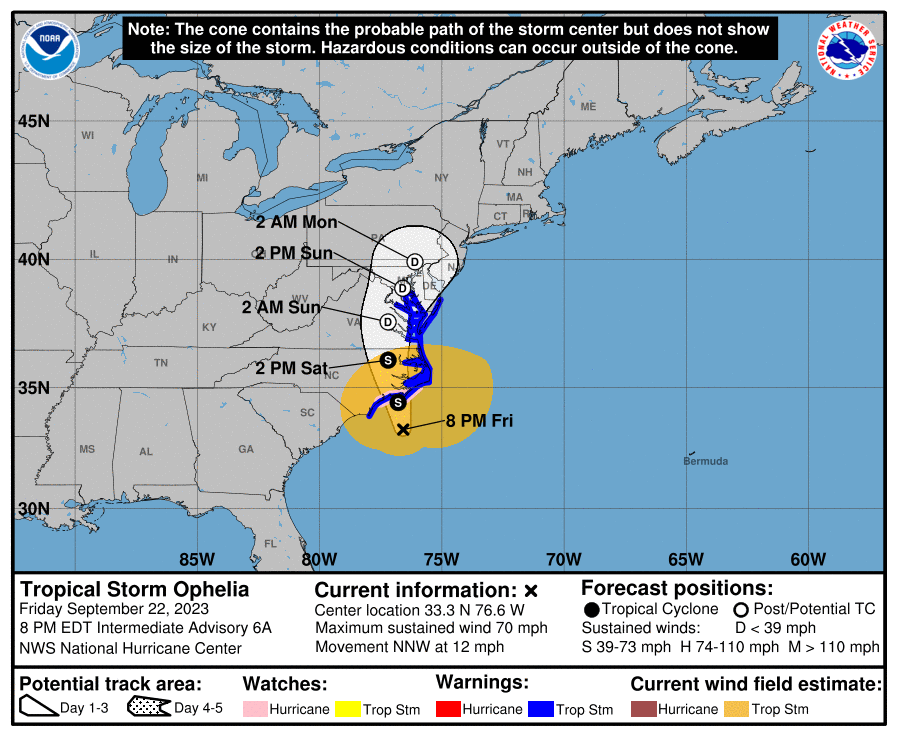
8 am update -