Hurricane Agnes
-
Posts
8,978 -
Joined
Content Type
Profiles
Blogs
Forums
American Weather
Media Demo
Store
Gallery
Everything posted by Hurricane Agnes
-
I kinda thought the same thing. Got up to 82 here too, which was my high (after a low of 65). It was overcast earlier this morning but once that went away, the temps started shooting up (as did the point and click forecast temp). It's been back to overcast the past hour or so now and the temp is down to 78.
-
-
-
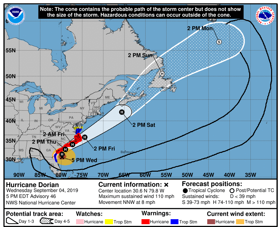
Josh started a first-person account of his Dorian experience via a twitter thread. Here is a link to the unrolled version (with 5 tweets so far) - https://threadreaderapp.com/thread/1170675844815216640.html
-
I finally ended up with 0.20" of Dorian rain with the last of it coming through just after 10pm. But wow.... didn't realize it was going to chill down this much. My high yesterday was 68 and the low ended up at midnight at 58. But this morning it is currently down to 55 and that brush with Dorian yesterday felt like a chilly nor'easter vs a steamy tropical hurricane I guess due to it pulling down some cold Canadian air when it got sucked into the trough. Definitely a "trigger" for plants and animals that fall is coming (and I know Birds~69 is loving it ) although it's supposed to warm back up into the low - mid-80s next week.
-
And as expected, as Dorian continues to move away, that band pivoted around and swung back over me from the NW and I am now up to 0.18" with some light rain still going on. This is probably the "coldest" tropical storm that I've ever experienced. LOL Temp is now down to 58.
-
Am now up to 0.17" so far from that band. The band has moved away to the NW of me as Dorian lifts to the NE and starts it's trek away from the coast, so it's possible that the little band may pivot around and move back down here from the N and then from the NW before it pulls completely away and is history. Currently 59 and overcast.
-
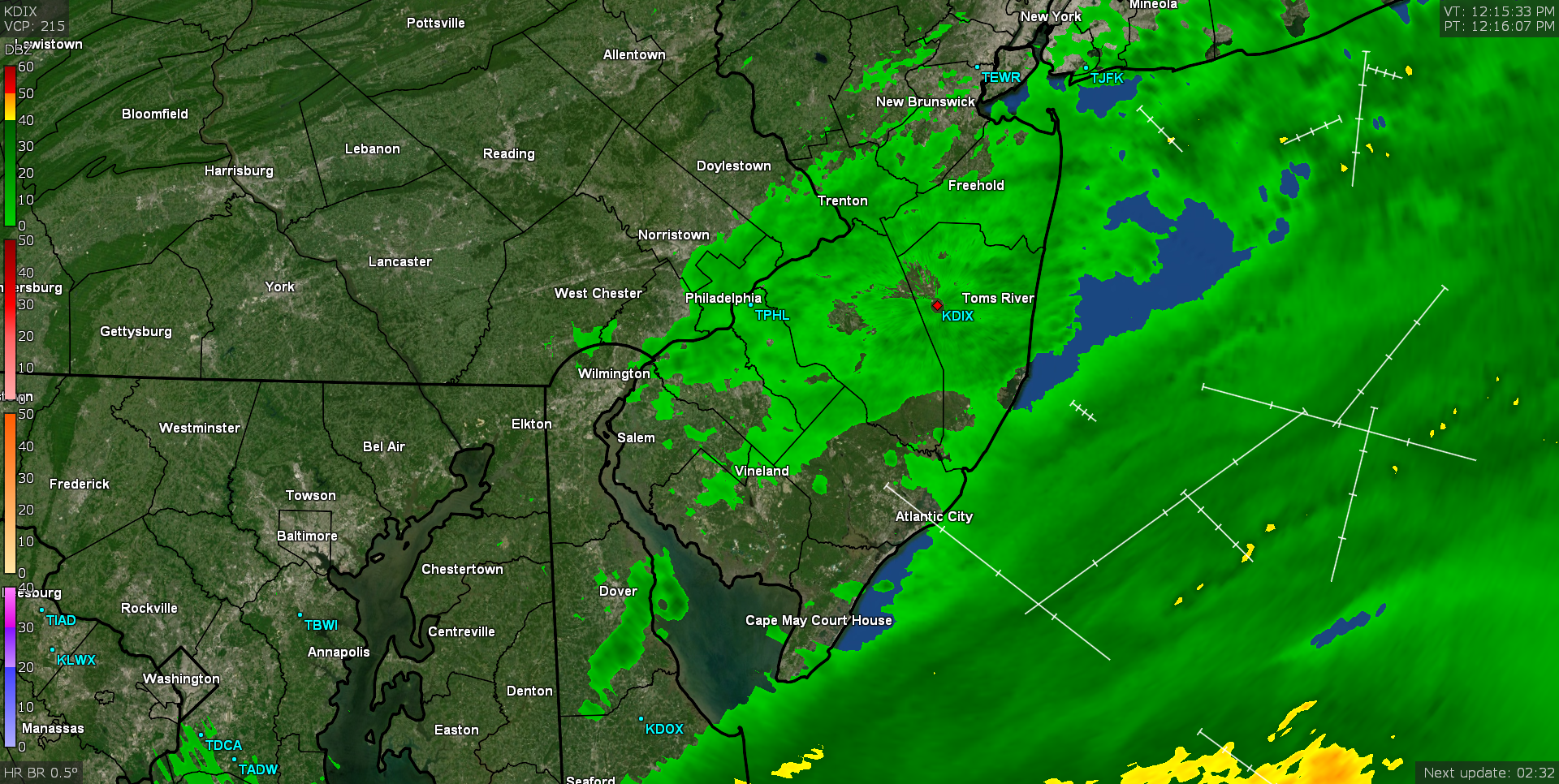
There has been a stray band from the outer bands of Dorian sitting over the I-95 corridor since this afternoon. Am currently up to 0.12" from it so it hasn't been heavy but it has kept the temps in the low 60s. Since the last couple storms either fringed or missed me, I had to pull out the hose yesterday and of course what happens today...? Currently 61 and breezy with light rain.
-
Now getting some measurable (have 0.01" so far). Temp is down to 63 with a persistent breeze out of the NE and some very light stratiform rain.
-
Have been getting "Dorian sprinkles" here this morning (nothing measurable yet). Getting a persistent but light NE breeze and it is plenty overcast. After a low of 64 this morning, am currently just barely hitting 68.

-
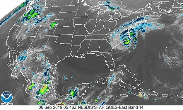
Had a high of 77 yesterday after a low of 64, with quite a bit of high clouds and overcast, but some occasional sun. Currently 64 and overcast. There was also a beautiful yellow/orange/red/purple sunset yesterday evening (enough that it prompted one of my sisters to text a pic of it that my niece took). Am thinking that may have been Dorian-related as the moist ocean-side feeders of the storm are visible east of us here -
-
Don't mess with Amidala.
-
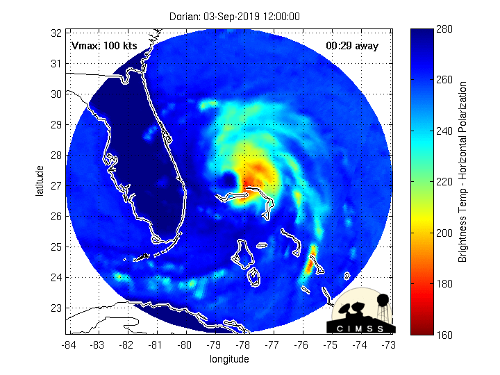
They didn't change it with the update unless they have to issue another correction. I would agree that I haven't seen anything higher than 81 kts with the recent drops although there is a newer recon in there still working.
-
Somebody was looking for you last night I think -
-
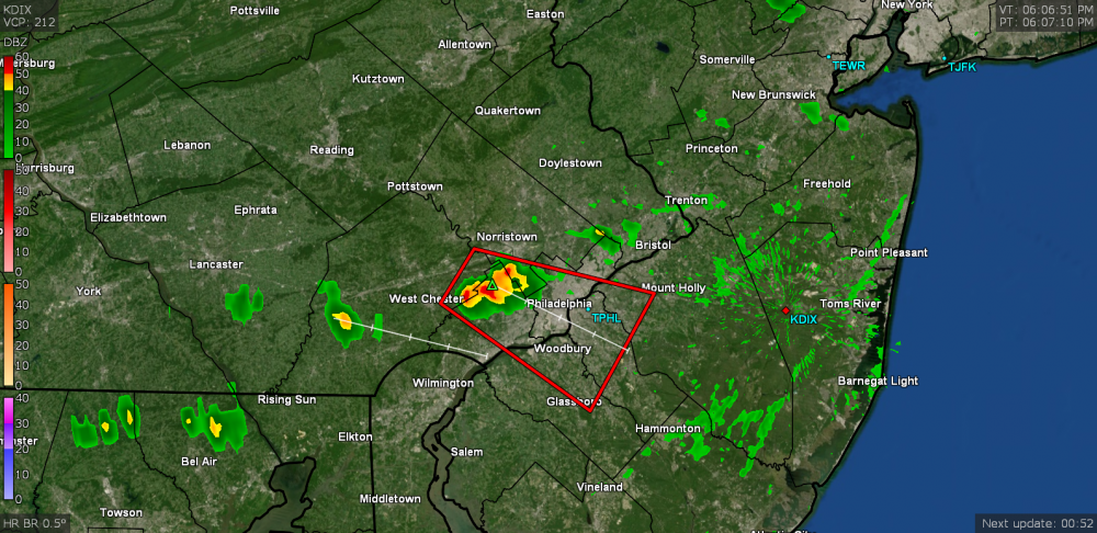
Severe Thunderstorm Warning just issued for parts of the area (it will probably miss me to the south by a few miles) - Otherwise it just tapped 89 here after a low of 67. Currently 87 and overcast with dews that have held in the low 70s much of today.
-
I saw a tweet with a corrected version.
-
Sandy took out the remaining 4 street trees that survived after Irene took out 6 others on that street the year before.
-
Josh is up in the air on his way to Abaco per his latest tweet -
-
It's moving (MW last 24 hours) -
-
Overall nice late summer day yesterday with a high of 82 after a low of 66 here. Today is supposed to be the warmest of the near/long term but I don't think I'll make it to 90 here today, especially if the overcast this morning manages to persist (at least in part) during the day. Currently mostly cloudy and 70 (where I actually had a low of 67 around 1:30 am and have been experiencing non-diurnal warming since).
-
I expect the government of that island may end up operating out of Nassau, which got a less significant blow (although had significant flooding despite no direct hit). The airport there was open but with obvious delays.
-
His 4th tweet (around the time of the previous ones) -
-
He had 3 tweets. The other 2 -
-
He does have a show premiere coming up - I think September 15.
-
Adding my here!