Hurricane Agnes
-
Posts
9,268 -
Joined
Content Type
Profiles
Blogs
Forums
American Weather
Media Demo
Store
Gallery
Everything posted by Hurricane Agnes
-
Yeah I switched over to KDOX this morning for radar. But as I type, it looks like it is back. Have been getting shafted by all the pop-ups, including one that was literally 2 miles to my NE that even produced a rainbow. The last "substantial" (in quotes) rain here was back on 6/18 (0.39") with a light event a couple days later depositing 0.05" and nada since. Had to pull the hose out. Temp did hit back-to-back 91s on Monday and Tuesday and today has been mainly overcast much of the day although making it up to 87, with dews in the low 50s, which is rare. That all changes tomorrow. Currently 80 and overcast.
-
Sun just popped out and I finished up with 0.31" total for the day (so far). Currently partly sunny and 75 with a dp of 72 (which is continually steaming up the windows)!
-
Ended up hitting 91 yesterday and yes it was a blast furnace feel. Got some overnight rain (0.09") and some steamed-up windows this morning, and have been getting sprayed from the hose line going across the area every once in awhile (so far got an additional 0.08" for a total of 0.18"). Temp currently 74 so as long as it is doing this, it is keeping the heat away. Just had Zeus rumble across the sky and shake the house. ETA - am listening to the city's coronavirus presser and the thunder could be heard in the background!!
-
Made it up to 78 today after a low of 62. With plenty of sun, low humidity, and an active breeze, it was literally what they call "a Chamber of Commerce Day". Currently partly cloudy at sunset and 73 here.
-
Ended up with 0.44" of rain yesterday and 0.02" from a shower that happened about 2 am this morning. My windows were all steamed up this morning and currently 76, mostly sunny and steamy.
-
Have picked up almost 1/4" (0.22") with this line but it has been slowly lifting to the north as it trains over areas and has been on and off here. Temp is down to 73 and a bit of a dry slot is starting to form over the city.
-
My windows have steamed up here and temp is down to 75 with dp of 73. The rain had stopped earlier but has picked up again as the line streams along its WSW to ENE path and lifts up from the south.
-
Getting fringed by that right now. Already deposited 0.08" so far. Temp hit 85 before the rain hit. Dp is like 72.
-
Flash Flood Watch issued - Current temp here is 74 and mostly cloudy with sun the breaking out here and there, but the humidity is creeping back. The heavy rain shredded my peony blooms. lol
-
I did actually hit the sack "early" (@ 9:30 pm) last night (I am normally up between 4 - 4:30 am most mornings so I try not to stay up late)... but had already seen some flashes of lightning as I was dozing off. The thunder and lightning did wake me up at around 10:30 pm though. I picked up 0.43" of rain from that round - and had almost 2"/hr rates too. There was another round around 2 am that deposited 0.11", so for both rounds overnight, I picked up 0.54". And I did put a bucket out to collect it (have been doing that on and off the past year since my indoor plants seem to like it much better than the Schuylkill Punch they normally got)!
-
I just hit my first 90 for the season and to celebrate -
-
Independence Day's blowing up of the Empire State building, Jurassic Park's T-Rex escape, Forrest Gump's Vietnam attack scene (made more dramatic by being preceded by Buffalo Springfield's "For what it's worth"), and just about any scene in Twister where a tornado appears (although the drive-in movie scene was probably the loudest). Also remember back then there wasn't really any "consumer high-speed internet", let alone any tablets or smart phones - and not even Windoze 98, so their sat connections were pretty cool-looking (although I expect relatively "slow"). If anything, I think it provided an alternative view of "scientists" beyond the stereotypical coke-bottle glassed nerds with a pocket protector and slide rule firmly attached to a pants belt, and brought some excitement (Hollywood style) to the field itself - and notably for chasers (I was this close >< to majoring in it and picked chemistry instead because at the time ('79), the job prospects were much better for chemists than for mets). And Mother Nature's "conservation of the temperature in a search for equilibrium" meant your 86 became my 88 (the other "lost" degree went to someone else). ETA - and I just clicked over to 89 so that little lone degree wanted to join his buddy over here.
-
That's hilarious. I remember when they finally released the film to buy in the fall of 1996 (just before DVDs were eventually made available in 1997), and I had already put together a Dolby Digital 5.1 home theater with an AC-3 laserdisc player and bought that on laserdisc. I used it, "Independence Day", "Jurassic Park", and "Forrest Gump" (all on laserdisc) as great "demo" movies for the sound (notably working out my subwoofer). That is definitely a movie. Well my temp has surpassed yesterday's high so far and am at 87. Dp is in the upper 50s, so not the sauna of yesterday (just popped outside and definitely a difference), but the sun is strong.
-
Current temp here is now 86, which was my high for yesterday before the derecho came barreling through. This time there's nothing on the radar in the area at the moment to rain the temperature down, so will see how high I'll go.
-
That came to mind to me too!! Off to the races this morning. Mostly sunny with temp up to 80 and dp in the sauna-like upper 60s.
-
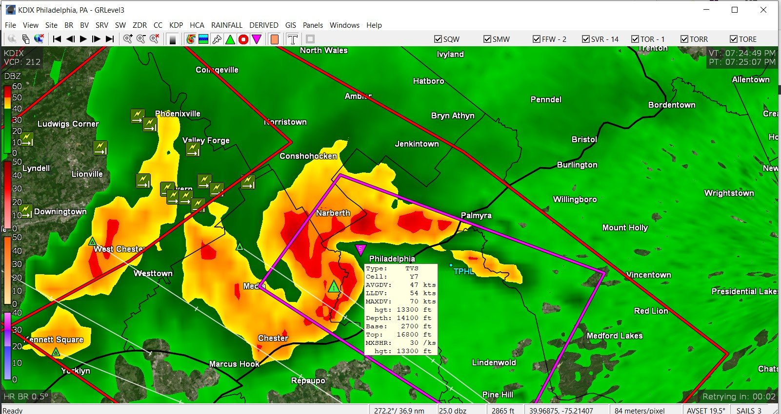
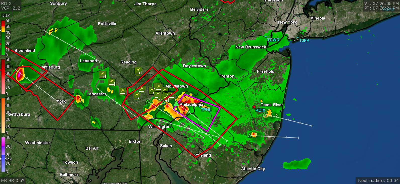
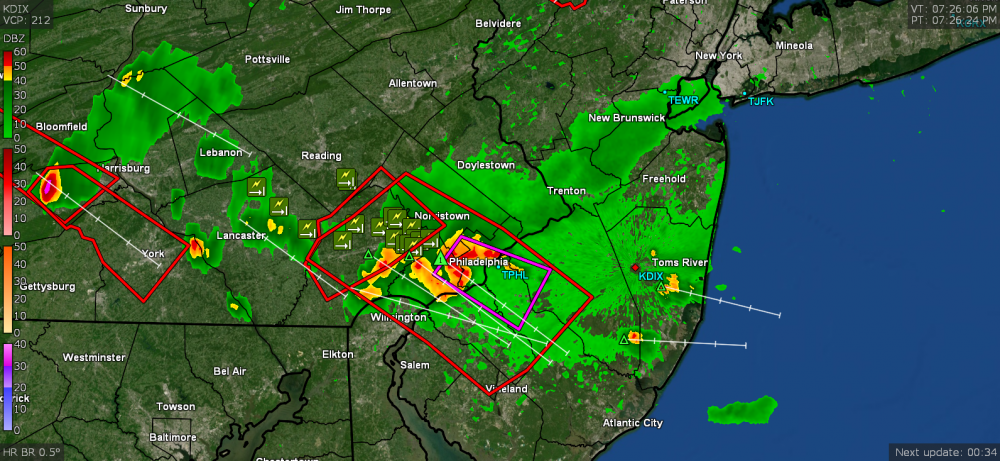
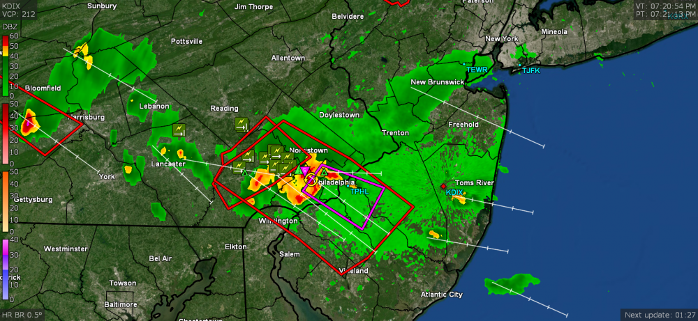
Great pic!!! When I was watching the little complex on radar coming down from the NW, it looked like 3 discrete cells that eventually congealed into a blob, with the cells still somewhat intact. One of the cells exhibited some rotation just before coming into Philly, which prompted the TOR. I didn't have my little convertible laptop with my GR2Analyst up and running to see what the volumetric view looked like (and how high-topped the cells might have been), but need to get that going in case we get more pulse-type stuff today. It might also get interesting next week with Cristobal remnants getting ingested in a Low progged to form in the midwest.
-
DEBRIS! Dusty we have DEBRIS!
-
Greenage.
-
This pretty much went south of me but I did get 0.05" of rain out of it. Starting to clear but you can see the dark clouds to the south and east of here. Temp is down to 71 but it's still a steambath with dews in the mid-upper 60s.
-
Did a zoom on that timeframe as it was coming through.

-
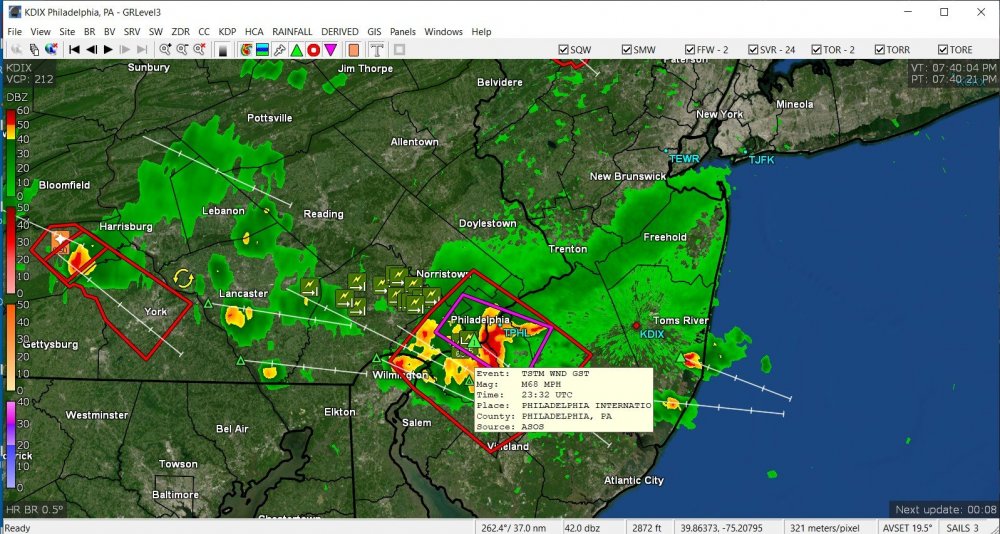
TOR just expired but KPHL reported a 68 mph gust.
-
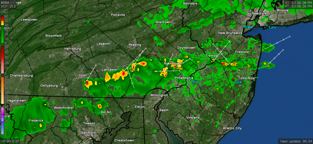
The heaviest stuff is rolling just south of me.
-
Tornado Warning in eastern Delco area.
-
TOR lofted -
-
This is a noisy storm. Popped outside and am hearing continual thunder and seeing some lightning flashes. The other one had a couple rumbles of thunder but this one is "blabby". Temp is down to 80.