Hurricane Agnes
-
Posts
9,357 -
Joined
Content Type
Profiles
Blogs
Forums
American Weather
Media Demo
Store
Gallery
Everything posted by Hurricane Agnes
-
Wasn't sure if I would do it, but after a low of 73 this morning, I did tap 90 just before noon today (#30 of 90+ since May). It's currently 89 and partly cloudy with dp bopping between 72 and 73. SPC has our area in a "Marginal Risk" (but hope I can get a little rain in to top off after the past couple days of heat).
-
Looks like the 96 was my high and I'm now getting some incoming clouds but am still partly sunny and "down to" 92, with a dp 71.
-
Have now hit 95 (although still haven't matched or exceeded my highest of the summer yet, which was 96 on 6/30/21). The few earlier wispy clouds have disappeared and now have all blue sky. Dp is 70. Some stuff has been firing west of Harrisburg the past couple hours.
-
Have already hit a 90 just after 10:30 this morning (#29 since May), with a low of 74. Am currently @90 with a mixed-out dp of 69 (much better than the mid-upper 70s earlier this week, which probably also included "burning off" the moisture from the antecedent rain at that time). May hit the mid-90s earlier today but will see.
-
Was figuring someone would cash in. I didn't, which is fine since I got something the previous 2 days. Currently much warmer this morning (so far) than the previous mornings this week and at 76, with dp 71.
-
I don't even bother looking for the annual meteor showers around here anymore. It's always either rainy or some deck of high clouds suddenly appear to block the sky. Thankfully i got chance to see the Perseids during an August work trip in Colorado about 35 years ago (at ~8200 ft altitude where the lodge was). The whole sky there was literally awesome at night. "Dark sky" was a misnomer because it was all Milkway and everything else, with a sprinkle of continual Perseids. I did pop out to see what will be a setting crescent moon in a pretty clear sky though. The critters are making a racket and the katydids are officially here making more noise than the crickets. Temp is "down to" 84 with dp 74.
-
Jinxed! Something did just bubble up around State College though. For all we know, if that line makes it over the mountains, it might be a 3 am fireworks show.
-
Looks like my 95 was it for the high and I'm down to 89 wih dp down to 72. Radar is still clear so I guess the past couple days took all the moisture out of the air and with today's "dry", it may actually get a little hotter tomorrow since there shouldn't be as much energy needed to remove the ground moisture this time (unless something forms overnight). There is a blob and line of convection back over Pittsburgh but that looks like it may take some time to get here.
-
Based on the past couple days being analogs, that means you'll be flooding. Temp so far has hit 95 as a high and currently 95 and mostly sunny with dp 76.
-
When all was said and done, I ended up with 0.25" from that line yesterday, which is fine. The low this morning was 71. Currently have blue sky to the south and some hazy high clouds to the north and 84, with dp 75. If it is going to hit mid-upper 90s here today, then it needs to already be close to or in the low 90s here by now, but we shall see.
-
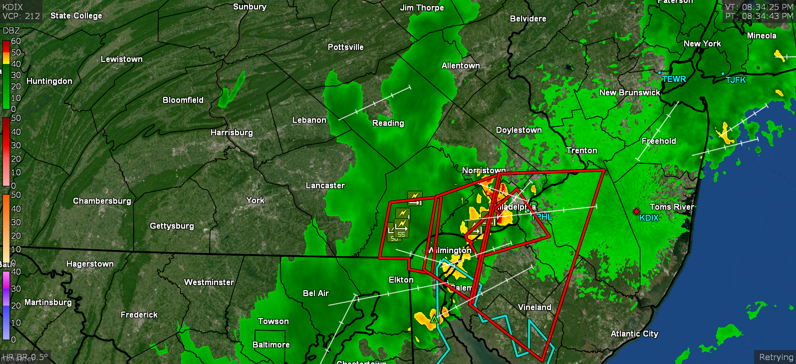
Yeah, what is with this late-ass thunder? There was nothing as it came through and now like 45 minutes later, we're hearing I guess what is the rocking and rolling going on in Jersey. As a note, my BIL and one of his buddies went to see the Phillies last night and I told my sis that they had to have been in a rain delay because there was a huge blob sitting right over the stadium area. I think it was a delay for something like 90 minutes. They probably should have just given up at that point considering what happened when they resumed.
-
Well so far, I got 0.22" out of it which is fine since I already got 1.68" yesterday. So a good top-off ahead of the torch the next couple days. The rain did drop the temp to 75 and the dp "down to" 73. Still getting some light rain.
-
And it reactivated over the hot streets and a blob just blew up over me. Getting heavy rain now.
-
It's fizzling as it goes over the Montco hills. Starting to get some rain now (0.01" so far). Temp is down to 81 with dp 72.
-
I'm in it now. Getting the winds and "night fell" look. Temp is down a couple degrees to 84. No rain yet, but it's coming.
-
Holy crap! Watching a shelf cloud approaching. Convection being picked up by lightning detector. Temp is currently 87 with dp 78. ETA - both my sisters are texting shelf cloud pics (from Delco and Montco ).
-
That might actually be an outflow boundary. It actually just started forming within the past 15 minutes moving out ahead of the main line. The main line is stll back a bit.
-
Am guessing you are under this conflagration. It has sortof hazed and clouded over here so the temp is down to 88 but dp is still high at 77. 93 pretty much ended up being my high given that with the clouds, it's done going up.

-
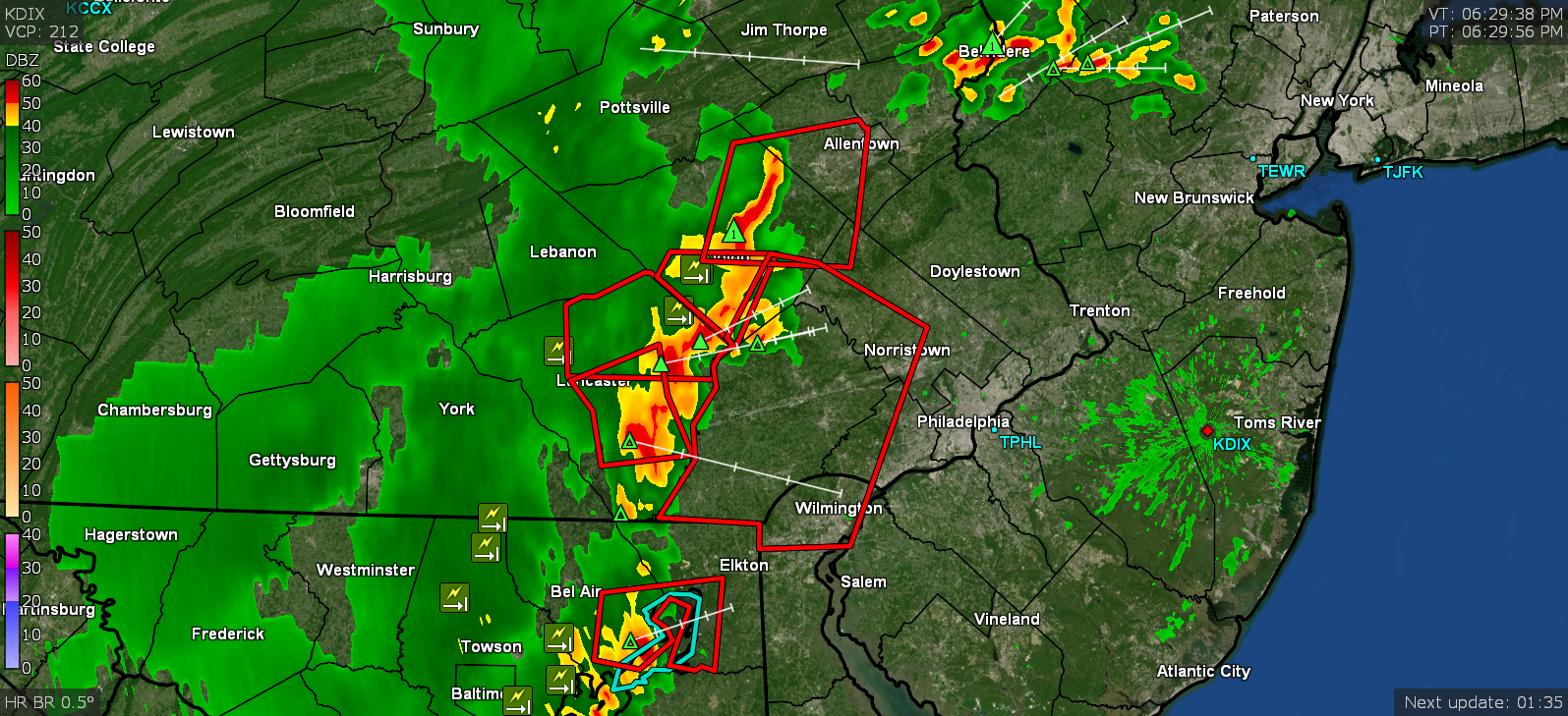
Could be they are thinking it will be running more to the south (where it is really juicy). You see that in Sterling's Watch area - I don't think SPC splits counties with parallelograms so they just left Burlington out, maybe thinking any convection from the north of there would send outflow down through there (NY doesn't have any T-storm Watches up at this time). It still obviously allows for short-fused Warnings as the storms develop (and/or redevelop) over areas not in a Watch area. I noticed yesterday that there was back-building and pop-ups in the middle of the incoming line cluster from the west, so I would definitely expect short-fused alerts.
-
SPC just put up a couple Watches for the area.
-
IOW - Currently partly sunny and sitting at 92 with a disgusting dp of 79. Had it briefly hit 93 around 2:30 pm (so far) though. Just stepped out to experience the unbreathable sauna and ran back in. ETA - and here is is from SPC -
-
Finished up with a total of 1.68" of rain for Tuesday (0.07" round 1, 0.23" round 2, and 1.38" round 3). The high was 91. Currently mostly cloudy, 71 and misty, with dp 71, producing the steamy windows. I think that rainfall I had here will preclude getting to the mid-90s here today, and/or tomorrow, although if there is no more rain here until the weekend, then Friday might get there and perhaps even reach the upper 90s. But I suppose that will depend on how strong the heat core is (i.e., if there had been an antecedent dry period, then we might have had a chance for triple digits this week, which we haven't had here in awhile).
-
Dayum.... I ended up with 1.34" out of that round 3 batch to give me 1.65" for the day (so far). I should be good for the rest of the week! Currently some light rain and 72 with dp 71.
-
Now up to over 2.75"/hr. Currently at 0.81". Temp is 74 with dp 73. That should hopefully get me through the rest of the week when the blowtorch hits.
-
Gully washer! Can hear it banging on the roof and windows. Short-fused Warning over the area. 1.3"/hour. Up to 0.53" for the day so far.