Hurricane Agnes
-
Posts
8,976 -
Joined
Content Type
Profiles
Blogs
Forums
American Weather
Media Demo
Store
Gallery
Everything posted by Hurricane Agnes
-
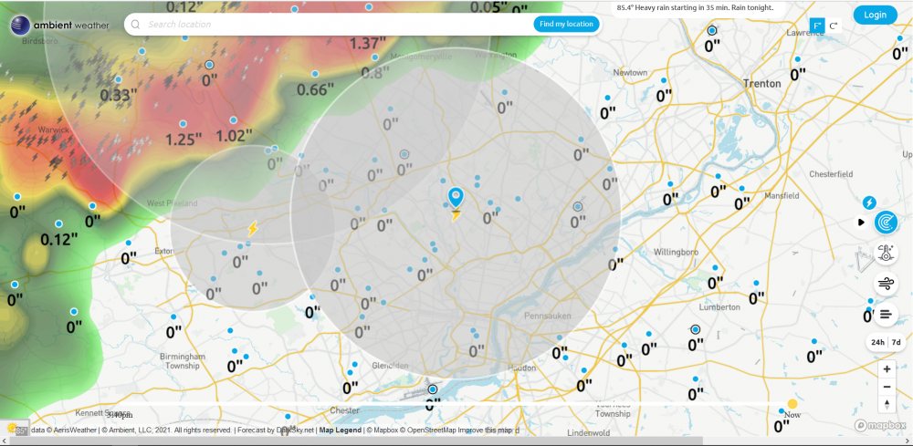
It took awhile but I ended up with 1.04" yesterday, with a 69 high and 49 low. Am up to 0.56" so far this morning, with a steady moderate rain and 47, which is my low so far. Amazing that Mt. Holly has a Climatology section up for possible record low maxes for the area this weekend!
-
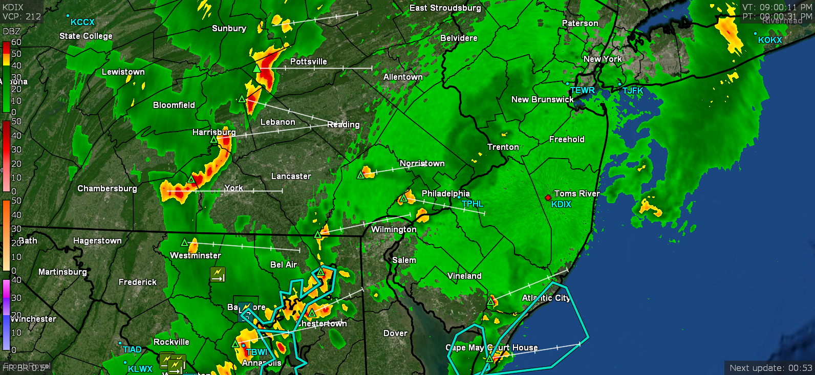
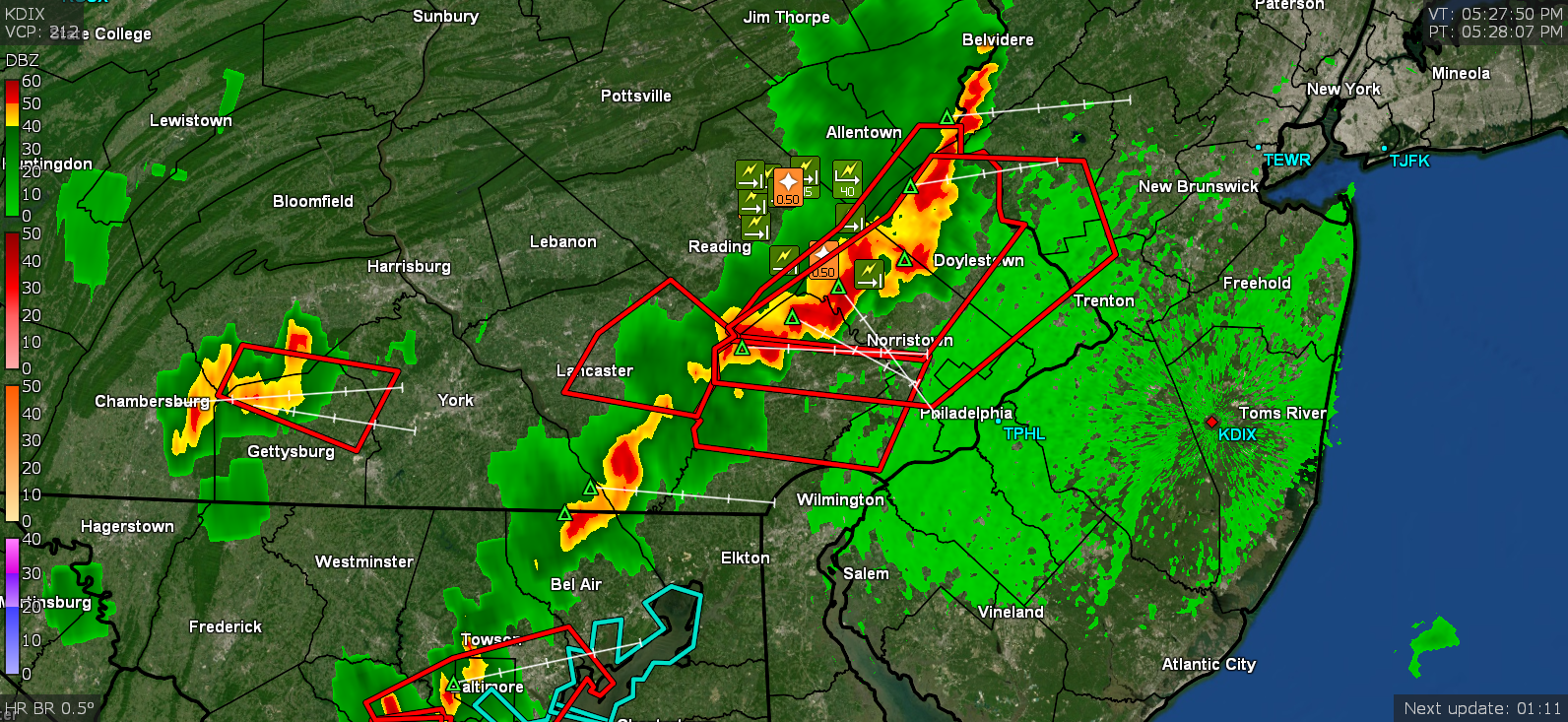
What I am dubbing "round 2 1/2" was rockin' and rollin' more than anything when under the warnings and afterwards the round 3, deposited just over 1/2" additional rain. Finished up at 0.77" for the day and it was MUCH needed! Currently a steamy (steamed up windows) 66 with dp 65.7, as the sun gets ready to rise through a deck of high clouds.
-
So far picked up 0.05" more from round 2 (total getting close to a total of 1/4" at 0.23") and I see a possible round 3 off to the west! The temp has still been holding in the 69/70 range here with dp 67.

-
Getting an extended rumble of thunder and another little batch of needed rain. Now up to 0.18". Temp has bopped up and down between 69 and 70. Don't know if this other little line will hold together long enough though but we'll see.
-
I did hear one low rumble of thunder from a distance and there is a lighter return band incoming here (hopefully it will provide some more). Am up to 0.17" of rain and temp at 68 w/66dp. I heard Glenn on the radio earlier this afternoon talking about upper 50s for the weekend for highs.
-
I saw a tree down report near you.

-
Briefly had 1"/hr rate but briefly. So far up to 0.13". Need some more but at least that washed some of the pollen off. Temp is down to 70, dp 64. Looks bright to the west.
-
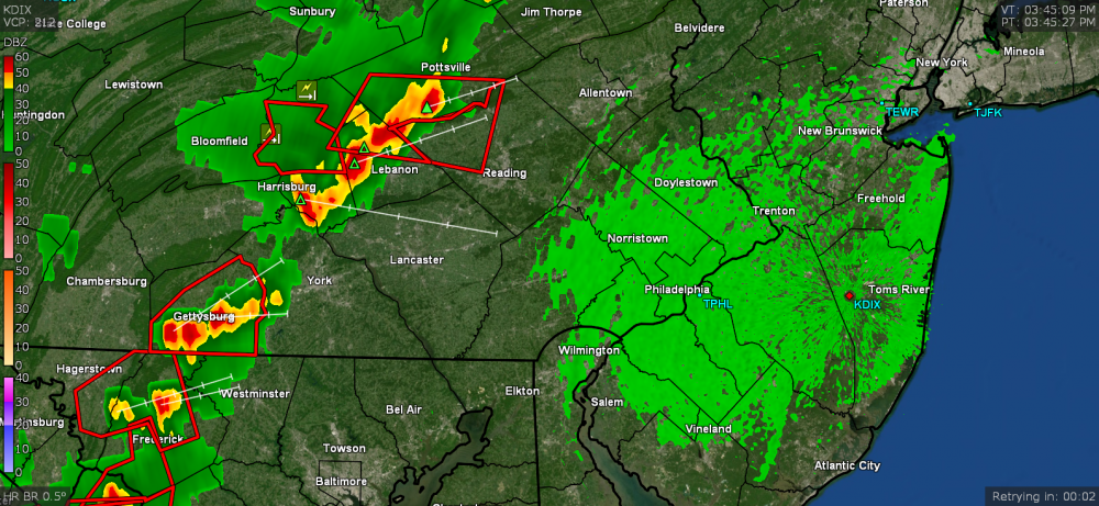
Getting pea-sized hail!
-
Getting big rain droplets. I'll take anything at this point. Getting fringed from a little blob. Warning expanded into Jersey. Temp is down to 75, dp 63.

-
Getting some good continuous gusts. Temp is down to 78 and dp down to 64.
-
Getting winds although I don't think it is the gust front yet. Lots of lightning being picked up by my detector.
-
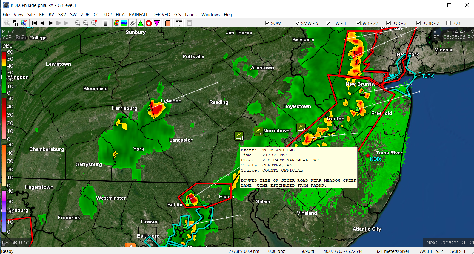
Am seeing the line of dark clouds to the west of me. Sky now mostly cloudy and temp is down to 87, dp 68. ETA - Warning just issued over my area (all the alerts came in).

-
My high (so far) just tapped 90 right before 3 pm so with that incoming line, that will probably be it for the day. Currently partly cloudy and 89 with dp 68.
-
Headed right for you!
-
It's all over the CWA!
-
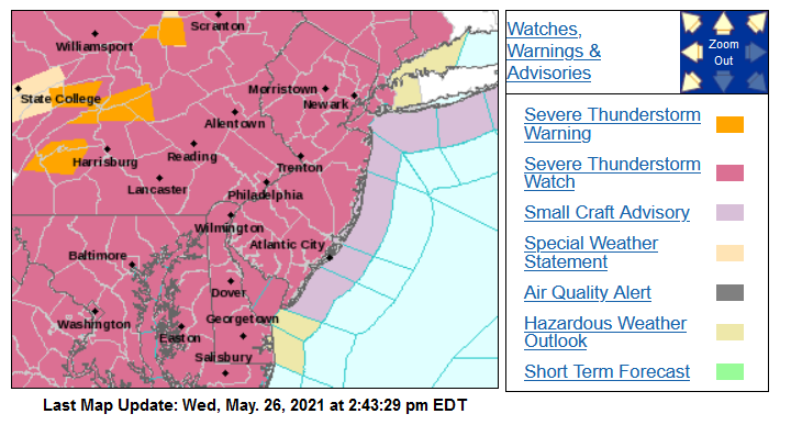
It was the "portability factor" as they were pushing them for use in cars. Of course the cassette was the deathknell of the 8-track. SPC just issued a Severe Thunderstorm Watch - My low this morning was 63 (a bit warmer than the past 2 mornings) but the humidity was fierce and had some fog. Currently a partly cloudy and hazy 89 with a dp bopping between 71 and 72.
-
LOL was going to post that we had one of those console cabinet stereos that you are describing - with the AM/FM radio and a record player, and ours had an 8-track player/recorder too. I remember one of my god brothers had a copy of "The Story of Star Wars" LP that had an abridged version of the dialog/sound effects of the original movie. I remember ripping that onto 8-track tape. I think it fit on one 8-track (all of 3 channels and most of the 4th). I may still have it in a crate in the basement. Don't have anything to play it on. You must be sweet! I'm surprised the carpenter bees bothered you though. They can appear aggressive because they are territorial, but are actually curious and want to "check out" anyone and anything coming in "their" territory, so they will swoop right up to you and hover. They usually don't attack despite looking imposing though. But like the other critters, when the temps go below the 60s, they tend to go into a torpor. My temp crept up to 73 and the sun did manage to pop out with dp 60. It's been breezy though.
-
You forgot the "Africanized bees" (that were WAY before the stinkbugs, "murder hornets", and lanternflies). All those "killer bee" movies were the result of those bees. (based off the scifi book of the same name - I think I still have a paperback copy of it on a bookcase somewhere ) As an obs, it was cooler this morning than yesterday morning (low was 57) and it's currently 70 and overcast. The dews are a bit higher too and at 57 here.
-
Ha! This was a bright idea - put concentrated Japanese beetle pheromones in a trap bag and attract/capture all those beetles in your yard, and from your neighbor's yard, and from every yard on the block. After awhile, I did hear garden shows recommend the traps be placed "far away" from your yard but good luck with that in a typical neighborhood unless it abuts some woods... I know the year my sis first moved into her current house (2003) and tried to start a veggie garden, her beans were just covered in them. They were literally 2 and 3 deep, one on top of another, sitting on the string bean leaves (both bush and vine type). A year or so later she put out milky spore (which was supposed to kill the grubs) and eventually they seemed to have disappeared a year or two after that, and so far, ever since (knock on wood). I do also remember seeing one of those red-eyed cicadas by her shed that is next to a wooded creek (either a 13-year or 17-year one) but never the swarms of them. I figured that over the years, so many people treated their yards with all kinds of stuff to kill weeds and grubs, the stuff probably got the cicada larva too.
-
My low this morning was 12 degrees cooler at 60, than yesterday's low. Took a little while to get there but it did. Also had some sprinkles early this morning, enough to moisten the pavement, as some kind of sea breeze front pushed inland and washed out over the city and immediate bordering western 'burbs. Was kinda cool to watch the progress on radar. Currently overcast and 66.
-
Hit 91 today (so far) a couple times - just after 2 pm and then just after ~3:30 pm. Amazing that the low this morning here was 72 and this is May. Will see how robust the cold front is when it drops down into the area. Currently bopping between 89 & 90 and mostly sunny, with some cumulus starting to roll in from the north and west.
-
Yeah I've been finally getting to some projects I've been putting off plus spring cleaning and getting my tropicals overwintering in the basement, ready to go out. A bunch can't take night temps below the low-mid 50s at night and we are finally getting there. As it is, I'm gonna have to pull the hose out now (there were some chances of rain maybe tomorrow and then a brief cool down for Monday, but we'll see). Simulated rain would definitely be appreciated by your tree though! Seems the rain is all down in the GOM states at the moment.
-
Most of those will go into sortof a stasis when the temps are below 60 and I know I've been averaging in the low-mid 40s at night most of this month until the past week or so, when the lows finally hit the low 50s. Definitely not bug weather but I did see some bees today. Am down to 85. Might take a bit to cool down although since it's dry, it might go faster.
-
I actually hit 91 just before 2pm today. Didn't expect that. It was brief since there has been a hazy deck of high clouds most of the day, with occasional breaks of sun. Haven't seen or heard any cicadas here, nor seen any lightning bugs... and so far I haven't spotted any of those damn lanternflies either, but I expect those might be hatching and at one of the nymph stages. With the chill the first half of the month, a bunch of critters went on hold, but the temps the next week or so will wake them up for sure though. First tropical development underway early with STS Ana (fish storm), but will see how this year's hurricane season goes. Don't think it will be as insane as last year but you never know.
-
What I thought was going to be virga actually produced some flakes. Dews have finally made it into the double digits this morning (yesterday afternoon my lowest dp was -3). Currently 35 and overcast with dp 17.