Hurricane Agnes
-
Posts
9,264 -
Joined
Content Type
Profiles
Blogs
Forums
American Weather
Media Demo
Store
Gallery
Everything posted by Hurricane Agnes
-
Temp here is now up to 36 (dp 35) and the sun is trying (but struggling) to peak out.
-
No updated PNS yet but there was a LSR submitted for Berks Co -
-
Except for I think Sunday with a mini-warmup, it probably would be good to make it to March 1st! There was a plow pile not far from my house that had been at least 4 ft high but still had about a 1 ft tall x 6 ft long remnant before the upper 60s temps and this storm. Haven't had chance to see what is left from it now but it did still have some staying potential since what was left was probably glacial.
-
LOL at the remnants. It's like a seedling of the original snow pile.
-
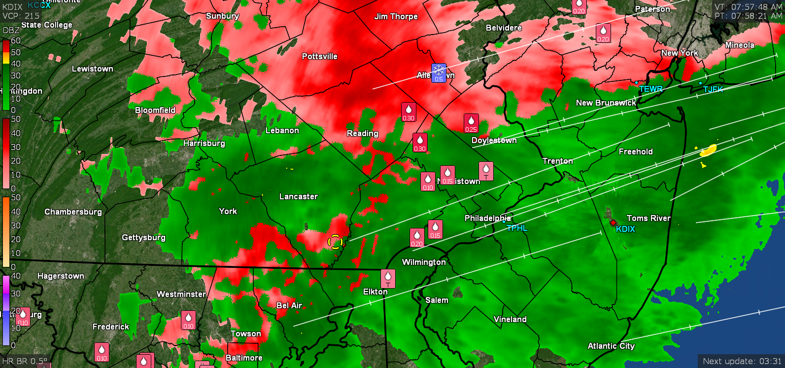
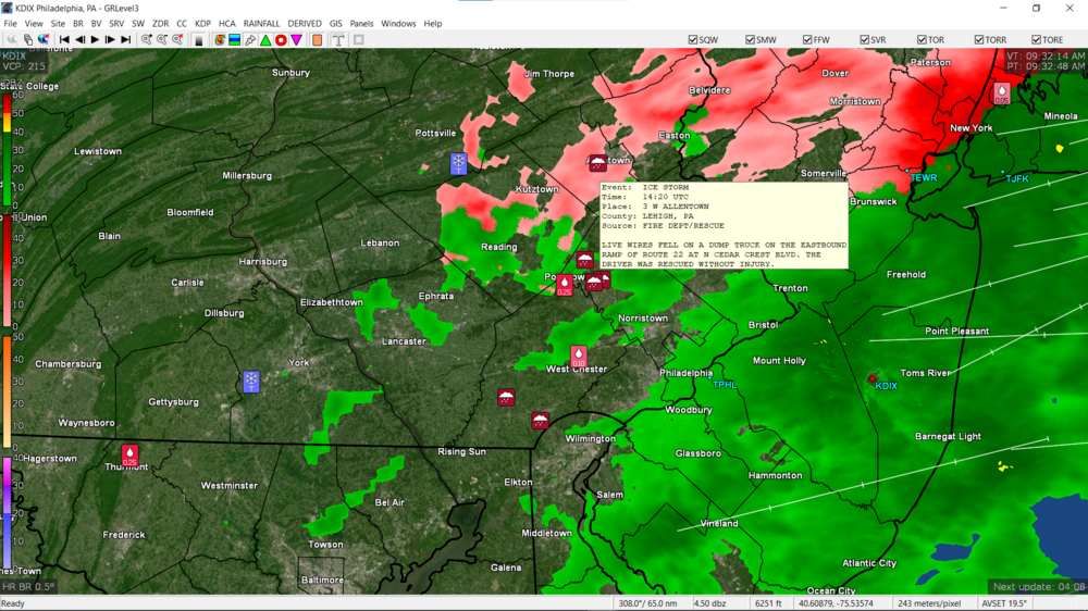
Looks like it might be wrapping up here. Currently at 33 with dp 33 and the gauge is finally unfreezing and I got a bucket tip (I can still get a reading from the Stratus though). I think this is the first time since I got the GRLevelX products that I saw the little "Ice storm" icons on the display. There have been some pretty rough problems this morning around the area (including in Delco and southern Chesco).
-
Currrently getting moderate ZR and it's still bopping between 32/33 with dp 32. My anenometer apparently froze over around 3 am (saw it was encased in ice) and the station gauge tipper was already frozen yesterday. So far the mPING reports are instructive.

-
Now that it is getting light enough to see, I popped out back and all my shrubs are completely encased in ice. I snapped off a couple twigs from one of my lilacs and measured 0.1" accretion. Temp is now hovering between 32/33 with dp 32, and there is dripping. But everything that is a colder untreated surface (including trees, shrubs, grassy areas) looks to be coated in ice (including the open grassy areas that may have had some sleet embedded). The cars are encased in ice and I have icicle drips hanging off my car's side mirrors. What an eventful "nothing burger non event".
-
Mt. Holly's morning tweet -
-
Temp here finally hit 32 sometime between 3 am - 4 am and it's currently 32 and misty with dp 32.
-
Getting some accretion but only on shrubs/tree branches furthest away from the houses. Nothing on the cars or rails, etc., at least yet. Temp 30 with dp 29.
-
My anemometer is still moving but my gauge bucket in the Ambient is frozen. I do have my Stratus out there.
-
Most of the recent runs of the models were showing a much lower impact in the SE corner of PA and further S/E across S. Jersey and Delaware. It's the people N/W that are going to have a problem.
-
Getting moderate rain here with temp at 30 and dp 28.
-
Will have to see how many of us (and when) we get into the warm sector (0z NAM is icy but am wondering if that is overdone).

-
Well the models may be saying that but they aren't using them verbatim for their guidance. They use a bunch of other things including their blend model (that RedSky calls the "scapple model" ). So for the 0z NBM, you get this -


-
18z EC looks ugly for ZR.
-
WPC's afternoon update earlier today -
-
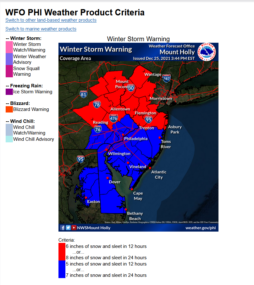
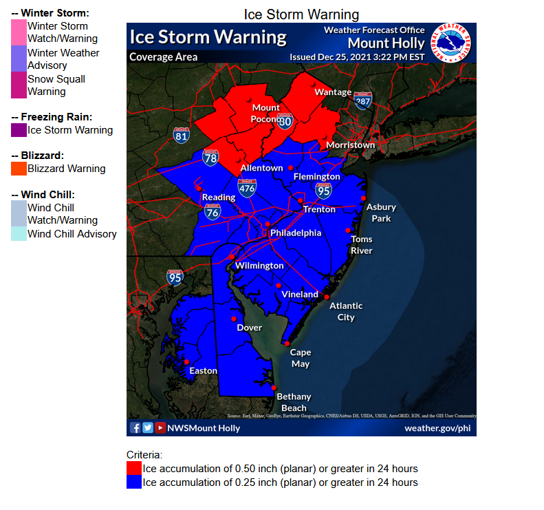
The Warning criteria is at least 5"/6" snow and/or sleet, and is also based on the designated certain amounts expected over either a 12 hour period or over 24 hours.. The Ice Storm Warning has its own amounts needed to qualify... The ice storm Warning is pretty significant icing - they actually have one up over on the western side of the state (lofted by State College's WFO). What often happens with these overrunning storms with marginal temps here is that the warm air comes pouring eventually and the estimated time for continuous icing might not make the 24 hour min.

-
This was the afternoon update from Mt. Holly -
-
Currently overcast (even though there are some scattered radar returns over me, it's virga at the moment) and 33 with dp 18.
-
I know the short-range models are probably better for this timeframe but since the 18z GFS is running, I grabbed what it has. It has been echoing the other guidance pushing the heaviest precip to the N & W.

-
State College WFO put up an Ice Storm Warning earlier this morning for portions of west central PA.
-
Now getting ZR. Temp bopping between 31/32.
-
12z HRRR continuing the trend of the higher precip to the west.

-
Getting a mix of sleet and snow. Not really getting anything sticking yet but I am guessing that this is chilling the ground and exposed surfaces. Temp at 32 with dp 20.