Hurricane Agnes
-
Posts
9,264 -
Joined
Content Type
Profiles
Blogs
Forums
American Weather
Media Demo
Store
Gallery
Everything posted by Hurricane Agnes
-
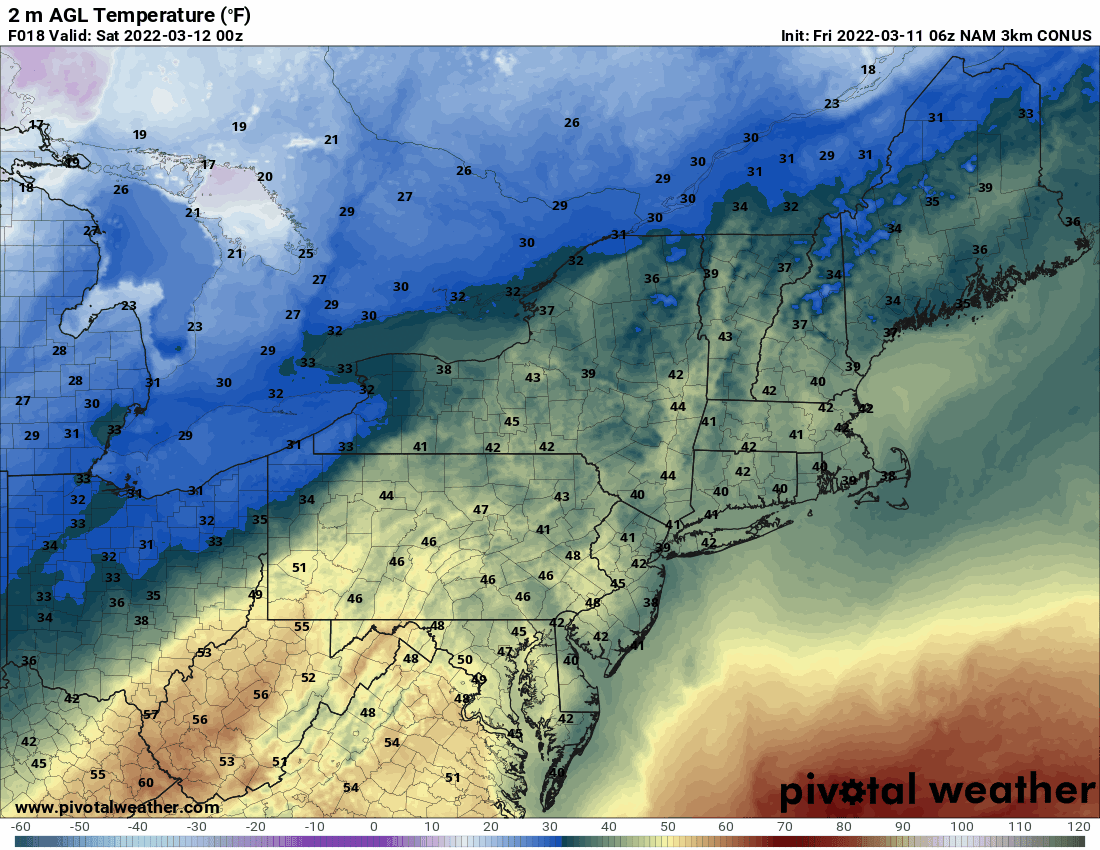
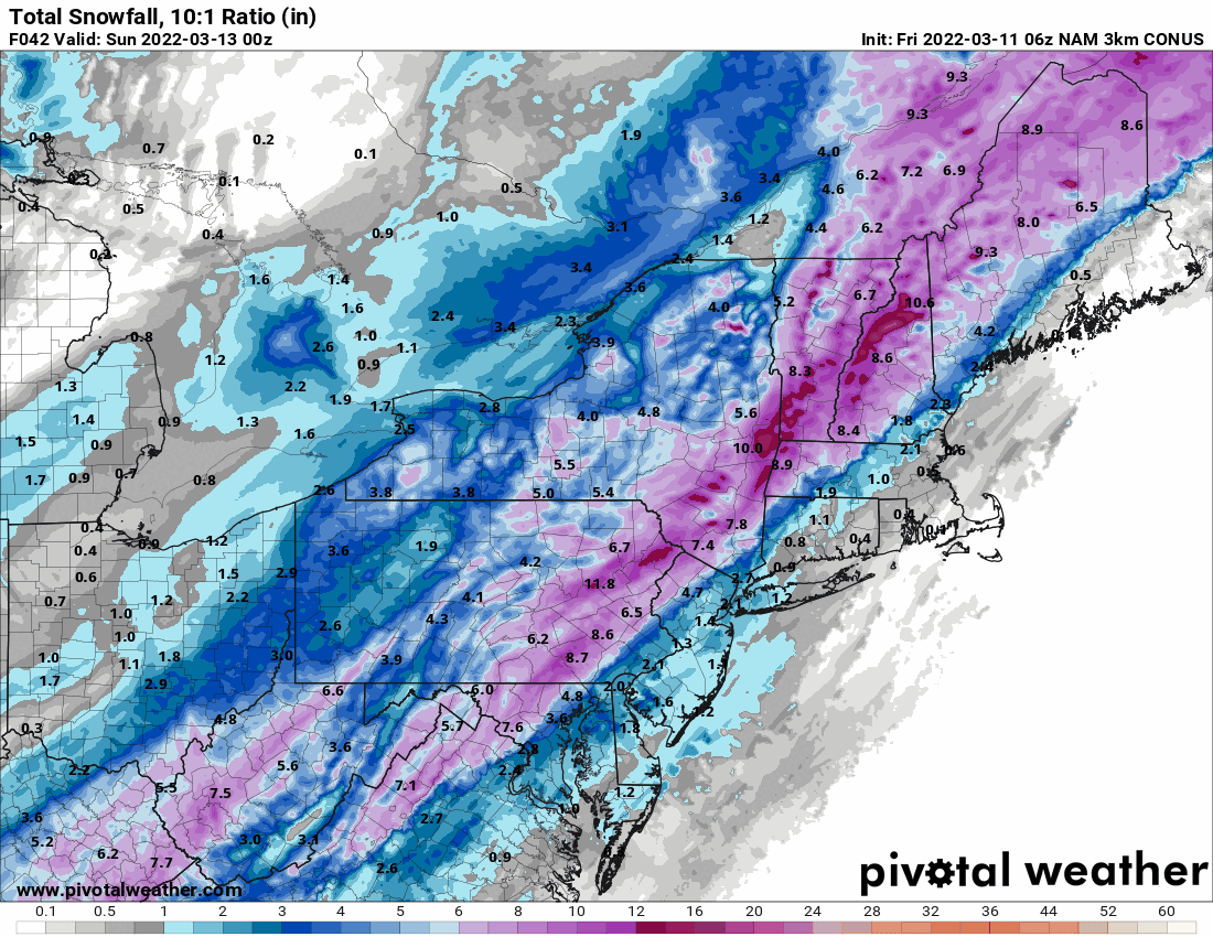
6z NAM with the temp timing. And note since this is a nor'easter, there will be some strong winds with it.
-
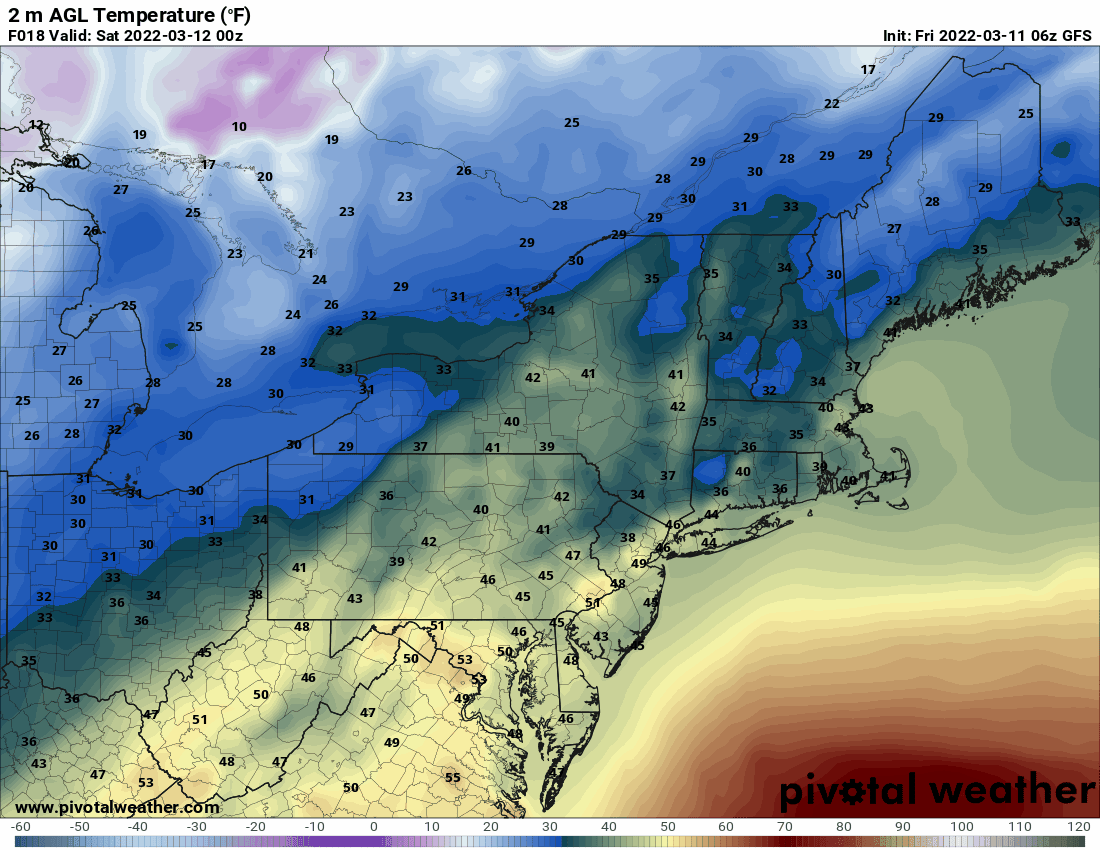
I know it's the 6z GFS (a 12z would be better) but just for the heck of it to look at what it thinks the timing is for the cold.

-
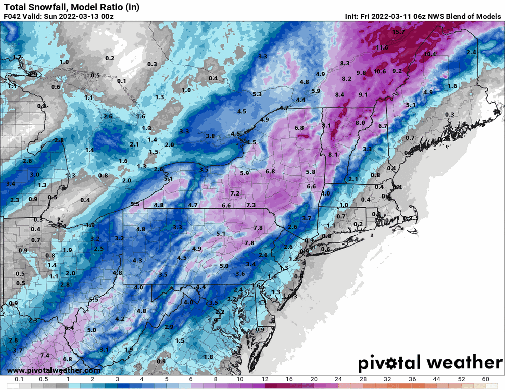
Waiting for today's WPC update from yesterday evening but even then, it was a non-zero chance for 4+" in much of the CWA except S/E with yesterday's evaluation. IMHO, if that low somehow moves east of where the models have shown it, all that heavier frozen moves east with it.
-
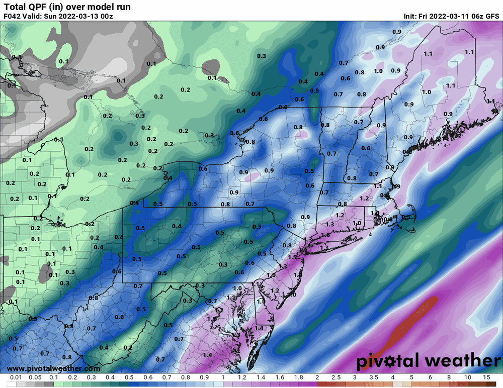
I think the issue may be that the low is much stronger than what we saw with the last storm and is juicier, so more total qpf available. The timing of the cold as the heavier precip departs will be key.
-
6z GFS (cold air coming in faster).

-
(these will probably become WWAs)
-
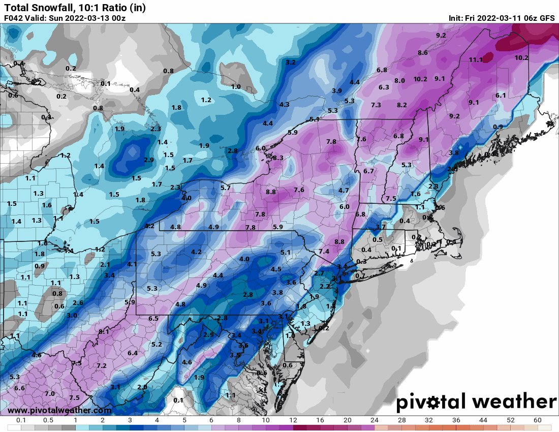
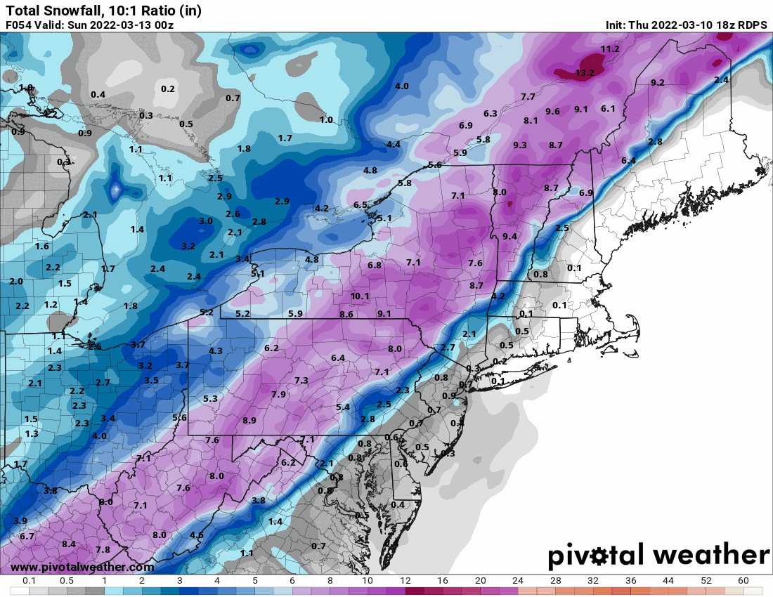
Mt. Holly overnight update and snow map (will definitely get updated this morning with the WSWs and Watch issued since the below) -
-
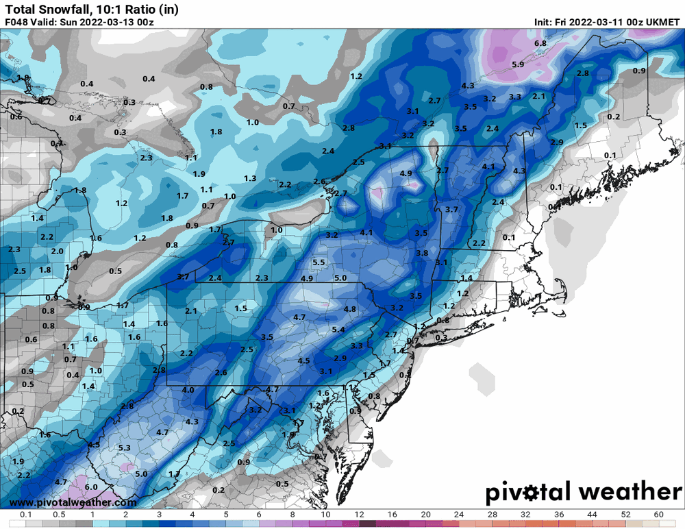
6z REGEM (and throwing in the 0z Ukie for good measure).

-
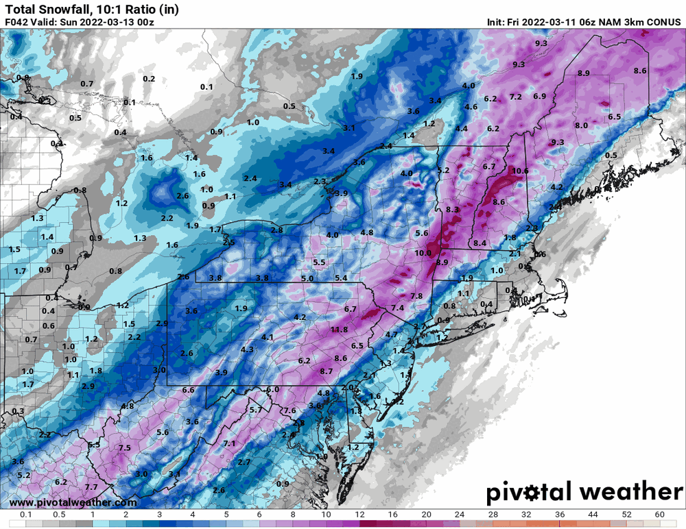
6z NAM takes it back a bit and NBM is trying to keep up with the wild swings.
-
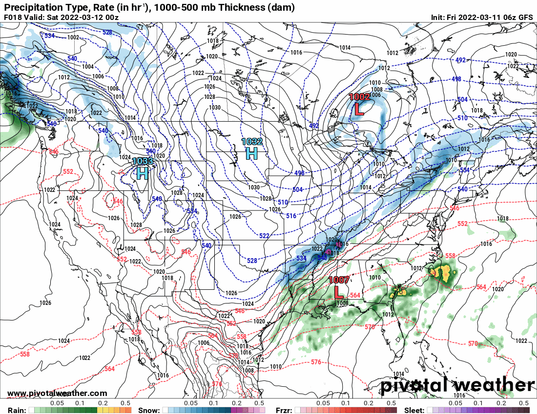
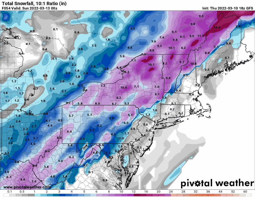
0z GFS - seems something that came in on the west coast got sampled and they are moving the low east.

-
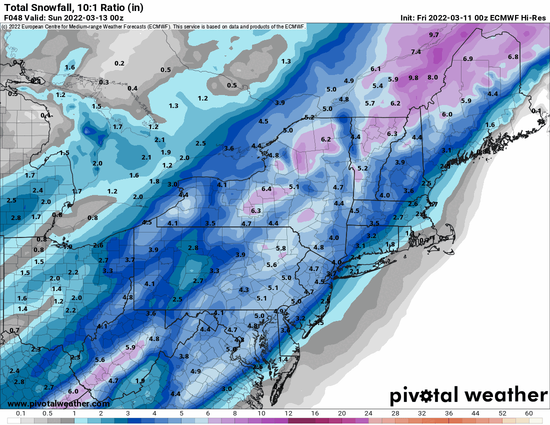
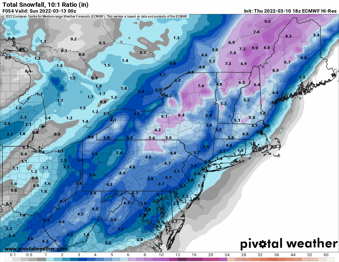
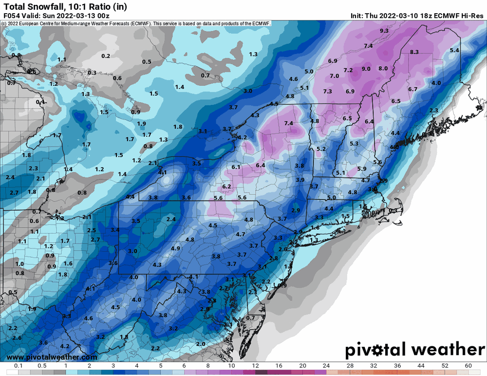
18z EC (everyone cashes in with "something" ).
-
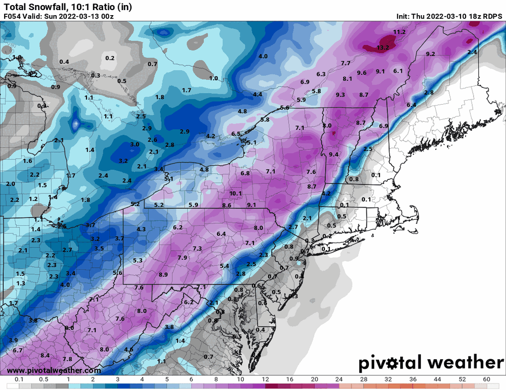
18z RGEM in the compromise position between NAM/EC and GFS.
-
E PA/NJ/DE Spring 2022 OBS Thread
Hurricane Agnes replied to Hurricane Agnes's topic in Philadelphia Region
Had a low of 31 this morning (with the freezing fog and frost on the car) and made it up to 51 as a high, with on and off sun. Currently 46 with dp 35. -
Mt. Holly snow map -
-
ANNNDDDD... the 18z GFS wants to be contrarian... again!
-
Well guys - it's back. https://www.cbssports.com/mlb/news/mlb-lockout-league-union-reach-agreement-to-continue-international-draft-negotiation-per-report/ And from MLB.com (both sources are continually updating with details) - https://www.mlb.com/news/mlb-mlbpa-agree-to-cba
-
Mt. Holly mention of the post-storm cold after this weekend's cold frontal passage (heard a similar forecast from NBC 10 folks) - Not expected to be record cold but well below normal for March. (*hears Paul rustling through his Chesco data* )
-
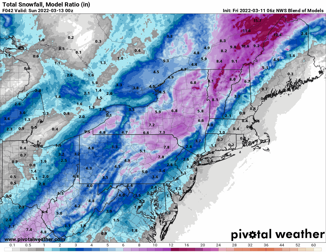
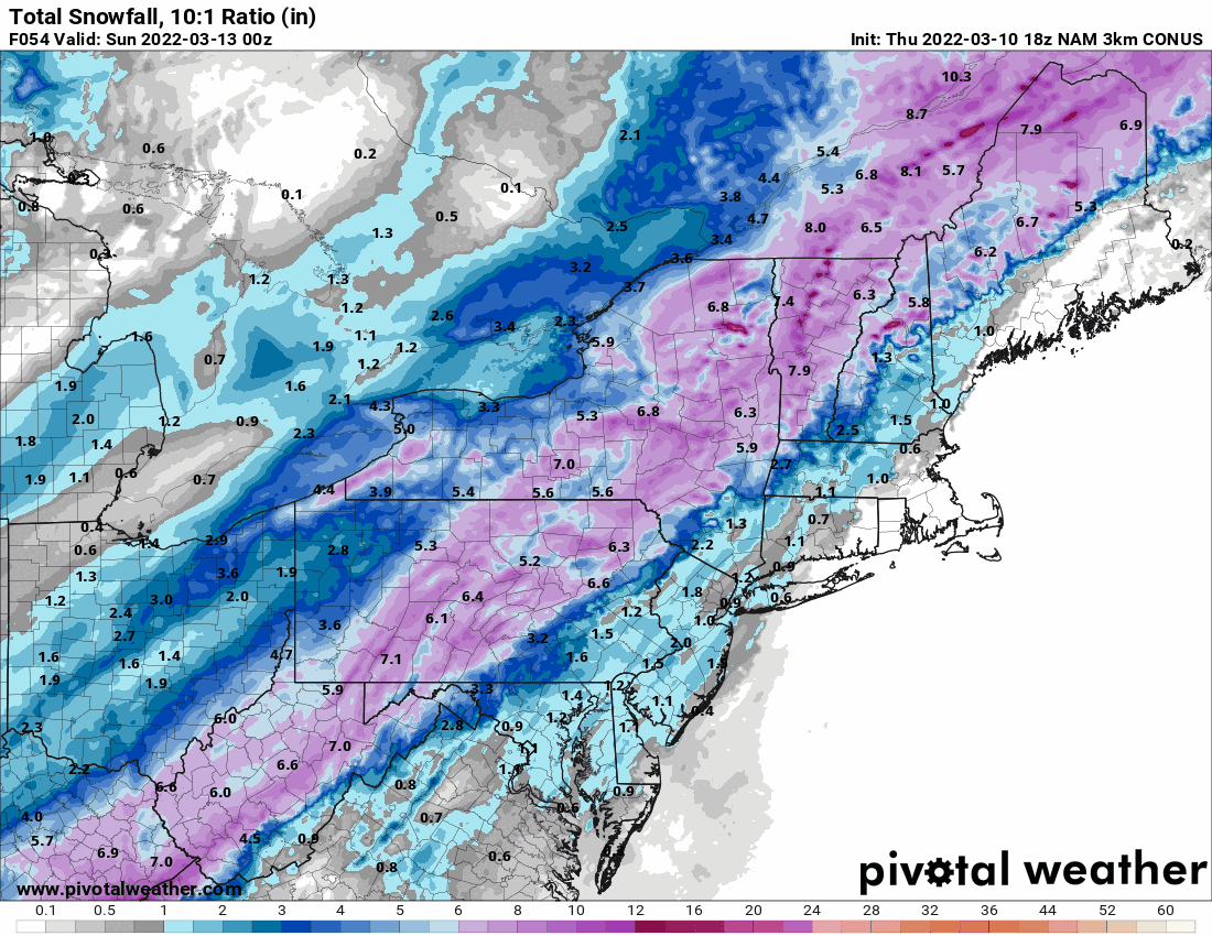
Even the 18z NBM brought the snow east (usually that is more conservative and pretty much nailed the last storm since it uses a number models and other data).

-
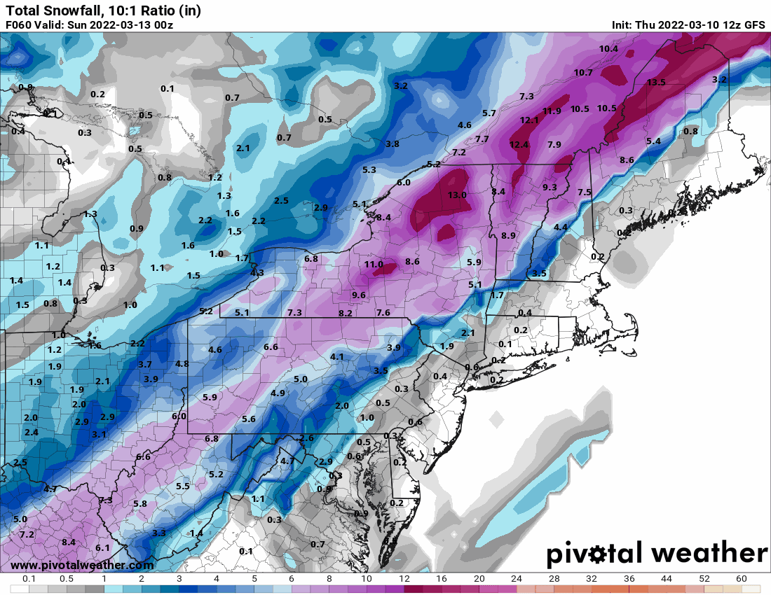
This near the end of the run panel looks like the 12z GFS.

-
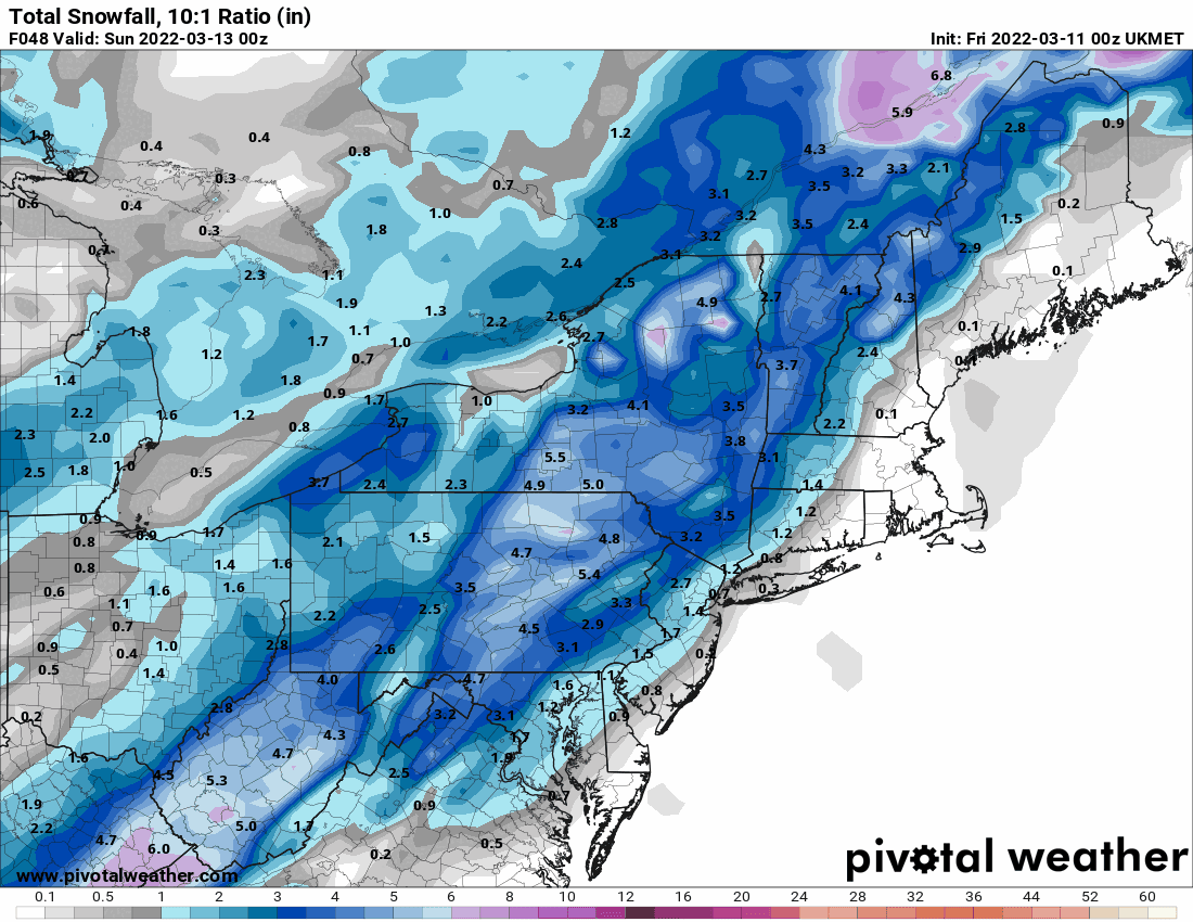
As the NAM is in process, this was the 12z EC. Kinda went "all-in" and even has a couple storms.
-
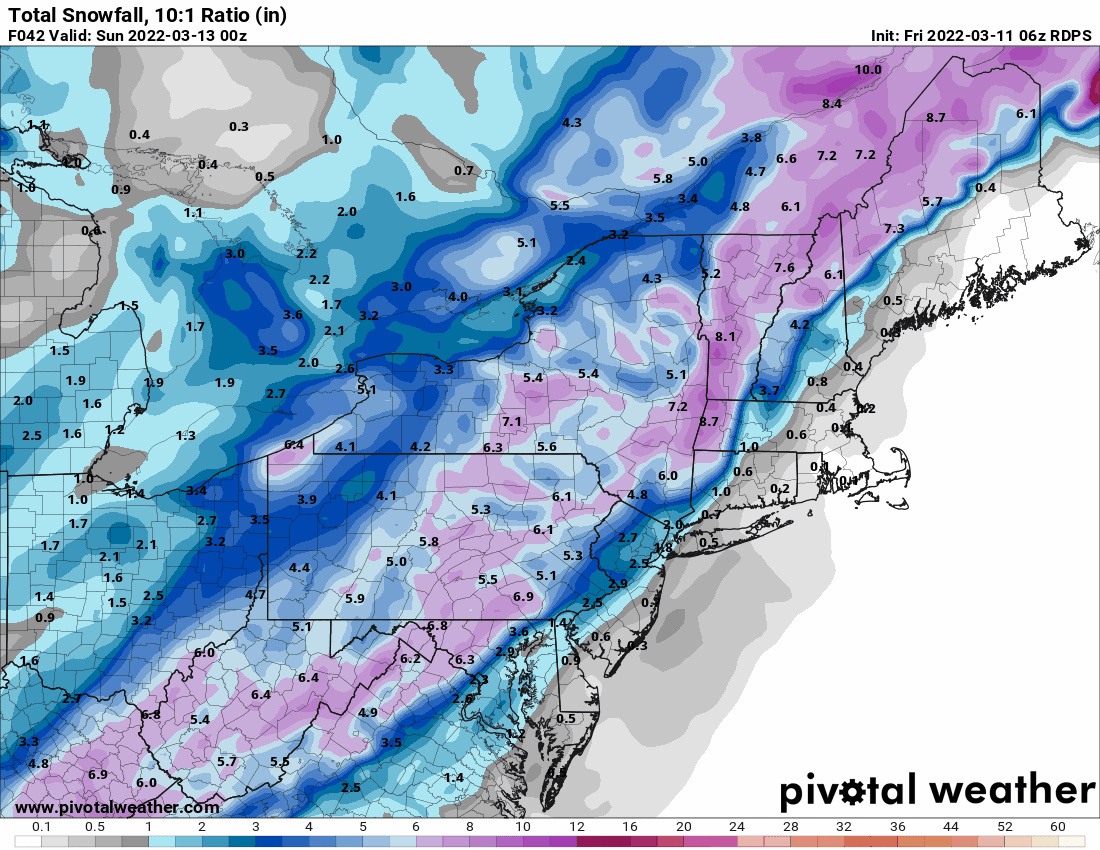
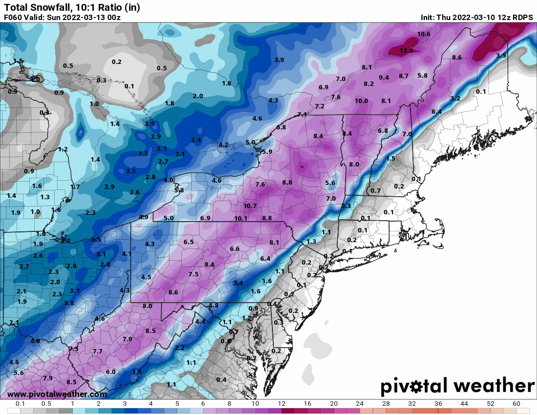
12z RGEM.

-
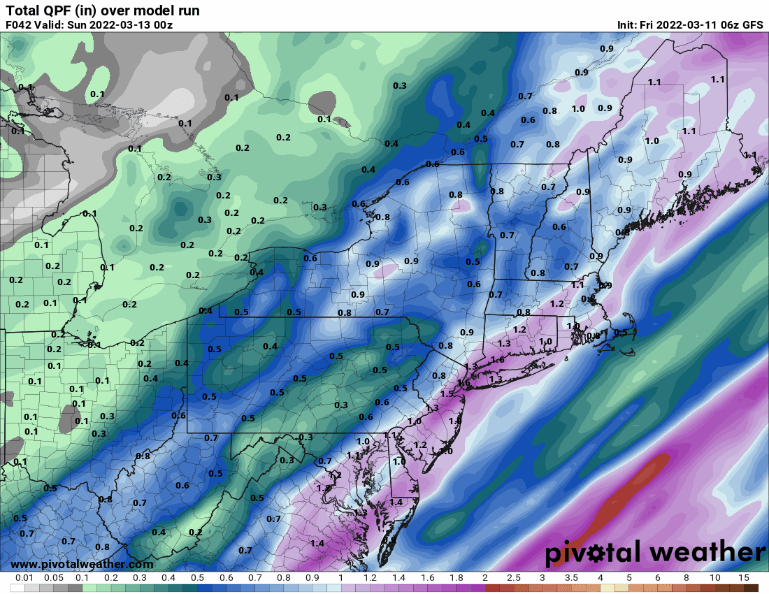
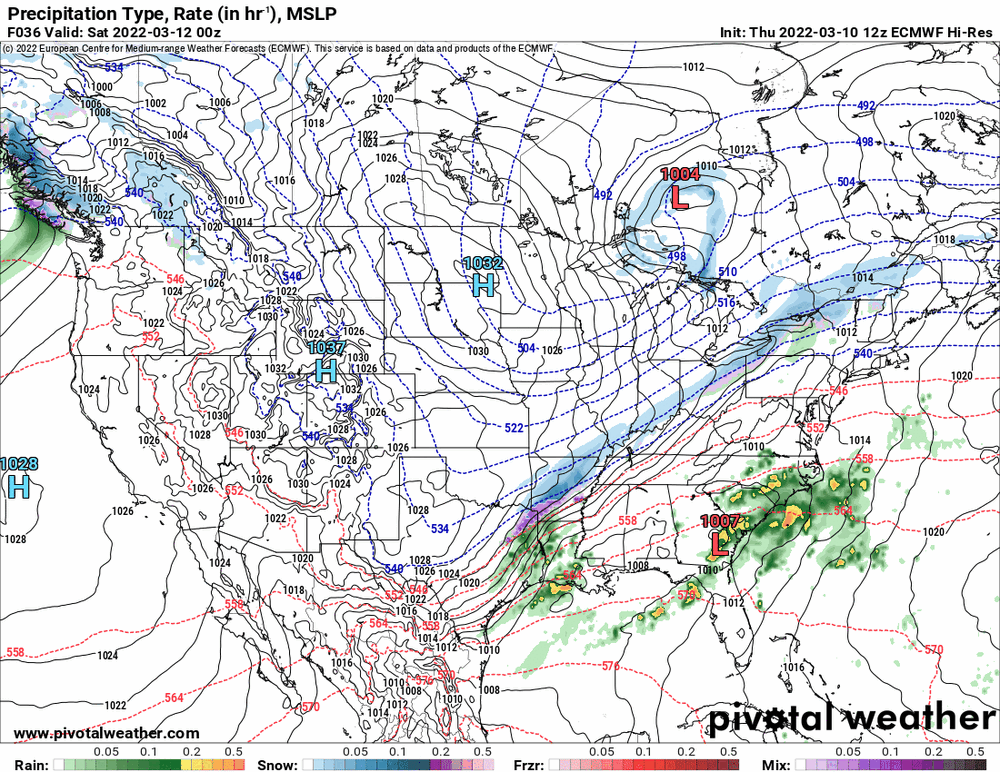
Will post what I had in the general obs thread regarding the 12z GFS. Back end thump (might not be enough for areas S and E).

-
E PA/NJ/DE Spring 2022 OBS Thread
Hurricane Agnes replied to Hurricane Agnes's topic in Philadelphia Region
12z GFS with a back-end thump corresponding with the cold front but might not be enough for the SE areas.

-
E PA/NJ/DE Spring 2022 OBS Thread
Hurricane Agnes replied to Hurricane Agnes's topic in Philadelphia Region
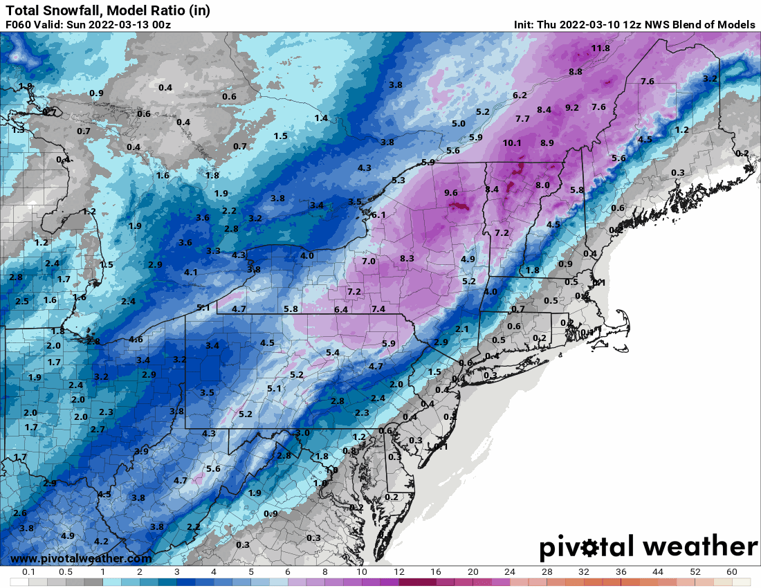
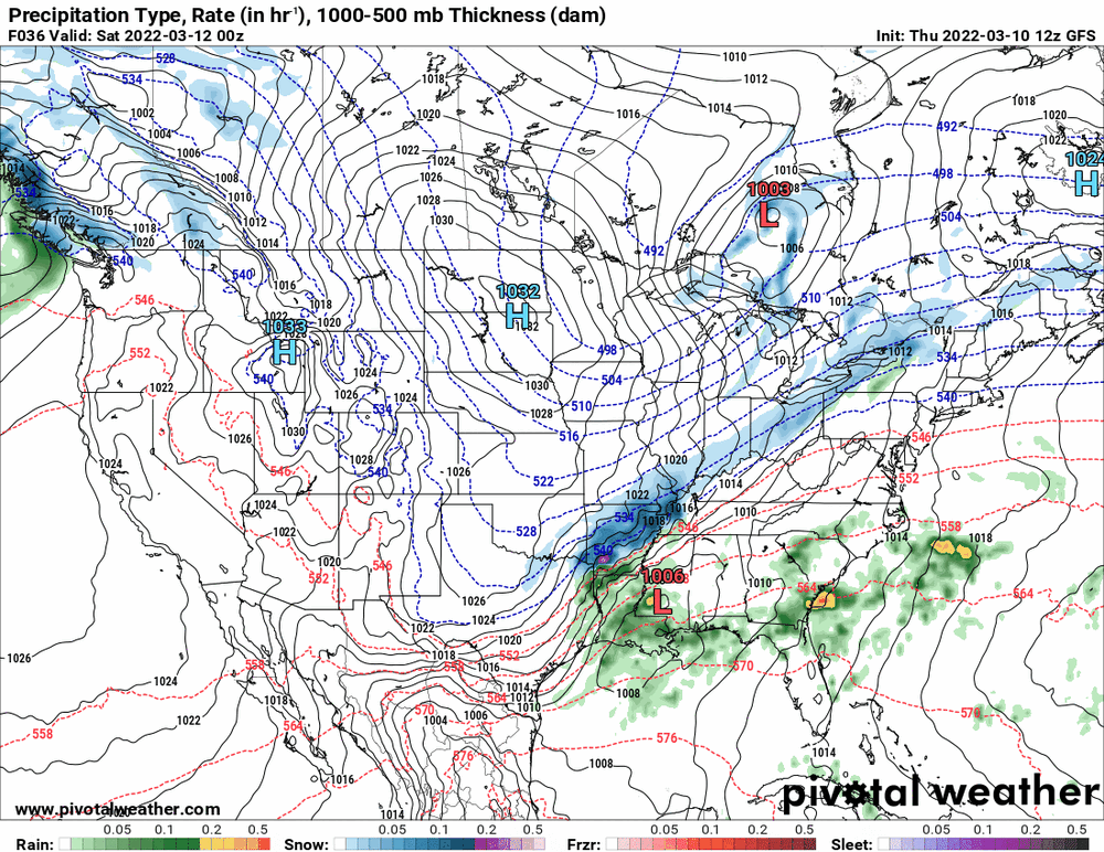
12z NBM (this is a stronger low/nor'easter than the last storm).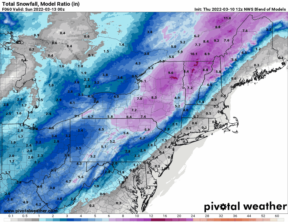
-
E PA/NJ/DE Spring 2022 OBS Thread
Hurricane Agnes replied to Hurricane Agnes's topic in Philadelphia Region
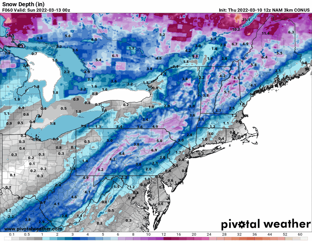
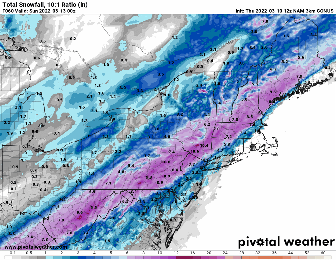
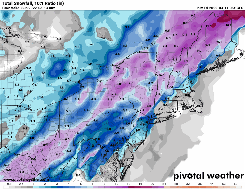
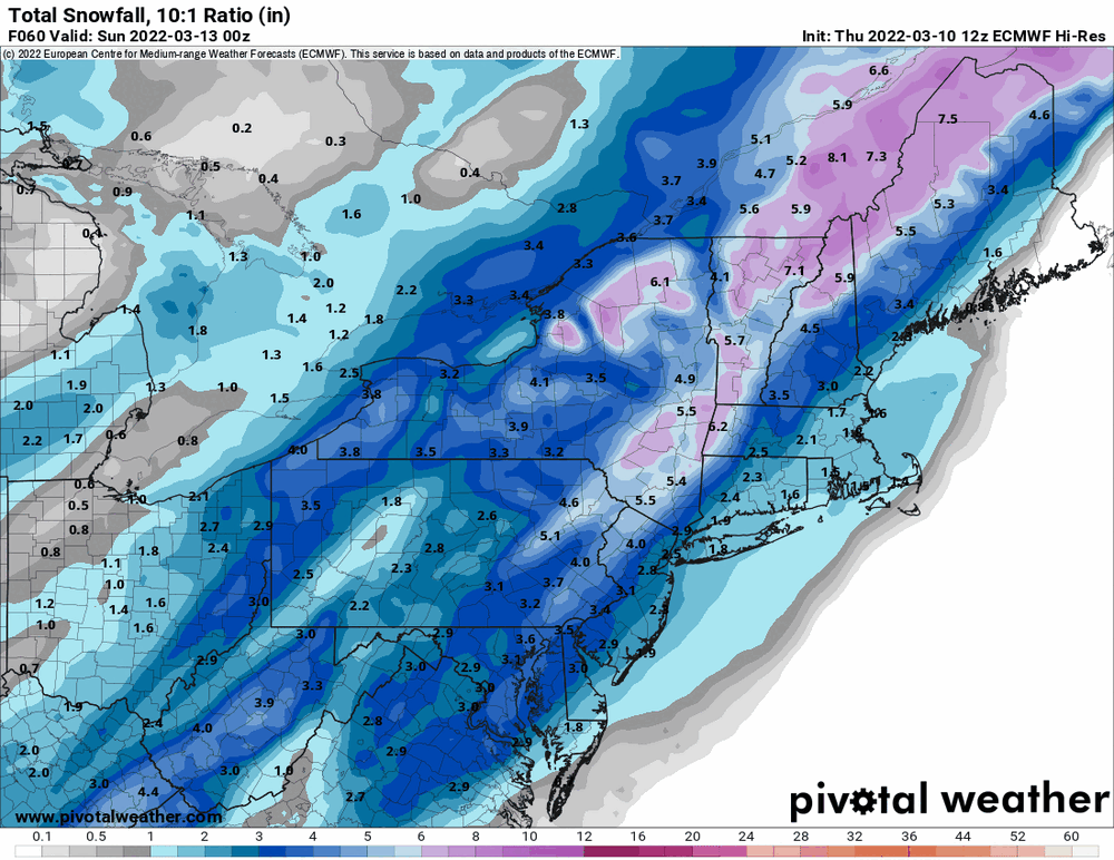
Here's the 10:1 and Snow Depth