Hurricane Agnes
-
Posts
9,264 -
Joined
Content Type
Profiles
Blogs
Forums
American Weather
Media Demo
Store
Gallery
Everything posted by Hurricane Agnes
-
Update to SPC SWDY1 -
-
-
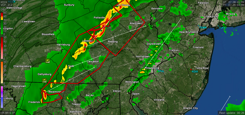
Here we go -
-
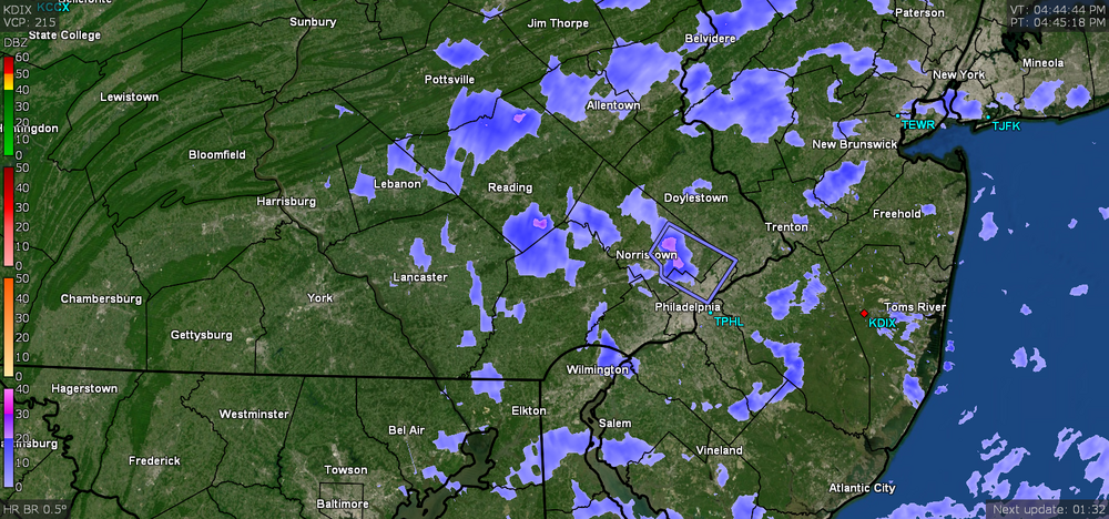
Well the "pop up" round one line gave me 0.22" of rain. The main event is still back over Lancaster county. Currently misty and 62 with dp 62.
-
Wow. A little line just erupted out of nowhere over the city. Currently windy with rain and 64 with dp 61.
-
Mt. Holly (Watch coverage) - Not sure how unstable it will be here because at least where I am, the sun never came out... but I did touch 70 earlier (just before 2:30 pm). It's currently overcast and 68 with dp 60.
-
And the earlier rare "Enhanced Risk" for just west of Philly metro -
-
SPC has the Severe Thunderstorm Watches up -
-
E PA/NJ/DE Spring 2022 OBS Thread
Hurricane Agnes replied to Hurricane Agnes's topic in Philadelphia Region
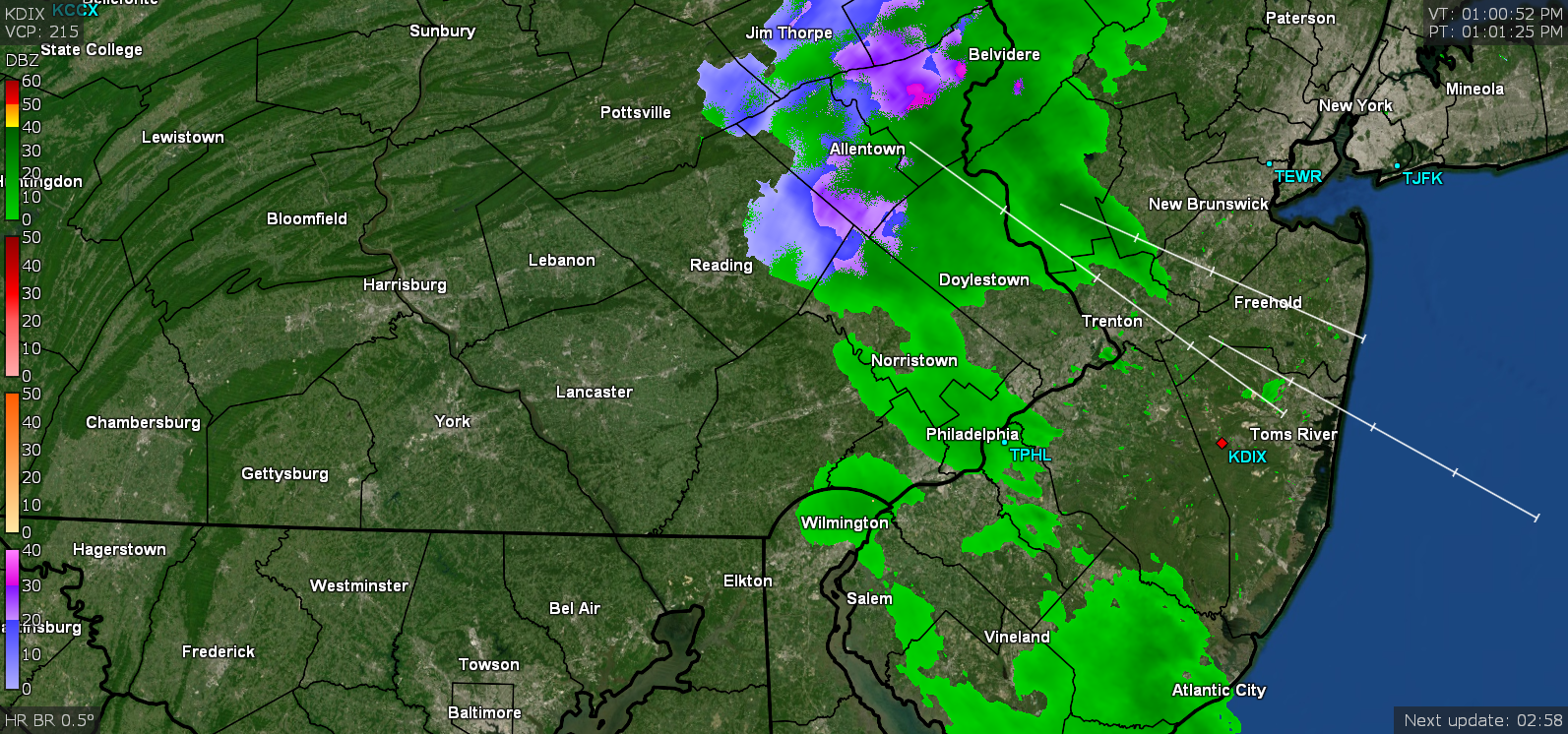
SPC just lofted a Watch - -
E PA/NJ/DE Spring 2022 OBS Thread
Hurricane Agnes replied to Hurricane Agnes's topic in Philadelphia Region
WPC has us hashed for severe - (their 8 am forecast which seemed to have shown the warm front moving a little faster than what actually happened this morning so far) -
E PA/NJ/DE Spring 2022 OBS Thread
Hurricane Agnes replied to Hurricane Agnes's topic in Philadelphia Region
Could even calculate how fast that warm front was lifting between the 2 latitudes! Took about 3.5 hours to get from where I am and up over you. (I know that is geeky ) It's currently overcast and 66 with dp a juicy 60. -
E PA/NJ/DE Spring 2022 OBS Thread
Hurricane Agnes replied to Hurricane Agnes's topic in Philadelphia Region
Wow. You can tell when the warm front got shunted up over this area because my temp suddenly shot up before 7 am. The low temp here was 45 just before 6:30 am and now the temp is up to 63 at post time. Although there is nothing on radar over me (the band is way out west), it's overcast and the sidewalk is wet - probably due to the dp that shot up from a low of 34 earlier this morning just prior to the lifting of the warm front, to a current dp of 58.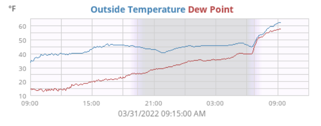
-
Some progged timing by Mt. Holly on the storms today -
-
E PA/NJ/DE Spring 2022 OBS Thread
Hurricane Agnes replied to Hurricane Agnes's topic in Philadelphia Region
That disturbance that passed through earlier gave me some non-measurable light rain and was gone in a flash. After bottoming out at 27 this morning, so far my high has been 47 today, with it mostly cloudy much of the early afternoon until the precip passed and the sky cleared. I know they have forecast non-diurnal temps overnight so depending on how that goes, I might end up with a high for today just before midnight. Currently mostly sunny and 47 with dp up to 22 now after a dry 12 earlier this morning.
-
I remember when they first did that color change and insisted the color was "teal". They apparently later decided to just call it "midnight green". Still have to wait but hopefully they will get it right.
-
Kelly Green is back next year (as an alternate)! Woot! https://www.bleedinggreennation.com/2022/3/29/23002155/kelly-green-eagles-alternate-jerseys-helmet-black-philadelphia-nfl-news-jeffrey-lurie-uniform-rules I still have an old shirt and cap from the early '90s with the earlier color and logo. IMHO the design of the current "wings" on the helmet can stay though (better articulated).
-
Just read in Mt. Holly's AFD and noting that SPC's SWDY2 has gotten a bit more bullish putting much of the CWA in the Slight Risk for severe -
-
E PA/NJ/DE Spring 2022 OBS Thread
Hurricane Agnes replied to Hurricane Agnes's topic in Philadelphia Region
I heard a number of vehicles had pretty much exploded and they were still trying to ascertain casualties. As an obs, I made it up to 39 today as a high and it's currently partly sunny and about 10 minutes from sunset, and 38 with dp 11. -
SPC SWDY3 has the CWA in Marginal Risk but the southern portions in Slight Risk -
-
E PA/NJ/DE Spring 2022 OBS Thread
Hurricane Agnes replied to Hurricane Agnes's topic in Philadelphia Region
Bottomed out at 23 this morning with my lowest dp at 7. Am currently partly cloudy and 36 with dp 12. -
E PA/NJ/DE Spring 2022 OBS Thread
Hurricane Agnes replied to Hurricane Agnes's topic in Philadelphia Region
Had a pile of flizzards, squalls, and quick snow showers - but mostly later in the afternoon. Looks like the lake effect machine has been turned off now. Currently 26 with dp back down into the single digits here at 5 and falling fairly rapidly. -
Latest Sub-Freezing Day in History on Monday??
Hurricane Agnes replied to ChescoWx's topic in Philadelphia Region
RER tweet from Mt. Holly - -
Latest Sub-Freezing Day in History on Monday??
Hurricane Agnes replied to ChescoWx's topic in Philadelphia Region
And another flizzard blob overhead. Temp down to 25 with dp 18. Also had a bunch of RERs today for coldest max for the date (Philly may have just missed it or tied it last I checked) -
-
Latest Sub-Freezing Day in History on Monday??
Hurricane Agnes replied to ChescoWx's topic in Philadelphia Region
And getting some more although the sun is out too... Temp 27 dp 15.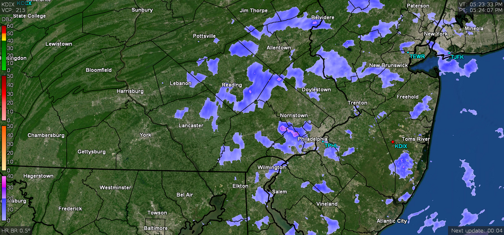
-
Latest Sub-Freezing Day in History on Monday??
Hurricane Agnes replied to ChescoWx's topic in Philadelphia Region
And another flizzard has appeared. Temp 28 dp 15.