Greenwald
-
Posts
26 -
Joined
-
Last visited
Content Type
Profiles
Blogs
Forums
American Weather
Media Demo
Store
Gallery
Everything posted by Greenwald
-
473K without electricity in Michigan alone. I mean I knew storms were forecast but wow..
-
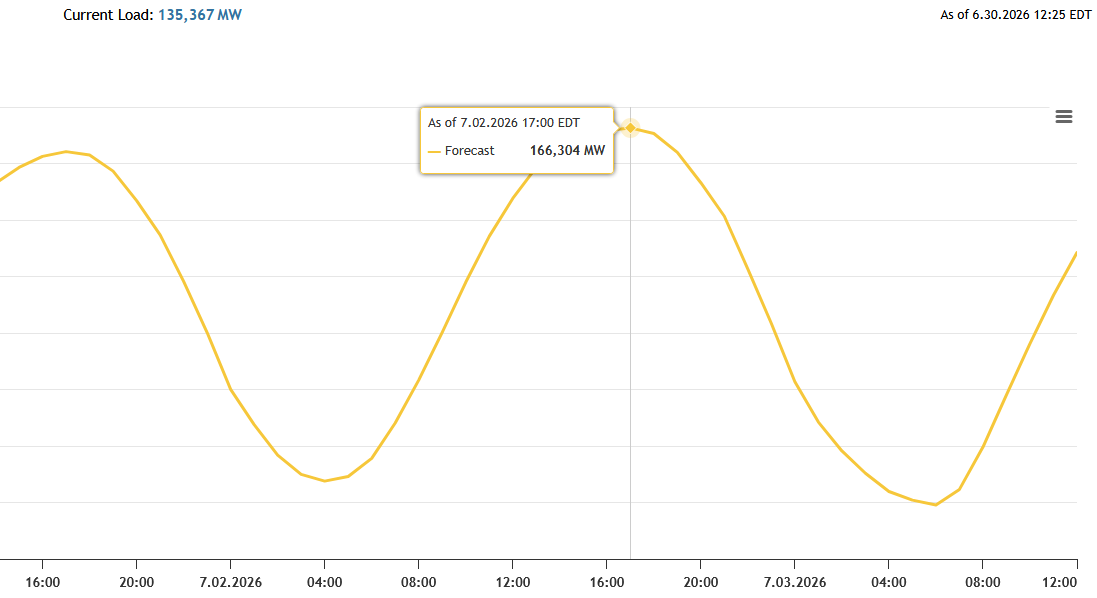
PJM is forecasting a record grid load on 7/2. Yesterday it was forecast to be 162, this morning they updated it to 166MW. The record I believe is 162 in 2006.

-
What a day.. I'm surprised they didn't go with moderate at some point. Even at 20z it was obvious something was up. Evansville fire and EMA were talking on the radio about watching Ryan Hall trying to figure out where the tornado was.
-
From the scanner it sounds like there's a lot of damage in the Evansville area and Warrick County. Took quite awhile to get a proper warning on that one too.
-
We did indeed have snow mixed in with rain around 4:35 this morning in northern Noble County.
-
Would be a perfect drought buster. Fingers crossed.
-
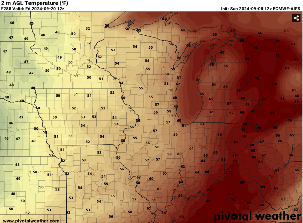
It looks like AIFS has been consistent on a cooldown around the 20th - 22nd.

-
We picked up quite a bit from the storms last night here in northern indiana. I'm in the process of acquiring a new stratus gauge so I didn't get any readings but other sources said 3 - 3.5" over the span of two hours. Really torrential rain. At one point I looked down to see it flooding into the warehouse around midnight.
-
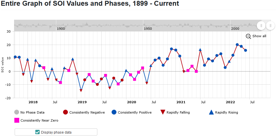
I think we're well overdue for the SOI to dip neutral / negative. Need to dump this hot nonsense.
-
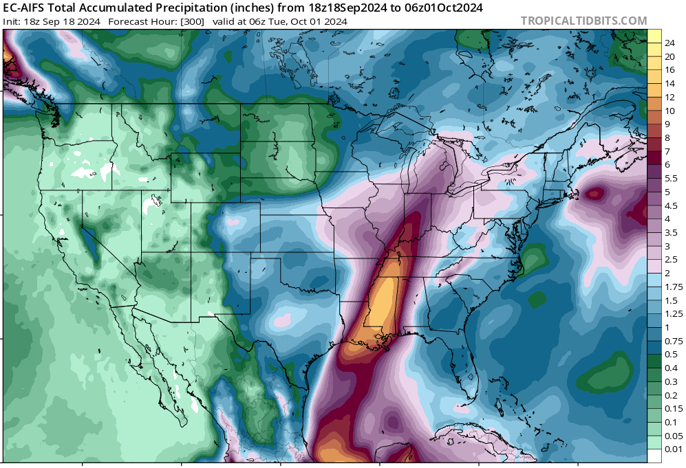
Fort Wayne has received some crazy amounts of rain the last couple days. A little over 9 inches after a flash drought. Lots of street flooding around on top of 60 - 70 mph winds last night that left 14K without electricity.
-
88/79/103 here in Fort Wayne right now. I guess a big storm went through Bridgman MI last night and flooded / destroyed a substation close to the lake. 14.5K out of electricity I feel bad for them as hot as it is. 7.44 inches in 144 minutes.
-
I was watching that band go nuts up there by SB wondering what it looked like on the ground. There's another moderate band over FW right now and then the end is near..
-
We have about 2 inches on the ground now in Fort Wayne. There's a lull right now.
-
I feel like IWX will be rolling out the warnings soon. Probably with a south bend cutoff.
-
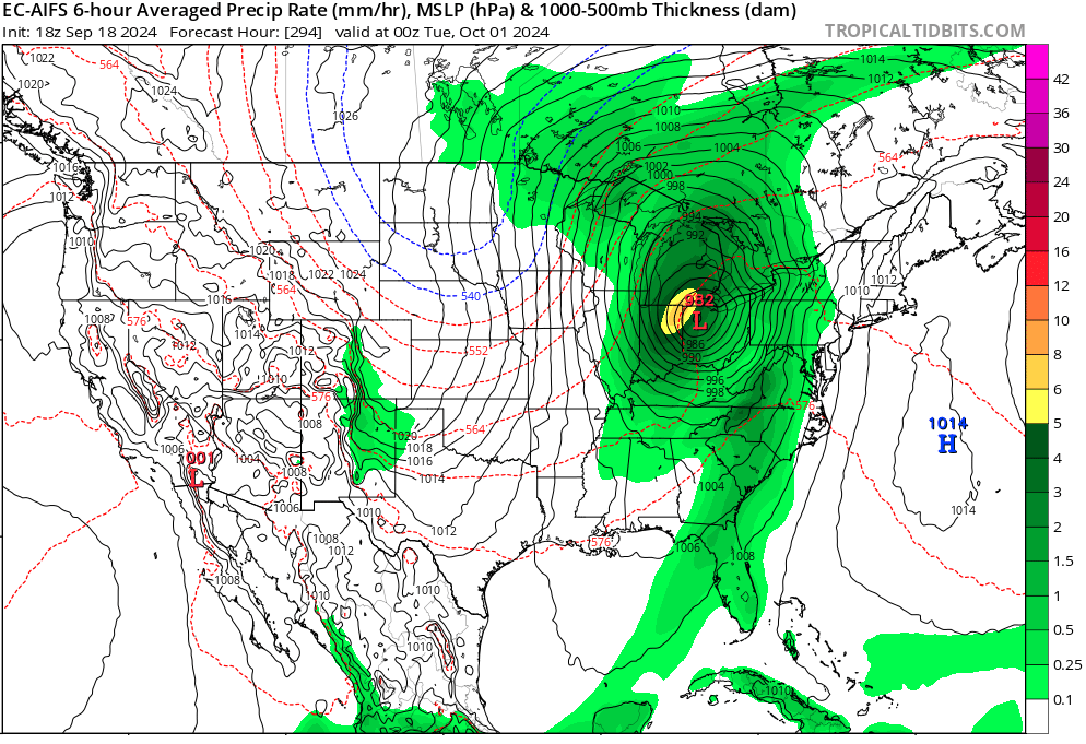
GFS v16 shows us cashing in on 12 inches with this first system and then ramps the total up to 18 by 00z Sat. So roughly 6 inches for the Thursday deal but still a long way out. It almost seems to follow the same track, snow amounts increase pretty linearly compared to the Monday system.
-
Area Forecast Discussion National Weather Service Northern Indiana 535 AM EST Sun Feb 14 2021 Confidence is medium in the forecast overall, with greater confidence in the southeast and lower confidence along the northwestern fringes. The totals occur over a 36 hour period, so we fall short of warning criteria in our far southeastern CWA. In collaboration with neighbors, opted to keep a high-end advisory for now, with potential for upgrade to a warning if the more aggressive solutions (NAM/ECMWF) look more likely. The first system will lift in tonight and exit by Monday afternoon/early evening before the next system if the GFS/GEM are correct. However, the ECMWF and especially the NAM keep the precipitation ongoing through that period, and develop a coupled jet structure right around 00z--which really amps things up as far as forcing goes. In addition, the ECMWF/NAM also have a weaker surface high sprawled across the midwest (as opposed to the GEM/GFS solution), which allows for that secondary low to lift further northwest as the stronger mid level trough inches eastward into Monday night/Tuesday. As far as Thursday`s system goes, both the ECMWF/GFS bring the upper level trough into the upper Great Lakes, and the subsequent strong surface low northeastward from the gulf into the lower Great Lakes/Ohio (the GFS faster and deeper with the system). With a negatively tilted trough and deepening surface low, I tend to go with the stronger solution and further northwest track. So have likely pops in the eastern CWA (mainly along/east of I 69) late Wednesday night into Thursday evening, and high end chances for the central CWA (lowest west half). Think this could be a better system than these first two, but a lot could change by then with this active short/mid term forecast so will hold off on any further discussion. So IWX may go to a warning, who knows. Forecasting 3-5 inches for us right now. Also a possible second "better" system on Thursday!
-
GFS v16 kuchera has us in 11 inches, my local news says 1-2 inches. NWS says 2-3 inches. Lol..
-
We were dealing with a moderate drought here in northeast Indiana and the lake levels are very low. Somewhere along the line we were upgraded to Abnormal but we still have a lot of storage to fill along the watersheds. With this prolonged cold the snow is piling up though and I feel like by the end of next week even more will have accumulated.
-
Fort Wayne here.
-
I think these models are over doing the long term and the only thing I base that on is the fact that temperatures warmed almost 12-15 degrees for this early week cold spell. Euro next weekend is showing below zero for my area and I feel like it will be a tad warmer when it gets here. GFS needs to do a reboot or spyware check.. something.. geeze.
-
12z Euro is still going all out @240. Negative temps all the way down to South Carolina.
-
12z Euro @240 is showing some really abnormal cold still hanging around for Saturday morning. I really don't see that happening. The short term has regressed back to the plains for the most part. Monday morning in my area was forecast to be -12F, now its up to 14F.
-
It looks like the Euro backed off the initial blast and strengthened the second round from Wednesday into Friday. Remnants hanging around still @240. Para has been awol since 06z Tue but seems to be trickling in now @12z.
-
You would think so. Record low for Fort Wayne in the northeast part of Indiana is -19F for February and -10F for March.
-
Yeah the Euro ends its run with a big cold wave pretty far south. GFS shows potent cold @384 as well. Wind chills of -15 in the texas panhandle. It would seem it's here for awhile.