Second Synoptic Breakdown 1/24-1/26
Hello again everyone! If you haven’t seen my first breakdown from yesterday I recommend reading that as it’ll help you understand some of the changes I’ll highlight, ofc it still should be understandable if you haven't read it. Similar to last time the important parts will be bolded. I will first go over our headlining changes from yesterday’s analysis before diving into each scenario. Additionally, I am basing this off a hybrid 12z and 18z suite (importantly NOT the 18z Euro which btw just appears to be even more amped!)
Edit: As for the 18z Euro it falls in scenario 2 as the solution you get if everything I analyzed in 12z goes perfectly.
Part 1: Headlines
- Scenario 1 from yesterday is nearly off the table
- Timing Changes
- Increasing likelihood of a Big Dog
1. Past Scenario 1 is off the table
This is our most exciting piece of news. As highlighted yesterday all guidance minus the GFS and Icon had an initial phase with the SW energy and a piece of NS vorticity which allowed the SW to open up and progress east which is essential in getting a major east coast snowstorm. While the GFS scared us (or at least me) by reverting back to this at 12z it has come back around to involving the SW which nearly guarantees a large east coast snowstorm. For reference see the difference with the energy’s tilt on the Pac NW between 12z (top) and 18z (bottom)
It's a relatively small change but has massive implications on our snowstorm. I consider this initial phase to be a prerequisite to the rest of my analysis/hopes of this storm. It is technically possible all models manage to shift towards the 12z GFS solution though ATP I think it is safe to say the SW will come east!
2. Timing shift
As most of us know an underrated story of this storm has been that the timing of this storm has shifted from starting Saturday to Sunday overnight but why is that? Well the answer lies in our SW ejecting eastward. Additionally, the later timing will have large downstream ramifications for phasing over the plains which is our path to a HECS. So let's dive in.
We will use the Euro to demonstrate as it's been the one that's really slowed down a significant extent from its runs a day or two ago to now. If we look way back to its 0z run on Monday we see the shortwave opening up by 12z this Friday
Meanwhile, compare that to the 12z (today) Euro run where the SW still has two closed Isobars
The trend that has caused this timing difference has been IMO that the SW has trended stronger and a bit further south. This could’ve been an extremely bad thing (and frankly still could be) but luckily the NS interaction has also increased which helps eject it. This also means that there is more upside even with the SW on its own as it contains more energy. As for down the road it also opens up the possibility of a phase with a lobe off the NS. The 12z Euro of today shows this interaction beginning at hour 102
Meanwhile the old 0z run of Monday had no chance at interacting with the NS in this capacity.
Once again, this increases the chance we get something monumental but does run the risk of a potential squash mechanism, though that appears unlikely. Overall I think the timing changes have been for the better (discounting the infamous sun angle).
3. Increased likelihood of our Big Dog solutions
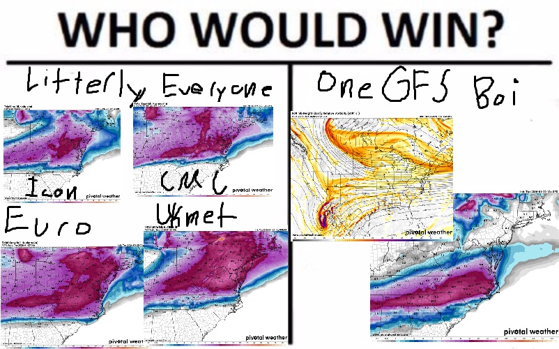
Firstly, I am not saying this is a lock by any means, as others have pointed out we got to get to Thursday to be really confident in this as it deals with multiple phases past the 100 hour mark. That said, most model output has trended towards the SW and NS interacting in a constructive capacity. The Euro, CMC, and Ukmet all have this occur to some degree of success. For example here is the CMC which has the most complete absorption of our SW.
Compare that to the models which limit interaction due to the NS not diving in far enough west or due to timing differences and its a world apart as the 18z Icon shows at 114
However, what should make us all ecstatic is that despite the NS not phasing well with the SW in the Icon still gives us a major snowstorm! We have redundancy!
Now with the major headlines covered lets dive into each updated scenario from least to most amped.
Part 2: Scenarios
Scenario 1: Two ships passing the middle of the night (ICON and GFS)
This is what will happen if the NS manages to miss a phase with our SW. The 18z Icon is the best example of this happening as it has the NS way out east of where we would want to see. Additionally, it has the NS further north than most other models
Obviously this isn’t going to cut it for a phased solution. The GFS on the other hand is so, so close but has the center of the NS angled east in a way that hurts its ability to constructively interact with the SW
This tilt of the NS leads to this H5 vort map on the GFS which basically just hangs out above our storm unable to interact much with it
Now, for an example of what we it to do we can see scenario 2.
Surprise! Scenario 1.5: Partial phase interaction (Ai GFS and Ai Euro 12z)
This is really just an extremely weak scenario 2 but it feels wrong including the AI GFS/AI Euro in that camp. The AI GFS has a strong enough dig with the NS despite missing the initial phase out west that its able to bring some more moisture up the coast
The Ai Euro is similar but doesn’t dig the NS as far south, however, it does generally eject more of the SW east.
Bottom line is that this isn’t unlikely and combined with scenario 1 they paint a good low end solution for our region… which is still a major snowstorm.
Scenario 2: Its All Coming Together (Euro, Ukmet, CMC, Improved CMC)
This is the HECS pathway. It involves a full ejection of the more powerful SW and then constructive interaction between the NS and the SW as it moves east. Of course, each of these models differ in how much interaction, how well it goes, and the ultimate result but we will not know how this shakes out until Thursday at the earliest. This is exciting, no other way to put it, and it is also the dominant solution. I’ll walk us through the 12z Euro as it seems to be a good middle ground between a slightly less favorable phase and the super amped up CMC/Improved CMC.
Firstly, the Euro (12z!!!) ejects our SW nice and healthy by hour 108
Secondly, we can see that NS diving south and while there are still two distinct areas of low pressure at hour 114 we can see that there is obvious interaction between them
Progress that forward to 123 and we can see how the NS is helping lift the vorticity and moisture from the SW up the coast as it absorbs it.
We are left with a ridiculous moisture transport across OCEANS (and a gulf)! I mean the jet streak starts back at the Pacific and then hits a max right where we need it to
Beautiful. Stunning. Magnificent. This is what we have waited for. Yet, it actually leaves some energy behind!!!
Truly insane the upside potential we have here with the scenario. Additionally, this scenario is so impactful because it has the ability to pop a coastal low and maybe even bring it up the coast some. The H5 and SLP map of the Euro shows our initial low pressure running up the TN valley and the new surface low that pops partially in response to our NS trough.
In order to reach our theoretical limit we want to see 1. All of the SW energy comes east 2. A sharper and further west NS trough 3. A more south NS trough to capture the surface low and prevent mixing.
Part 3: TLDR
What a setup. We have the potential for something really special here now that it looks like we’re over the initial hurdle of the SW getting stuck. I would say its a near guarantee someone on the East coast gets a foot of snow now. Who gets that (and the max amounts) will be determined by interactions between our beefed up SW and the NS lobe over the Great Plains. For now all we can do is wait and see, though I think a floor of 4-8 and max of 18+ is possible. As for suppression worries I think the only real way we get screwed over is if the NS starts acting as a suppressive force which so far no runs show. On the contrary I also don’t think we need to worry too much about a prolonged period of mixing assuming the NS doesn’t become so involved it yanks the primary way up north (edit: the 18z Euro shows how a full phase starts to bring this mixing risk, though its still low as of now)
Basically, it's going to snow.
Happy Tracking!