Jt17
-
Posts
677 -
Joined
-
Last visited
Content Type
Profiles
Blogs
Forums
American Weather
Media Demo
Store
Gallery
Everything posted by Jt17
-
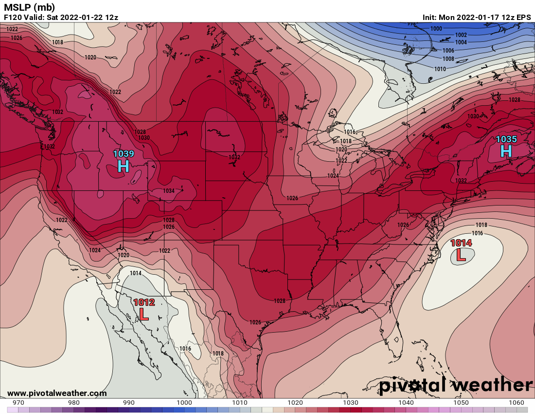
I'm sure it isn't very good, but after a few years of not checking weather models, I'm now back and don't really know anything about the ICON. But it looks to be one model that took a pretty big positive step for the potential Saturday storm. Moved quite a bit west.
-
Thank you! To my untrained eye it seems like there's just a chaotic amount of energy and it's far enough out from now that all of the models are all handling it slightly differently. With so much going on expecting model convergence this early in the game doesn't seem reasonable!
-
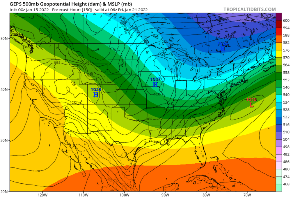
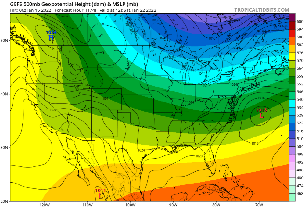
GEFS looks to have made another tick towards Euro, ways to go, but still a little progress.
-
Compared to the same time yesterday the models have moved MARKEDLY closer to the Euro solution. Just because they've had 2 runs where the progress has stalled on most models (and apparently gone back on the CMC), doesn't mean anything is done trending in one way or another. There's still enough lead time for substantial changes
-
Hope the trends continue towards the euro
-
I-95 weenies would rejoice
-
Powerful and slow moving it appears to me...
-
Would be a nice way to finish the day with GFS clearly trending towards euro - potential storm is in the 4/5 day range - they should start to converge.
-
Sigh, verbatim that's a simple lovely cold snowstorm that literally makes everybody happy. Only 5 days away, so these runs start to have some merit to them. Hopefully GFS starts to trend towards the Euro!
-
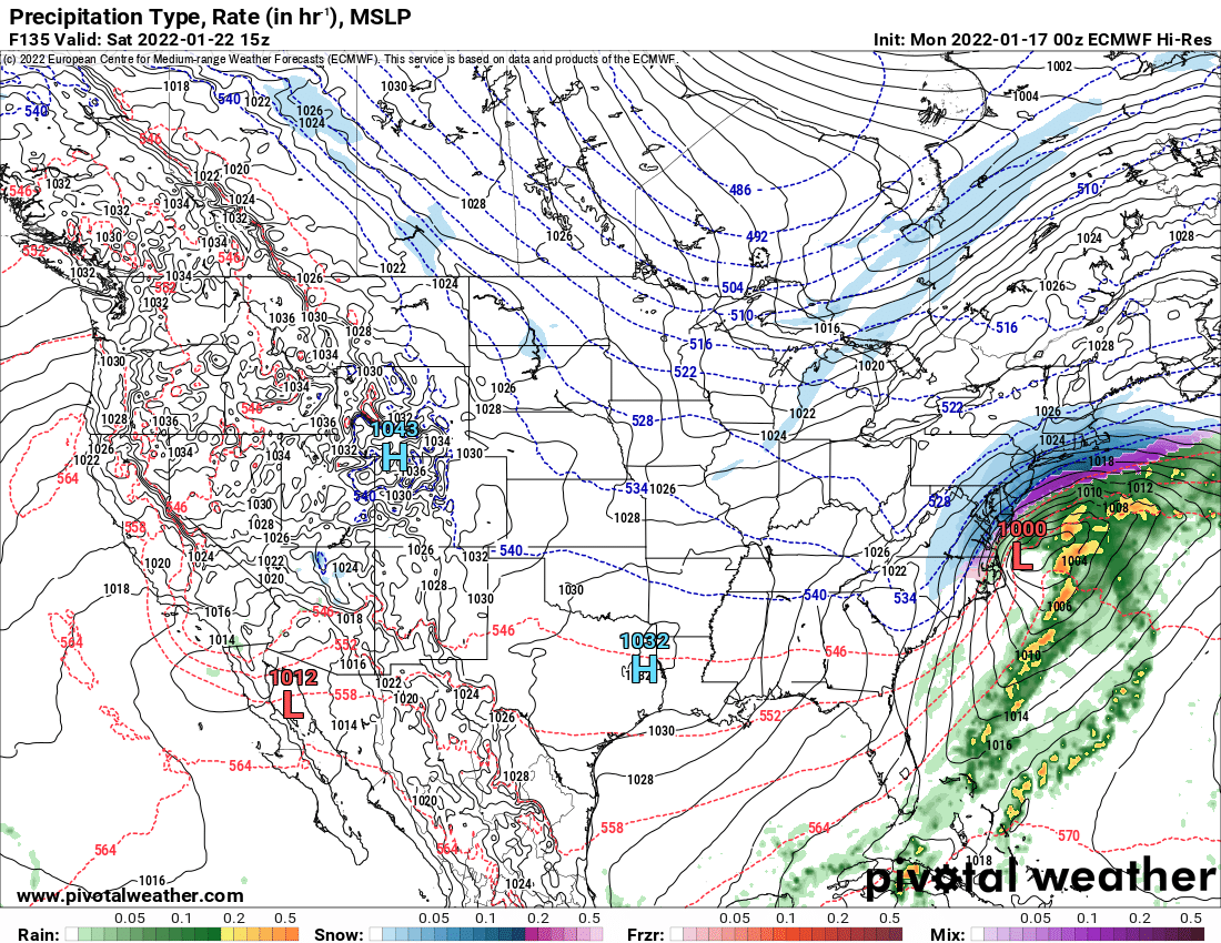
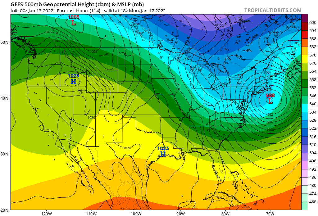
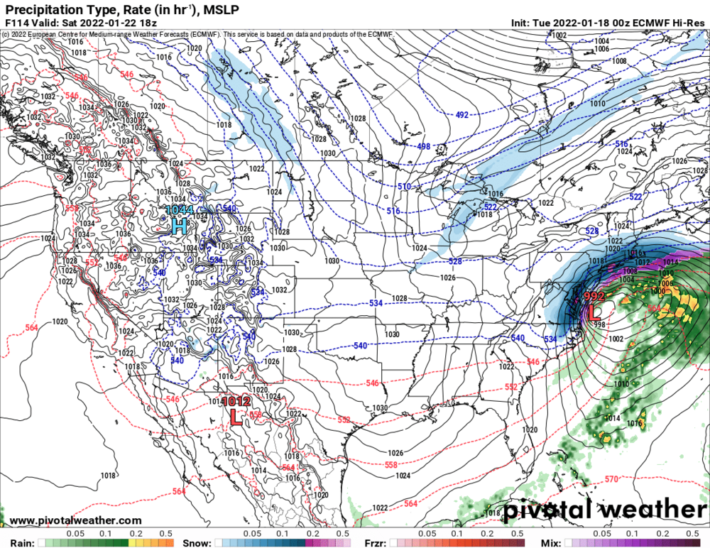
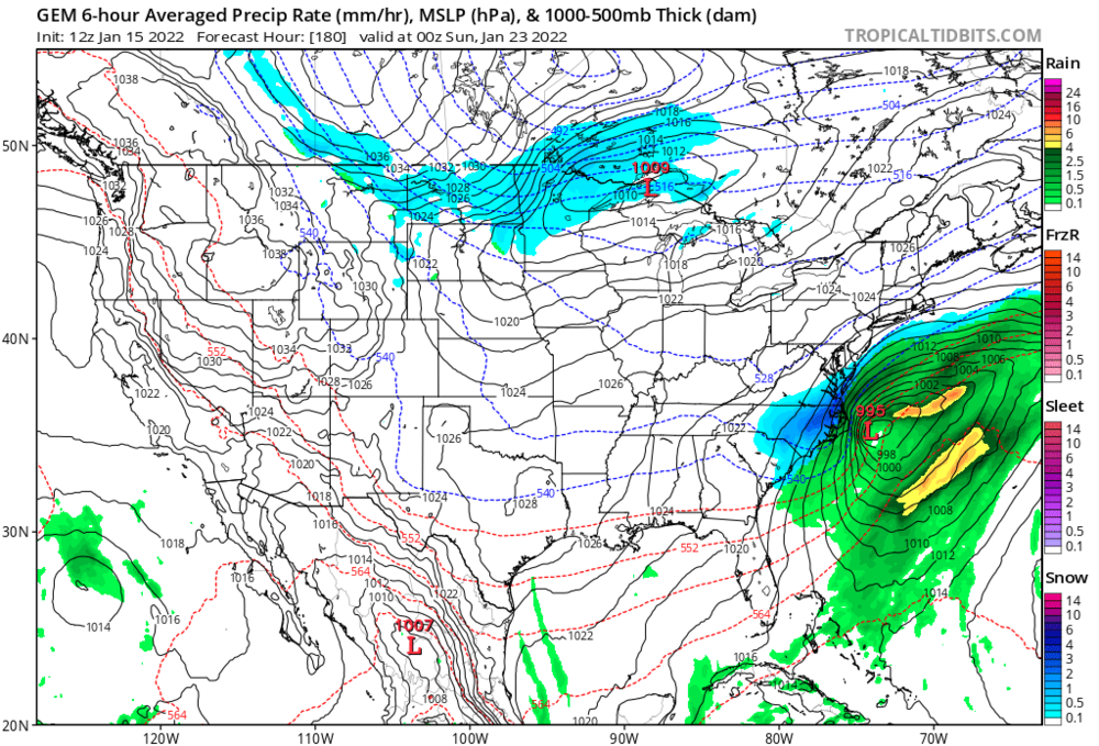
00z suite including Euro have storm again for Saturday, Euro just misses with something nice

-
00z GFS looks like it lost the Sunday Night/Monday solution, but brought back the Friday Night/Saturday idea with a close(ish) miss to the SE
-
CMC looks a lot like the GFS 6 hours ago. At least that energy is out there lurking or hitting on all of the models. Something possibly exciting to keep an eye on.
-
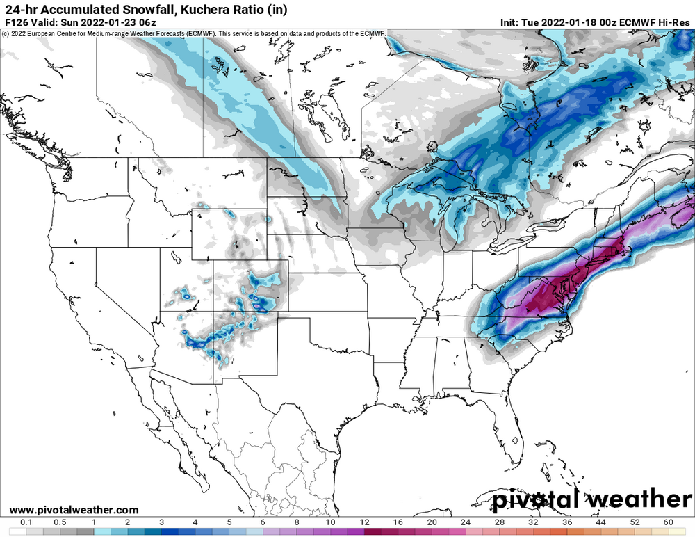
Looks like 20+ hours of snow
-
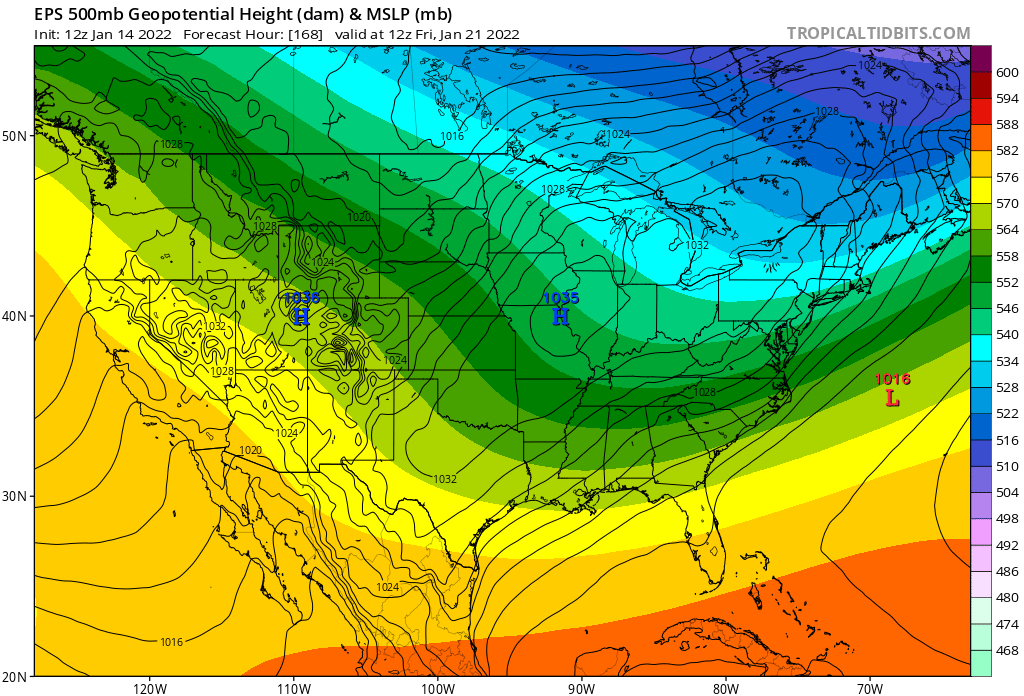
Lol at gfs next weekend
-
One way too look at it, but also every model has a LP system pop off the coast next weekend with the Canadian having it in the nicest position before heading out to see. With the NW trends we keep seeing it's probably best it's showing up, but heading out for sea on every model right now lol
-
Next weekend?

-
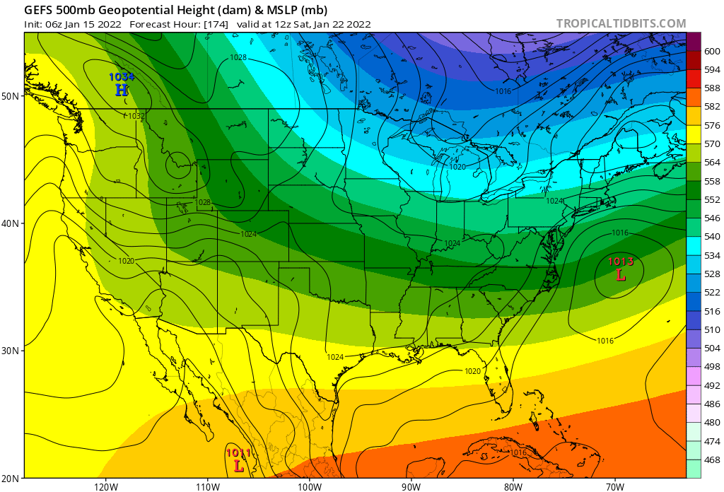
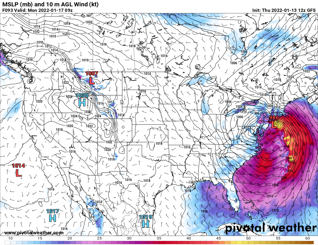
GFS op just moved quite a bit east from what I can tell on my phone. Actually has the low off the coast of Jersey now.
-
Is there any rhyme or reason why the seemingly weaker low pressure tugs the more intense low pressure west on the GFS the last few runs into PA. Seems like the last GFS ensemble was hinting that it was an exaggerated scenario...?
-
It's actually kind of refreshing to have some unbridled joy for a change
-
Definitely looks like the GFS and the GEFS trended towards a better solution for snow. GEFS says that crazy hard phase that brought the low into PA was way exaggerated, hopefully it's onto something!
-
At 102 to 105 the low just dives hard inland, it looked more promising up until then though.
-
The 850 freezing line was pretty far from the area which is why I said that, but thanks for the heads up. I don't want to be badly mistaken again. Gee no wonder these forums are so dead compared to the old days.