

Northof78
-
Posts
387 -
Joined
-
Last visited
Content Type
Profiles
Blogs
Forums
American Weather
Media Demo
Store
Gallery
Posts posted by Northof78
-
-
WS Watches extended west in NJ
-
Just now, BxEngine said:
Ratios arent determined by surface temps.
Correct, it is cold at 850 as well with our relation to the storm position well to our S/E and with little overrunning lower ratios
-
Just now, Blizzardo said:
Dont even bother posting kuchera maps...
With the cold we have here on the backend of a CCB 12-13:1 should be realized
-
 1
1
-
-
Just now, Northof78 said:

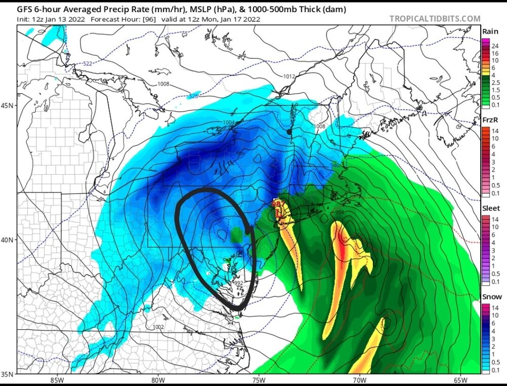
12Z NAM, Kuchera, major storm for almost all on the forum.
-
Close to 0.9" QPF in NYC of the NAM, with some ratio, should be 10" - 12" in CPK
-
NAM should be 8-12" for most of the region, outside of C/E LI with more
-
1
-
-
3 minutes ago, MJO812 said:

This and the NAM actually shows low occluding/stalling to our south and fairly tucked, any option obviously is still on the table...tomorrow 12Z should be the runs where we can nail it down
-
3
-
-
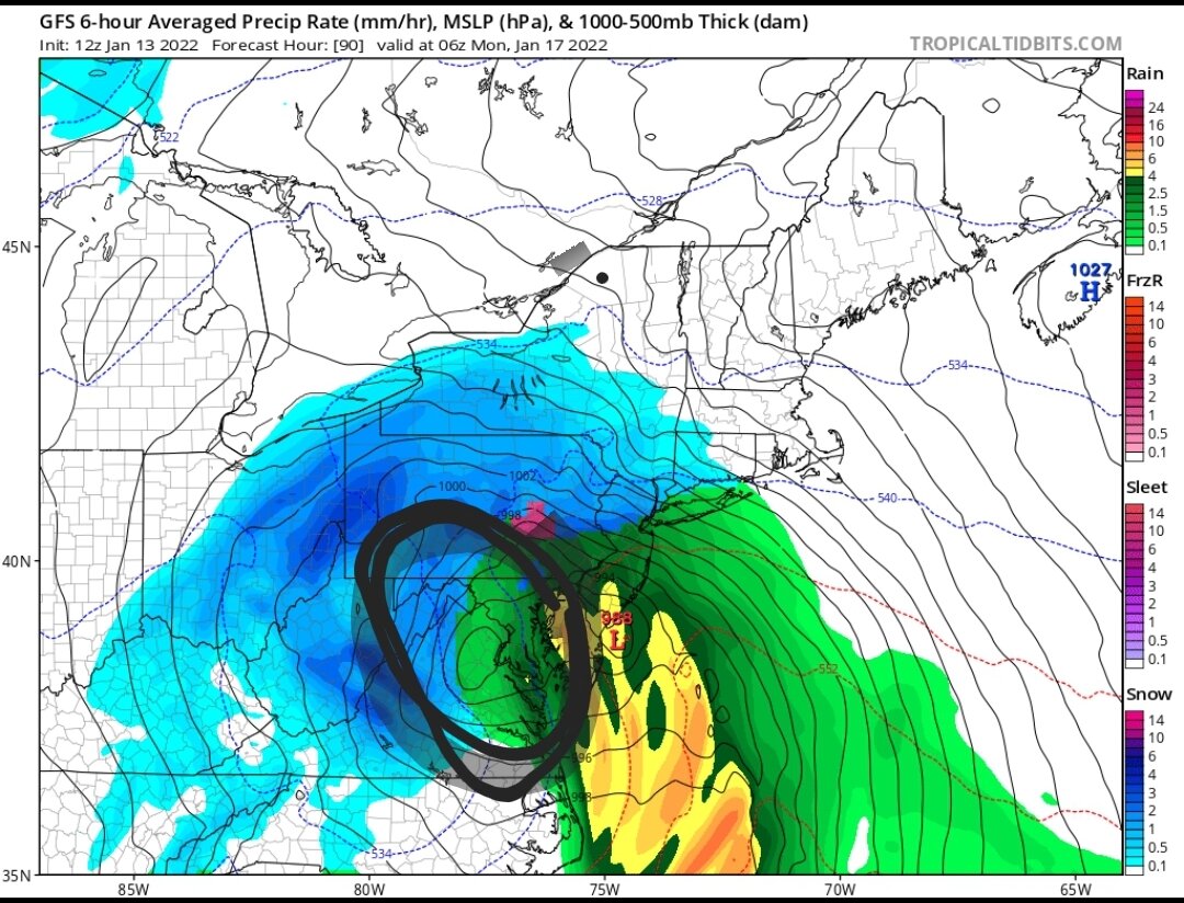
NAM and EURO are almost identical
Nam has the low well tucked just E of LI, likely to make landfall in SE MA or the islands....All of Metro 12-24"
-
8 minutes ago, David-LI said:
If this verifies it is looking like starting Saturday evening and ending Sunday evening. It's interesting that it seems that most of our biggest noreasters fell on Sat/Sunday.
Light snow starts Friday afternoon/evening
-
When the most S/E major model (GFS) has the 6" line running around I-95, with others (NAM, EURO, RGEM) 12" plus...get excited.
-
2
-
 1
1
-
-
At this range for the coast (especially E LI/SE Mass), starting to think mix/rain more an issue than a miss with overall setup
-
NAM looks like mostly a I-95 & SE event, but could just be random movement
-
6Z NAM good for a nice 2-4”

-
This looks like a very nice setup for I-95 and most here...3-5" certainly possible
-
2
-
-
46 minutes ago, MJO812 said:
Anafront continues to look good
Seperate thread for that, and that now looks like it could be a 3-5" storm, likely bigger storm that whatever this turns out to be
-
1 minute ago, Franklin0529 said:
Euro trending towards gfs an other guidance. Not a shock since it's been on its own. This one looks like its headed the wrong way
Real storm to watch is Thursday (anafront wave)
-
3
-
-
I think this will be the bigger storm over the next week, looks like a nice 2 - 4" for most...other looks offshore
-
-
-
Just now, jm1220 said:
Those snow maps are likely showing a lot of sleet as snow until you're well north in New England or west in PA/NY. The mid level low tracks are horrible- winds at mid levels are out of the E/SE and strengthening. And the GFS usually doesn't see the mid level warming soon enough. NAM is better with that which we'll see a few runs from now (if the overall setup doesn't improve). I've gotten burned numerous times with seeing big snow totals on maps with bad mid level low tracks. It'll change over way sooner than it thinks now.
Very little sleet with this storm and the thermal profile most likely, either rain, snow, or no for 95% of the precip
-
Insance cut-off right around Rt.78 or the Raritan River between C-1" and 6"+
-
 1
1
-
-
Again, 4"+ thump from about Rt.78 N and NYC area and W. Models are starting to converge on this solution.
-
1
-
2
-
-
Verbatim new GFS is a hard SNOW thump from about Rt.78 and N
-
3
-
-
3 minutes ago, Rjay said:
There's still a surface reflection here too

Great Thump depicted that frame mostly dry slot...maybe a touch of wrap around flurries, etc.
-
1
-
1
-

January 28-30th Possible Nor'easter
in New York City Metro
Posted
Very large move with the GFS to essentially meet the other models at this point, now just a matter of how clean the storm is or more strung out...but snow is coming...