

Northof78
-
Posts
387 -
Joined
-
Last visited
Content Type
Profiles
Blogs
Forums
American Weather
Media Demo
Store
Gallery
Posts posted by Northof78
-
-
2 minutes ago, SnoSki14 said:
Nah I'm not concerned about that at all
If you live north of 84, maybe even 80, you should be...
-
The bigger risk now is this south/suppression/flat trend continues, not too far north..need to see trend stop now
-
 1
1
-
-
I would be cautious currently north of I84, there is a sharp cutoff around there on almost all models....
-
On 2/8/2024 at 2:23 PM, Northof78 said:
Latest EURO, GFS give the NYC Metro advisory or warning level snows, others more mix. But the liklihood of a signficant winter storm is high.
:-)
-
Looks like we got a good one here boys…enjoy the show! Many will be surprised with this, nice bombing coastal low off VA/Delmarva moving ENE will do that…all models now on top of each other
-
5
-
-
15 minutes ago, Metasequoia said:
That's an inch plus of qpf for NYC metro, LI, and north. That would add up.
Thats not QPF, that's accumulation of snow map
-
Monmouth jackpot?
-
 1
1
-
-
Temps today about 3-5F colder than progged, fresh NW wind
-
1
-
-
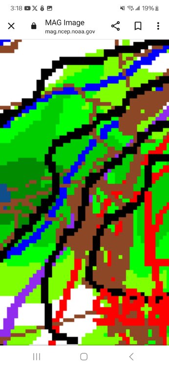
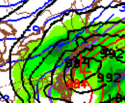
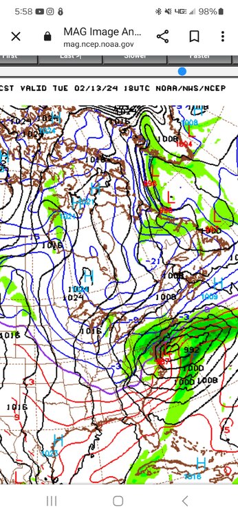
NAM exists low off VA coast and SECS for the region...
-
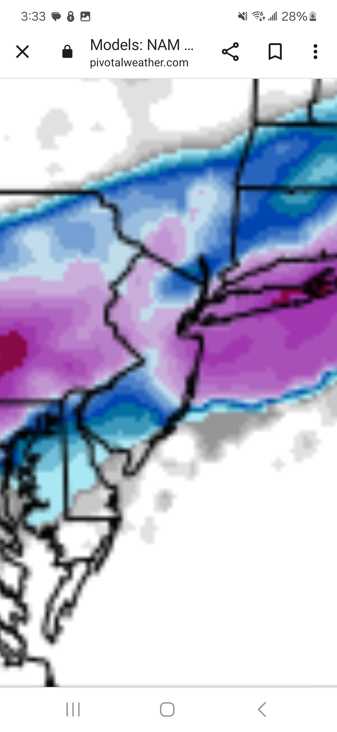
First and Final Call:
S LI/C NJ Coast: C-2”
N LI/NYC/Immediate NJ suburbs/C NJ: 1-3”
N/C NJ ( N of 78/W of GSP), to 287 in S NY State: 3-5”
N/W NJ, N of 287 in NY State: 4-8”
Should be an interesting, dynamic coastal storm, and could be largest this year for some on the forum
-
4
-
 1
1
-
-
When models are still hundreds of miles apart, a 25/50 mile blip from one model one way is noise, patience and let this one settle into the pocket. I think something close to the GFS/EURO blend is about right, with 2-4" near the coast/NYC and more N-W, but lets see...
-
1
-
-
3-5" for NYC from both the EURO/GFS and the most north models...seems like a good start for accumulation potential
-
2
-
3
-
-
Just now, 2wheelin said:
Show me how you get maps on your Atari 2600 lol
Old school is best, none of this fancy mumbo jumbo....
-
1
-
-
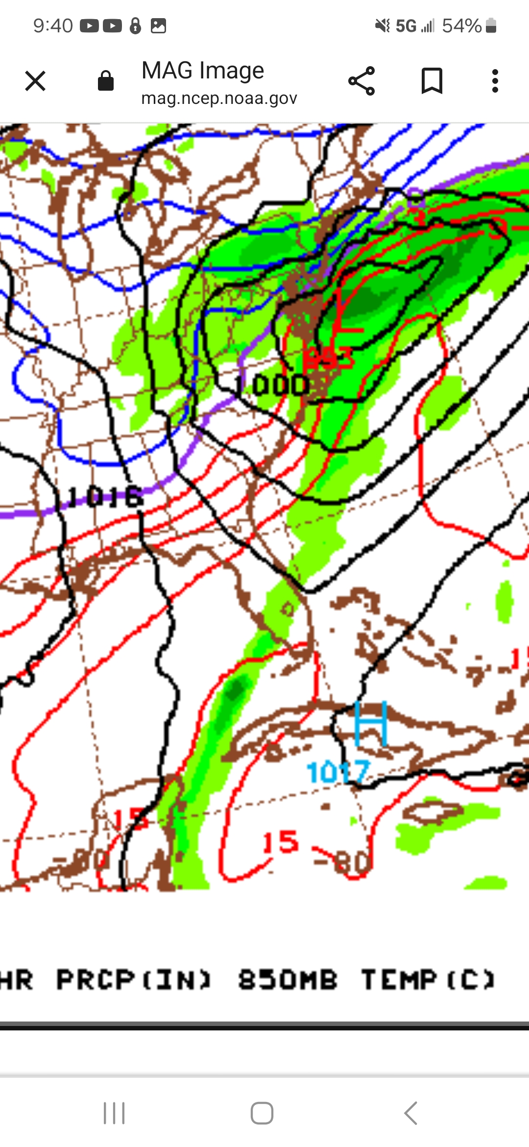
GFS shows a nice CCB (-3F 850) with snows as low exists to the NE south of us...has about 3-5" for NYC and more to the N/W
-
1
-
-
NAM/RGEM/CMC south/surpressed, EURO/GFS middle ground, ICON far north
-
2 minutes ago, Stormlover74 said:
It's also fairly weak. No ccb. It will change
Agreed, prob end up stronger and closer to EURO
-
1
-
1
-
-
12Z NAM continues way south with suppression more of an issue

-
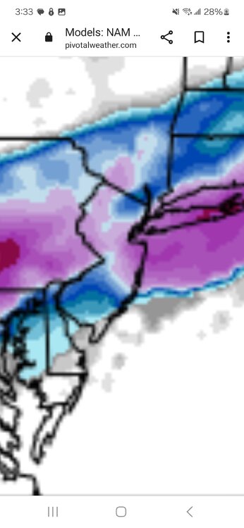
Looks like 3-6" type event for Metro north of Rt.78 or so
-
1
-
-
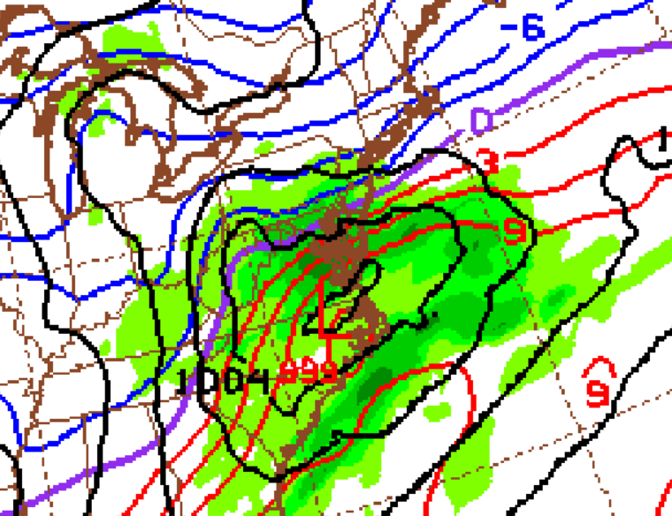
18Z NAM....book it
-
Very early to get a sense from the NAM, but looks quite promising at the last frame for a good metro storm, looks roughly in line or a touch south of latest GFS.
-
1
-
-
New GFS about as classic as its gets for metro snowstorm
-
3
-
-
Latest EURO, GFS give the NYC Metro advisory or warning level snows, others more mix. But the liklihood of a signficant winter storm is high.
-
2
-
 1
1
-
1
-
-
GFS pretty widespread 2-3" for almost all in the forum, a little more in coastal C NJ
-
1
-
-
Seems like for the most part the GFS/EURO have been left in the dust with recent storms in terms of being way to supressed/weak. 2-4 days prior to this past storm the fear was light precip and out to sea with little or no coastal, in the end the most snow fell in VT with the metro getting a lot of ice/sleet with tucked in coastal position.
Ride the NAM/RGEM/S-T models until they throw you off this winter....
-
2
-
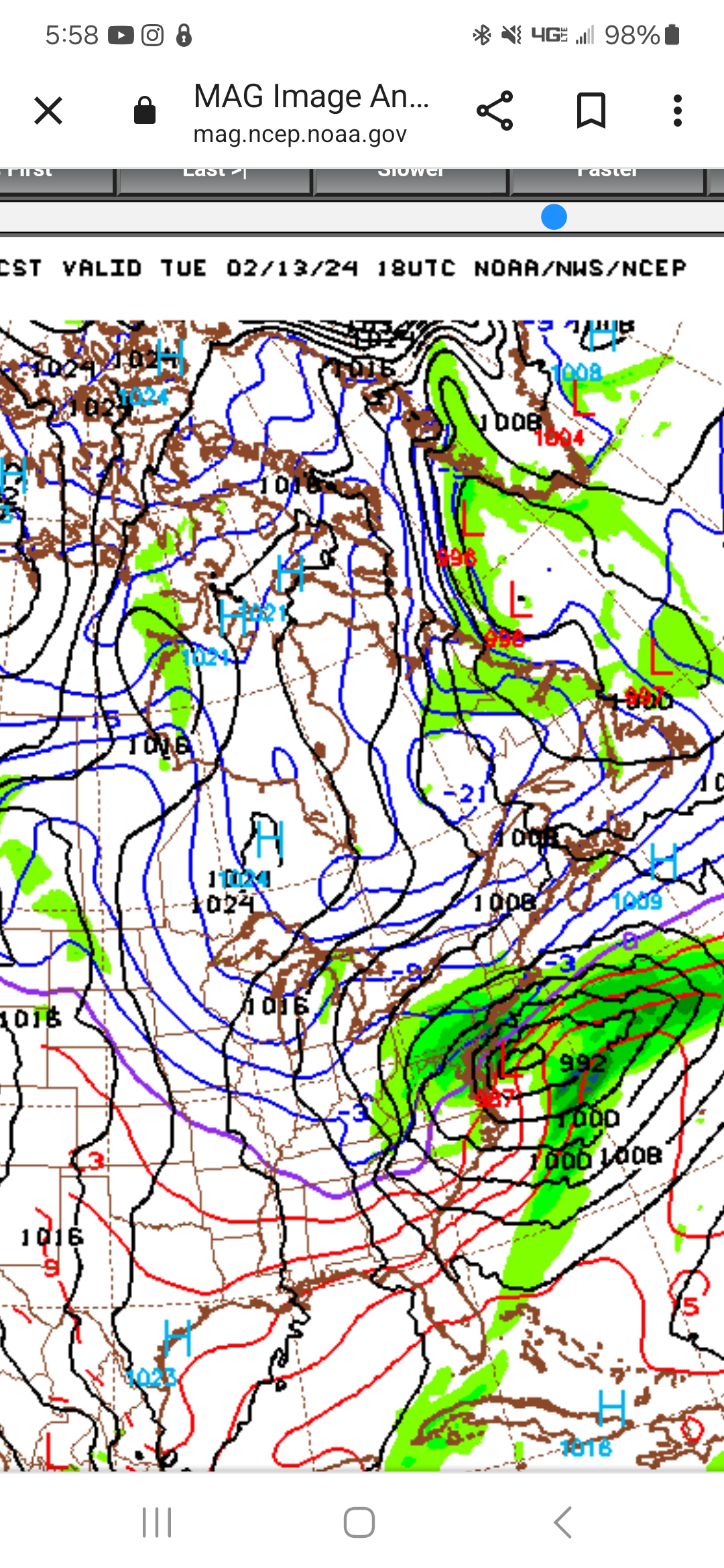
2/13 Significant/Major Winter Storm Discussion & Observations
in New York City Metro
Posted
New NAM....large banding signature and very strong storm in nice spot 6-12" for almost all of region...