

Northof78
-
Posts
387 -
Joined
-
Last visited
Content Type
Profiles
Blogs
Forums
American Weather
Media Demo
Store
Gallery
Posts posted by Northof78
-
-
-
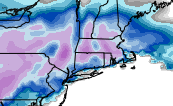
Final Prediction:
E LI: 1-2"
W LI/C NJ Coast: 1-3"
NYC/C NJ/NE NJ (inland): 2 - 4"
W NJ/ S NY State: 3 - 6"-
 1
1
-
-
1 minute ago, Stormlover74 said:
Cmc is a pretty decent hit
2-4/3-5"?
-
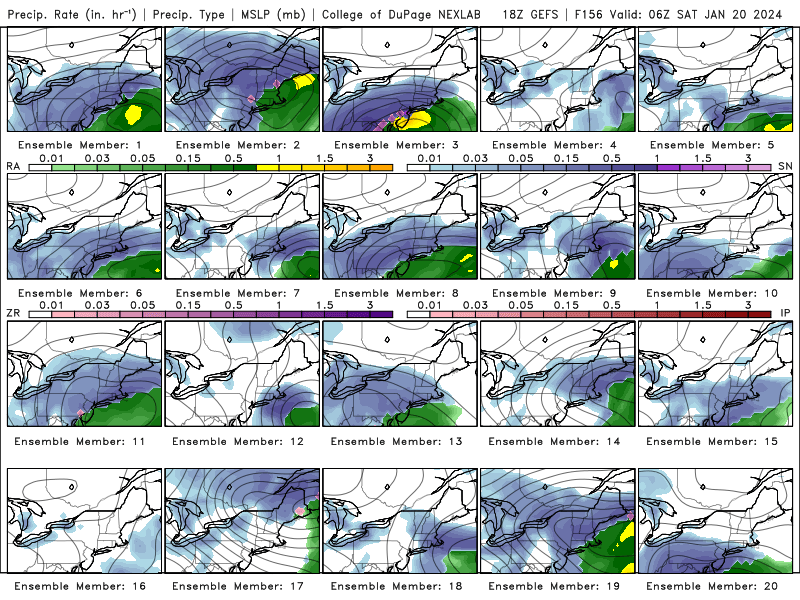
GFS/EURO horrible with this storm compares with NAM/RGEM, GFS basically has a coastal hugger at this point with significant precip...borderline warning storm for just inland
-
2
-
-
-
Nam verbatim is a decent coastal storm with moderate/borderline warning accums inland, light accums at coast, probably too amped, but that is the trend
-
Looks to be potential for a coating - locally 2" North and very highs winds with arctic front passage tomorrow....
-
1
-
-
57 minutes ago, mannynyc said:
Good look but I have a flight on the 20th...I have a flight as well late the 19th, where you heading...
-
NAM looks really nice for Tuesday...3-5" through hour 84 for entire forum
-
 1
1
-
-
90% of the time storms get more amped and N/W from 24/36 and out across the model suite (see last snowstorm), so I think we are in pretty good shape here.
-
2
-
 1
1
-
 1
1
-
-
-
-
Both GFS/NAM strong signal for front end thump of 2-4/3-6" with no CCB/wraparound which sounds reasonable. Should be a nice storm vs. last 2 years of nothing with some period of moderate/heavy snow.
-
1
-
-
Front end thump with 2-4"/3-6" probably across most of region.
-
2
-
1
-
-
-
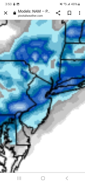
NAM 12Z as expected shifted SE/colder and most precip fall as snow w of Hudson with front end thump, 3-6"/4-8" verbatim
-
1
-
-
Fresh, cold, dry new infusion in place, everything still seems on track with original forecast for 3-6"+ W GSP/N 78, 1-3" NYC/-I-95, C -1" east of there...enjoy what you get and ignore wobbling models...probably a shift back S/E slightly with 12/18z models as wobbling continues...
-
3
-
-
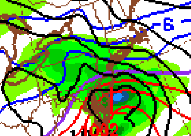
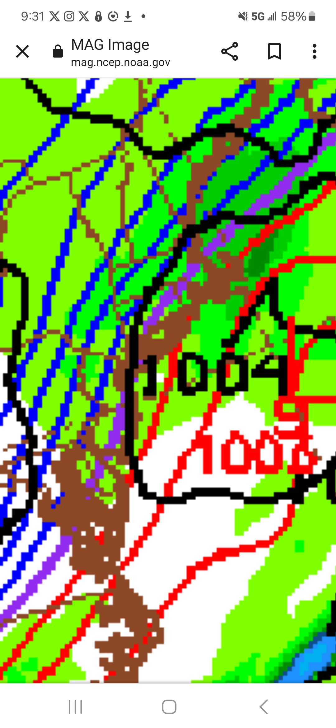
GAME ON,; GFS, EURO, RGEM all very close now with N NJ and W metro and NW in a significant snow storm.
-
1
-
-
Better/Colder Euro run for many, worse for none
-
1
-
-
RGEM (always one of warmest models) giving good snow to many should be the sign...we are in early January with decent cold/dry/fresh air injected in 1-2 days prior to storm with a good track...we will snow.
-
2
-
-
Everything still looks good and on track with an increasingly strong storm for 3-6"+ N of 78 and W of GSP, borderline 1-3"/2-4" near NYC, and then sloppy 1" or so W LI N NJ Coast...looks like a really nice storm for many (not all) in the forum.
-
1
-
-
Looks like 50-100 mile model run flip flopping, but relatively safe to say NJ coast/most of LI 1" or less, NYC borderline but most likely 1-3/2-4" decent storm, once into N/C NJ and NW NJ 3-6/4-8"...
-
1
-
-
This is a decent airmass, highs in upper 30s and dry will do it every time without too much of an issue in early January
-
Looks like W of GSP and N of 78, good to go for a SECS; right along 95, tight, but probably decent accums of 2-4", once east of the city/LI/beaches less than 1"
-
1
-

Potential extensive winter event, I-95 west and with again a chance for NYC first inch(es) of snow Mon or more likely Tue Jan 16, 2024 (serves as OBS thread as well)
in New York City Metro
Posted
1.2" @ Millburn