ineedsnow
-
Posts
22,144 -
Joined
-
Last visited
Content Type
Profiles
Blogs
Forums
American Weather
Media Demo
Store
Gallery
Everything posted by ineedsnow
-
try harder..
-
Euro op is a nice ice storm here
-
a few chances on the GFS
-
Moderate snow in leominster.. wont last long though
-
Remember how good they were march 2023 up here
-
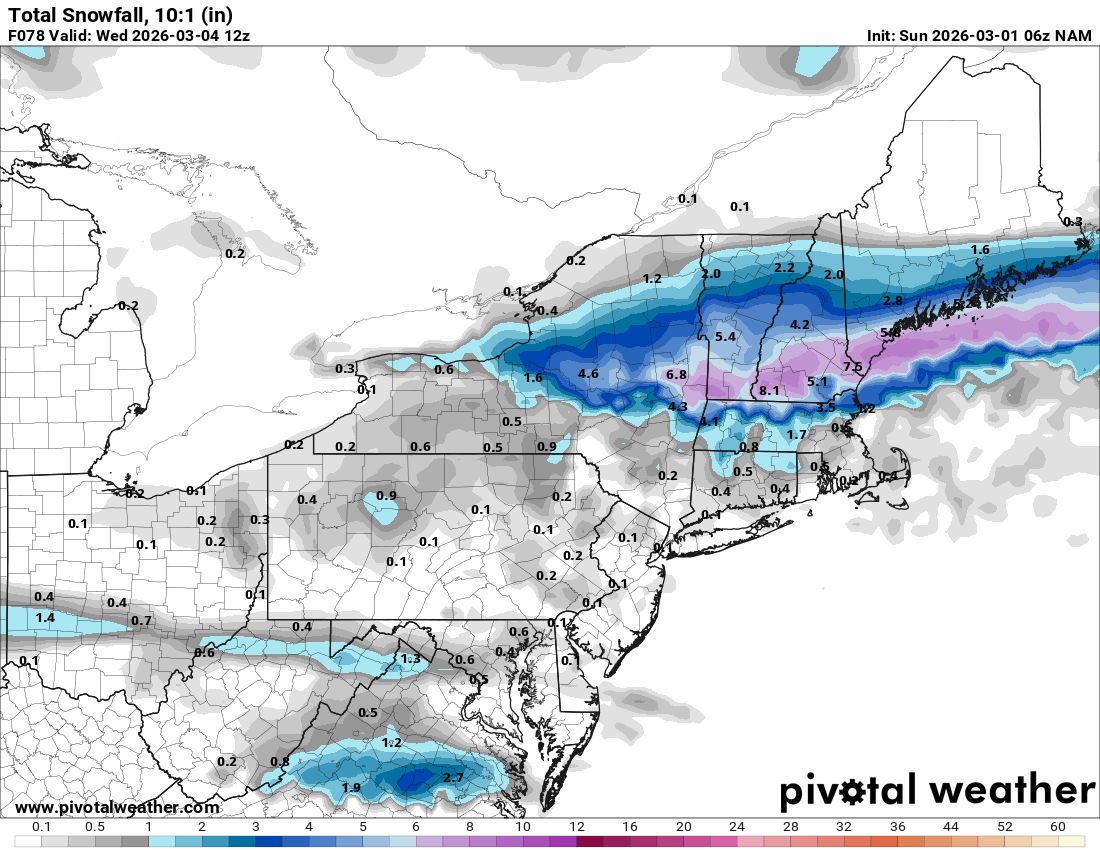
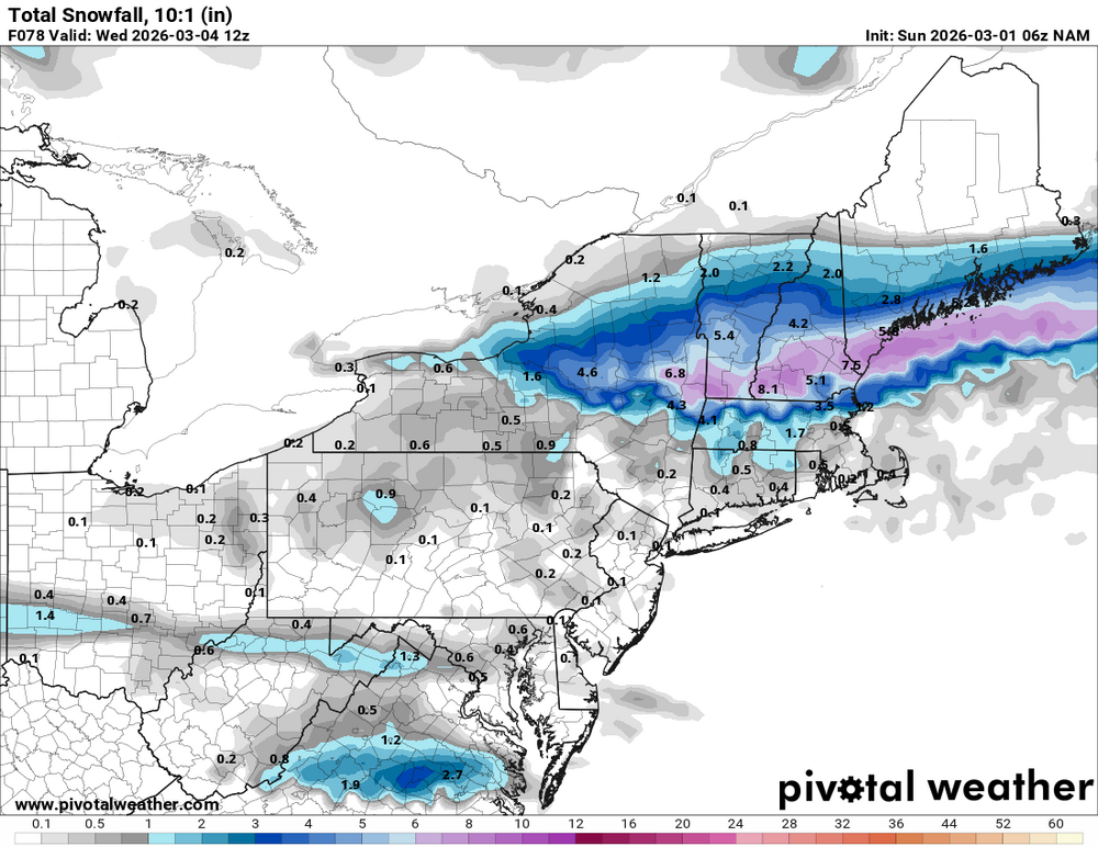
Well sounding are snow here so we take.. Euro looked the same
-
Right on the edge but has a 5 spot.over me.. not sure how that's horrible
-
We NAM
-
Let's try to bring 1998 further south

-
NAM and RGEM look like they would pretty icy beyond hr 84
-
6z Euro AI is very meh with the warmth.. maybe a couple days but that is a stormy look for us
-
That high is a beast.. huge temp contrast.. Hopefully we can get a ton of precip and keep temps cold enough
-
GFS and ICON like it. NAM not so much
-
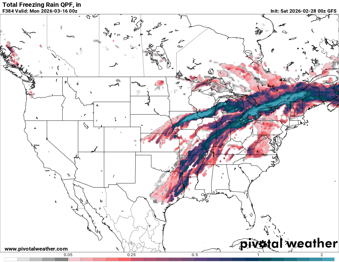
probably a few days of muted warmth then back to winter.. Ice storm threat is real next weekend
-
Let's get 5 to 10 inches of rain and a quick melt out.. I want to see some epic flooding
-
I'll never ever like dews unless there's a big rare severe threat
-
Feels like spring this morning.. actually feels good after the relentless cold this winter
-
Best ice jam I've ever seen was on the coaticook river in quebec.. the sound was nuts and when it let loose there were 6 foot icebergs left in fields
-

Clipper Fires In Wednesday Feb 25 Disco/ Obs
ineedsnow replied to Damage In Tolland's topic in New England
Squalls turned out to be meh.. coating -
that's all I've been hearing all winter
-
Clipper Fires In Wednesday Feb 25 Disco/ Obs
ineedsnow replied to Damage In Tolland's topic in New England
@Damage In Tolland most not even close to 3 1 to 2 overall like I said yesterday meh.png.7f93d4ca864cf2caa793c16d9c5f30c0.png)
-
Clipper Fires In Wednesday Feb 25 Disco/ Obs
ineedsnow replied to Damage In Tolland's topic in New England
1 to 2 over a few hours or a inch in 30 minutes.. hmmmm -
Clipper Fires In Wednesday Feb 25 Disco/ Obs
ineedsnow replied to Damage In Tolland's topic in New England
RAP and HRRR give my area a inch or so tonight.. hopefully those squalls hold -
it might but doesn't look to last long