ineedsnow
-
Posts
22,680 -
Joined
-
Last visited
Content Type
Profiles
Blogs
Forums
American Weather
Media Demo
Store
Gallery
Everything posted by ineedsnow
-
 almost gone here
 -
I see Blue SKY... about time!
-
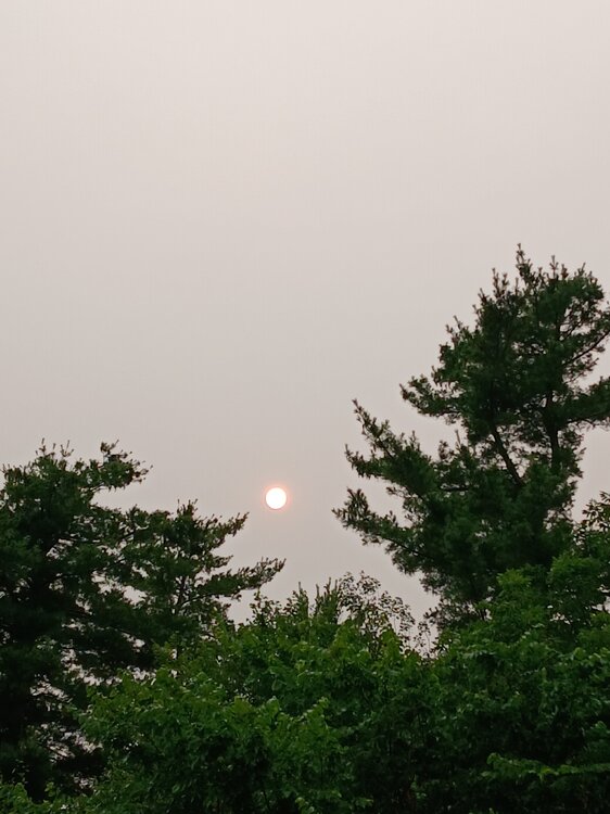
Smoke filled sky.. sun not even able to peak through.. Definitely a burning smell to the air.. summer sucks
-
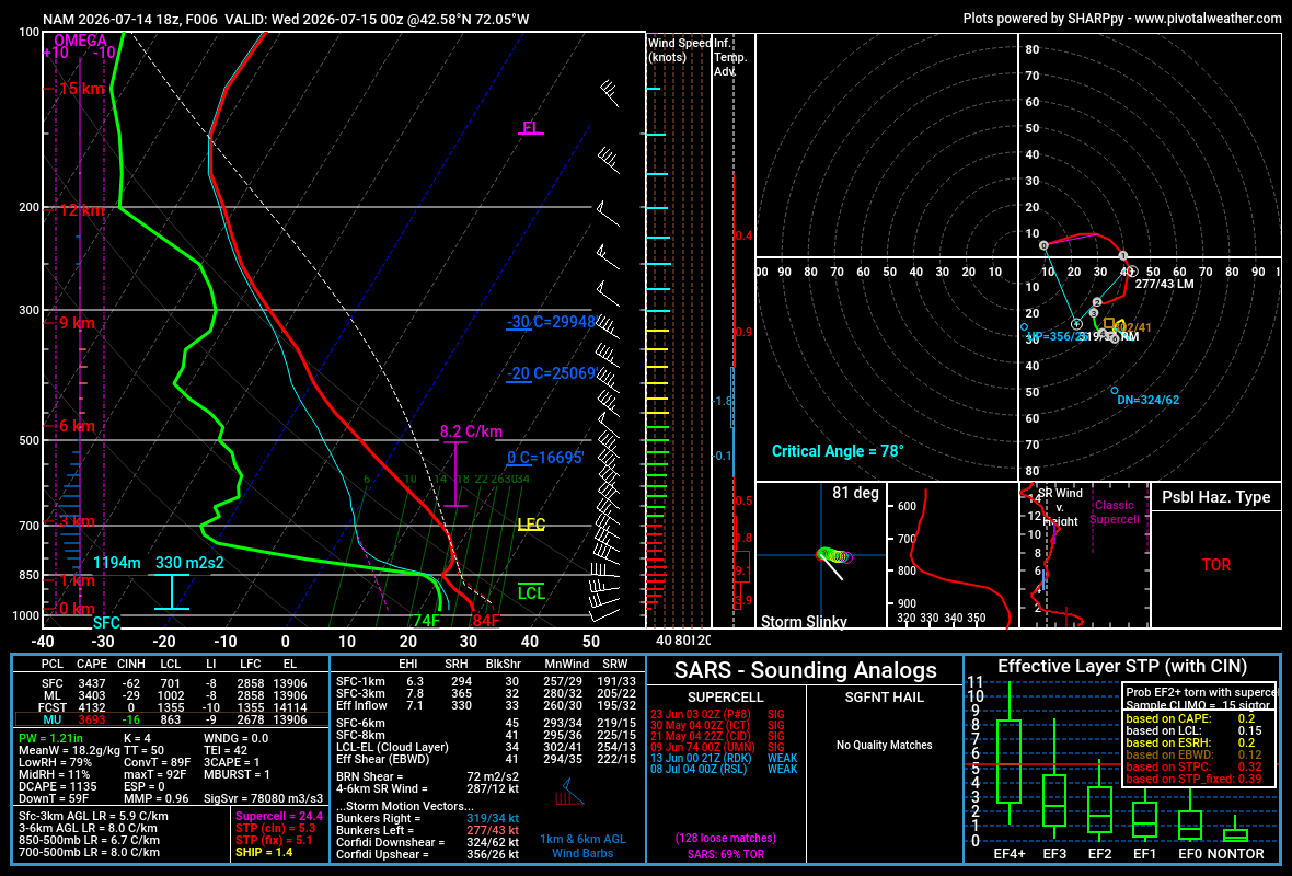
GEFS and EPS showing a cooler pattern coming up with highs near normal to below at times.. Hopefully it holds
-
Eerie yesterday.. but pretty neat. Hopefully we this more in the coming days.
-
Big storms rolling through vt right now
-
Tons of smoke in the sky now.. the sun looks awesome
-
Now off to the senate.. ugh wish we went to standard time though.. Reuters @Reuters The House of Representatives overwhelmingly voted on a bill to make daylight saving time year-round and end the twice yearly practice of changing clocks.
-
If only we had everything come together here lol

-
Ya its nasty looking.. tomorrow doesnt look any better now.. NWS Boston @NWSBoston · 10m Another plume of wildfire smoke is likely to shift southward into the region in larger concentrations Weds, some of it detectable at the surface. This will again limit temperatures while also bringing hazy skies and a hint of a smoky smell in the air tomorrow.
-
still 77 here
-
77/64 pretty meh considering today was supposed to be oppressive
-
Cloudy and some smoke around.. sun is trying to come out but cant.. maybe only upper 80s here today?
-
All these extreme heat forecast are going to go up in smoke today!
-
We wont get a heatwave here but still sucks Today Sunny and hot, with a high near 91. West wind 6 to 15 mph, with gusts as high as 26 mph. Tonight Partly cloudy, with a low around 73. West wind around 10 mph, with gusts as high as 24 mph. Wednesday A chance of showers and thunderstorms, mainly before noon. Partly sunny, with a high near 89. Northwest wind 9 to 13 mph, with gusts as high as 25 mph. Chance of precipitation is 30%. Wednesday Night Partly cloudy, with a low around 64. Northwest wind around 5 mph becoming calm in the evening. Thursday Sunny, with a high near 82. Light west wind increasing to 9 to 14 mph in the morning. Winds could gust as high as 28 mph.
-
We pray.. this is what we need!
-
Meh.. lets get a cat3 through SNE
-
lots of clouds with convection rolling through the central part of the state
-
please please let it happen.. I know many people here that don't think a Hurricane can even happen here.. the ones that do say it wont be bad even if one hit.. I honestly hope a big one hits soon!
-
We need this so bad.. I would love to.see peoples reactions around here.. I lost power for 10 days in 2011 and didn't bother me really.. that storm was beyond awesome.. once we started as snow and saw branches starting to sag.. i knew it was going to be something great.. almost constant shotgun blast living near the woods and seeing trees fall all over was awesome.. even had a tree on a power line catch fire.. i ended up calling it in and they said there was nothing they could do about it since they had so many calls. The neighborhood looked like a bomb went off the next morning.. Just a great experience overall and can't wait for another one..
-
Chigger?
-
Average high in Miles city is 90 though.. didn't realize that but still
-
It's 115 in Miles City Montana right now.. that's nuts!
-
The last time the city entered critical drought restrictions was in July 2024, when the Manchester Reservoir lost 7 feet of water over seven weeks amid drought conditions. Critical restrictions remained in effect for months afterward. Initially, officials believed the drought caused the severe water loss. It was later determined the loss stemmed from a valve connecting Orr’s Pond and Manchester Reservoir — Attleboro’s two main drinking water sources — that had been left open longer and wider than it should have been. The valve was open for nearly two months.
-
Missed a good downpour by a half mile earlier. It was pouring right down the road and by the time I got home it was dry.. looks like we might get a quick downpour now though