ineedsnow
-
Posts
22,756 -
Joined
-
Last visited
Content Type
Profiles
Blogs
Forums
American Weather
Media Demo
Store
Gallery
Everything posted by ineedsnow
-
 looks much much better now
 -
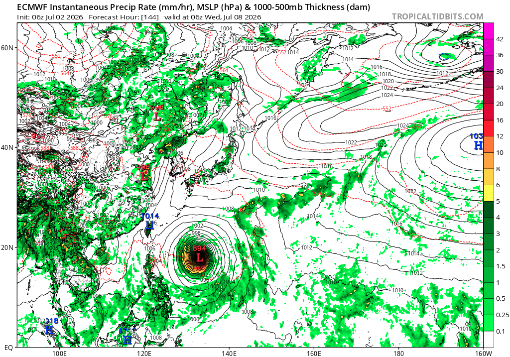
Could hit a island or Taiwan.. it would be nice to get a peak then.. btw for being a cat 5 right now satellite looks meh compared to what we usually see
-
160 mph now cat 5
-
Euro going wild with that Typhoon

-
Glad you and your friends enjoy sweaty balls and swamp ass.. enjoy
-
Found out why the ramp by rt2 was closed this morning.. some on the local forum saying lightning.. but the news doesnt show a cause yet.. https://www.wcvb.com/article/crews-battle-fire-at-auto-auction-lot-in-templeton-massachusetts/71804462
-
Not here but I think we're going to hear alot about this Typhoon in the coming days

-
That storm last night must of been fun.. I woke up towards then end of it but a bunch of small to medium branches down throughout town..
-
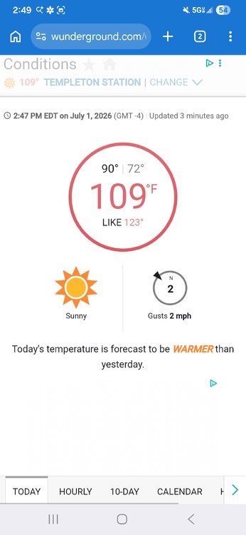
Templeton wins again clearly in the sun
-
Looks like its starting to turn a bit
-
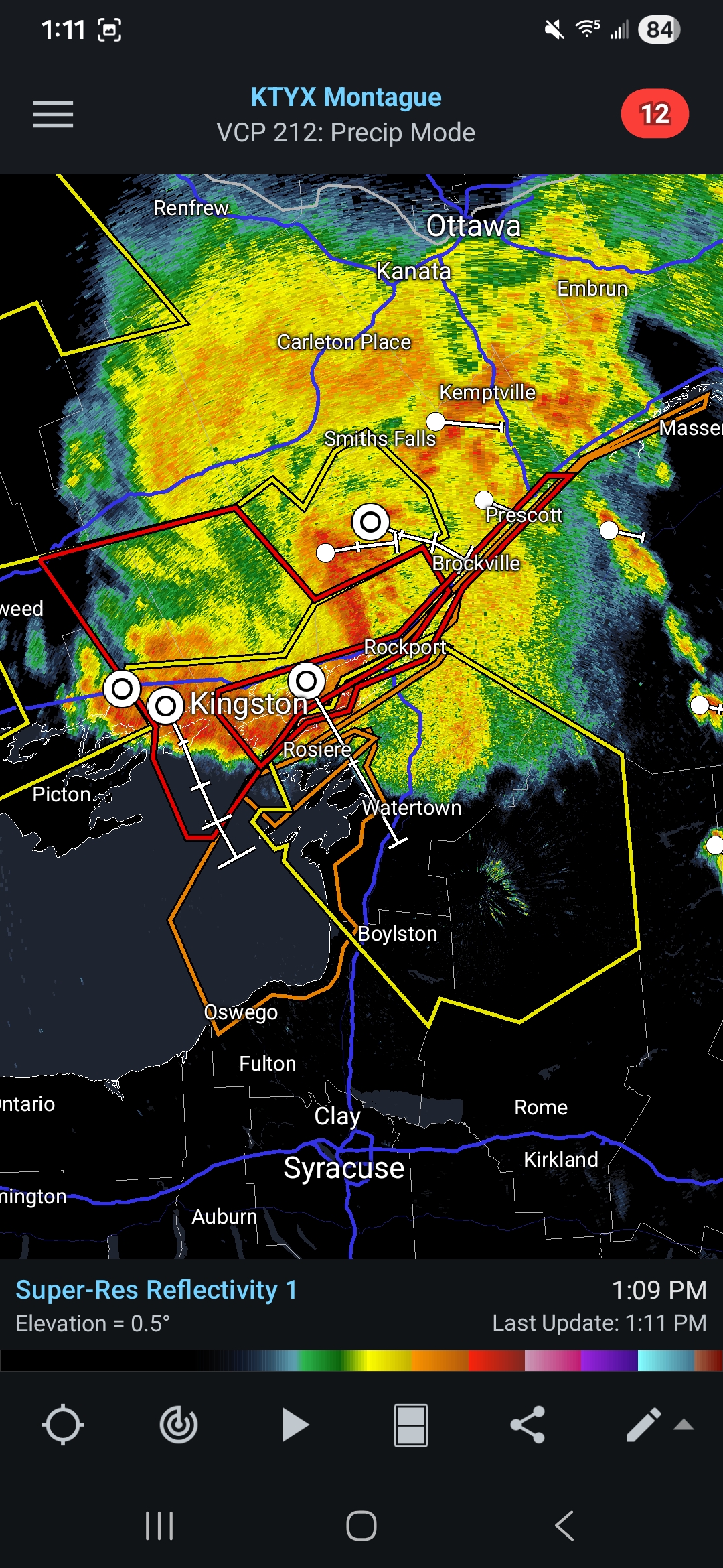
I watched a live webcam from Watertown but was pretty meh for the most part.. storms firing just west of here now.. hoping for something
-
Not sure why models are weakening this but sure does look good.. lots of tornado and severe warnings with it

-
I wish we could hit 100 here just to say we did it.. but not sure that's even possible
-
another quake video from the other day https://x.com/Breaking911/status/2071626498885206234
-
Haven't had a change in rates here
-
Electric rates are cheap here.. templeton light and power FTW
-
I remote start mine to cool it down
-
https://x.com/MaxVelocityWX/status/2071655454279680226 Impressive!
-
https://x.com/spann/status/2071707754075427175
-
Thats usually a good call any year.. I bet its really cold January 12th 2027.. or might have to wait until January 2028 depending on how el nino ends up
-
You always say big heat though so in Summer at some point you'll be right.. congrats though.. hope your swimming in ass sweat this week
-
Ya its kind of hard to be wrong when you always say big heat.. its kind of like me saying its going to be cold all the time and then it eventually happens
-
-
I'm willing to be you got all giddy posting that
-
Outflow boundary by Paxton Holden.and Spencer?