Ed, snow and hurricane fan
-
Posts
2,133 -
Joined
-
Last visited
Content Type
Profiles
Blogs
Forums
American Weather
Media Demo
Store
Gallery
Everything posted by Ed, snow and hurricane fan
-
 Inlaws had a portable generator but only a day's worth of fuel and everything was closed yesterday. They are in Buda, we are by DFW airport. May be here for a day or three more.
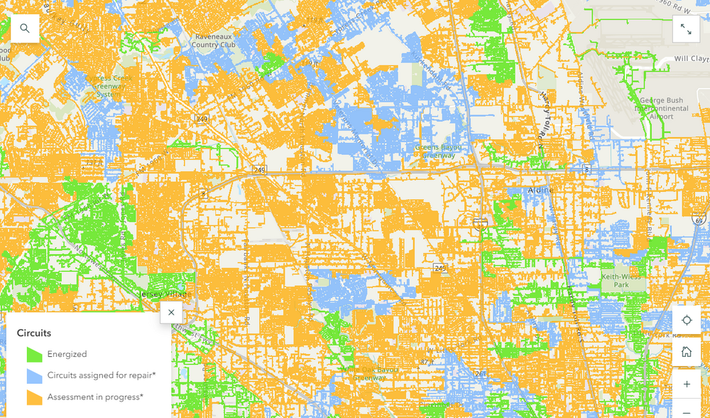
-
Texas 2024 Discussion/Observations
Ed, snow and hurricane fan replied to Stx_Thunder's topic in Central/Western States
In Bedford, in the DFW Metroplex. I've become habituated to air conditioning. Some neighborhood roofs lost shingles, fences blown down, but not as bad damage wise as Ike. Ike was mid-September and it wasn't hot, however. -
In Bedford, TX. They have electricity here. No idea when power is back, we'll probably head back when customers w/o power drops but it looks like about a third that lost power is already online. A little generator is about $400 apparently. We'll buy some box fans as well for next time.
-
Power has gone out a few times. Windy and raining
-
Northern eyewall or eyewall feature is almost onshore, the window to strengthen has closed. But winds near hurricane force are well to the E of the center. Local TV in Houston suggesting winds 50 to 74 mph in Harris County, that doesn't twist and buckles the big steel truss transmission towers like the May tornado/derecho event did, but widespread wind gusts above severe TS levels to near hurricane force will cause some power outages.
-
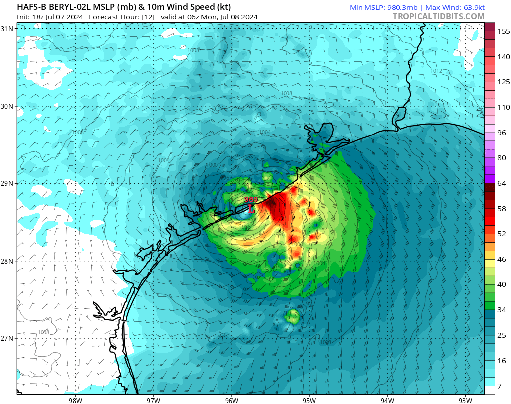
It would now need to come due N or even NNE to landfall Galveston. As spread out as it is, the island would max out on winds with a landfall nearer Port Jackson, though even that requires a turn due N almost immediately. Sargent seems as good a place as any for landfall. I suspect it does start to deepen quickly, but it has enough time to get low end Cat 2, looking at HWRF, which shows the upper bound. HAFS have ot on the brink of Cat 1. Minimal Cat 1 is probably the way to go. There'll be flooding, but not as bad as Imelda or beta, or even close to Alison or Harvey.

-
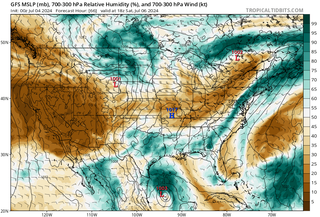
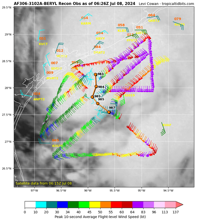
80*F dewpoints at 5 pm isn't usual. That is a 7 am dewpoint. We almost always mix below 75*F. GFS gets Houston very close, Euro gets us right to 3 inch PW. That is impressive. Glad to see a NOAA flight that hasn't turned around before making a center pass. The reliability of the planes over 50 years old is getting suspect.
-
If I read it correctly, the next recon won't even be sending data back until sometime around 11:30am CDT. I think the 50 year old NOAA plane had a failure, it didn't spend long in Beryl. Even so, 12 hours between center fixes on a storm a day from US landfall is actually kind of sad. NHC can't help the NOAA P-3s from the Viet Nam era can't fly anymore, but they maybe could have at least scheduled staggered flights between the less than 20 year old USAF planes and the decrepit NOAA planes. The good news is, Beryl at worst makes it to Cat 2, and Texas can handle that, more or less. In a 20+ NS season, a storm a little over a day away from US landfall in ASO might be stronger than that.
-
NOAA plane has an extrap 992 mb pressure. Just looking at 12Z and 18Z models, Corpus Christi to Matagorda Bay seems the target. A hint of a SW shift in the models after the models were generally chasing N shifts for a week. I assume warming clouds tops are associated with DMIN, I wouldn't expect much increase in strength or organization until deeper storms fire up again.
-
Just by the science, what Beryl did 4 or 5 days ago in the Caribbean in no way influences what it does now. Beryl is not a sentient thing that learned the value of hard work in the Caribbean and will therefore defy the models and become a major hurricane. That isn't how physics work.
-
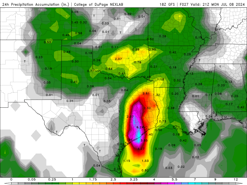
It seems it took both shear and land to kill it. No reason not to think it won't eventually reorganize, high res hurricane model suggests a TS or Cat 1. I wouldn't rule out a category higher, although SHIPS doesn't show mid-level RH getting over 60% and a landfall strength right at a minimum Cat 1. Looks like trend N has slowed or stopped. Heaviest rain missed the Hill Country per GFS, Lake Travis looks to remain 40% full or about 500 feet low.
-
I'm glad they listened. Near 1000 mb, it will take time for it to strengthen.
-
KTRK 13 Travis Herzog showed a forecast model he suggested was AccuWeather proprietary and not available online that through 48 hours showed the center of Beryl just N/E of the right side cone and perhaps turning enough to actually miss Houston to the E. He stopped the model, I think to avoid hype with a system outside the NHC cone.
-
I was typing Windspeed's comments almost verbatim when he posted. I think the hurricane watch comes further N, just seeing most Euro ensembles are W of where the center appears ready to emerge, and where the op Euro and the center of the spread is. I was expecting the San Luis Pass breakpoint, the county line between Brazoria and Galveston counties. Based on Alberto covering Galveston island outside the Seawall, the surge product should have also been further N. EDIT TO ADD: Euro verbatim being sustained TS force winds into Galveston Bay and the Bolivar Peninsula.
-
Eye is finally gone but satellite still shows a fairly organized low which is getting close enough to open water to probably not weaken much more. If it hits water now, it still looks like it might have enough organization to need less than the expected day to organize enough to start deepening again. The difference between TCHP and SST pops up if something like the HWRF crawling offshore comes close to happening. The width off the offshore shallow water widens heading N on the Texas Coast from Deep South Texas. Data buoy 22 nm E of Galveston is cycling between 87 and 90°F, but the water is only 16 meters deep there. A faster storm wouldn't have much time to upwell that much, a slower system will react to the warm water being churned. That larger shallow water, OTOH, adds to surge.
-
Somewhere along the Laguna Madre of Texas as possibly a Cat 2 making a run at Cat 3 intensity would be a nice consolation prize.
-
He would have had to pick the right island and then get there before the airports closed. Jim Edds did it, it isn't impossible, but he played the probabilities and didn't win.
-
Isidore stalled over the Yucatan, the reason it weakened so much. After it finally came back over water, the inner core could never rebuild as the storms away from the center kept inflow from reaching the center. But the idea of a disrupted core having issues reorganizing as the hurricane models may suggest is possible. Coastal convergence just before landfall does seem to help Beryl intensify just before landfall.
-
Track across Yucatan is just S enough it doesn't short cut any of the land. Recon still looks much more like W than WNW, NHC 275* seems correct.
-
His job is tropical forecasting for private clients and he doesn't have to hedge his bets in the interest of public safety. Re: ATL: BERYL - Hurricane - Discussion #2420 Postby wxman57 » Thu Jul 04, 2024 12:30 pm Don't read too much into wobbles. Should track south of Cozumel (maybe not too far south) and make landfall south of Brownsville. Of course, the key will be how much the core is destroyed over the Yucatan tomorrow. If it's really torn up, then a farther south track is likely. HAFS-A and HAFS-B shifted south to near Tampico. Levi has a new video just published: https://www.youtube.com/watch?v=NpC6Z_OCI-0
-
Wobble or trend? Satellite and Cayman radar seems to be showing movement almost due W,
-
All the hurricane models, GFS and Canadian show weakening to a strong TS or Cat 1 before Yucatan landfall, and little restrengthening back over the Gulf of Mexico. Satellite continues to degrade. Shear in the Gulf doesn't look horrible, but I assume there isn't enough organization to allow much strengthening until just before landfall/ GFS and Canadian both suggest dry air is still close to the core.
-
Hurricane force winds at FL well N of Jamaica.

-
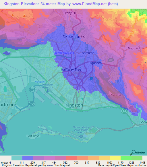
See my post about very steep terrain, several hundred meters elevation change in about a 1 km distance in the hills not far N and E of the city center. I suspect that is where many of the poor live. The gusts at 200 or 300 meters will be rough. Inland will see very heavy rain.
-
I don't know how to get more than once an hour obs from Kingston, and I'm not sure if the hurricane force 58 knot gust was the highest recorded that hour. Airport, like many, is close to the ocean, gusts in the city may not be that high, but no reason to think the hills N and E of the city. EDIT I don't see a distance scale, but that runway is 2.7 km per Wiki, or the increase in elevation in short distances on the E side of the city is large.