MN Transplant
-
Posts
17,813 -
Joined
-
Last visited
Content Type
Profiles
Blogs
Forums
American Weather
Media Demo
Store
Gallery
Everything posted by MN Transplant
-
Keeps Friday near freezing, maximizing our cold chances into the weekend.
-
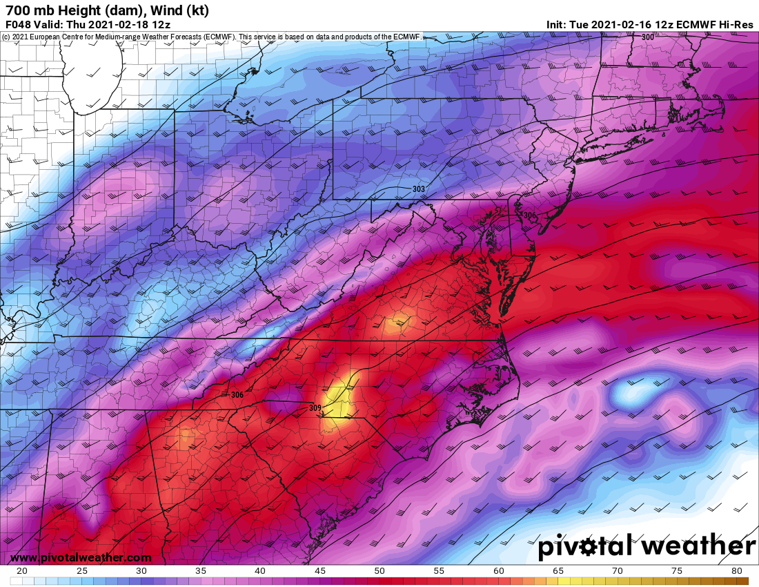
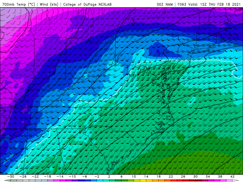
One of these things is not like the other. One of these things (hopefully) doesn't belong.
-
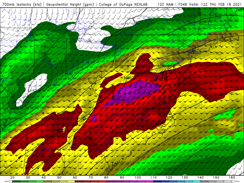
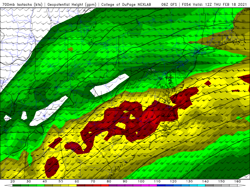
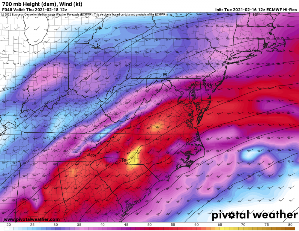
This is still a wild difference at 700mb. 12z NAM and 06z GFS for Thursday morning.
-
It is lighter, but we do get back into some frozen later in the evening also on the NAM.
-
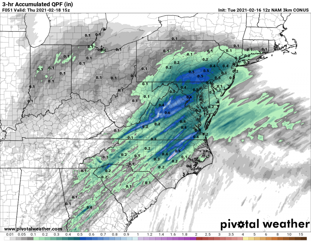
This is 3hrs of pounding sleet in DC on the NAM 3k
-
Well, we've taken a step backwards on the 3km. No front-end thump.
-
NAM is mid-20s at the surface during the morning quick hit of snow.
-
Lost the column by 15z in DC, but at least some front-end snow.

-
Feb Long Range Discussion (Day 3 and beyond) - MERGED
MN Transplant replied to WinterWxLuvr's topic in Mid Atlantic
There is lightning showing up tonight SW of Richmond. -
Feb Long Range Discussion (Day 3 and beyond) - MERGED
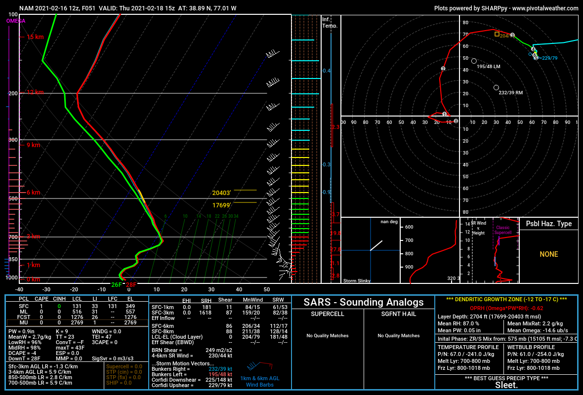
MN Transplant replied to WinterWxLuvr's topic in Mid Atlantic
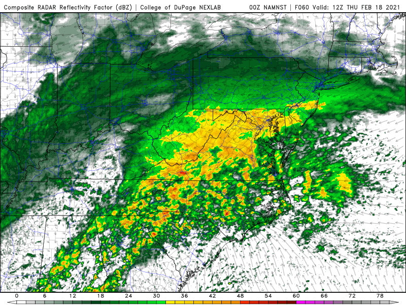
3k NAM. This is the sounding at DCA (top) while the sim radar looks like that (below).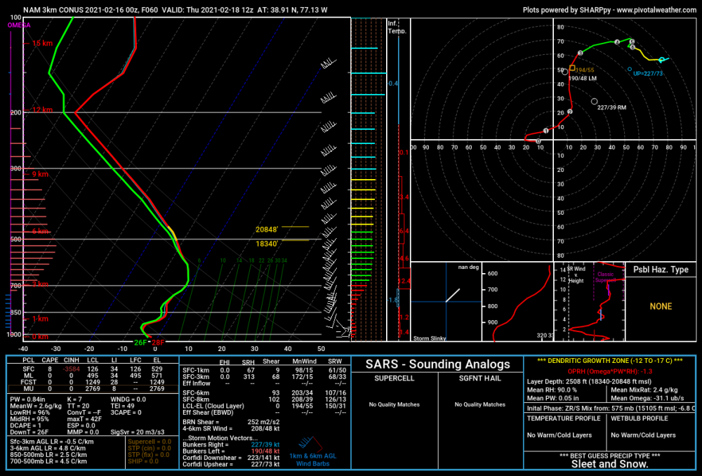
-
Feb Long Range Discussion (Day 3 and beyond) - MERGED
MN Transplant replied to WinterWxLuvr's topic in Mid Atlantic
The 3km is a front end thump DC and north. Nearly 0.3” in 3 hrs, apparently snow and 28-29 degrees. -
Feb Long Range Discussion (Day 3 and beyond) - MERGED
MN Transplant replied to WinterWxLuvr's topic in Mid Atlantic
15z on Thursday - 90kts at 700 blasting through on the NAM. Not so much on the GFS.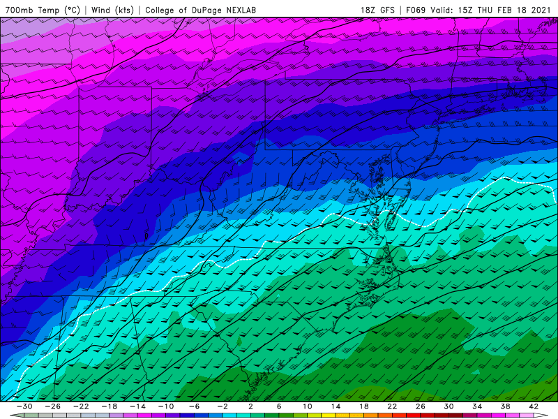
-
Feb Long Range Discussion (Day 3 and beyond) - MERGED
MN Transplant replied to WinterWxLuvr's topic in Mid Atlantic
Absolutely wild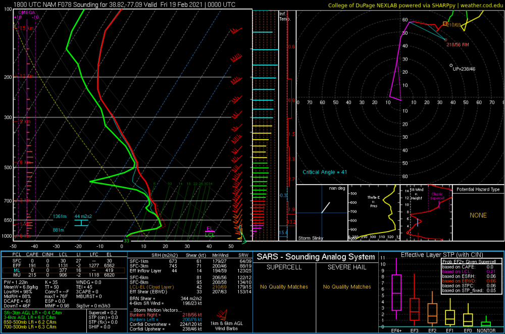
-
Feb Long Range Discussion (Day 3 and beyond) - MERGED
MN Transplant replied to WinterWxLuvr's topic in Mid Atlantic
The NAM is strengthening the primary in Ohio. That’s not what we want. -
Feb Long Range Discussion (Day 3 and beyond) - MERGED
MN Transplant replied to WinterWxLuvr's topic in Mid Atlantic
Lol. DCA ~6hrs into precip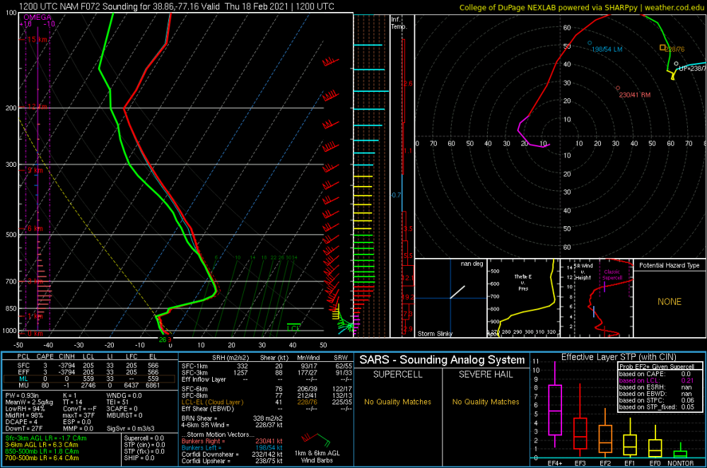
-
It is a convective band that is pouring snow. Fantastic.
-
Both the Atlantic and the Apps. Expansive cold air outbreaks are often shallow.
-
It is colder in Houston right now than it has been at DCA for years. This is amazing stuff.
-
Snow and blowing snow at DFW right now and 11 degrees. Wonder what is the last time DCA had an ob like that.
-
I’m always skeptical of those obscene ratios unless they are doing a snow core measurement. If they are comparing to a heated ASOS bucket I toss.
-
Feb Long Range Discussion (Day 3 and beyond) - MERGED
MN Transplant replied to WinterWxLuvr's topic in Mid Atlantic
Everything? -
0.41” precip. That is a ton of frozen. Skating rink on the sidewalks out there this morning.
-
There are 400k Dominion Energy customers in Fairfax County. One poor sap is without power right now.
-
Sure enough, sun went down and it all froze up nicely. There is the faintest breeze, and you can hear the trees crackle. 27.3 and freezing drizzle.
-
Just took a walk with the dog. Sidewalks greasy but not slippery, if that distinction makes sense. There is a glaze on all elevated surfaces, but nothing significant. Maybe 1/8”. This would have been a big deal if it happened overnight. 29.2