

MN Transplant
-
Posts
17,625 -
Joined
-
Last visited
Content Type
Profiles
Blogs
Forums
American Weather
Media Demo
Store
Gallery
Everything posted by MN Transplant
-
I think we all need to be realistic about the situation post-storm also. It doesn't seem to matter which model, but the cold air does not rush in quickly behind this storm. If it does snow along 95, it is going to drip-drip-drip on Monday. This is a storm where we enjoy the front end and then move on to looking for the next one.
-
ICON looks ok. 500 low effectively tracks over DC.
-
Ah, crap. That's right. We really want to avoid this:
-
Where was the 500mb low passage on the 06z Euro? We desperately need to keep that south of us like the 00z Euro and 06z ICON have. The GFS/CMC solutions are bummers.
-
It isn't exactly like the event has disappeared. It is still an impressive storm, even if many of us are going to see snow-to-rain.
-
You are super wrong about the current forecast models, but you do have some support on the analog side. There are groups out there that are experimenting with machine learning using a trained data set (the analogs). It’ll be interesting to see how that works out.
-
Temp is near 50 in La Plata during the low passage.
-
Persistance!
-
Predicting the HH GFS. We are in full weenie mode now.
-
28 at 2pm. Below freezing looks like a lock, below 30 is very much still possible.
-
977 lol
-
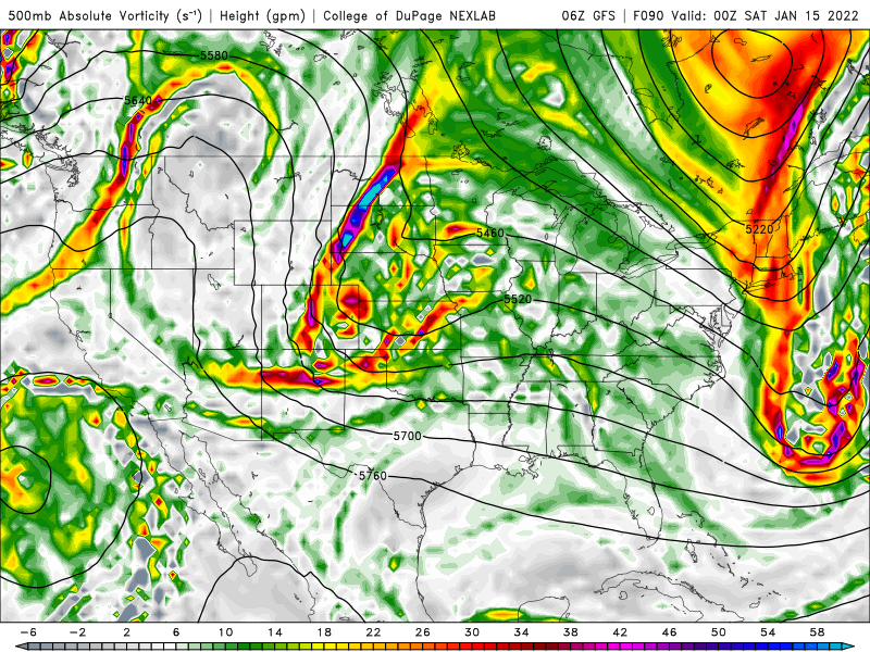
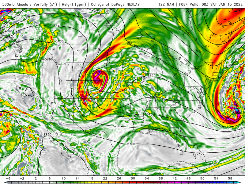
They got there in slightly different ways, but closed low in Mississippi with a near neutral tilt on both the GFS and Euro at 126.
-
Amazing how positively tilted it is. Digs a bit further south than the GFS.
-
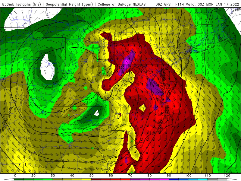
500mb is closed off at 84 in NE/SD.
-
dogs and cats living together, mass hysteria! (out to 12 on Pivotal)
-
Will be really interesting to see if the Euro closes off the 500 low on this run. The other globals do and the NAM (lol) looked like it was headed that way.
-
-
We had a couple of cold days in 2019. 21 was my lowest daily high, and 6 was the low. The 2020 and 2021 Januarys were straight torches, however.
-
Hands down the August 11th microburst in the NW DC Beltway. 59mph on my anemometer before we lost power and the best gusts came through. 6+ houses within a few blocks hit by trees and uninhabitable. More damage than the derecho locally. I’ll give a runner up to the Arlington tornado.
-
That is wild.
-
Tomorrow's highs look quite cold, the lows are not as impressive.
-
Mid-Atlantic winter 2021-22 snowfall contest
MN Transplant replied to PrinceFrederickWx's topic in Mid Atlantic
If it comes down to us, there are going to be some pissed weenies that this pattern delivered zilch. -
-1 point differential and 8-9. They are who they are. Zimmer firing probably gets announced tomorrow.
-
I’ll officially be down to a T on the ground tomorrow morning. 43 and steady rain.
-
Not ZR, but tomorrow unfortunately looks like a snow eater. NAM is 40 and rain and the HRRR takes DC to the mid-40s prior to the front. Hoping the wedge holds more than that, but I’m not encouraged.


