Modfan2
-
Posts
3,339 -
Joined
-
Last visited
Content Type
Profiles
Blogs
Forums
American Weather
Media Demo
Store
Gallery
Everything posted by Modfan2
-
90 here in S FL, not sure I could handle 50 with windchill in the 40’s
-
How can I find last 3 week rainfall in SNE?
-
Dry begets dry
-
How much did you get Wednesday?
-
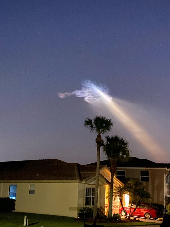
Space X launch from my driveway this am.
-
I like this time of year to listen to the Fire Towers in Mass, trying to triangulate Fire locations old school style by site lines
-
Little concerning for some with winds back up this weekend
-
7/10 split, Looks like southern ORH county into NE CT Steined
-
Dry begets dry, almost time for Stein talk time.
-
Below is a recap by one of the people staying on the fire side of the inn I want to start this by saying, it’s true you never know what you would do in this situation until you’re in it. My biggest fear has always been getting caught in a fire. Unfortunately, that fear became a reality that I’m still trying to wrap my head around. All I want to say at this time, is that Paul Bevis quite literally saved my son and I’s lives. We had fallen asleep for a nap before heading out to the water park for the second time today and if it wasn’t for his phone alarm going off to wake us all up for the water park, who knows what would have happened. We woke up to the room full of smoke. The smoke detectors failed to go off and sprinklers failed as well. Paul went to check to see if we could escape the room through the hallway and as soon as he opened the door, the room immediately was englufed in black smoke to the point it was choking us. We ran to the balcony and saw that the room to the left of us and as far down as we could see through the smoke, all of those rooms were on fire as well. The only way to go was right but there were dividers to separate each rooms balcony. I grabbed Kellan and told him he needed to army crawl under each one as far as we could because the fire was spreading our way. We needed more time and more air. So we crawled under about 3 or 4 before we hit a concrete wall instead of a divider; we couldn’t go any further away from the fire. By this time, a family with a wife, husband and their two boys were with us trying to find a way down. It was too high to jump from the 3rd floor to the ground. Paul Hurled himself over the railing (til my last day I will NEVER understand how he did what he did) and swung himself to the balcony below us which was the main floor of the hotel. He then told me to hand him my son to get him away from the flames, heat and suffocating black smoke. I Handed Kellan to Paul & Paul RAN my son to safety out an emergency exit while the women handed one of her sons to her husband who had done the same as Paul. Meanwhile myself and this women and one of her sons are still trapped trying to fight the smoke. Paul then comes BACK (after fighting through someone trying to stop him from running back into the burning building) and helps this women and husband save their second child. Once the husband got his children to safety, Paul had told me “YOU NEED TO JUMP!” And I froze terrified. Screaming I couldn’t because I wouldn’t make it. I couldn’t angle myself how he had to make it to the second floor balcony. I heard Paul once more and then a fire fighter (who had come to the front of the building on the first floor) and they screamed “YOU NEED TO JUMP NOW”. Right as he said it, there was an insanely loud crashing/exploding sound and I just jumped. Paul managed to grab me BY MY ANKLES and swung me on to the second floor balcony where he was. I knocked out for half a second and woke up to him about to drag me to safety. I came to and my first thing out of my mouth was “WHERE IS KELLAN” and I jumped up. Paul took off down the hall forgetting he had given Kellan to the staff member at the emergency exit prior to running back in. I saw Paul go left towards the exit screaming for Kellan, so I went right to cover more ground looking for him. I made it about one hotel room over before the fire was back in my face and the smoke was making it impossible to see. I turned back to the emergency exits and booked it down the hall running outside screaming “has anyone seen a five year old boy”. By the grace of God, Paul had my son wrapped in his arms.. I will NEVER be able to repay this man for his heroism and bravery. He saved not only my life and my sons, but another woman’s children as well. We may have lost everything in that fire, but we did not lose our lives and that is entirely thanks to this man. I don’t know many people who would run back into a burning, collapsing building to save us, but that is EXACTLY what he did. I know he doesn’t want recognition for this, but it’s not every day that you save multiple lives from dying by being trapped in a fire. I know everyone is going to reach out and check in, that is why I wanted to put exactly what happened out there now so I don’t have to explain it over and over. But more than anything, I want everyone to know that my boyfriend is an absolute hero and I would quite literally not be alive to write this had he not acted as quickly as he did. Kellan was treated at the hospital for smoke inhalation. His carbon monoxide was 12 ; normal levels for a kid are between 0-5. Thankfully, he was released a few hours ago after a long night of getting those levels back to where they need to be. Now it’s just fighting the nightmares and the flashes that play as we close our eyes.
-
Looks like elevated Fire weather the next few days with the wind and not much rain from yesterday.
-
Outside Indianapolis visiting family for Easter and woke up today to a nice coating of snow; back to the warmth of FL later today.
-
Don’t worry, when DIT is pulling in 3-5” of cement he’ll say he was knew it was coming all along.
-
Doesn’t matter; same down here in S FL. Problem where I am is all people moving south and those moving out of Miami/Dade, Broward counties moving north putting squeeze; I could sell but where am I going?
-
Here are some good new 80’s like bands for @Cold Miserand myself
-
Yes, they played the Worcester Centrum on that tour
-
-

March 2022 Obs/Disc: In Like a Lamb, Out Like a Butterfly
Modfan2 replied to 40/70 Benchmark's topic in New England
Lock it!! -
March 2022 Obs/Disc: In Like a Lamb, Out Like a Butterfly
Modfan2 replied to 40/70 Benchmark's topic in New England
Top 10 weekend here in S FL, no humidity, lows in the low 50’s; high of 78-79 with a light breeze; doesn’t get much better. Days and days of humidity coming with highs in mid 80’s and low 90’s -
March 2022 Obs/Disc: In Like a Lamb, Out Like a Butterfly
Modfan2 replied to 40/70 Benchmark's topic in New England
RIP Taylor Hawkins -
March 2022 Obs/Disc: In Like a Lamb, Out Like a Butterfly
Modfan2 replied to 40/70 Benchmark's topic in New England
Yup, top Five and a probably Ace’s best solo -
March 2022 Obs/Disc: In Like a Lamb, Out Like a Butterfly
Modfan2 replied to 40/70 Benchmark's topic in New England
-
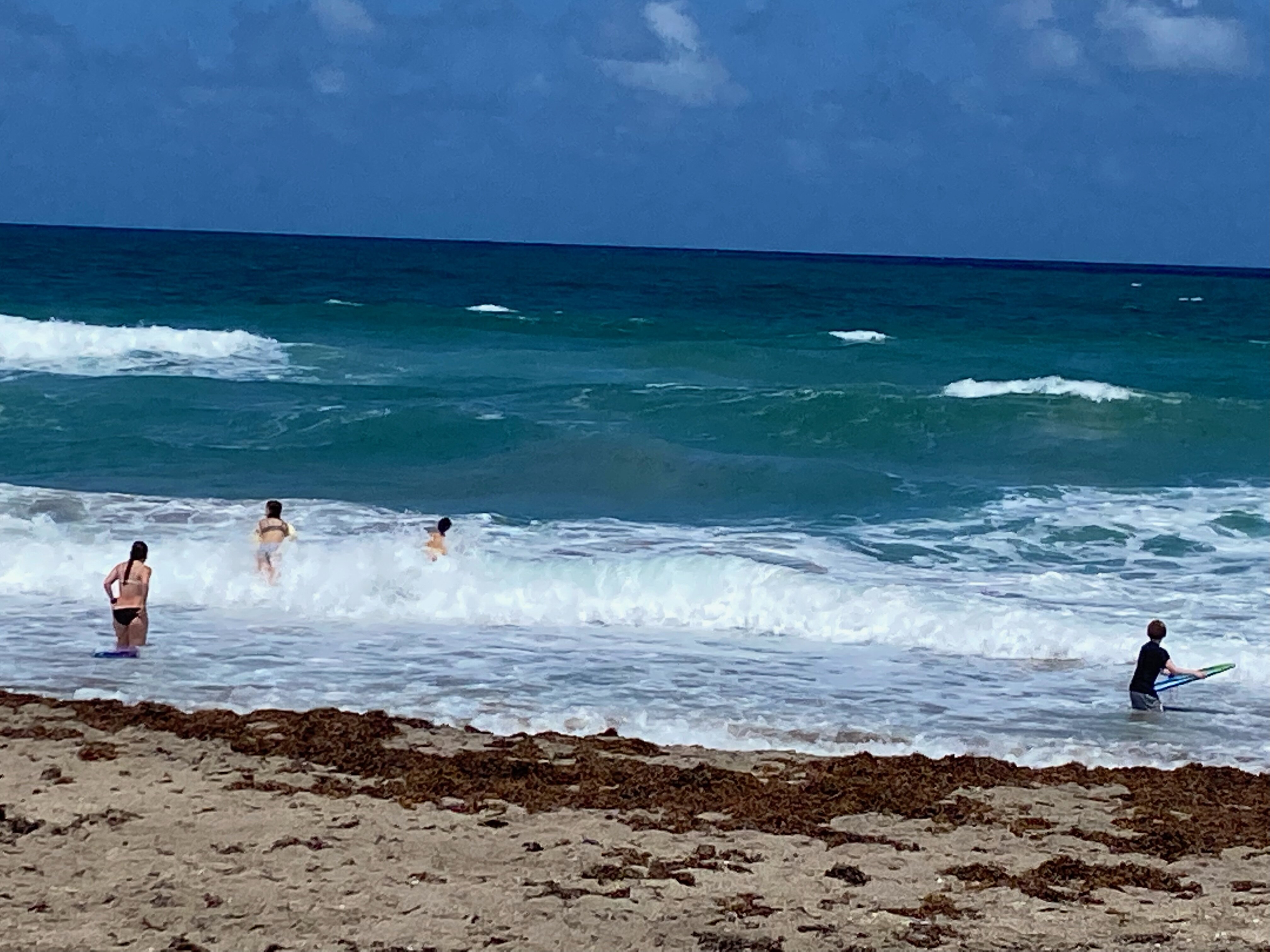
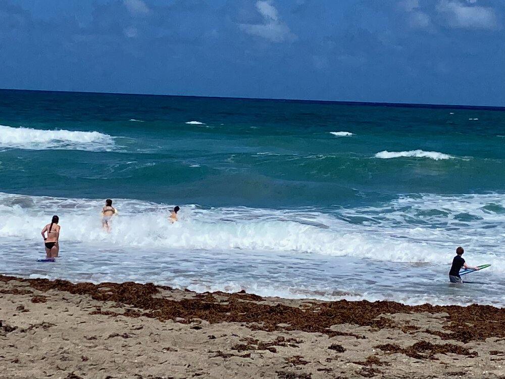
What’s the best radar setting for hail? About get hit with 1/4 size hail
-
You should flip soon
-
Yeah, but sunny and 80 with the occasional front gets boring to track