

Modfan2
-
Posts
3,344 -
Joined
-
Last visited
Content Type
Profiles
Blogs
Forums
American Weather
Media Demo
Store
Gallery
Everything posted by Modfan2
-
 It’s been consistent with a back door like cold tuck in Emass
 -
Tip starting a thread has been the kiss of death this season for SNE.
-
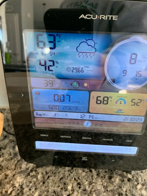
Bottoming out at 46F this morning.
-
Fully expecting down here a cold rain which is fine by me; wash any residual sand or salt from the roads and ready for Spring!
-
Like Ronnie James says It’s like Heaven and Hell
-
Rain here, shocker! See if it trends cooler by Thursday to get me some sleet. Currently 23F here.
-
How does it look for us in the tropics south of the pike? Lol
-
Yeah, only kidding and complaining about the rain we got.
-
What streak, 6” of rain lol?!
-
The baffling part for someone who works around tech everyday is how is the modeling so off or are we putting too much stock outside of 5 days? The cold snap two weeks ago was probably the best modeled event of the season. Does anyone track model consistency for each event to see which is closest?
-
Given this winters track record this will not materialize
-
Really starts to get hot in May; once the Dew point stays above 70 until October
-
21F and crisp here to start
-
The only people who root for Hurricanes are ones that haven’t been through them!
-
I’d take that!!
-
When’s the forum GTG Brewery crawl?
-
I think so
-
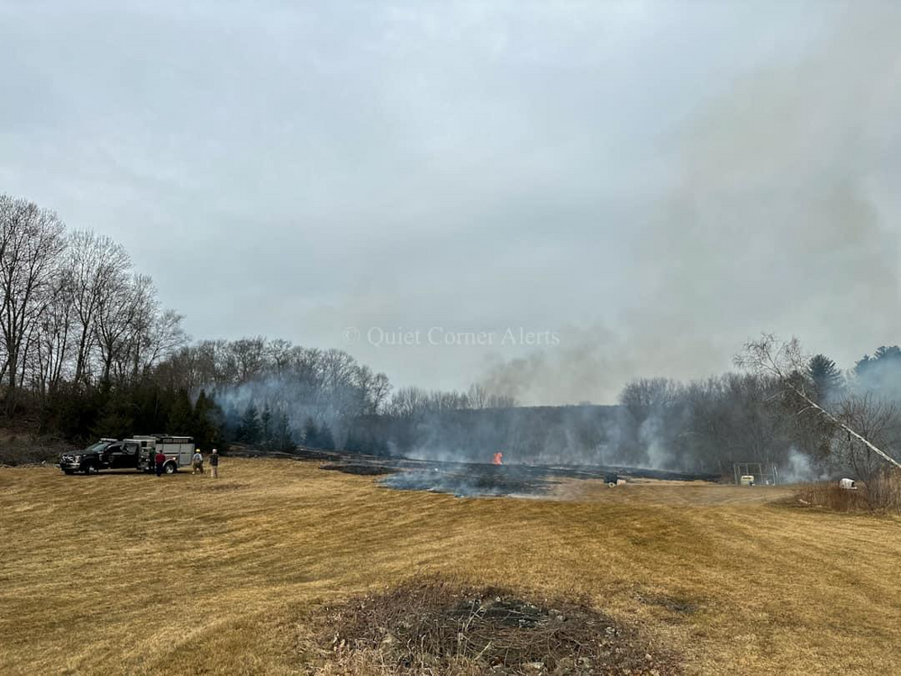
I was there, about 2.5 acres, someone burning brush and got away from them
-
64F and filtered sun here in Brooklyn CT
-
60F and breezy here in Brooklyn.
-
What time frame, next Thursday?
-
Been doing that all winter LR; based on models I’d be basking in Epicosty but we are not and I am fine with that. Would be nice to see a good storm or two before the seasons out but won’t be surprised if it doesn’t materialize.
-
Surprised we haven’t done a GTG there
-
We dry!
-
Plenty of mud here, part frost and part of 6” of rain from January


