Gino27
-
Posts
556 -
Joined
-
Last visited
Content Type
Profiles
Blogs
Forums
American Weather
Media Demo
Store
Gallery
Everything posted by Gino27
-
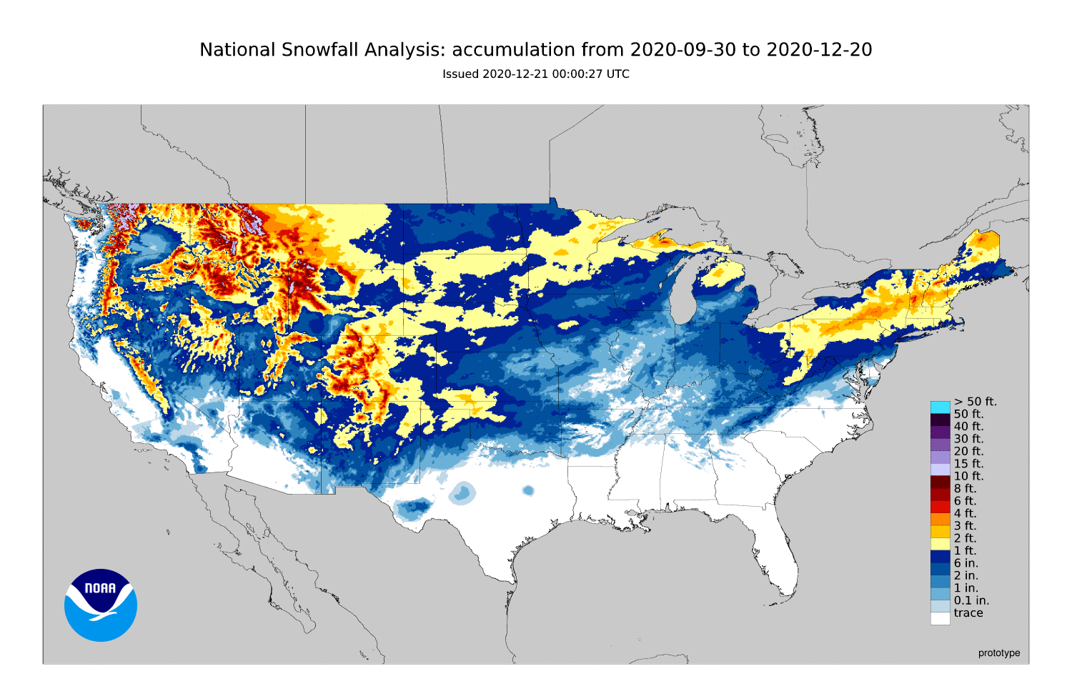
Outside of NE Ohio it's still been relatively weak here. I've measured just north of 4" here NW of Columbus. Sure we've had more action but it's nowhere near what some of y'all are portraying it to be.

-
How exactly does one "sacrifice" a storm? Given that you all to the west get more snow than me, with the exception of the first month or two of this season, you all certainly deserve it. But whatever happens is what happens.
-
Most of the sub hasn't had much... so yes.
-
Love you too
-
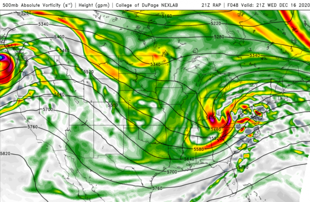
Interestingly enough, IWX's AFD seems to support something frontal. I think what's tripping a lot of people is that the 500mb pattern is a more conducive to what they outlined in their tweet. Time will tell...
-
NWS offices and numerous mets don't like the idea of there being a primary low up north with a secondary maybe forming over the apps like the models have. Maybe models will sort themselves out over the next few day.
-
I 100% agree. Twitter seems to really be down on it too. It's still a blob out on the middle of the ocean.
-
There's some nice things to like about it, mostly the very very cold air it has to work with. I worry it'll be too fast and a bit too warm. Hopefully we can get the trough to go negative a bit earlier like models had, and might be trending to.
-
2.8" so far at CMH. New daily record. Old one was 1.8"... easy one to beat.
-
Maybe. Pockets of it seem to be intensifying too. I measured about an inch a while ago so hoping it keeps going.
-
It's ripping right now but coming to an end soon. Very quick 1/2 inch
-
Might get "saved" by the stuff coming out of the south. High res models had it picking up some moisture but it'll probably fall apart like everything else. LOL!
-
Oof. Major dry slot totally screwing me in Union county. Not even a dusting. Just drove around the north end of I-270 and it was dumping with huge flakes. Looked like more than an inch for sure.
-
Wooohooo! Looks like some of us get a big beautiful dry slot to start the morning. In all honesty It wasn't really supposed to get started this early so I have no worries.
-
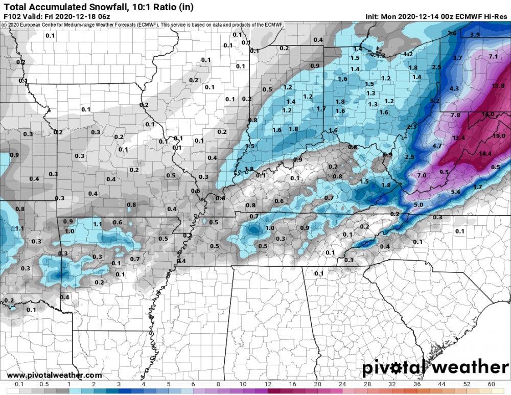
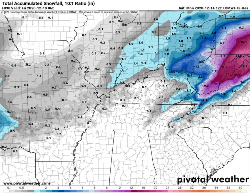
I'm thinking 1-3 across most of the Columbus area, but 3 is probably a stretch and would depend on whatever weak deformation we can squeeze out. It's nice to at least be tracking SOMETHING after last year.
-
I didn't know this was where all the Ohio folks hung out. Tomorrow looks like a nice thump for eastern OH and an inch or two for everyone else unless we get lucking with back end or something.
-
Sorry ¯\_(ツ)_/¯ ... I still don't like the way it has that gap between western and eastern ohio. Keeps looking better on vort and euro had a similar look. Might be a sneaky good system.
-
Well I'll be damned
-
Reminds me of a surprise 4-5 inches I got ahead of a big NE storm in 2018. High res models were the only ones to pick it up and not until about 36 hours out.
-
-
Possibly yeah. Will probably depend on what radar shows the day of honestly. I will have to deal with pretty rough temps and mixing with rain unfortunately.
-
Like @StormfanaticInd said, I'll gladly take this. A a few more ticks west and this ain't bad at all.
-
Could be my climate where I get small dogs at the consistency of big dogs. Coming up on 10 years since my last 10+.
-
With something like this I'd much rather be where you are. Lots of these systems leave a dead zone from about I-71 to Pittsburgh.
-
I will likely get screwed by the transfer and only pick up a dusting. Unless of course there's a big time trend either east, or west in which I get the edge of the main event or the pre-transfer.