Gino27
-
Posts
556 -
Joined
-
Last visited
Content Type
Profiles
Blogs
Forums
American Weather
Media Demo
Store
Gallery
Everything posted by Gino27
-
Good luck guys. I think this is yours.
-
3” here north of plain city. It’s even still coming down. I can’t remember an overachiever like this in awhile.
-
Snowed good for 20 mins here north of Plain City. Back to just pixie dust. Dry air is gonna ruin the party again for us west of Columbus.
-
Near Plain City. Looks like I’ll be in a dry slot for hours. Ugh!
-
Snowing pretty hard now. 24 degrees at the surface but still mixing some. Hopefully it keeps this up.
-
Well... there's this. Idk if I've laughed this hard in a while.
-
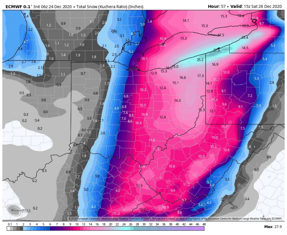
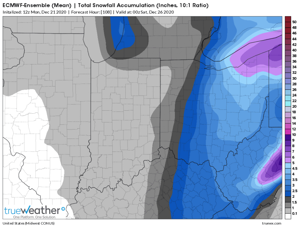
euro casually bumps west big time. Doesn't matter since the event is essentially underway but ig there's hope for Columbus.
-
It’s too bad it has to be mostly frontal. When I hear low running west of the apps I think big time snow.
-
Someone has to get screwed with every system. Shame it’s been our side of town for all three so far.
-
I spoke too soon. <1" for me now...

-
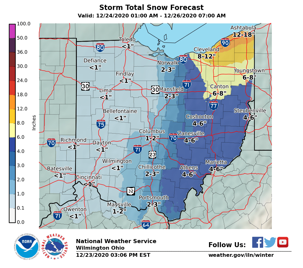
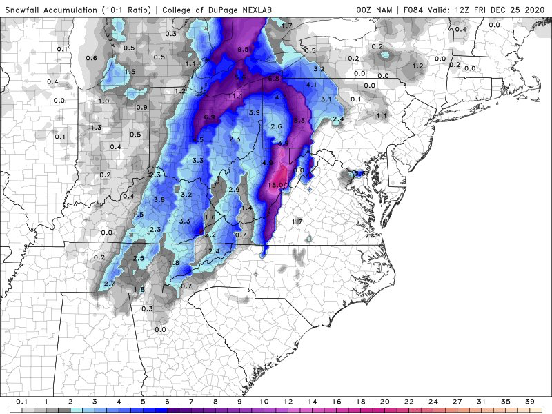
Models look like a total whiff for For the whole state of Ohio but NWS still has me near 3" I can't believe it lol.
-
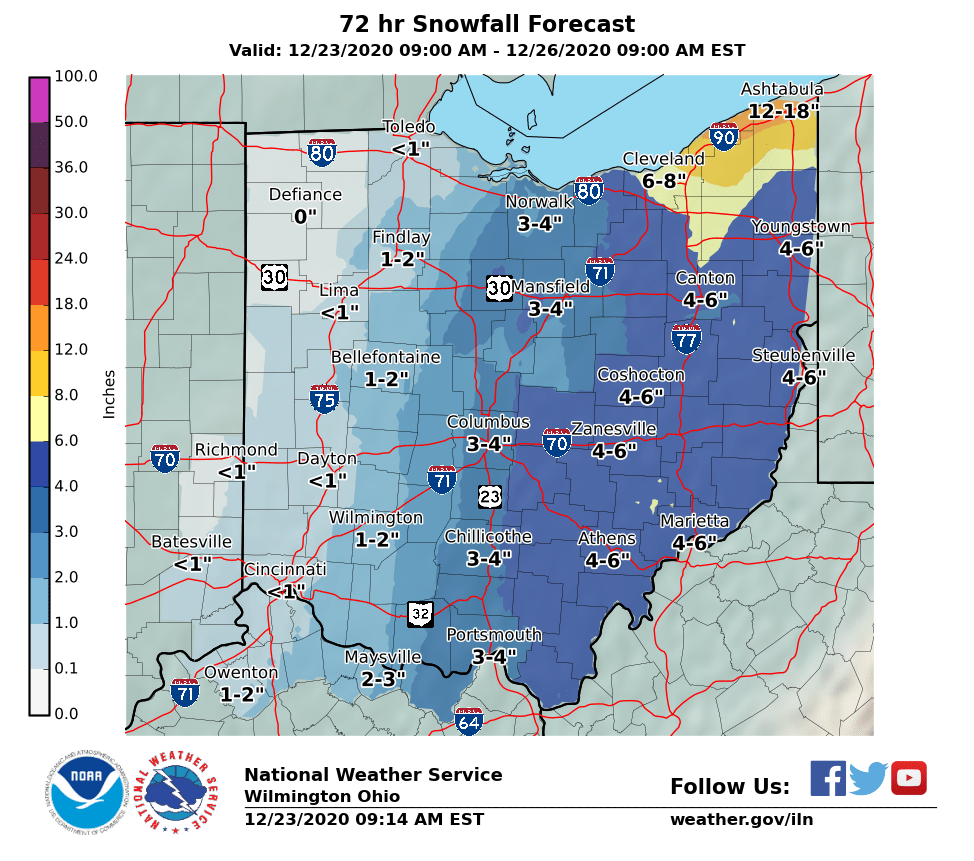
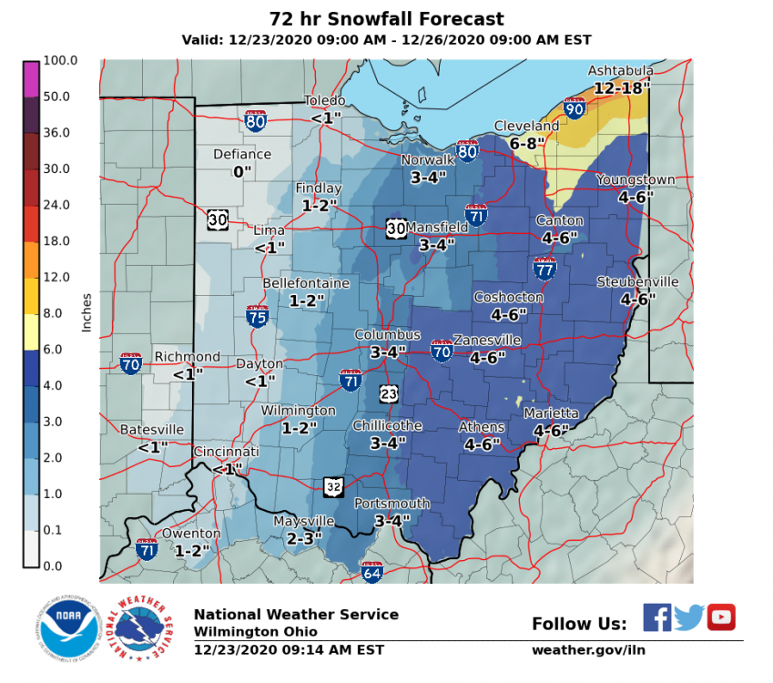
Didn't expect to see this given the latest model suite, but I'd gladly take this.
-
Aaaaaand it's gone
-
Wheels fell off on the GFS. Could be the end for the west trend.
-
CMC is absolutely insane on Kuchera. I know there will be some higher ratios after a while but holy smokes.
-
Same here. Kuchera casually drops 10" here lol
-
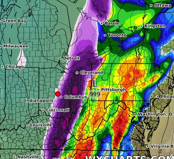
RGEM/RDPS with a bump west too.
-
Higher res nam still keeps the bulk of it way east, but it did boost the secondary low.
-
Needs to go a bit more. Gradient will be scary tight around Cbus.
-
Wut
-
Just chillin on the edge.
-
Right in between Dublin and Marysville. It's technically Plain City. It's gonna be a razor thin cut off I'm afraid.
-
Looks decent for you in Mt. Vernon. Painfully close for me. Euro wants to keep that snow in the general area for about 9 hours.
-
Probably going to be all east of me, maybe a coating. Just a slight tick west and I could see an inch or two. Eastern Ohio will do well again.
-
Latest euro is painfully close to a decent snow. Rest of guidance seems more to the east and hits more into PA. It's probably for the better so no one can complain about it snowing in Ohio.