mdhokie
-
Posts
1,702 -
Joined
-
Last visited
Content Type
Profiles
Blogs
Forums
American Weather
Media Demo
Store
Gallery
Everything posted by mdhokie
-
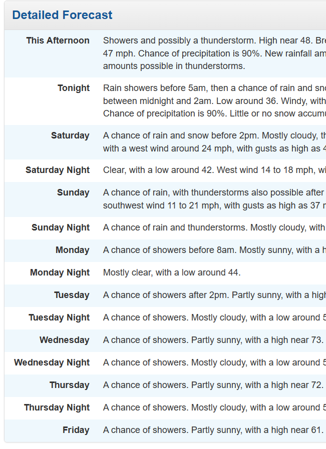
Yea we torch for a couple days then its back to rain chances for a week.
-
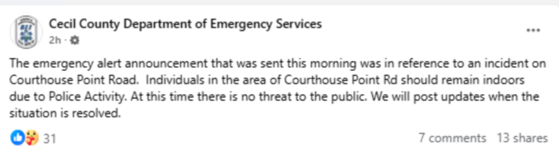
Cecil county sure has a hot mess of alerts and social media. I couldn't access their facebook as a guest, had to use my burner account. I can't believe they would make NWS send something like that out. Irresponsible in my opinion and a reason why people start ignoring alerts and warnings. @Eskimo Joe whats your take?
-
Dont worry the wildfire smoke will mute the June/July melt.
-
Forecast is looking a little better... lets hope it keeps trending towards DRY.
-
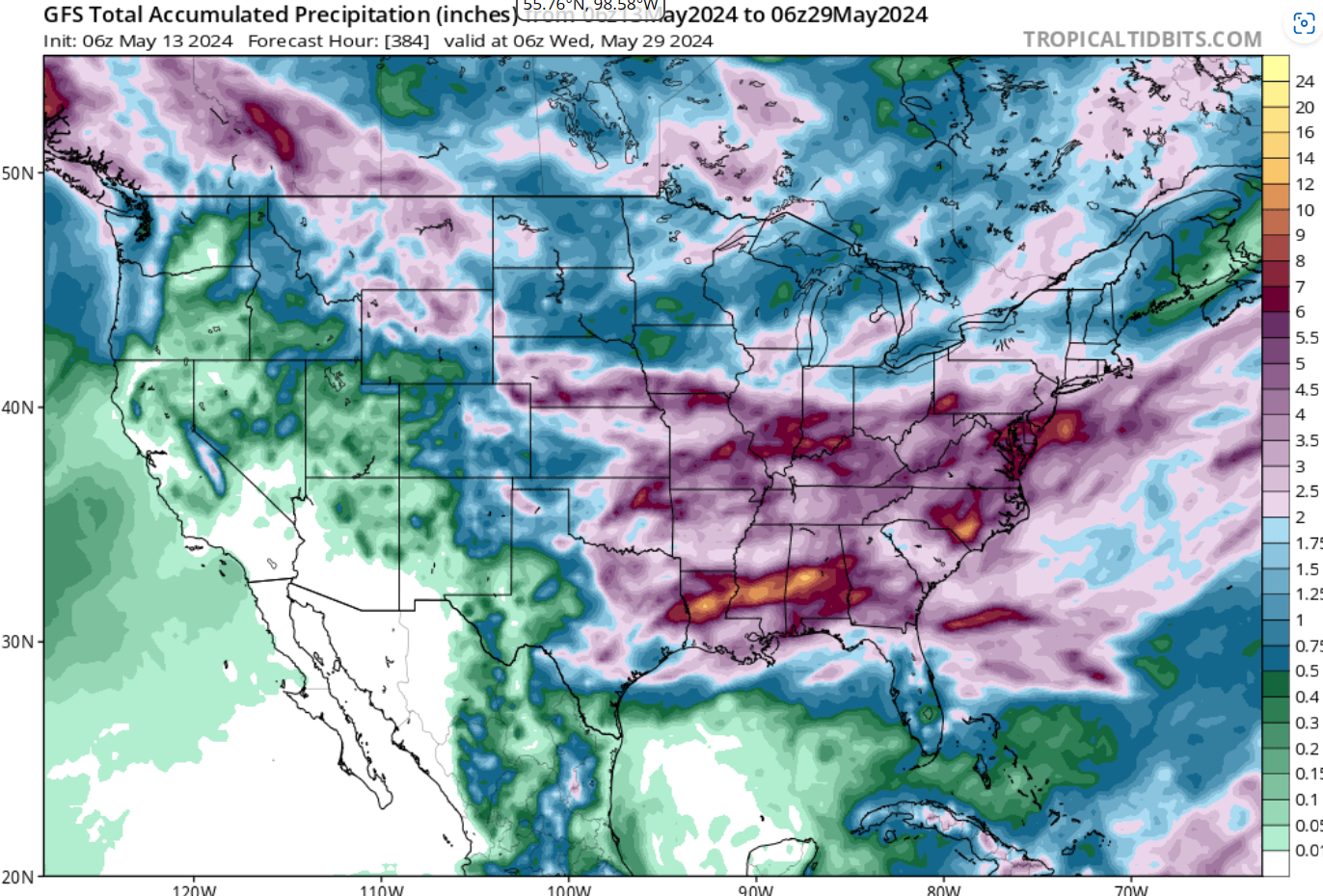
Looks like another wet period coming up: EDIT: Also looking at the temp anomalies, the next three weekends are all way BN.

-
You are correct. I guess the cooler periods stand out more because of the effect on outdoor activities. I think it was wxusaf who said we are either torch or cold, not getting the actual "average" of the month.
-
Never? I feel like ever since that epic Feb forecast bust we've been living in this bad pattern. Other than that week or so of toasty weather we've been mostly wet and chilly. Bring on the drought and heat! I'm ready for wildfire smoke and 80+ dews.
-
Nothing like trying to grill Mothers Day lunch while standing under an umbrella.
-
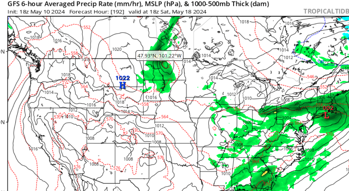
Dont look now but heres next weekend:

-
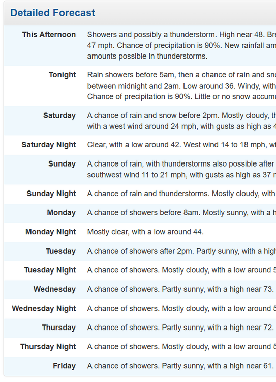
This weather blows. Made for a chilly wet round of golf and cancelled my outing to Six Flags. Kids are bummed. Softball fields probably wont dry out for tomorrow either so even more games to make up. I know we can't change it but damn I want to vent. We need to shift the calendar so these crappy days fall during the week.
-
They at least get sun... This is like a bad combo of southeast asia humidity/rain and pac nw clouds.
-
I'd rather drought than waste weekends with this crud. Send in the tumbleweeds!
-
Last saturday was cold and wet for softball and looking like the same this saturday. Wish our precip would line up with weekdays!
-
Is this something that can be crowdsourced? If the admin/mods dont have the time or knowhow, I'm sure someone who uses this forum knows. I would think in this day and age whatever software is running this board would have a dark theme built in...
-
Grass in the median of the highway is turning brown. I'm flip flopping on my drought stance!
-
Thought a home game against the As would be a sure fire win... Ugh. Well still had some fun with the kids at the ballpark.
-
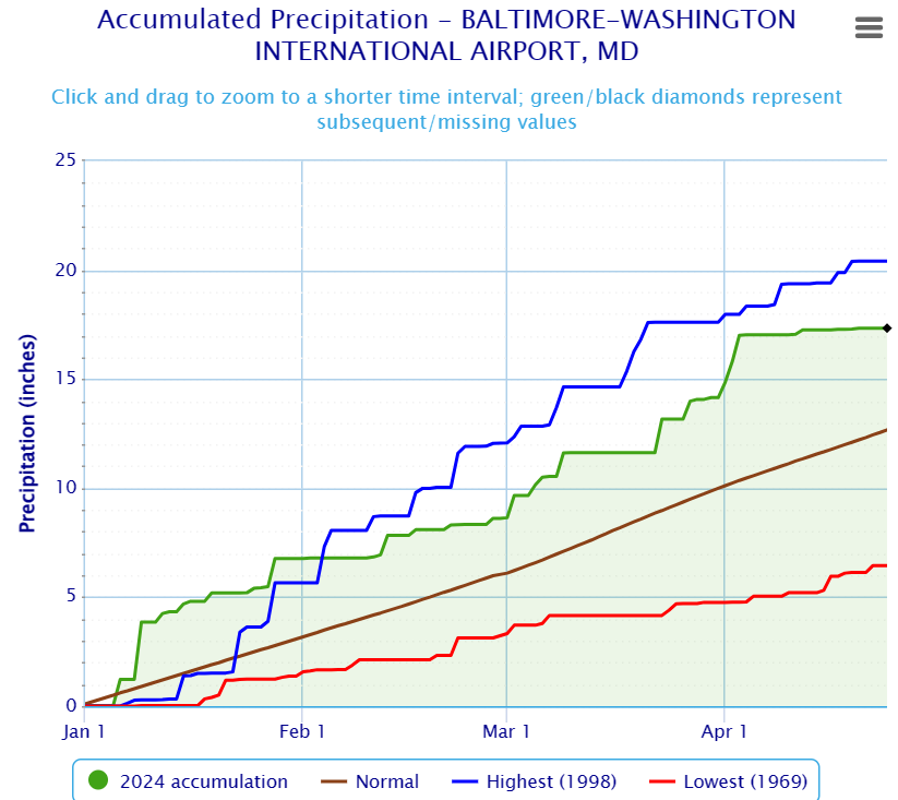
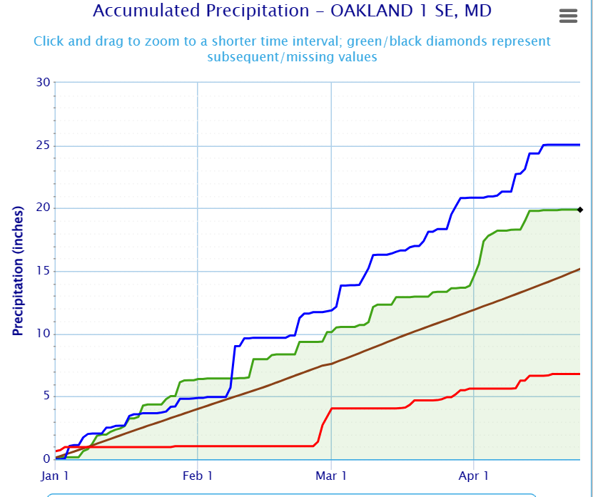
Are you all drought trolling or do we just have a lot of micro climates in the DMV? I've been digging in my yard and the soil is plenty moist. Digging out in Deep Creek too and my boots are caked with mud. We are well above normal both at BWI and Oakland. Granted the last couple days have been dry but to be honest we needed that around here to do any outdoor work.
-
Lucked out big time, Friday was terrible and today is looking cold and cloudy. Had two kids sports events yesterday and it was a perfect day weather wise.
-
I was gonna say, Stormy must live in a micro climate desert. Garrett County MD is flush with too much precipitation. They've had to let water out of deep creek lake, it has exceeded the April limits and was half a foot below the spillway elevation (which is about 2ft above normal for this time of year).
-
One of those rare days where it was warmer in the mountains. Other than a brief shower this morning it was a good day in deep creek. Sun came out for a bit. 67 when i left this afternoon and I watched the car thermometer DROP driving home. Im assuming some sort of easterly winds bringing in cool ocean air?
-
What happened to our snow???
-
Whats the JMA say?
-
Low of 48 in Western MD this morning felt brisk, high of 73 for a 25 degree swing which felt hot in the sun. We maxed out at 86 on the way home just outside of Hagerstown. Stopped in Cumberland for some ice cream and the hot wind felt odd. Kinda reminded me of Vegas or Arizona, hot dry wind.
-
Groundhog day out in western md... Friends who live in Western PA say they've had real bad flooding.