

NorthHillsWx
-
Posts
7,652 -
Joined
-
Last visited
Content Type
Profiles
Blogs
Forums
American Weather
Media Demo
Store
Gallery
Everything posted by NorthHillsWx
-
Definitely going to be a situation where it will either reform or die. To your point, almost no chance the weak center survives. Also, the convection to the south is likely going to be choked off going over the mountains. This system could very easily fizzle without much ado at this point, though I think we will see some form of center reformation to the north of Hispaniola in 24 hours
-
Poor Fred, about to take the worst path possible for land/mountain interaction
-
Please be careful buying into specific model runs at this juncture especially as it pertains to Florida impacts. I’d focus more on large scale factors at this point considering the uncertainty of land interaction and state of the system afterwards. I will say, this one has a high ceiling especially if the models showing the decreasing shear and favorable shear vectors are correct
-
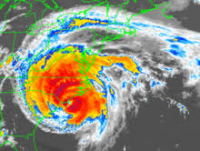
Outflow looks awesome at the moment, the upper level anticyclone is really helping fan out. New deep convection keeps firing over the estimated center and this sustained convection will see pressure falls shortly. I’m convinced we have a cyclone, in visible you can clearly see what looks like a vigorous SW and SE component to low level cloud motion, and this screams to me that the fully closed circulation is there underneath the convective envelope. Further, we now have radar data and it appears to show a cyclone at this time. As for intensity, the hurricane hunters did not find TS winds, however since that time, some pockets of 40-45kt height based estimates exist, so it’s definitely on the threshold of a TS. Given the favorable upper level pattern and position in the far eastern Caribbean Sea in peak season, the short term prospects for intensification look promising. If it’s able to develop a core and mix out dry air (mid level dry air should not prevent strengthening with little shear to mix it into the circulation, assuming circulation is well established) I see no reason why this won’t be a mid-high grade tropical storm AT LEAST when it starts to interact with the Hispaniola. Not going to forecast intensity beyond there, there are too many variables, but if the circulation survives and remains vigorous regardless of wind speed, the environment becomes very favorable east of Florida.
-
I can’t stand Katrina comparisons and wish pro Mets would stop trying to drum up attention for their posts. This isn’t even named and to see a Katrina comparison, even if it’s based on pattern not storm composition, is irresponsible and not helpful
-
Coming into view on San Juan radar. Have to say, that looks like a cyclone to me.
-
Last year most storms managed to skirt the islands or took fortuitous tracks to minimize land impact
-
This system could get interesting. Latest HWRF is significantly stronger than past runs, largely due to the system missing more land masses, and brings the system a bit further north into the Bahamas. Both it and GFS have some shear issues to deal with (while the system is also interacting with Hispaniola), but if it can maintain, the environment looks much more favorable for strengthening in the vicinity of the Bahamas/se Florida coast. HWRF now brings the system almost to hurricane strength before landfall, significantly stronger than previous runs. A lot of moving pieces with this track, land interaction, and shear, but if it survives to the East coast of Florida it may have a bit higher of a ceiling. As noted above, it’s satellite appearance looks ahead of schedule for models at this juncture. ASCAT was a very sharp trough axis and it looks to be closing off as we speak, watch the last few frames of the visible satellite. Almost looks like a westward component. From my experience watching these storms, establishing a strong vortex before land interaction goes a long way for a systems survival chances. Short term intensity before it reaches Hispaniola may have greater implications down the road as to its ability to survive/possibly strengthen. Anyway, this one has my attention and is in a very favorable position for a Florida impact
-
al Message from NHC Issued 9 Aug 2021 20:10 UTC NHC will initiate advisories on Potential Tropical Cyclone Six, located just east of the Lesser Antillies, at 500 PM AST (2100 UTC). Advisories being issued on PTC6 at 5pm
-
We finished with 1.23” over the weekend for a monthly total of 1.44.” Currently 86.4 degrees with a heat index of 96.1 at 10 am… was nice having the cooler air while it lasted
-

2021 Atlantic Hurricane season
NorthHillsWx replied to StormchaserChuck!'s topic in Tropical Headquarters
94L looks healthy this morning. Definitely the most organized look from it so far. Let’s see if it can maintain convection and continue to form a LLC today -
0.27” in the rain bucket since yesterday
-
Currently 75 out mid afternoon on August 6, I’ll take it. Did get up to 86.7 before clouds and a few showers rolled through. Picked up 0.03” of rain. Feels great out now though
-
63.5 low this morning, 86.7 this afternoon
-
So you’ve surpassed your monthly average 4 days into the month! Wow
-
Just over two tenths of an inch so far. Glad we got something, seemed to be in question earlier. High of 74.3 today. Currently 69.1, almost chilly out with the rain! What was the record cold high for RDU? Finished with 0.21”
-
General Severe Weather Discussion
NorthHillsWx replied to nwohweather's topic in Southeastern States
Must be some pretty amazing waterspouts offshore of Atlantic Beach right now -
I do not believe you will be needing any rainfall for some time after this week!
-
.NEAR TERM /TODAY THROUGH TONIGHT/... As of 245 AM Tuesday... The forecast for today looks quite different than it did 24 hours ago, or even 12 hours ago. The stalled front that has been across the eastern Carolinas for the last few days will still be the main player in the forecast, but all models, synoptic and convection- allowing, have shifted the front farther east. While this will still result in extensive cloud cover and cool temperatures across the region, it will bring a lower chance of rain to every location west of I-95. Pops will be the highest across western counties between sunrise and noon before diminishing as the shortwave moves east. However, the entire precipitation shield should be shifted east since the frontal boundary will be farther east. Across an area from Burlington to Raleigh and Roanoke Rapids, have dropped pops down to chance through the daytime. While the previous forecast kept a slight chance of thunderstorms across southern counties during the day, and an isolated elevated thunderstorm could still occur, did not have enough confidence to keep thunder in the forecast anymore, with barely any instability present in model profiles. Similar to today`s forecast, models keep the forecast quite dry tonight west of I-95. Pops were cut everywhere, and likely were not cut enough, considering how little precipitation is shown by the NAM, GFS, ECMWF, and HREF, especially in the Triad. Lows will be in the mid 60s. && .SHORT TERM /WEDNESDAY THROUGH WEDNESDAY NIGHT/... As of 245 AM Tuesday... The changes to Wednesday`s forecast were not as dramatic as the changes to today`s forecast, but nonetheless pops were cut once again as the front will be closer to the coast. There are minimal areas with likely pops east of I-95, but otherwise chance pops will rule the day. Highs will inch up slightly, rising into the mid to upper 70s. Expect little change Wednesday night, with chance pops and lows once again in the mid 60s. && .LONG TERM /THURSDAY THROUGH MONDAY/... As of 320 AM Tuesday... Rain chances Thursday and Friday should largely remain confined to eastern/coastal NC, INVOF the weakening surface front that will remain pinned along the coast, with little of the way of PoPs west of I-95. As of right now, it appears that the best chance for rain area-wide will be on Saturday, owing to the approach of the mid/upper level trough. Thereafter, rain chances will primarily be diurnally driven. Well, our guaranteed rainfall this week has been changed to a hard “maybe.” Pretty crazy to see models go from 2-4 inches in the triangle for the week to some now showing absolutely nothing in the matter of just a couple days. Feels like snowstorm tracking! At least the cool air is a guaranteed lock!
-
You mean outer banks, it’s really really dried out west of 17. Actually has less than an inch for 95 west through triangle through the end of the run. We’ll see, last week looked like a lock for most areas in central NC picking up a couple inches now looks to be much more limited
-
More action that us, no rain here. Have had some nice cooling outflow breezes
-
Same here. Over the last 13 days we’ve seemingly missed out from every direction, more recently just to our east. Only 0.16” in that timespan from one storm that fringed up and a brief shower the other day. Amazing how quickly it can dry out this time of year when it’s in the 90’s everyday
-
Highest temp was 97.5 for July Monthly precip was 6.56” but the vast majority of that fell in 2 events, it’s been quite dry the last two weeks.
-
Well, our luck ran out. 97.5 for the high today, hottest day of the year and first reading in the upper 90’s. No sugarcoating this heatwave, it’s brutal out. Thankfully the humidity mixed out some, our maximum heat index today was 102.1
-
8am with a heat index of 87.6. Can already tell where this day is going. Get ready to fry
