NorthHillsWx
-
Posts
7,315 -
Joined
-
Last visited
Content Type
Profiles
Blogs
Forums
American Weather
Media Demo
Store
Gallery
Everything posted by NorthHillsWx
-
High of 87.8 today, warmest of the year at my house. Low of 66.4. Picked up 0.19” of rain with 3 rounds of rain. Just enough to moisten the ground, on top of yesterday’s 0.14”
-
We got shafted in my neck of the woods. Just 0.14” for the day. Does feel amazing out
-

General Severe Weather Discussion
NorthHillsWx replied to nwohweather's topic in Southeastern States
Any damage reports from those earlier cells? -
General Severe Weather Discussion
NorthHillsWx replied to nwohweather's topic in Southeastern States
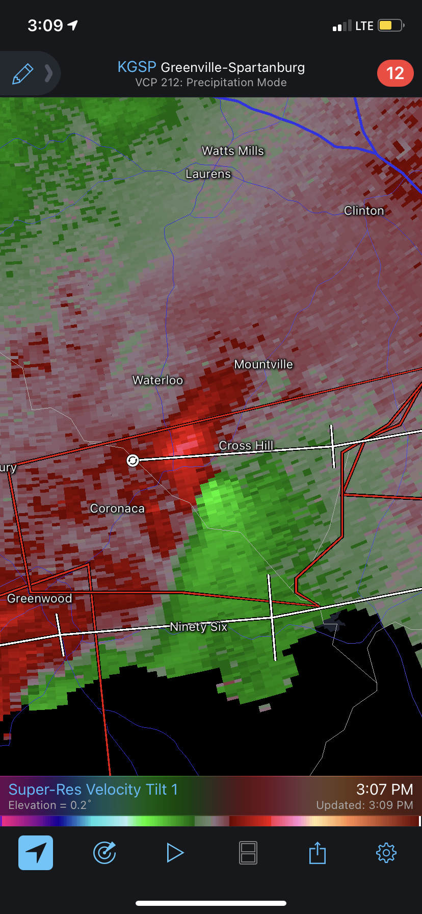
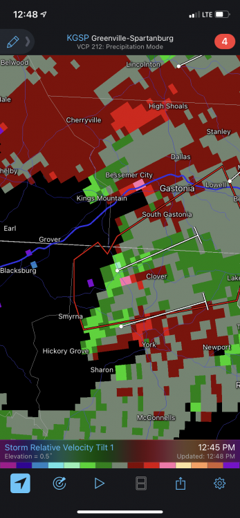
Albeit broad, rotation has definitely increased in the past few minutes
-
General Severe Weather Discussion
NorthHillsWx replied to nwohweather's topic in Southeastern States
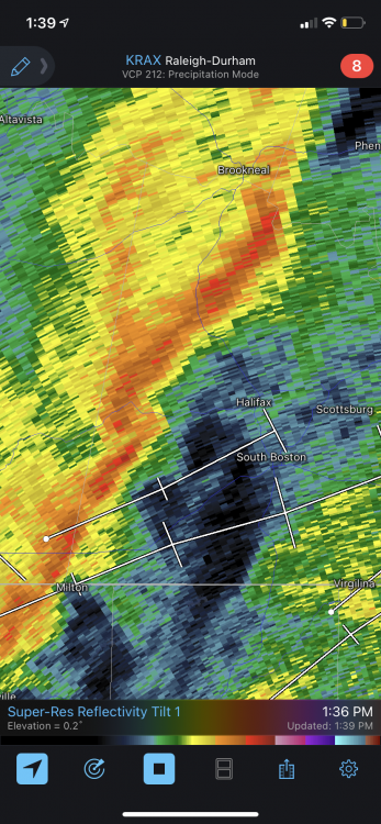
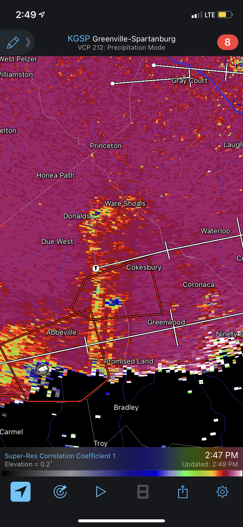
Storm moving into Coronaca may be getting ready to cycle back. Looking like a more defined hook is redeveloping on radar -
General Severe Weather Discussion
NorthHillsWx replied to nwohweather's topic in Southeastern States
From radar, those looked like strong tornadoes. Thankfully I believe they both passed through very rural areas -
General Severe Weather Discussion
NorthHillsWx replied to nwohweather's topic in Southeastern States
Woof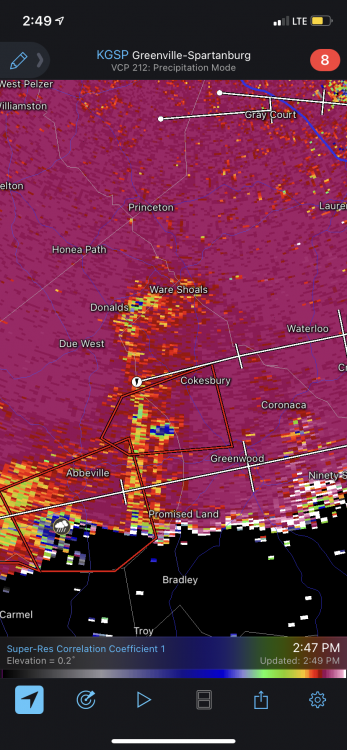
-
General Severe Weather Discussion
NorthHillsWx replied to nwohweather's topic in Southeastern States
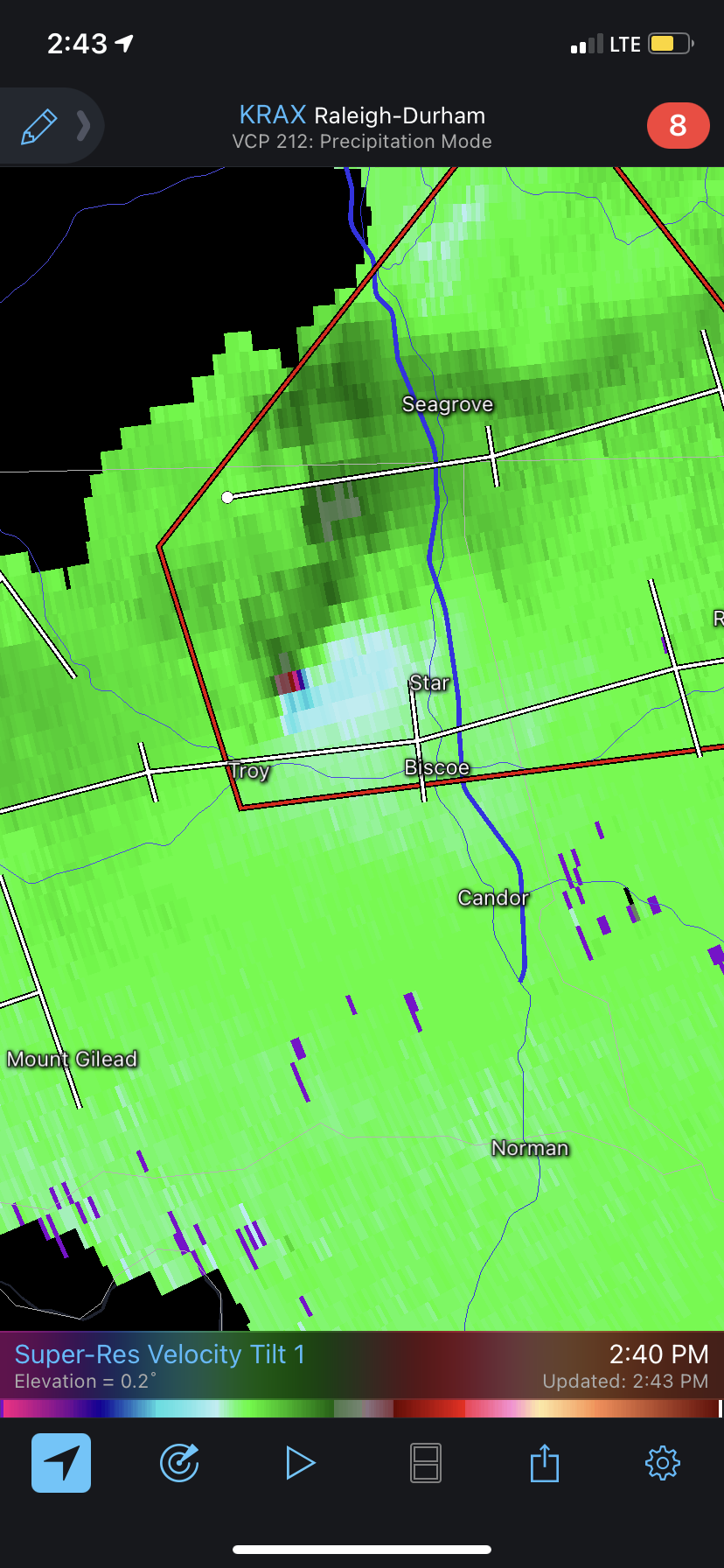
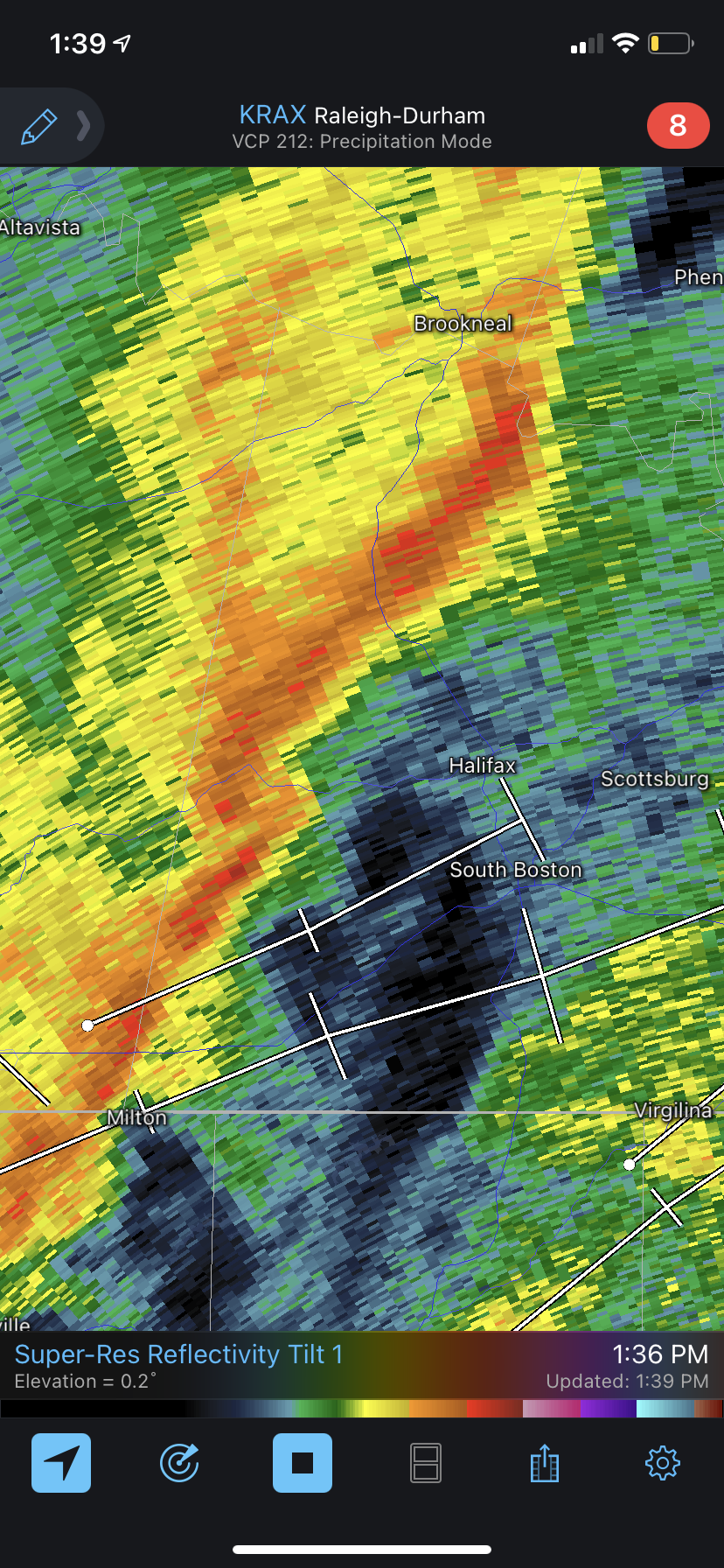
Cell heading in general direction of RAH has a tight couplet near Star, NC
-
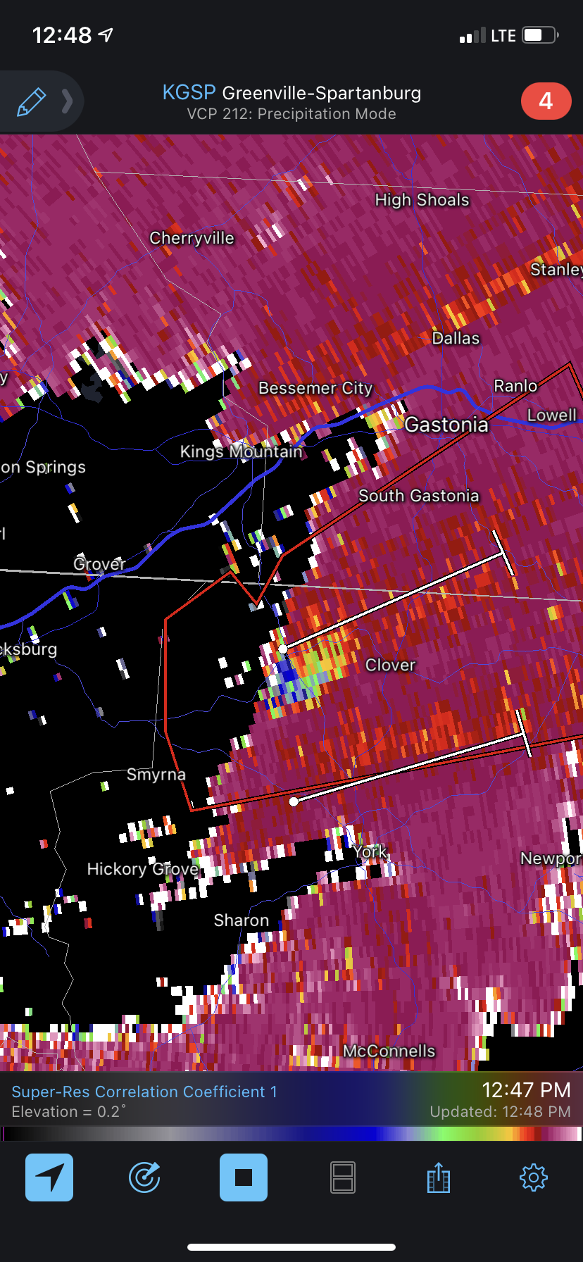
There may have been something otg with the storm west of clover. Not definitive but definitely some strong rotation

-
0.02” here so far and still raining. Really hope we get something substantial from the next band
-
Definitely trending towards drought. Cannot be denied at this point.
-
83.3 and much more humidity today. 62.8 dew point... summer!
-
Had a brief shower early this morning but just a T of precip. Friday looks dry so we likely will end the month at 0.93” barring something changing. Strangely, looking at climate records, April is climatologically our driest month, averaging just 2.80”
-
Forecast looks drier and drier. May make it to may before our next rainfall. That would be less than an inch of rain imby for the month of April
-
Beautiful morning. 48 degrees and perfect crisp feel to take the dog out. Glad I got to enjoy it before this hot stretch
-
We have only had two rain events this month, the 10th and yesterday. Friday’s looks quite light. Finishing April under an inch of rain, we’re still below an inch here for the month, is a terrible way to go into the hot season! I think WRAL said Raleigh is 3.3” below average for the spring at this point. Pattern looks like any rain will be quick fropa variety and not soaking rain. Saw some yellow shades show up in drought monitor thus week into central nc. Definitely not the time you want to see that!
-
Just 0.31” for the weekend rainfall total. Really looking like we’re going into another extended dry period. Low of 45 this morning.
-
RDU tied a record low of 32 this morning. Knew it’d get cold with that front but wasn’t expecting widespread record cold. Models were 5-6 degrees too warm
-
Haven’t seen “QPF” and “Much needed right now” together in the same sentence in some time: QPF (much needed right now) - is expected to be in the 0.5 to 0.75 inch range in the south and west, with lesser totals possibly as low as only 0.25 to 0.33 in the far NE zones. Regardless, this would still be a good soaking rain for most of the region.
-
32.5 for the low at my house. Minimal frost. Looked around and a very impressive amount of sub freezing temps across central NC for it being April 22.
-
High of 77 today. Still no rain since the 10th. Very dry out, hopefully we get something Saturday!
-
Just watched that Seneca tornado video posted above that was CRAZY!!! Can’t believe that hasn’t garnered more attention
-
Heck of a dry stretch setting up while it’s already been quite drive this entire month. Seeds of a drought? Haven’t mentioned that word in here for a few years
-
Need rain bad to wash this pollen away
-
I’m surprised there isn’t a warning with that storm. Obviously nothing strong but definitely capable of a spin up or two with that kink in the line and rotation showing up