pen_artist
-
Posts
128 -
Joined
-
Last visited
Content Type
Profiles
Blogs
Forums
American Weather
Media Demo
Store
Gallery
Everything posted by pen_artist
-

October 2026 General Discussion
pen_artist replied to SchaumburgStormer's topic in Lakes/Ohio Valley
Great running weather so can't complain there! -
knew I was going to be in for an early morning when the flashes of lightning shot through our dark curtains before the the booms of thunder
-
Great point you bring up there. Wouldn't hate some LES hits and possible svr chances (depending on how warm the warmth surges are) this winter
-
Honestly at this stage in my life I really do enjoy more urban areas. My go would be in NYC area, not quite the city but close enough.
-
Any chance you see this getting upgraded to perfect? :0
-
Real close presentation to how it actually played out albeit 50 or so miles more southward.
-
Curious to know if you saw anything of note!
-
-
Destructive severe warning now for a lot of metro just along 88 and south
-
Tornado warning up now for portions of Kane, Will and DuPage counties
-
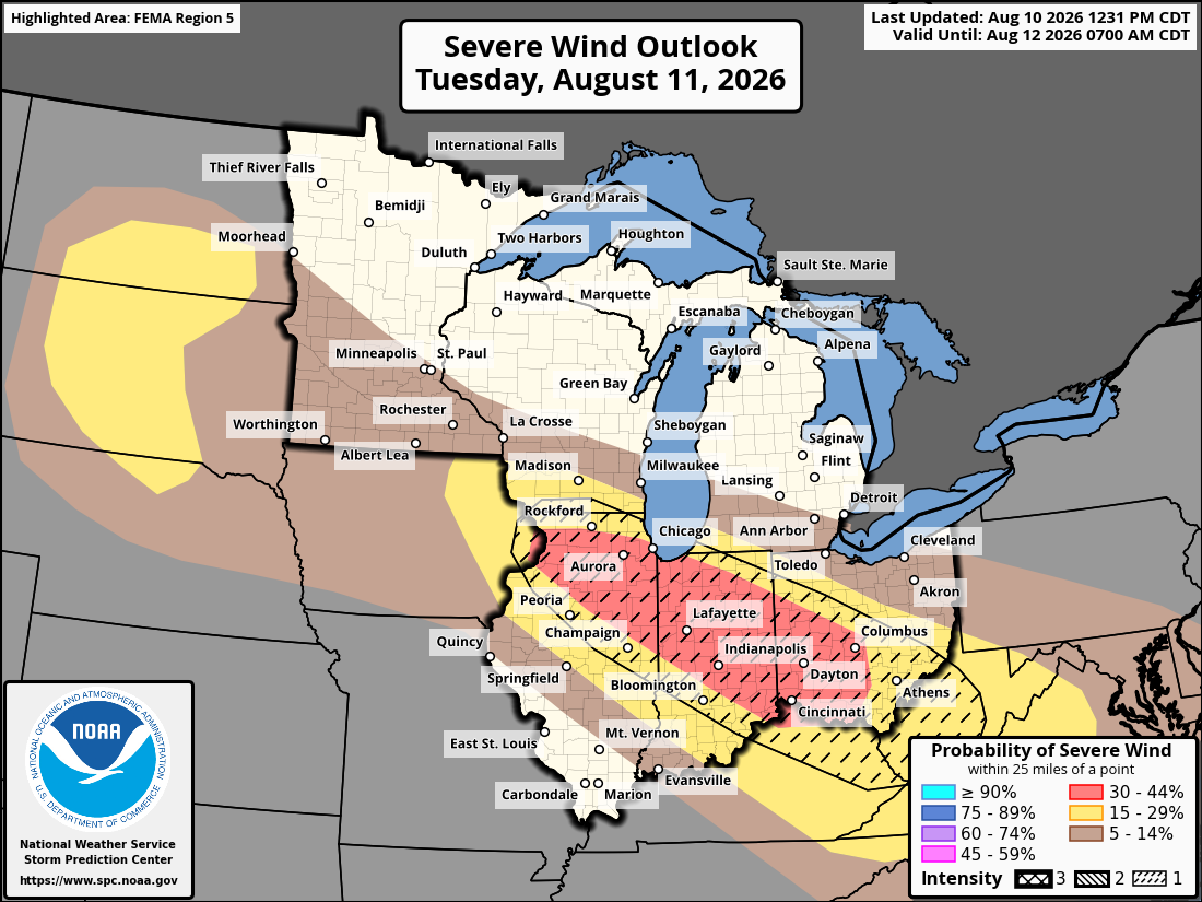
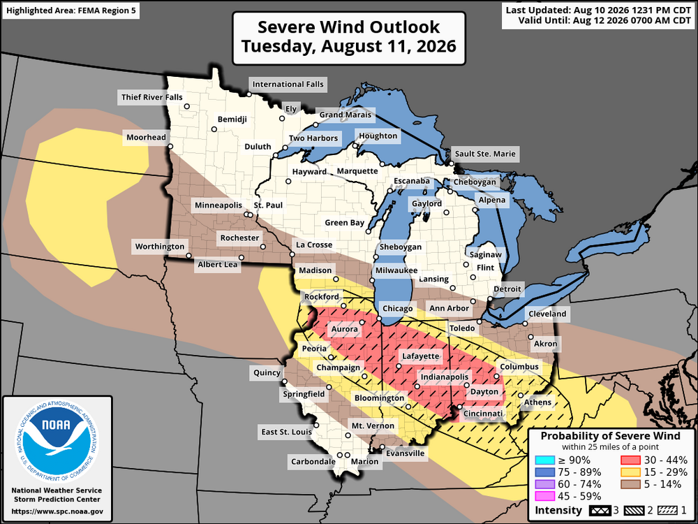
Doubt it verifies verbatim but 18z HRRR sniffing out some max wind gusts of 100 mph in DuPage co. with the midday complex tomorrow. Taking it with a grain of salt but thinking we'll see some 80+ gusts if consistency continues.
-
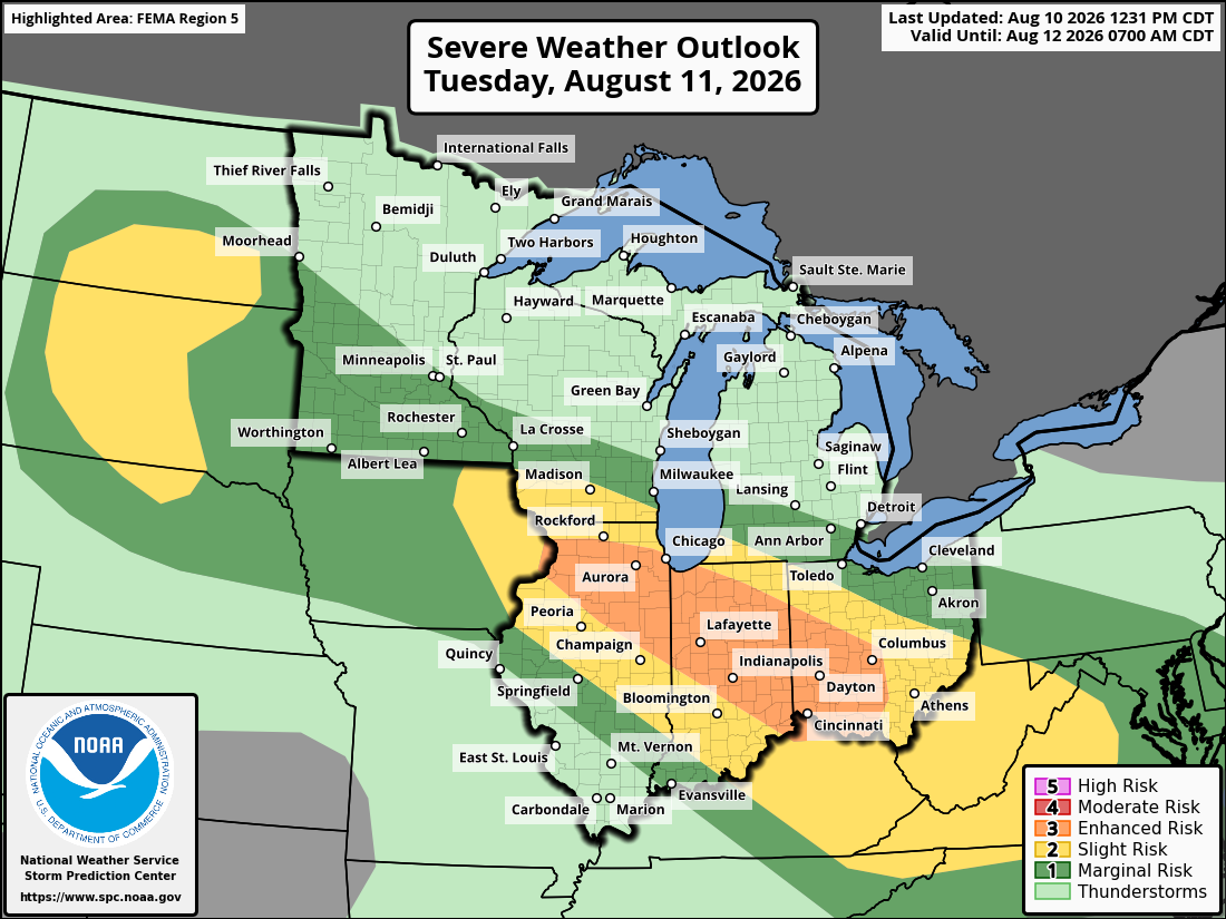
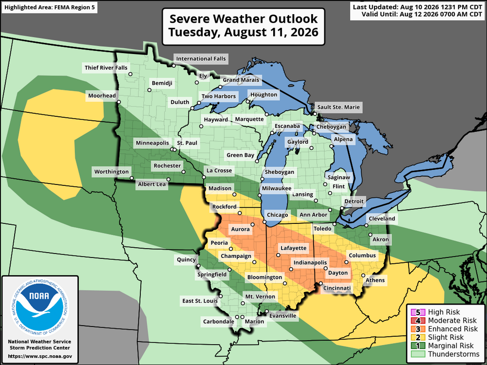
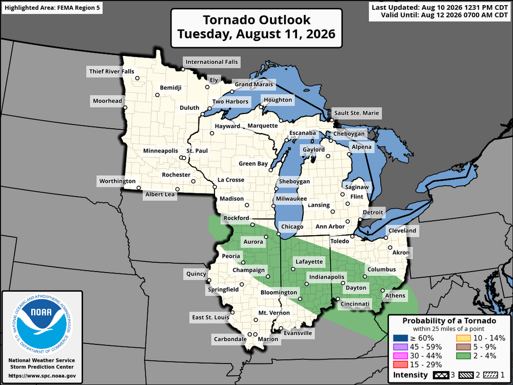
Day 2 Enhanced introduced. The way it is outlooked, has the making of a long term wind event, possible derecho.
-
After yesterday's surprise uptick, figured creating a thread might be good for what models have really highlighted-- consistently-- as being the most active stretch, is warranted.
-
Ready 2 be buried...in stratiform rain puddles
-
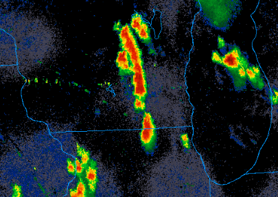
Currently got the line in central wisconsin going straight south toward Chicagoland. May not be out of the woods just yet
-
Lighting up
-
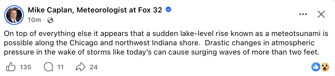
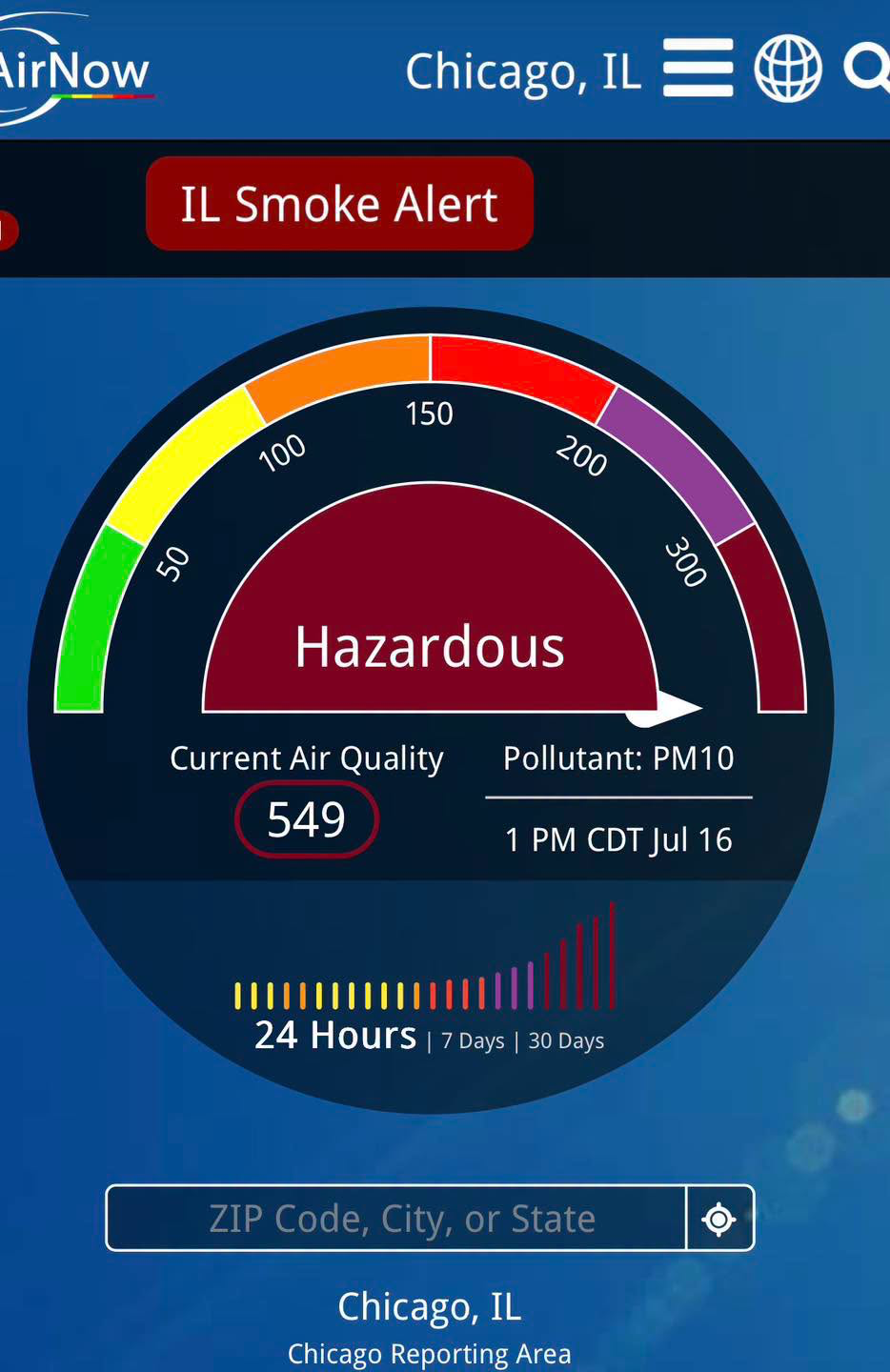
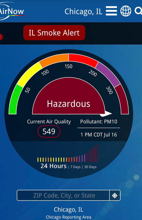
From Mike Caplan Chicago Meteorologist: This is incredible. AQI of 549 in downtown Chicago at 1pm
-
Hands down the strongest I have smelled wildfire smoke in Chicago area. Glad I opted to do my run indoors this morning
-
Brining me back to 2014-16 summer times. Love it
-
Lots of discussion concerning ring of fire pattern setting up with this heatwave coming through. Honestly feeling like we'll get missed north this time around
-
Still a lot of summer left. Hoping you snag a great, closer chase
-
Likely strong tornado ongoing in IA heading toward southwest/west wisconsin
-
Does anyone have any good examples of when the warm front has advanced far north in just a few hours i.e. low central IL to far N IL? It feels like more often than not models will suggest this can happen but often it just stalls or barely retreats north.
-
Little under 48 hours out looks like a thread the needle event for areas of DuPage and Cook near the city. Will be incredibly fast storm motion
-
I want to believee