ORH_wxman
-
Posts
93,099 -
Joined
-
Last visited
Content Type
Profiles
Blogs
Forums
American Weather
Media Demo
Store
Gallery
Everything posted by ORH_wxman
-
Yeah it did. That was kind of weird but probably not totally surprising given the trouble that model guidance has had handling all these shortwaves. I’d still lean against a storm right now but we certainly cannot rule it out yet.
-
I think the most "useful" aspect of an SSW going on right now for snow lovers is that it would act as a major vehicle to disrupt the baseline La Nina Feburary climo (even if we take your stance that it is a muted ENSO climo signal with hadley cells....if anything that probably makes the Feb la nina climo even worse). Feb Nina is usually not all that favorable for our region unless we have some -AO assist or other disruption and the SSW could be that disruption we want.
-
The Dawn Awakening?
-
Completely destroyed his finished basement when the 1/24/15 storm was getting more defined on the models.
-
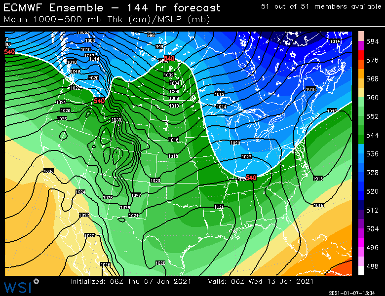
Pattern is definitely there for some big opportunities beyond the ides of the month. I know it's a pain in the ass to wait for a lot of people....sometimes the "meat" of a pattern change gets pushed back a few days even if the general favorable setup starts earlier (we're already in a generally favorable setup next week). I brought up Jan 2013 and 2015 on purpose to illustrate that point. 2015 actually got decently favorable earlier than when the storms started....we got an unlucky brutal cutter mid-month that sent a lot of people over the edge. Ditto Jan 2013....nice longwave pattern and then a brutal cutter to interrupt it before we cashed in. Obviously it would be silly to predict a HECS like either year right now, but the longwave set up is going to be there. It could merely end up with a string of moderate to borderline heavy events like Jan 2009 too (there are similarities with that month's pattern). Or we could get largely skunked like January 2003 after the 1/3-1/4 storm.
-
Northern steam + big meridional flow tends to wreak havoc on lead time (same thing happened in Boxing day too...even if we all didn't like that storm)
-
I'm just starting to get some late Jan 2013 vibes in here....or mid Jan 2015 vibes
-
Fixed your real complaint
-
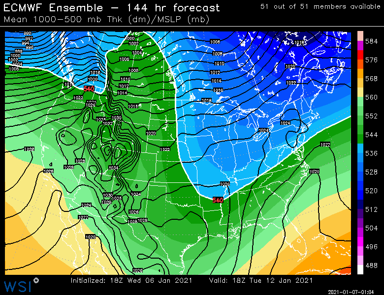
Euro is a whiff too now next week. All the guidance looks pretty similar in the wave interference.
-
The pattern does support a good arctic intrusion later this month. Whether we get a truly frigid period or not is still up for debate, but when you see the Pacific load up a poleward ridge like that, then it is a definite possibility.
-
Ukie is a no-go as well. With so many shortwaves it's going to be difficult to get an ideal setup. The longwave trough is favorable at least, but you still have the problem of wave spacing inside the longwave flow with the multiple shortwaves.
-
Yeah they could really use some base....they did get that moderate SWFE back on New Years, but may places are still significantly behind.
-
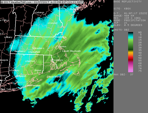
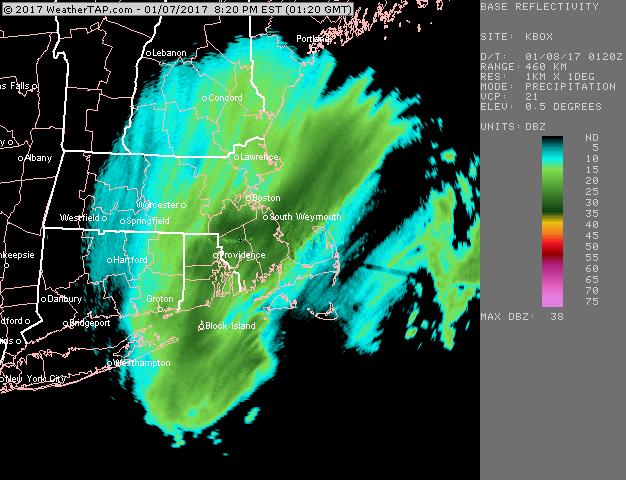
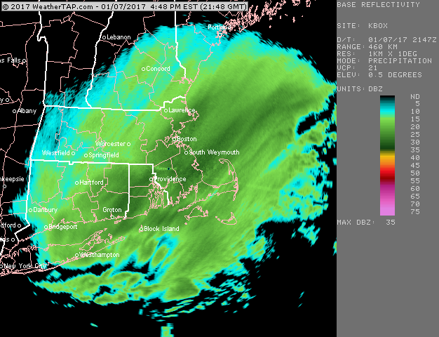
Yeah rough storm for SE MA...these loops are all 2 hours apart
-
EPS says we watch with one eye....but that's all for now
-
EPS has it. At 18z too...though it doesn’t quite go out far enough at 18z but you can see it developing.
-
Lol, you actually responded to him....you fell for his bait. Pretty much everyone in here ignores his posts now.
-
There's like 5 shortwaves in the flow....doubtful that gets figured out any time soon. It also reduces the chance at a significant event. Wave spacing is always an issue when you see that. Northern stream is coming to play ball though shortly after, so no reason to fret even if 1/12-1/13 doesn't deliver.
-
They have some of the records in-house there. I believe they do have the '95-'96 record as I've seen in referenced (most recently in the 2014-2015 winter when we were threatening it)...and they also have the 33.0" '97 blizzard total which had previously been the record storm total until Jan 2015. I resent the ORH reconstructed data to them recently actually sometime last year...I think they are going to make another attempt at some point to get it in the NCEI database. Hopefully they are successful this time. We initially tried way back in like 2008 or 2009 and ran into too much red tape.
-
ORH's record snowfall according to them is still 1992-1993.
-
And that first one actually melted some areas completely out. Like 40"+ packs. Some areas in SE MA lost 46" in 1 week....but they did start the melt-out in the 1/12 storm that dumped a foot of snow over the interior. We never fully melted out even in the subsequent cutters. Got close though...I think at the nadir, we had like a 3" bulletproof glacier.
-
Other way around, lol.....That winter was great and then turned to garbage in mid-January for 2-3 weeks. Then it revived in Feb/Mar/Apr.
-
Still on the ensembles....06z GFS actually had a scraper. You wouldn't favor anything hitting at this time range, but it's definitely still showing up as possible.
-
Significant upper middle Atlantic S/CNE mix/snow potential Jan 3+
ORH_wxman replied to Typhoon Tip's topic in New England
WHats going on in windham county? We need Ginxy to drive north a few minutes and report to us. That looks quite intense actually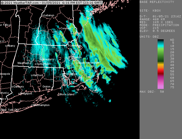
-
If there's one time the fabled SSW will actually help us for once, it's this February. The longer range guidance really wants to start building the Aleutian ridge up and that is usually kind of crappy for us in La Nina February unless we have a -AO/NAO. But who knows, this year has acted way more like an El Nino than a La Nina so far, and every time we expect it to change, it doesn't.
-
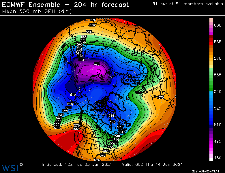
Here's the loop....you can see the western ridge amplifying 3 different times....it does slowly retrograde west each "cycle".