ORH_wxman
-
Posts
93,092 -
Joined
-
Last visited
Content Type
Profiles
Blogs
Forums
American Weather
Media Demo
Store
Gallery
Everything posted by ORH_wxman
-
I can't believe the amount of business there one like 10 minutes from me does. Even when I pass it on a random weekday at like 2pm, it will have a decent amount of cars there and then on weekends it's frequently jam-packed. State must be cranking 50-100 mil in revenue per year off the sales tax on that.
-
Cannabis store near me was packed yesterday and today.
-
It's even weirder to me to see people with masks on outside who I know have been vaccinated. That's a double whammy...it already has an extremely hard time spreading outdoors, but now you are also vaccinated and STILL wear one outside? Bizarre. But to each their own. I'll carry one on me outside just in case I end up in some random group of people all within a couple feet of eachother (unlikely). But I mostly do it out of courtesy these days. Not out of fear of catching it or spreading it. I've been vaccinated for over 6 weeks now.
-
Around here it's prob like 1 out of 3 outside walking I see with masks on (I'm not counting parking lots where people are entering and exiting buildings....I'm referring to people walking their dog or jogging, etc)
-
Yeah almost time for the cutoff “wheel o ‘rhea” in a low geopotential gradient environment in May.
-
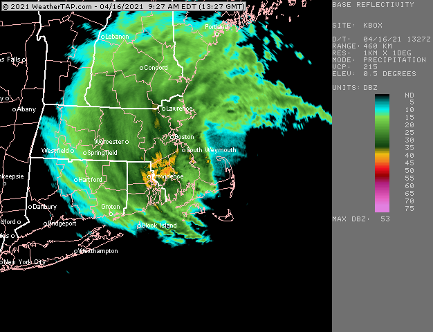
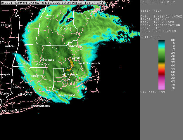
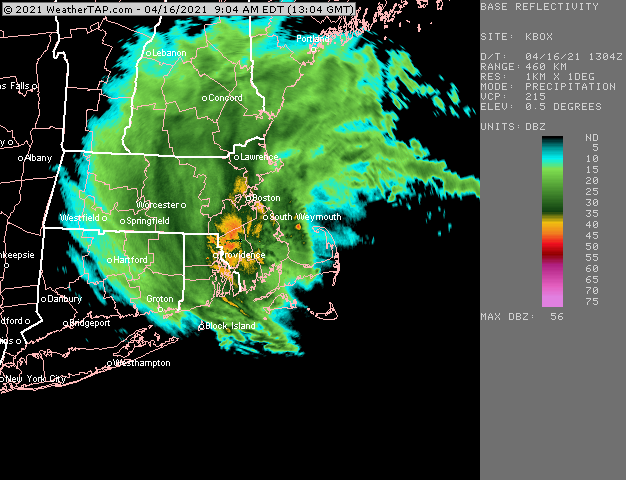
R/S mix here right now with these bands rotating south.
-
Getting those putrid 1980s out of there was important. Particularly for southeast New England where that decade was the worst.
-
ORH had 0.7" from that storm, but it is not in the official database....but it was actually in their old archived PNS of that storm and it matches my obs (i recall nearly an inch in that)
-
Hard to totally ignore the deep troughing sig over the eastern half of the CONUS. While it is unlikely, another snow event is certainly plausible in that pattern.
-
You should've drove up winter hill..... I mentioned earlier there was a huge elevation gradient. Southenr part of the city below 500 feet prob has 2-3" at the peak before it melted back to slop.
-
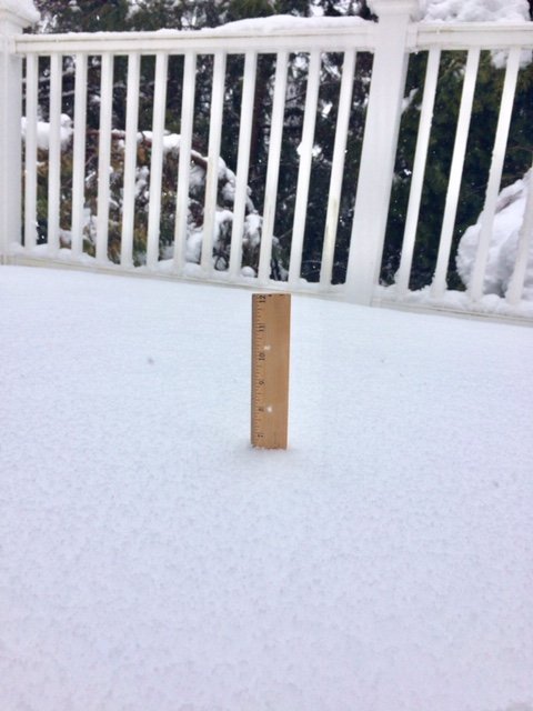
I think the rate of compacting/melting is starting to exceed the rate of accumulation. About 6.5-6.6”. That’s without clearing. Clearing gets us around 7”.
-
Yeah Union to Palmer/Belchertown is getting croaked in the meat of that band. Snowing good on each side of it too, but right in the middle of that must be 1"+ per hour.
-
That band moving to the west now a bit
-
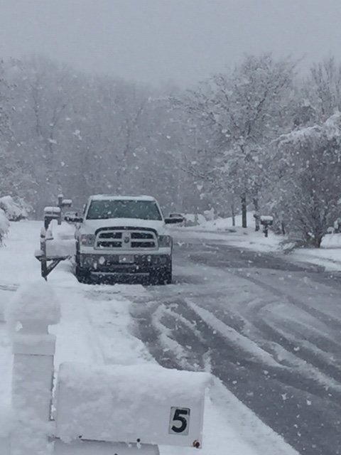
Eyeballing about 6" on winter hill
-
Fricken ripping
-
RAP ftw yesterday. Kept showing that.
-
Kind of annoying that two of our best looking storms happened with marginal temps (12/5 was the other).
-
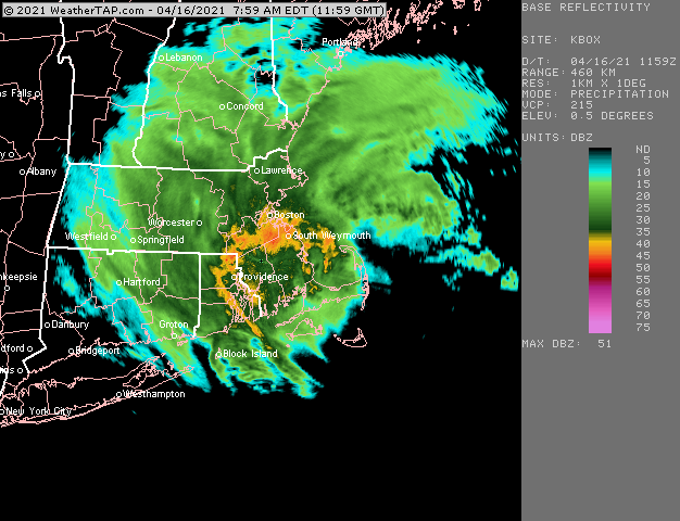
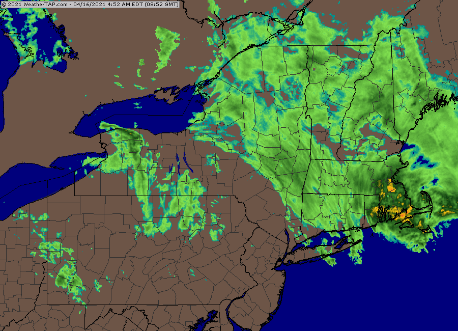
Radar looks promising for MA and S nH
-
4” on winter hill so far.
-
Impressive radar in this storm
-
Temp has risen here to 36.5F. We had R/S mix at 4am. Nada now. The mesos did actually hint at this overnight and then they crash things around 7am. So I guess we’ll see. I’m headed to winter hill I’m a while so we’ll see where the lines are.
-
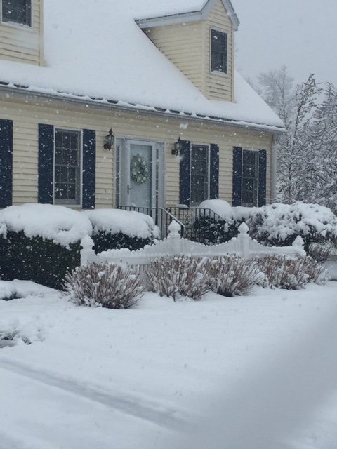
Woke up and checked outside and we have flakes mixing in here in Holliston. Temp 34F. Gonna be up at winter hill later. Radar looks quite promising as there’s some crazy stuff developing just north of the dryslot

-
Yeah I'm thinking a lot of ORH county above 600-700 feet is going to get annihilated. We'll see about a little bit lower, but the higher terrain is looking pretty favorable right now based on how quickly things are cooling. Even these hi res models like the 3km NAM and RAP were 2-3F warmer at 01z than what I'm seeing right now. Hard to say how well this translates ahead a few hours, but I don't think it's going to hurt...it can only help.
-
Lots of 33s showing up in Gardner/Ashburnham. They must be at or nearly all snow there now.