ORH_wxman
-
Posts
93,095 -
Joined
-
Last visited
Content Type
Profiles
Blogs
Forums
American Weather
Media Demo
Store
Gallery
Everything posted by ORH_wxman
-
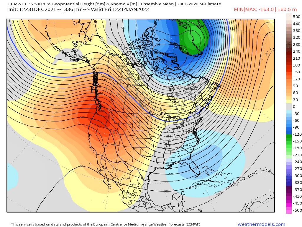
EPS still looks very cold going into mid-month.

-
Yeah that’s great looking. Sucks that it’s 6 days out still. I’d be getting pretty pumped if we were 84-96 hours instead Anyways, here’s the individual plot members


-
Yeah it’s further north anyways than other guidance. I’d toss it.
-
All the QPF on the northern 25 miles of Monday's system is prob going to be Virga.
-
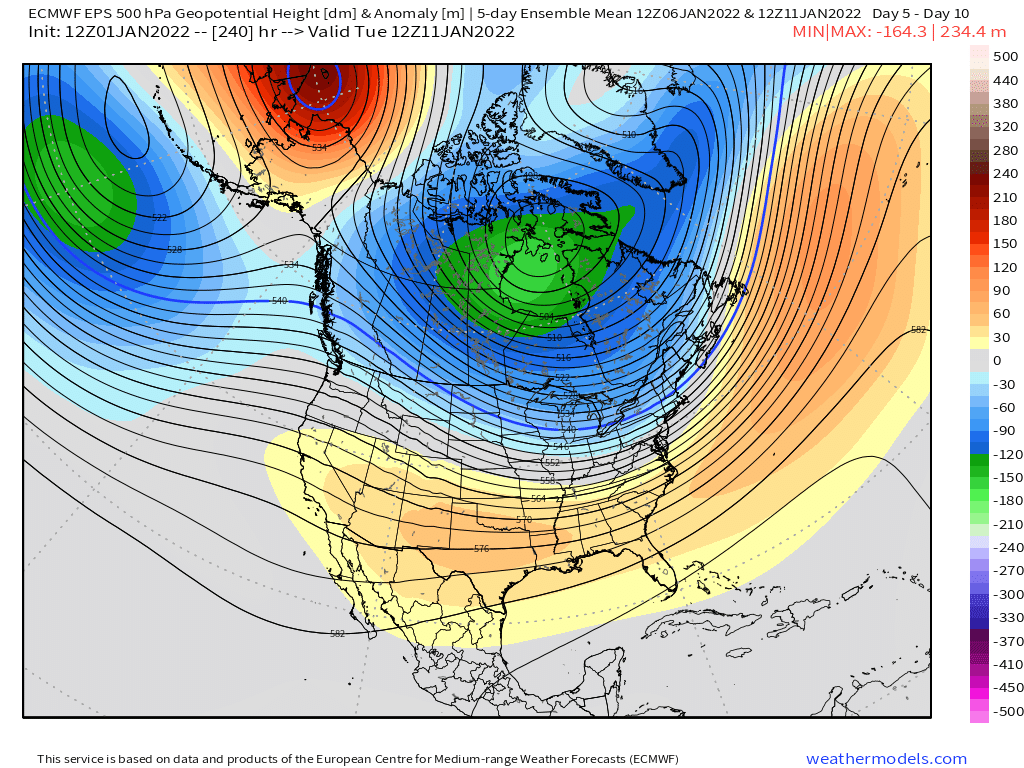
That type of phased PNA/EPO ridge in the second image is a very cold pattern historically. So it wouldn’t surprise me to see a very strong arctic outbreak at some point if that verifies.
-
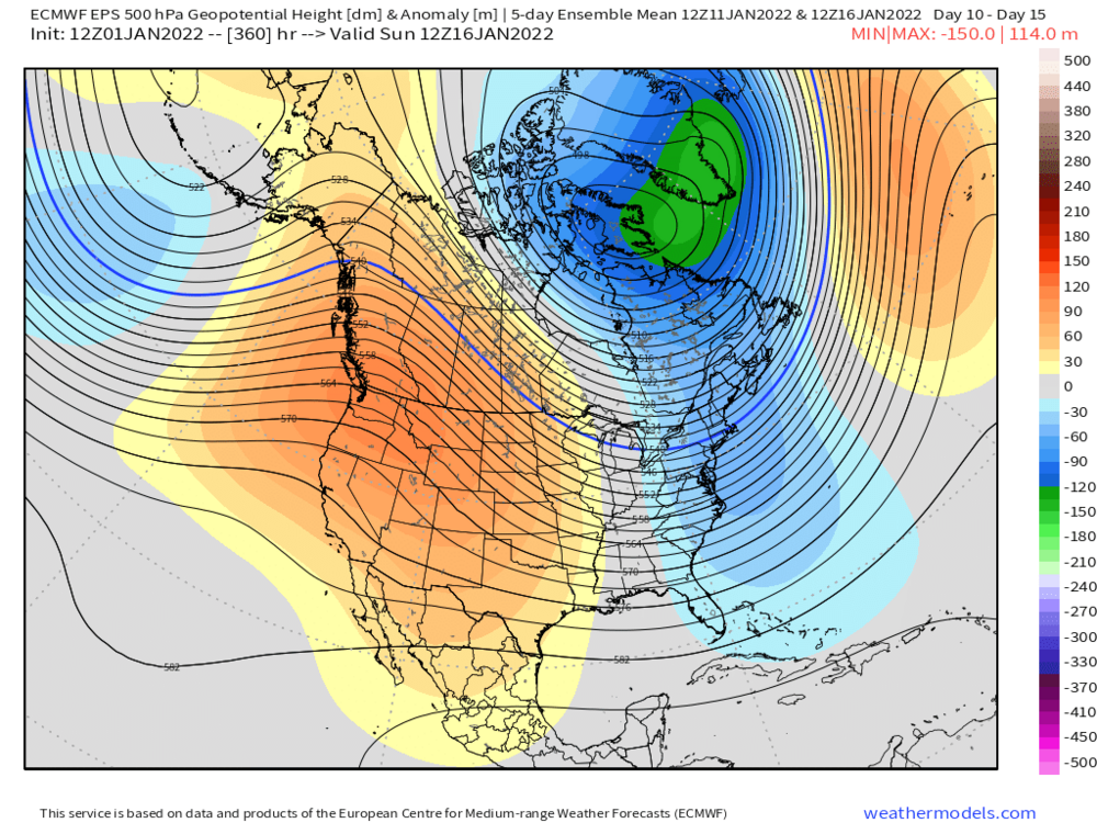
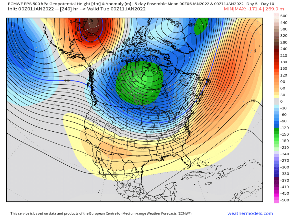
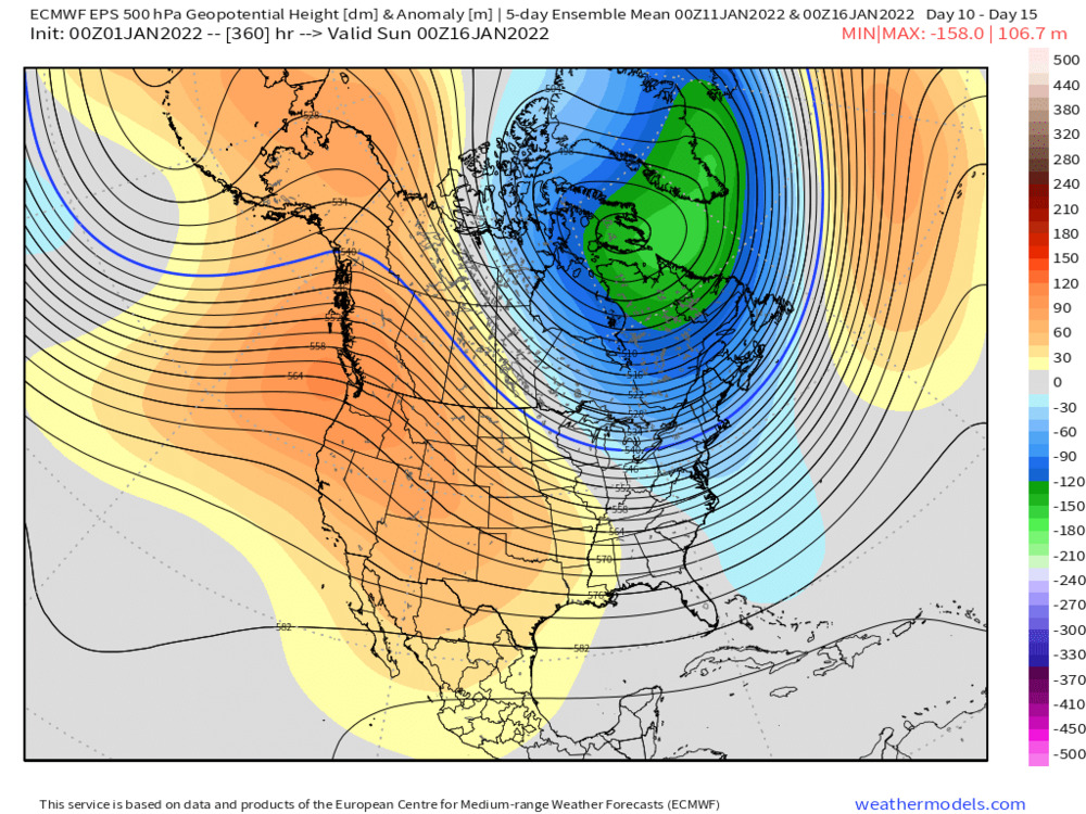
Here was last nights EPS…first map is 5 day mean between D5-D10 and the next one is days 11-15
-
06z eps has a pretty big spread…not a tight cluster
-
We traded with Seattle for 2-3 weeks. At least the EPS continues to improve. Looks even better than 12z did.
-
Yeah I'd wait until we're inside 10 days. The good news though is that the western ridge starts building pretty quickly by D9
-
Tip will like the lower heights in the SE later in the period....no Hadley cell geopotential medium compression for you....

-
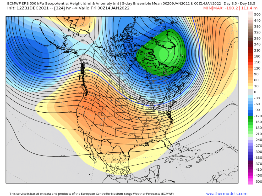
Here's 5-day mean D9-13
-
December 2021 Obs/Disco...Dreaming of a White-Weenie Xmas
ORH_wxman replied to 40/70 Benchmark's topic in New England
Well if you think about we kind of traded our climate with them for the past 2-3 weeks. -
EPS looks pretty nice in the extended....that's the best it's looked in a while. Trended toward GEFS a bit. @CoastalWxwould definitely like that western ridge anomaly max sitting over Idaho/Montana. PV actually gets shoved into SE Canada. Probably a legit arctic outbreak if that look verified.
-
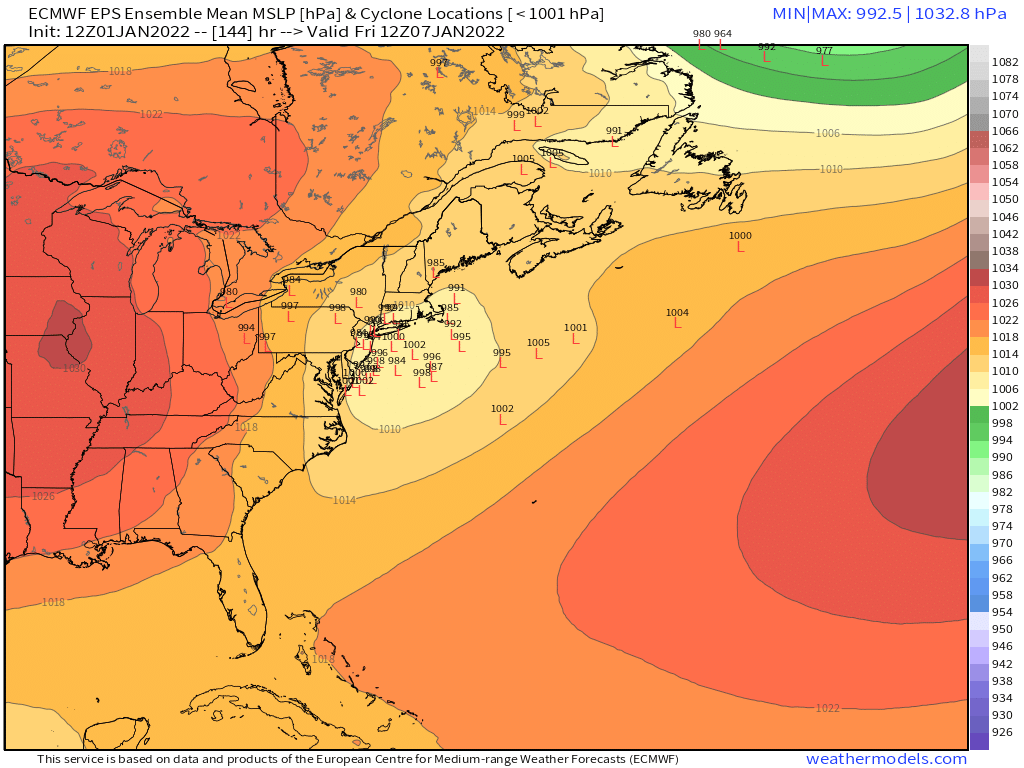
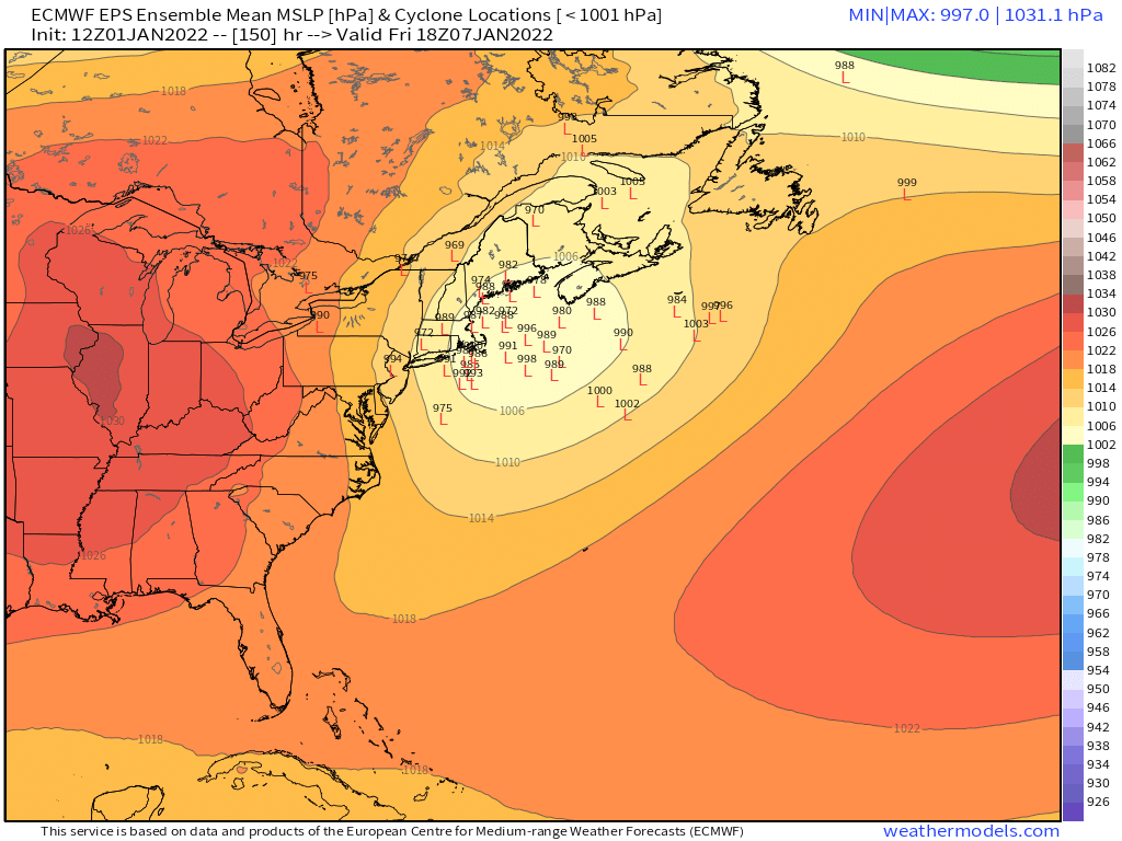
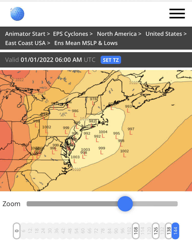
EPS takes the system over SE MA...pretty decent spread in solutions so way too early to talk about whether the system is "lost" yet.
-
GGEM actually scrapes the Cape now....lol
-
It can be strong...it just depends where the shortwave amplifies. On the Euro, it doesn't amplify until further east...there's a bit more confluence.
-
Massena NY FTW.
-
Yeah EPS is still totally fine but GEFS would be better. EPS actually starts retrograding the western ridge a bit at the end to a nice spot.
-
Man the GEFS and EPS are pretty different in the N PAC in the 11-15. GEFS has a nuclear EPO ridge…almost 2015-Esque. EPS are really lowering heights in AK though there is still some cross polar flow to the N of AK
-
Euro still liking 1/7 for something trackable.
-
This is really surprising.
-
12/30/00 storm was pretty meh in ORH....we had about 10 inches and then a ridiculous dryslot.
-
I’m completely ignoring the 1/3 system until non-GFS guidance shows anything.
-
GFS actually has the 1/7 event now, though it’s a bit too far west for good snows. Still way out there, but EPS/Euro suite has been entertaining that system. So if you want something to latch onto, that system would likely be the best shot.
-
December 2021 Obs/Disco...Dreaming of a White-Weenie Xmas
ORH_wxman replied to 40/70 Benchmark's topic in New England
That stretch actually continued into January...had a reinforcement after the 1/4 blizzard. That was a pretty epic stretch if you look brutal cold sandwiched around a huge snowstorm